MESONET TICKER ... MESONET TICKER ... MESONET TICKER ... MESONET TICKER ...
December 16, 2016 December 16, 2016 December 16, 2016 December 16, 2016
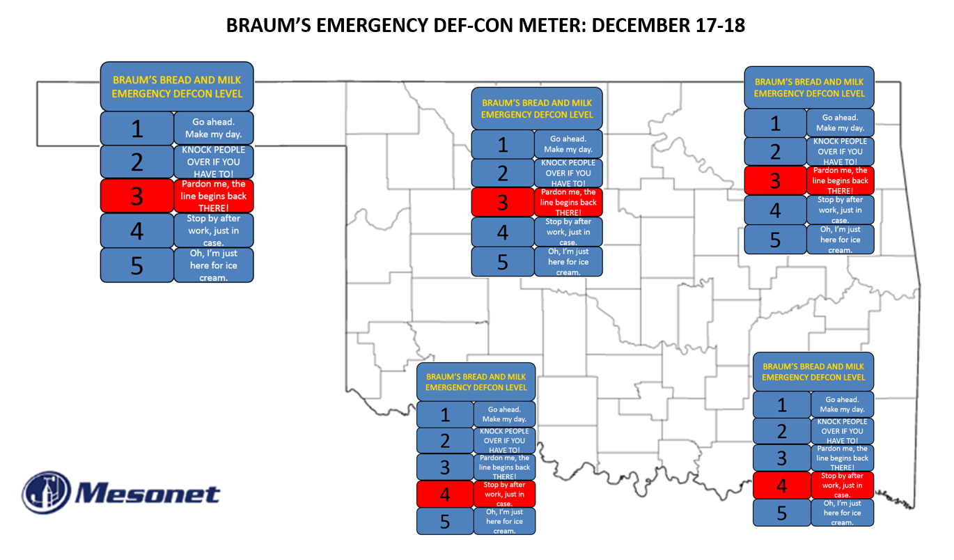
WE'RE CALLING IT...GET TO BRAUM'S TODAY!
http://ticker.mesonet.org/archive/20161216/braums-DEFCON.png
Oh, you enjoyed your 2-hour drive home last night like I did thanks to an
infinitesimal layer of ice on the local bridges and overpasses? Unfortunately,
said layer of ice resulted in hundreds of accidents and even more unfortunate,
three fatalities. So we're going to take this "maybe an inch, maybe a dusting
of snow" we keep hearing about tomorrow a little more seriously, given that it
will be combined with winds gusting up to 40 mph with wind chills dropping into
the negative teens. All cold weather precautions should be taken tomorrow because
if you are caught unprepared out in those conditions, it can be life threatening.
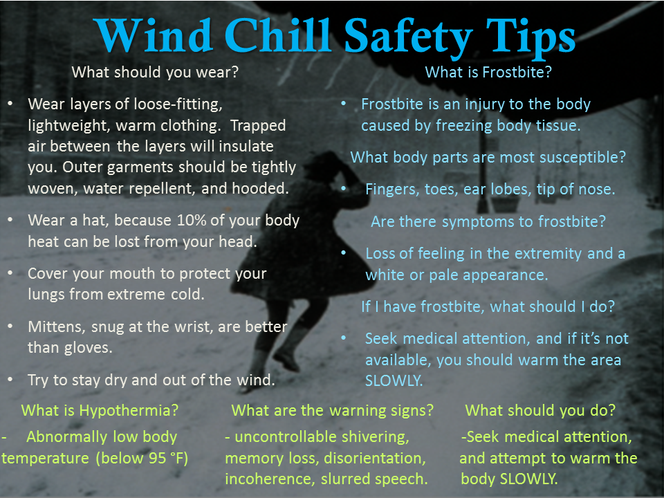
Here are some windchill safety precautions to follow.
http://ticker.mesonet.org/archive/20161216/nws-ama-windchill-safety.png
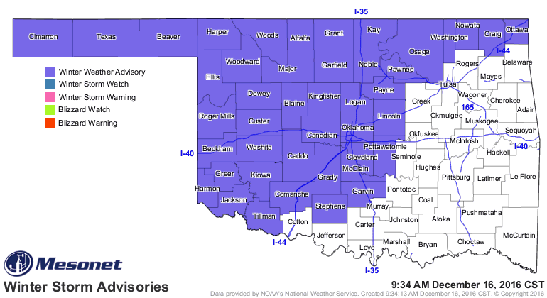
The NWS has issued a winter weather advisory for much of the state thanks to the
possibility of snow, blowing snow which can reduce visibility, sleet and dangerous
wind chills. If ANY of the precipitation falls as sleet or even worse, freezing
drizzle, before it transitions to snow, things could be bad.
http://ticker.mesonet.org/archive/20161216/latest.oklahoma.winter.gif
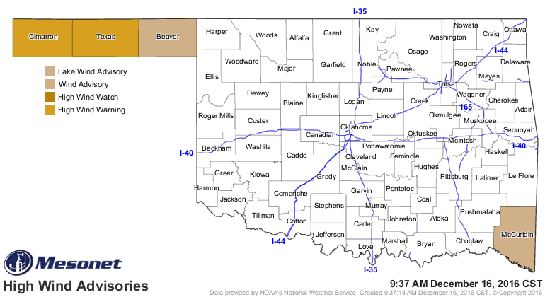
Part of the problem will be the high winds, which also led to NWS advisories.
http://ticker.mesonet.org/archive/20161216/latest.oklahoma.winds.gif
We've covered what's going to happen this weekend extensively, starting tonight
in the NW and blasting through the state throughout the day tomorrow. But first
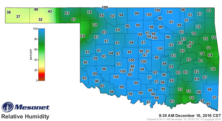
we're going to have to get through today. For most, it will just be a mild, gray
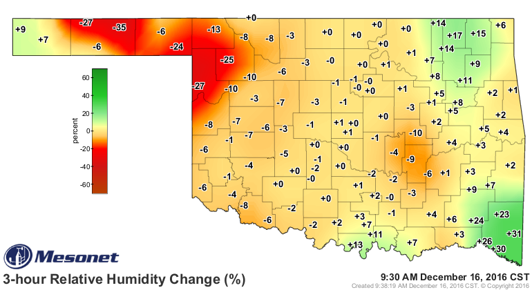
and windy day. For western Oklahoma, where the humidity is not quite as high
(and beginning drop fast)
http://ticker.mesonet.org/archive/20161216/current.RELH.png
http://ticker.mesonet.org/archive/20161216/current.RELH_03H.png
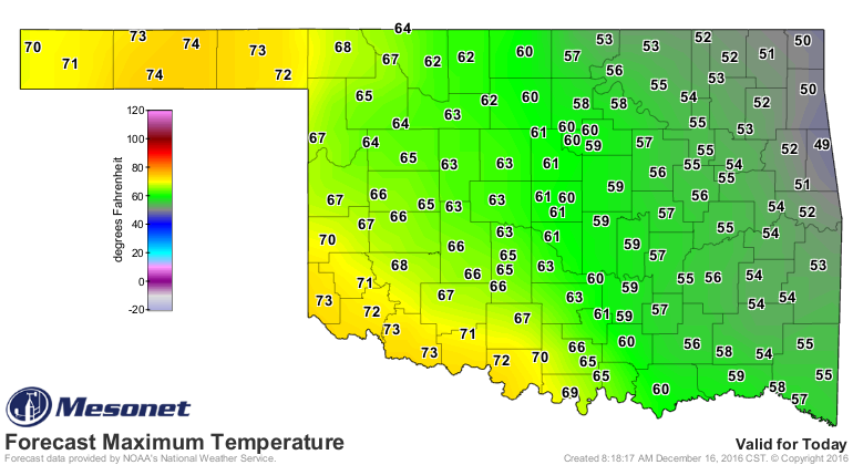
fire danger will be a threat. Near record heat out that way will not help matters.
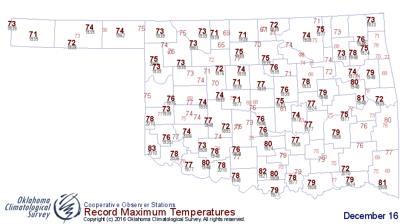
http://ticker.mesonet.org/archive/20161216/todays-forecast-highs.png
http://ticker.mesonet.org/archive/20161216/todays-record-highs.png
As noted by today's Fire Situation Report from the Oklahoma Forestry Services:
"Moist atmospheric conditions this will limit relative humidity values
from falling below critical values, but fuels will be receptive to
ignition and rapid fire growth this afternoon. Temperatures in this
area near 70? with depoint temperatures 30?-35? will result in relative
humidity values this afternoon 22-27%. Southwest winds 20-35 mph with
gusts 30-45 mph will result in potential for extreme rates of fire
spread on active fires. Gusts in excess of 50 mph cannot be ruled out
in portions of the Panhandle. Rates of fire spread in excess of 300
ft./min are likely on active fire fronts with ROS even greater where
wind and topography are aligned."
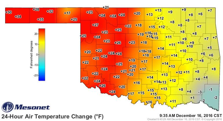
I know we're enjoying this
http://ticker.mesonet.org/archive/20161216/24hour-temp-change.png
but it will be fleeting. And then sleeting.
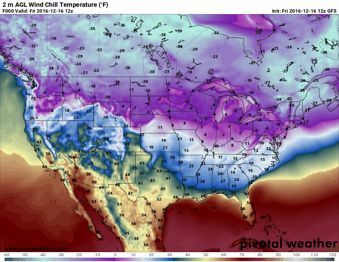
http://ticker.mesonet.org/archive/20161216/GFS-winchill-forecast-loop.gif
My advice? Go see the earliest showing of Star Wars tomorrow and just refuse
to leave.
May the Warmth be with you. Always.
Gary McManus
State Climatologist
Oklahoma Mesonet
Oklahoma Climatological Survey
(405) 325-2253
gmcmanus@mesonet.org
==================================================
The OCS/Mesonet Ticker
https://ticker.mesonet.org/
To subscribe or unsubscribe from the Ticker
or for questions about the Ticker or its content
Phone or Email the Ticker Manager at OCS
Phone: 405-325-2253 Email: ticker@mesonet.org
---------------------------------------------------
-C- Copyright 2024 Oklahoma Climatological Survey
===================================================
|


 Tweet
Tweet