

| ... sign up for
the Ticker! |
... about the
Ticker |
||||||||||||
|---|---|---|---|---|---|---|---|---|---|---|---|---|---|
| . . . Day by Day . . . | . . . October 30 in Mesonet History* . . . | ||||||||||||
| Find a particular day's Ticker.
If you're a bit off, don't worry, because just like horseshoes, "almost" counts on the Ticker home page! |
* Mesonet History = since 1994
|
||||||||||||
| . . . Search the Ticker Archives . . . | |||||||||||||
|
|
|||||||||||||
| . . . Tell Others About This Ticker . . . | |||||||||||||
 Tweet Tweet
|
|||||||||||||
| . . . The Most Recent Ticker . . . | |||||||||||||
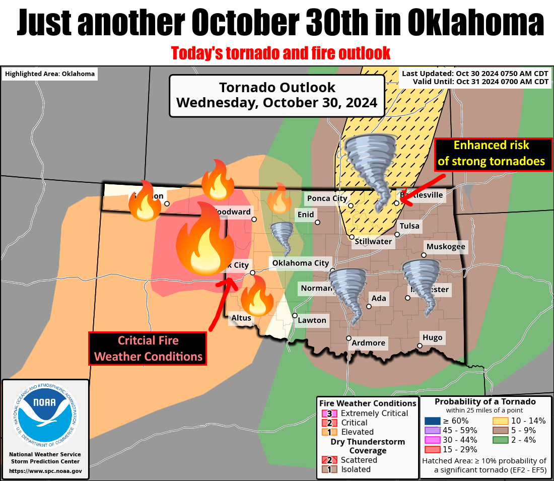
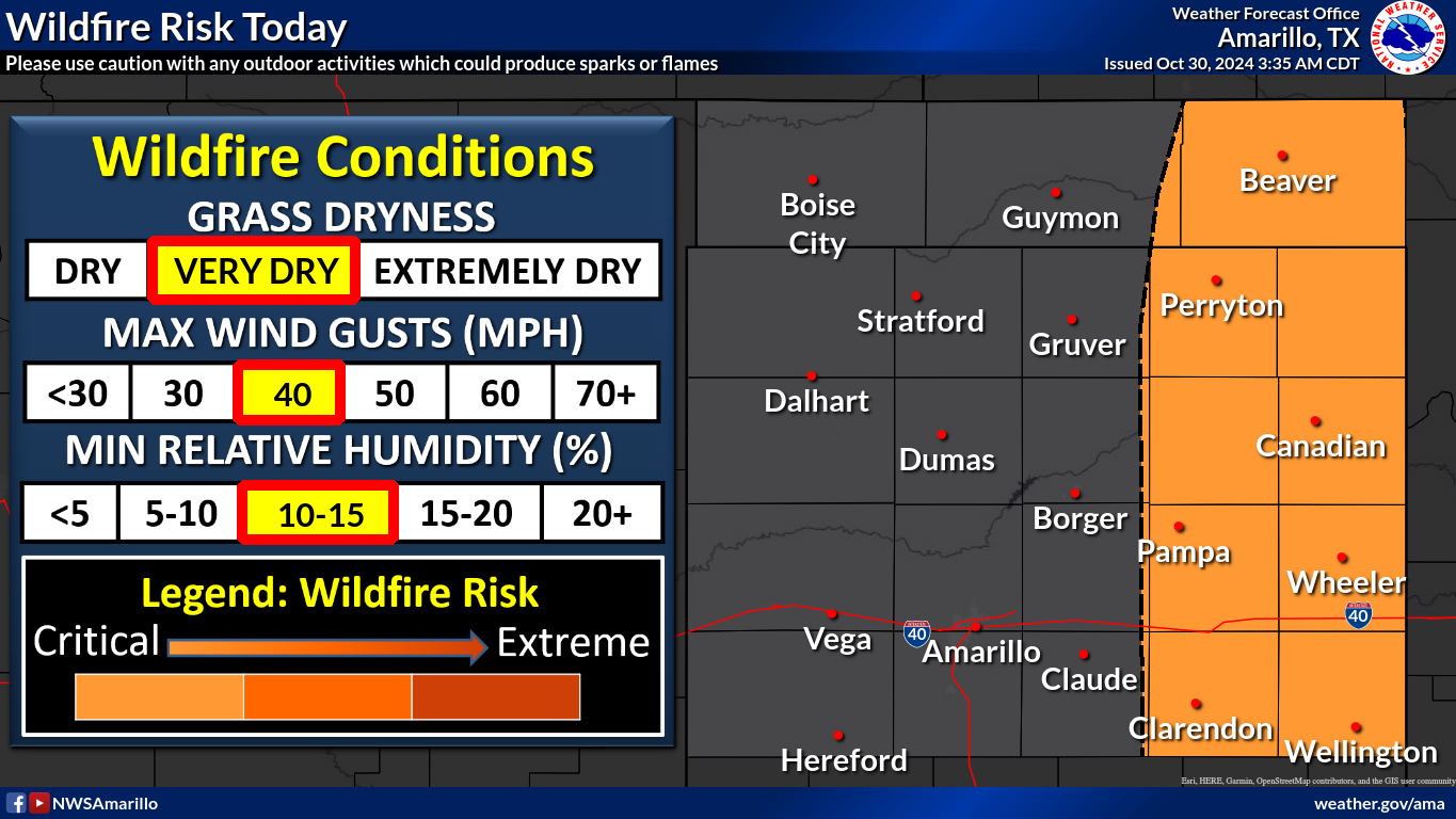
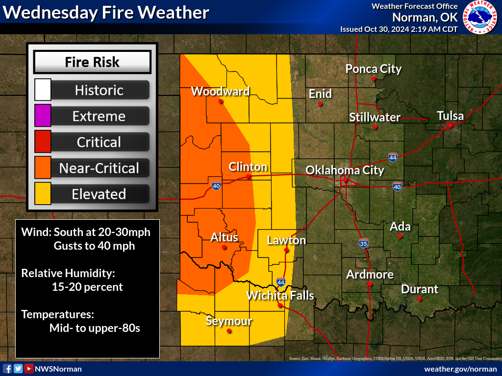
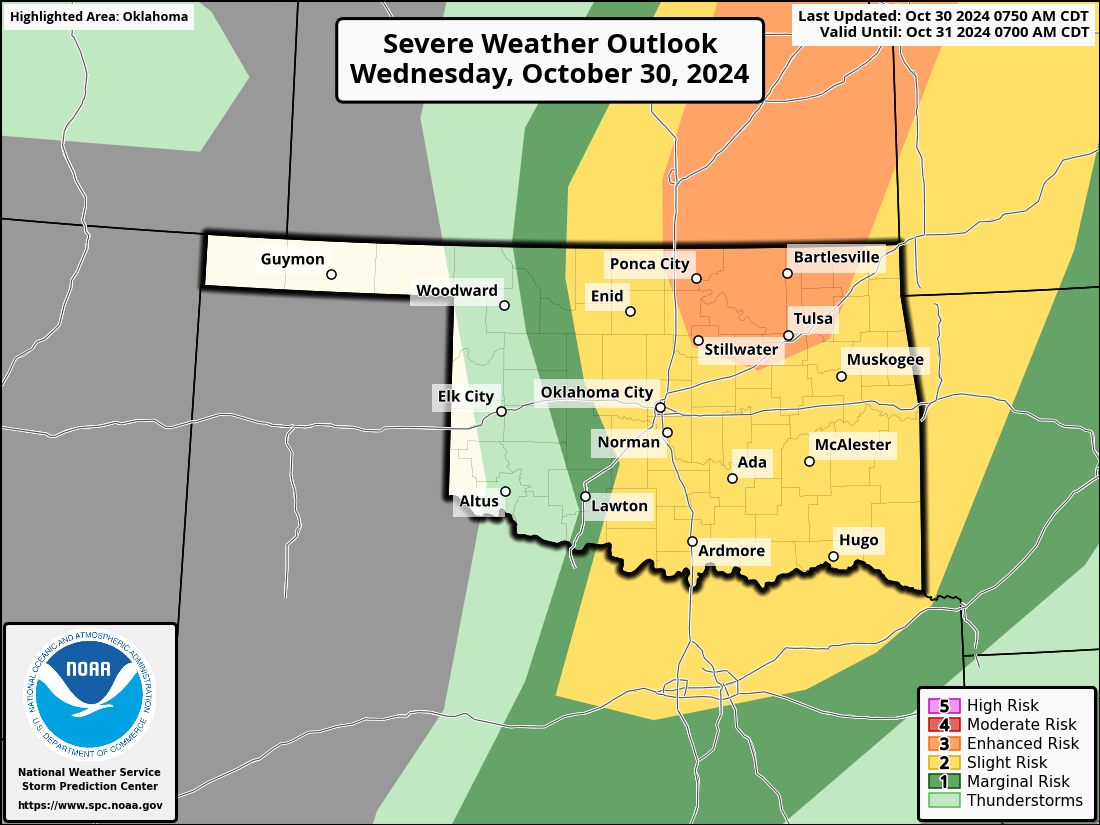
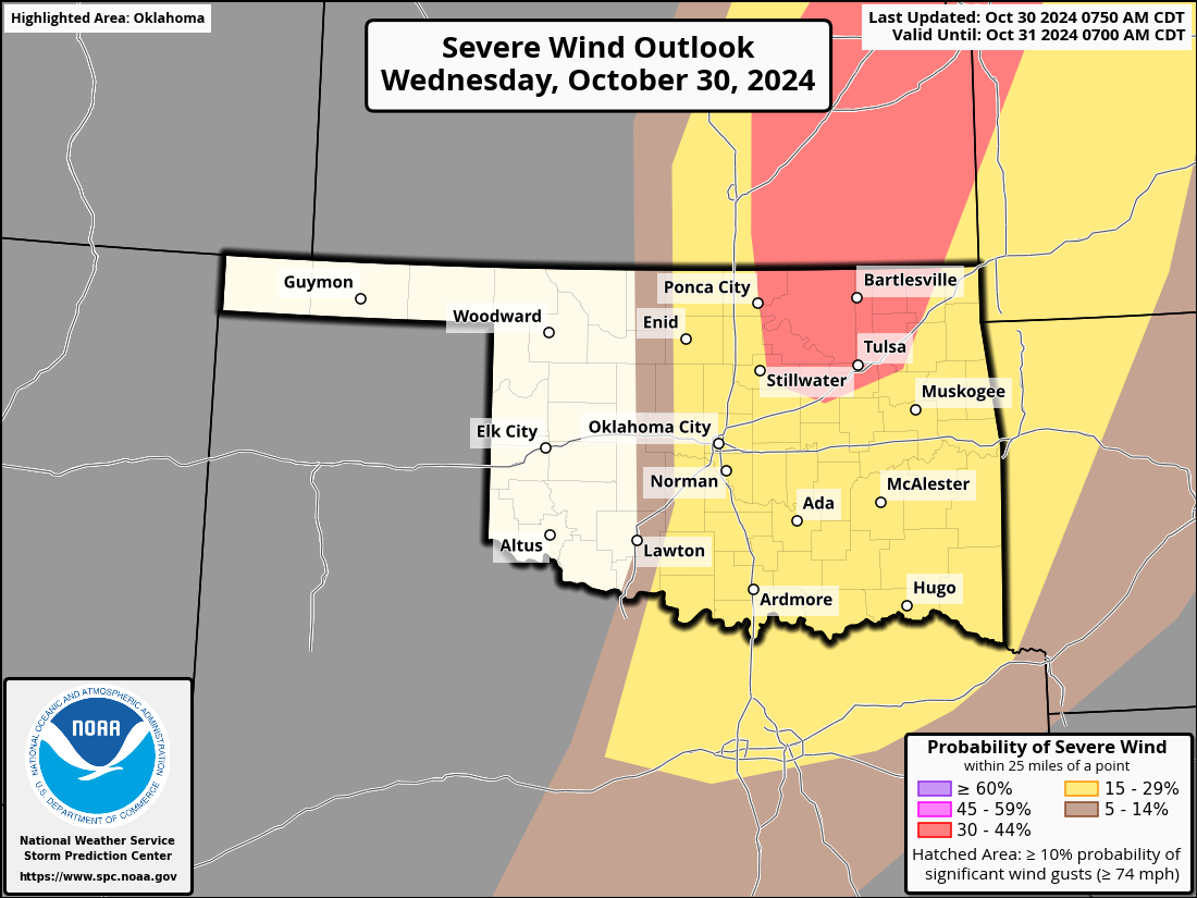
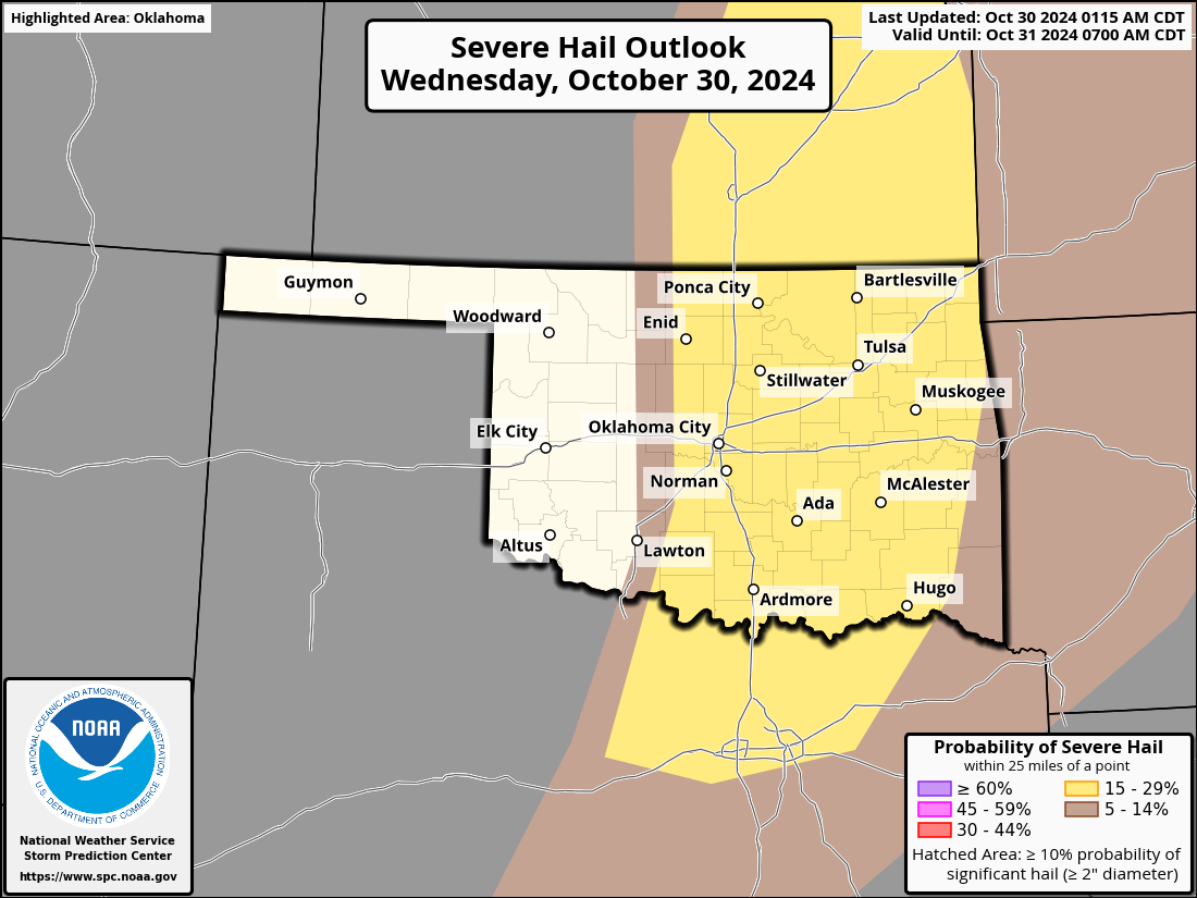
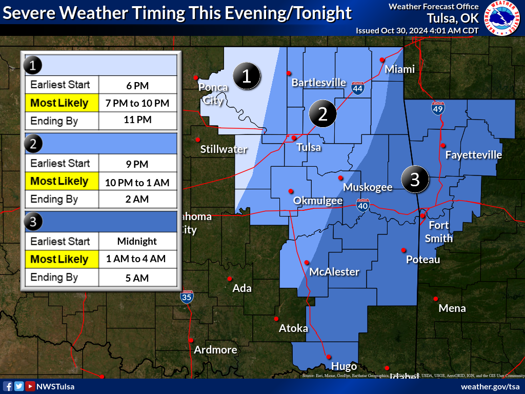
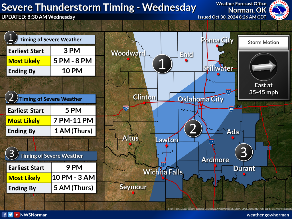
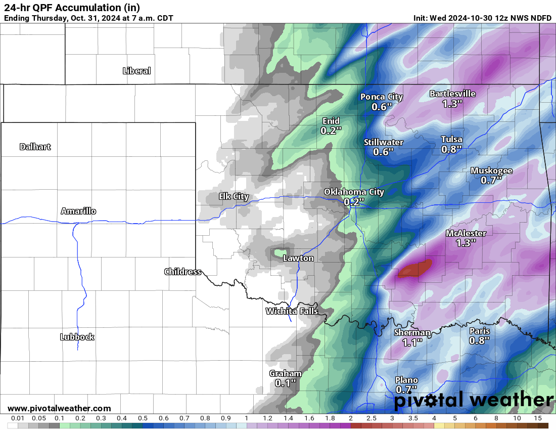
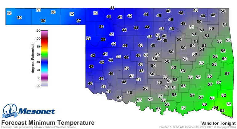
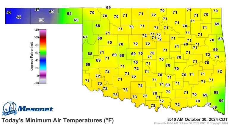
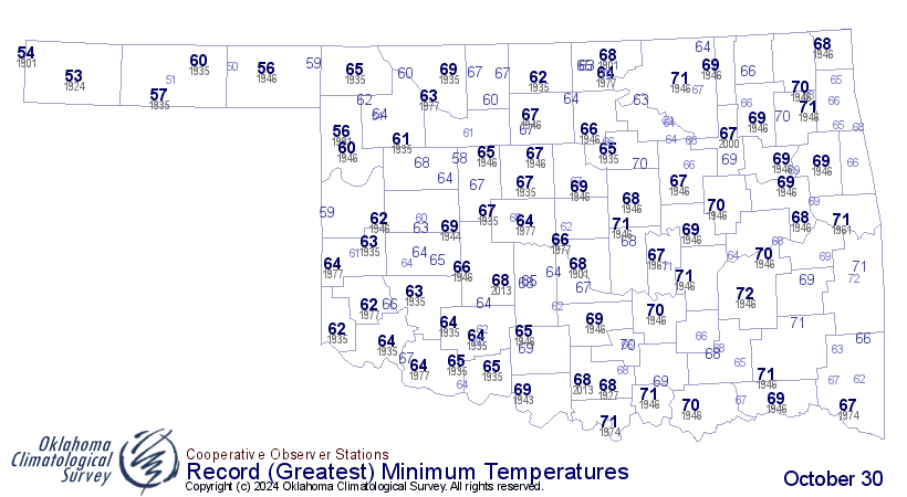
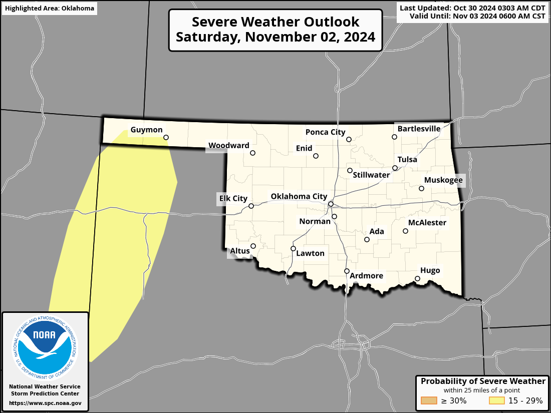
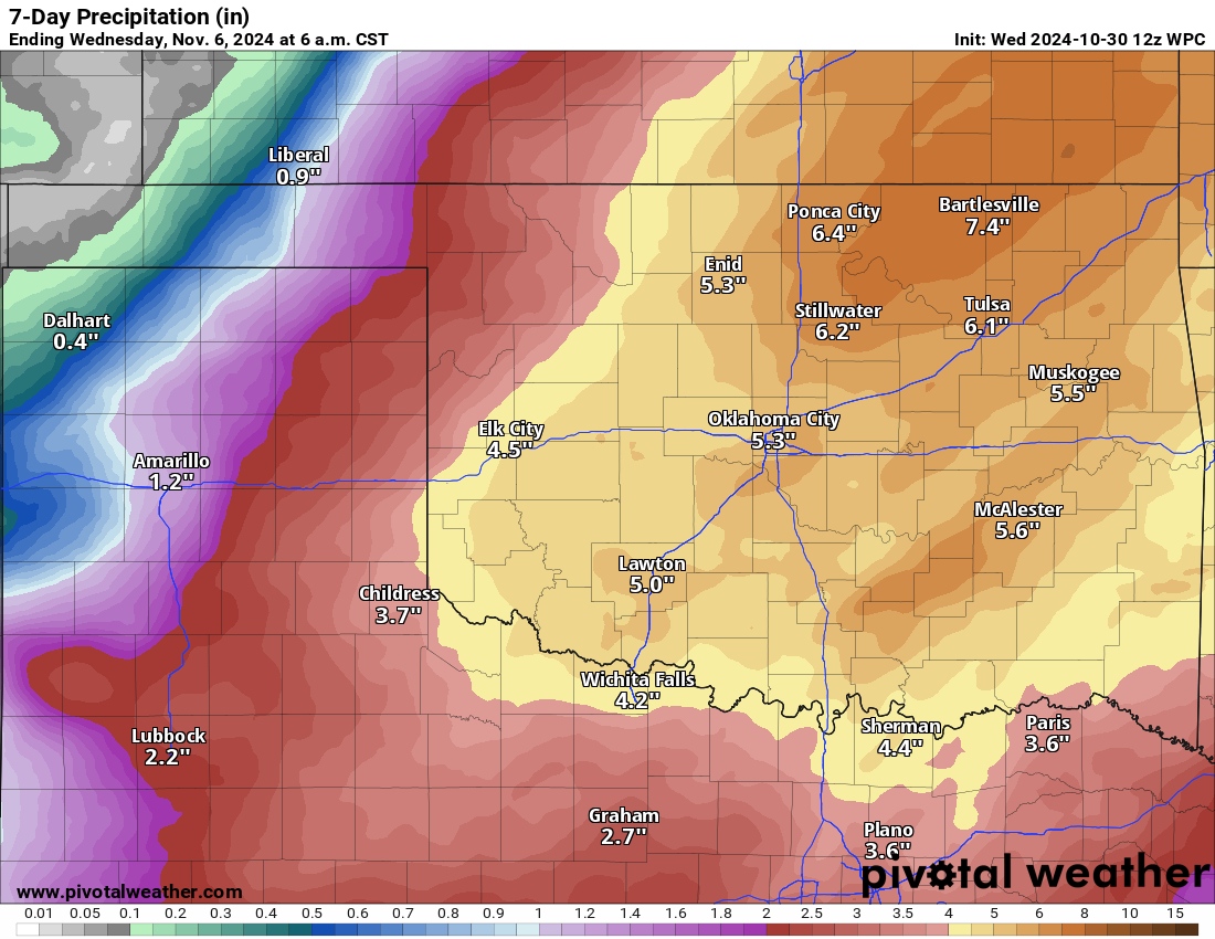
MESONET TICKER ... MESONET TICKER ... MESONET TICKER ... MESONET TICKER ...
October 30, 2024   October 30, 2024   October 30, 2024   October 30, 2024


WildTorFireNado


https://ticker.mesonet.org/archive/20241030/OK_swody1_TORN.png

Tornadoes? Wildfires? Large hail? Severe winds of 75 mph?

That's nothing! The air conditioner in my car only blows out the floor vents now.
Do you like driving around with cold feet?

I thought so.

All kidding aside (kidding is now on THAT side...over there...no, the other side),
we have some serious weather today, and a look outside tells me it's one of THOSE
days in Oklahoma...one of those days where you get up in the morning and see the
low stratus streaming northward and you go and throw your calendar in the trash
(don't throw you colander in the trash...how will you drain that spaghetti??).

The setup: we'll have a storm system moving through the Southern Plains with a
surface low  just to our north dragging a dryline and cold front through the state.
Behind that dryline, bigtime wildfire concerns.

https://ticker.mesonet.org/archive/20241030/latest.oklahoma.fire.gif

https://ticker.mesonet.org/archive/20241030/nws-amarillo-fire.danger.png

https://ticker.mesonet.org/archive/20241030/nws-norman-fire.danger.png

And in front of that dryline we should see storm initiation later this afternoon
with the possibility of the aforementioned hazards, including the risk of
strong tornadoes in the yellow hatched area.

https://ticker.mesonet.org/archive/20241030/OK_swody1.png

https://ticker.mesonet.org/archive/20241030/OK_swody1_WIND.png

https://ticker.mesonet.org/archive/20241030/OK_swody1_HAIL.png

Timing is late afternoon through the overnight hours, west to east.

https://ticker.mesonet.org/archive/20241030/nws-tulsa-svr-timing.png

https://ticker.mesonet.org/archive/20241030/nws-norman-svr-timing.png

The rain will be welcomed, of course. It often comes with bad things in
Oklahoma, unfortunately.

https://ticker.mesonet.org/archive/20241030/24hour-rain-totals.png

Temps will drop below freezing up in far NW OK behind that COLD front.

https://ticker.mesonet.org/archive/20241030/latest.oklahoma.frostfreeze.gif

https://ticker.mesonet.org/archive/20241030/thursday-lows.png

So an eventful 24 hours coming up! And that's AFTER record-setting high minimum
temps this morning, although I guess those could be wiped out when the cold
front moves through (i.e., our low temps could come right before midnight in
some parts of Oklahoma).

https://ticker.mesonet.org/archive/20241030/todays-lows.thus.far.png

https://ticker.mesonet.org/archive/20241030/oct30-record-hi.tmins.png

A nice seasonable Halloween followed by MORE rain and MORE severe weather.

https://ticker.mesonet.org/archive/20241030/OK_swody4_PROB.png

https://ticker.mesonet.org/archive/20241030/OK_swody5_PROB.png

https://ticker.mesonet.org/archive/20241030/7day-rain-forecast.png

Sunday's threat looks like a hail/wind deal, not so tornadoey. Now back to my
cold feet...hey, maybe Mother Nature will get cold feet on the severe weather?

Just in case, start tuning in to your favorite media weather source and local
NWS Office. Time to get weather aware...you know the drill!

Gary McManus
State Climatologist
Oklahoma Mesonet
Oklahoma Climate Survey
gmcmanus@ou.edu
|
|||||||||||||