Ticker for June 18, 2026
MESONET TICKER ... MESONET TICKER ... MESONET TICKER ... MESONET TICKER ...
June 18, 2026 June 18, 2026 June 18, 2026 June 18, 2026
Dividing line
Donkeys vs. Elephants? Bah humbug.
Chili with beans vs. no beans? Pick a side.
Taco Bell vs. Taco Mayo? Pick your poison.
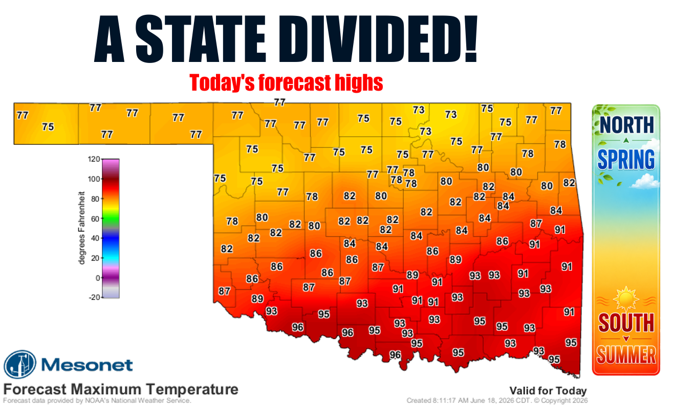
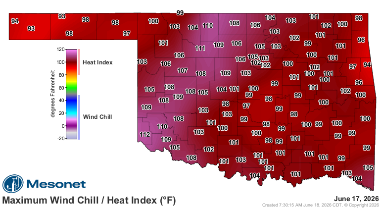
Strawberry vs. Cherry Pop-Tarts? Well, that one is obvious! But so is the side
of the state you'll probably want to be on today, because almost NOBODY likes
heat index values up into the 105-110 range like we saw yesterday, and what we'll
see in southern OK today.
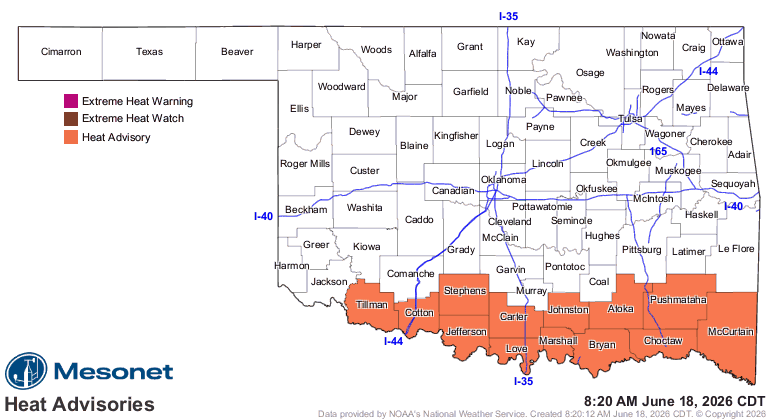
I mean, if you WANT to be making your own gravy for a second day in a row, then
by all means (well, not ALL, but most if not many or even a few) take a trip
to the Red River today. If not, enjoy the spring across the northern half or so
of the state.
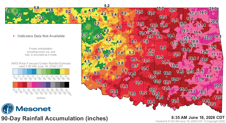
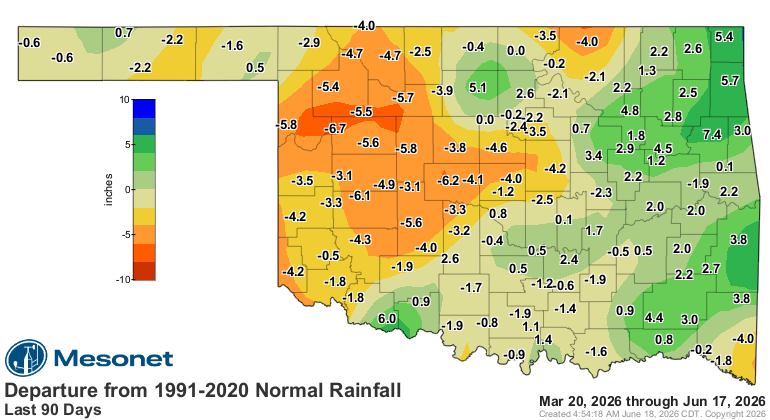
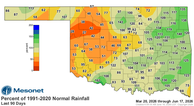
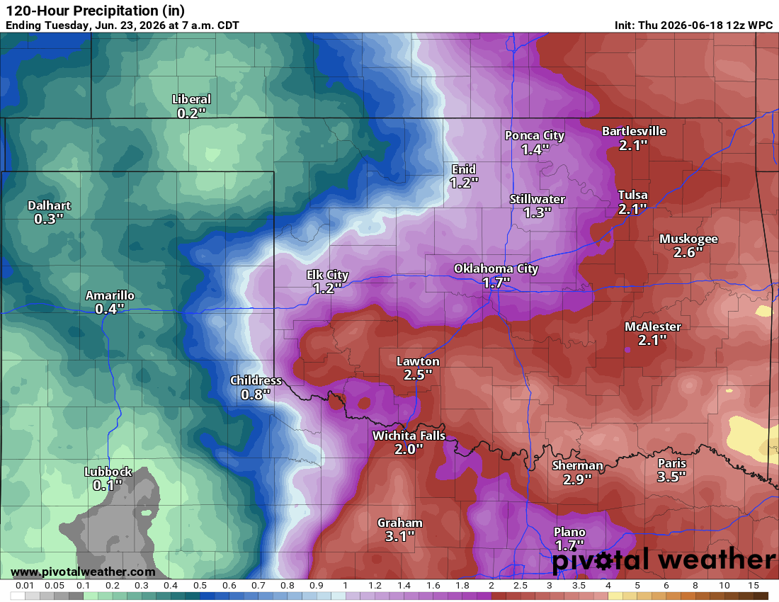
Hey, speaking of divides (except by zero...math rules apply even to the Ticker),
take a look the other dimension...east vs. west, and how drought's fortunes
have differed between the two. Roughly, at least, over the last 90 days.
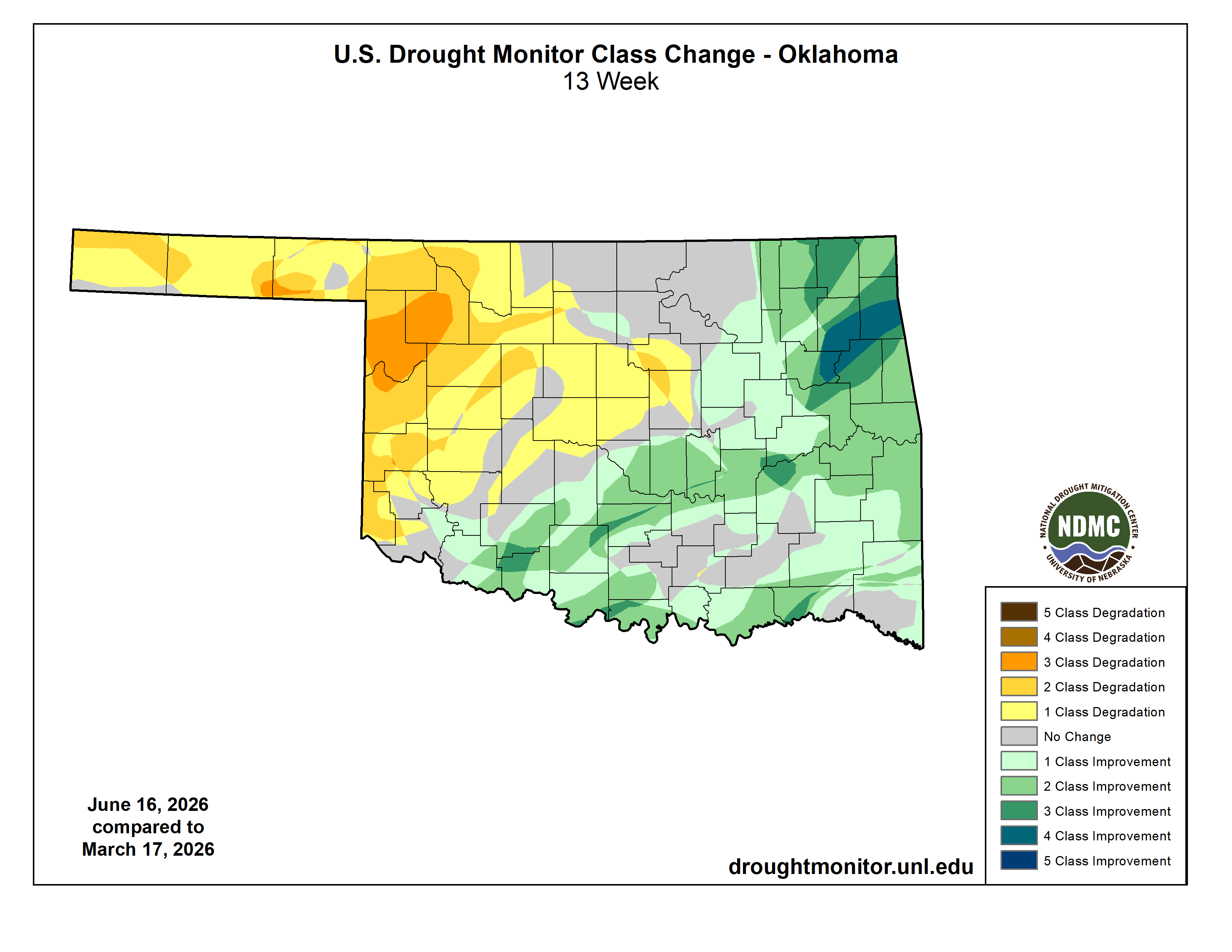
And that's due to the difference in rainfall. Duh, I say!
Which leaves us with our current drought picture, at least by the USDM's
methodology.
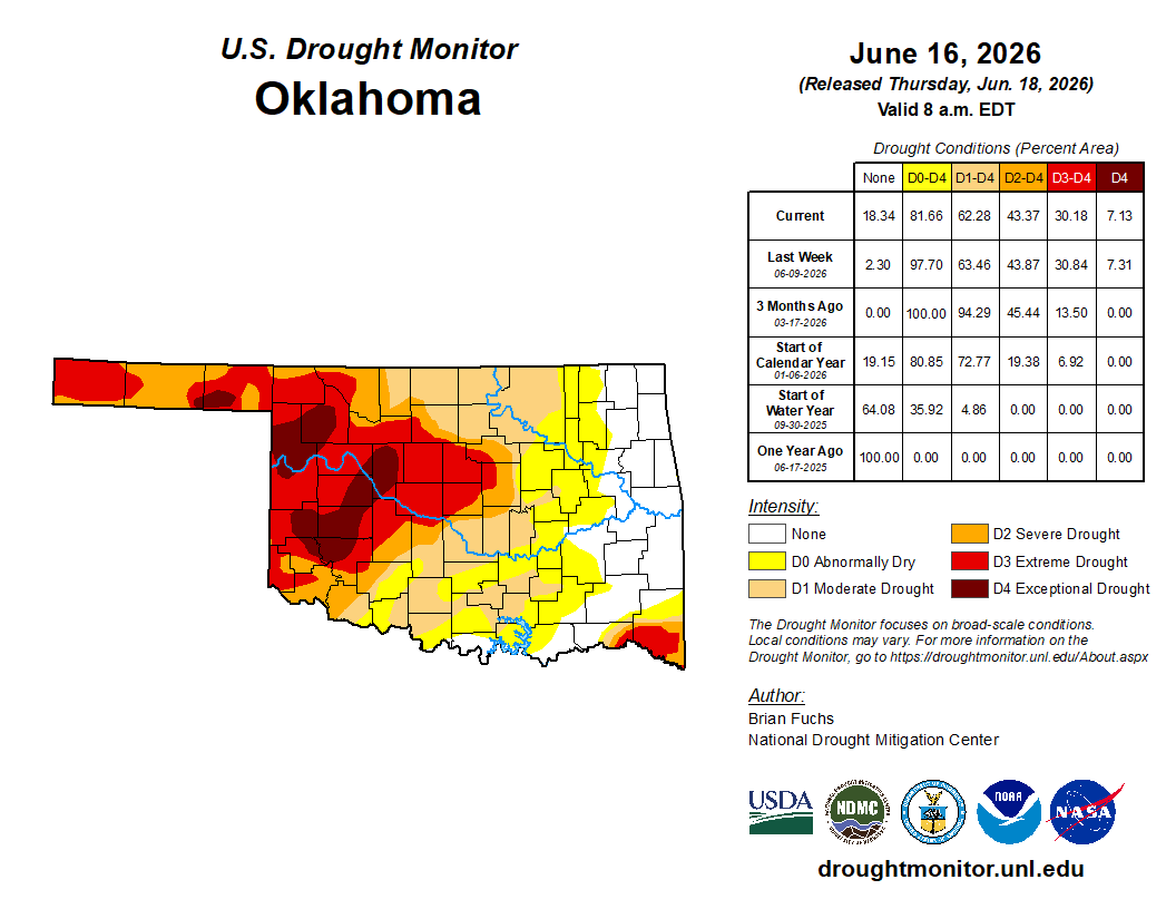
The cure for western Oklahoma is more rain. And McFlurrys, but the ice cream
machine is down. Sorry.
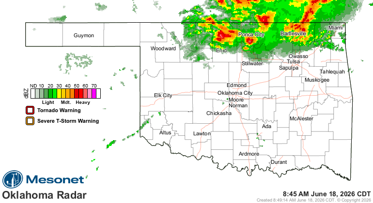
Heck, it's raining right now, for crying out loud!
For the next 5 days? We'll see.
Gary McManus
State Climatologist
Oklahoma Mesonet
Oklahoma Climate Survey
gmcmanus@ou.edu
June 18 in Mesonet History
| Record | Value | Station | Year |
|---|---|---|---|
| Maximum Temperature | 110°F | GRA2 | 2011 |
| Minimum Temperature | 42°F | KENT | 1998 |
| Maximum Rainfall | 5.74 inches | HOOK | 2024 |
Mesonet records begin in 1994.
Search by Date
If you're a bit off, don't worry, because just like horseshoes, “almost” counts on the Ticker website!