Ticker for June 9, 2026
MESONET TICKER ... MESONET TICKER ... MESONET TICKER ... MESONET TICKER ...
June 9, 2026 June 9, 2026 June 9, 2026 June 9, 2026
Mune?
Amember yesterday when I produced a graphic predicting heat index values from
105-110F up in NW and NC Oklahoma? Yeah, that was a good one.
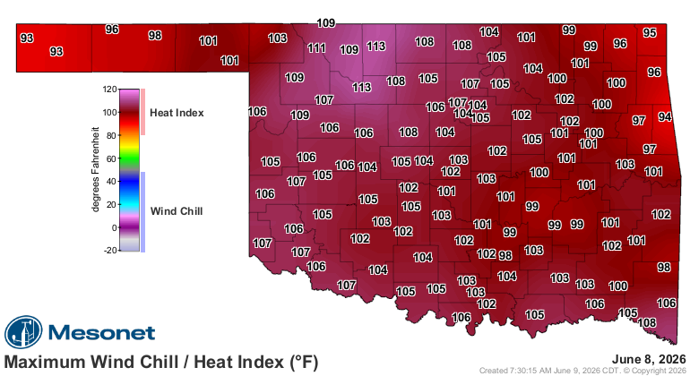
Obviously I should have thrown the old "+" sign on the end of that, because
we ended up with the highest heat index we've seen in the state since July 21
of last year, oddly enough (I HEARD THAT!) at Cherokee, which also shared
yesterday's crown with Fairview.
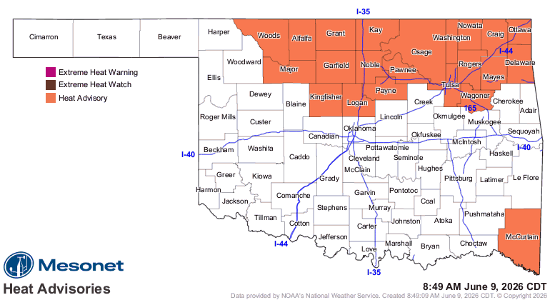
And while I don't know (Mr. Hand should write that on the chalkboard for me) if
we'll see a repeat of the 110+ today, it's still not gonna be pleasant!
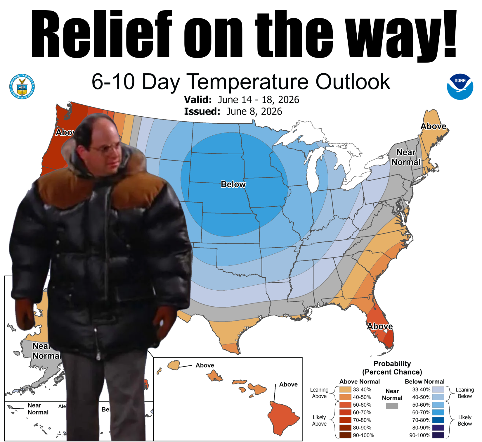
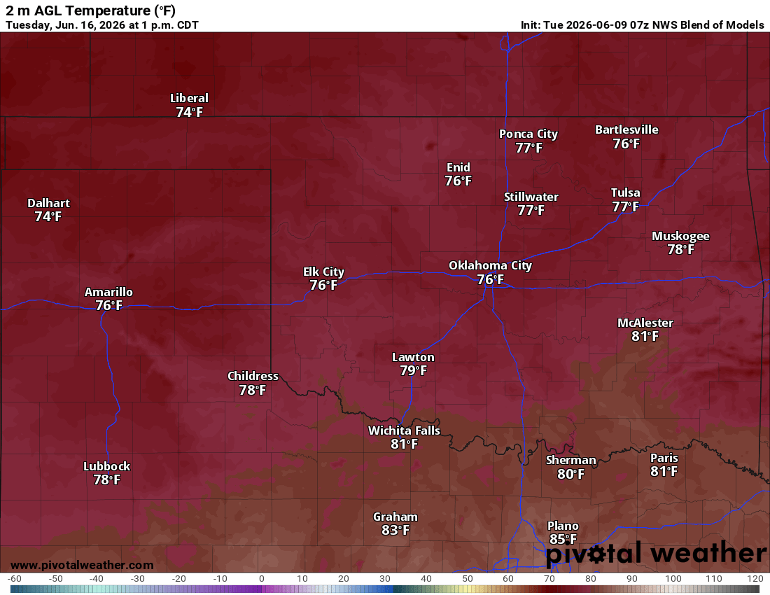
We will see relief moving our way this weekend, and as we get into next week as
the top graphic shows, we'll be taking a trip back to May...heck, May-be (see
what I did there?) even April with highs in the 70s early next week. May-pril?
So as you're making your own gravy today, break out the industrial strength
antiperspirant and dream of next week.
Gary McManus
State Climatologist
Oklahoma Mesonet
Oklahoma Climate Survey
gmcmanus@ou.edu
June 9 in Mesonet History
| Record | Value | Station | Year |
|---|---|---|---|
| Maximum Temperature | 104°F | ALTU | 2011 |
| Minimum Temperature | 43°F | EVAX | 2020 |
| Maximum Rainfall | 5.12 inches | BOWL | 2008 |
Mesonet records begin in 1994.
Search by Date
If you're a bit off, don't worry, because just like horseshoes, “almost” counts on the Ticker website!