Ticker for January 14, 2026
MESONET TICKER ... MESONET TICKER ... MESONET TICKER ... MESONET TICKER ...
January 14, 2026 January 14, 2026 January 14, 2026 January 14, 2026
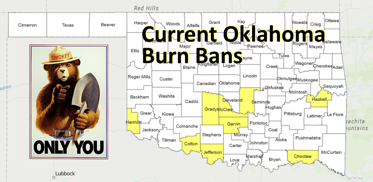
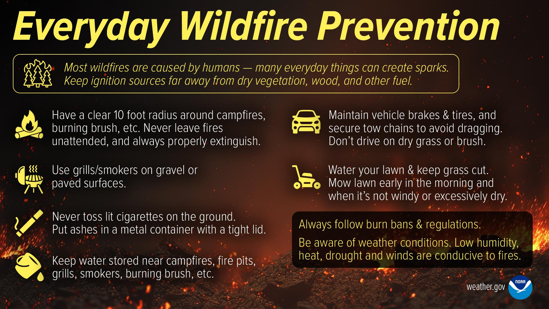
Smokey sez no
Why, Mother Nature! WHY! WHY! WHY!
Well stop asking "WHY" and tell me "WHAT! WHAT! WHAT!"
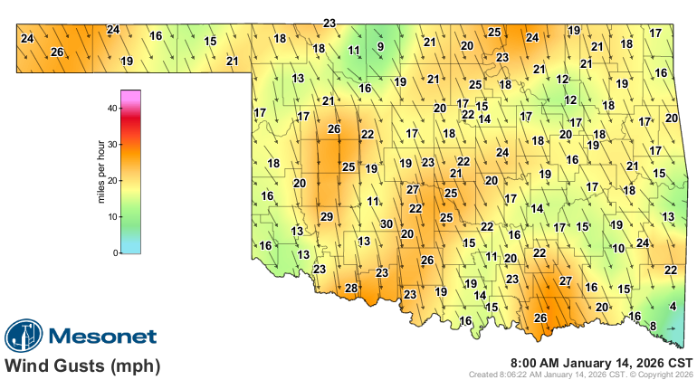
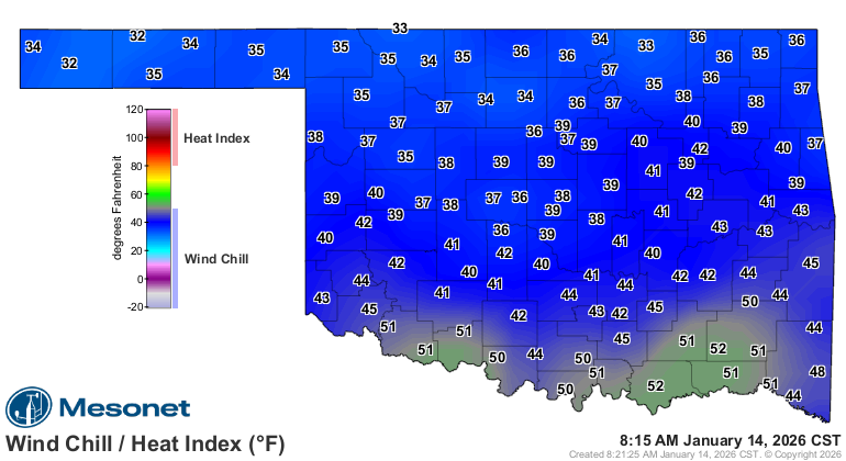
The cold front last night, that's what! Currently moving through the state--DRY,
of course--, giving us those winds gusting close to 30 from the north and giving
us wind chills, uhhhhhhh...close to 30 as well. That's gusts to 30 mph and wind
chills of 30 degrees, not the other way around, but you knew that. Now those winds
are coming from close to 30 degrees, but that's another geometry and I was told
there would be no math.
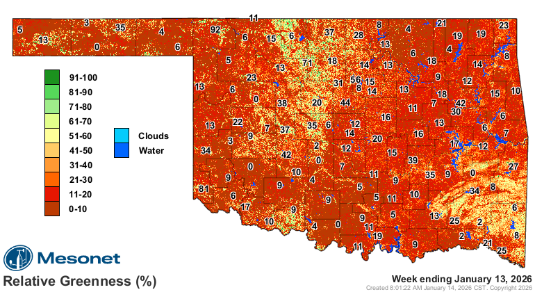
No big whoop, right? It's January, after all. Well, there's this thing that occurs
this time of year that IS a big problem, given all the dead and dormant
vegetation, low humidity, and strong winds.
That's right, gas. Whoops, no, that's a Taco Bell problem! No, I mean fire
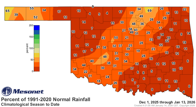
danger. And the underlying drought doesn't help matters.
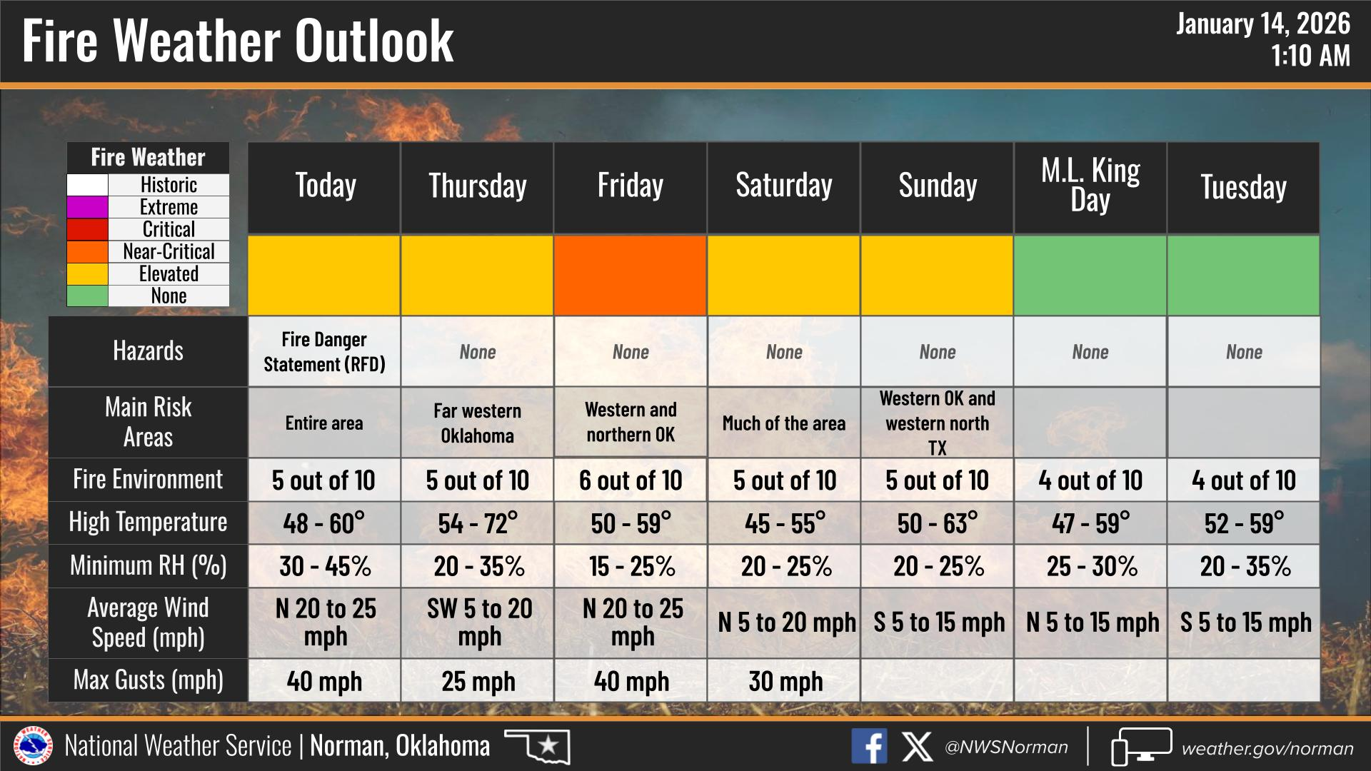
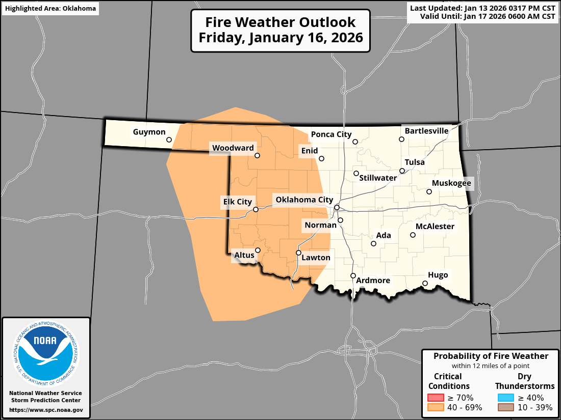
Our friends from the NWS pinpoint the fire danger for the coming days. I'll let
them do the talking because their talker is better than my talker.
The fire danger will continue, of course, until we get green-up of our
vegetation in the spring. Or summer. #Oklahoma. But we'll stick to the next
few days, as detailed in the latest OFS Fire Situation Report, which you can
see here:
https://ag.ok.gov/wp-content/uploads/2023/04/Most-Recent-Fire-Situation-Report.pdf
"Statewide Discussion: Elevated fire weather (primarily windspeed) over dry,
dormant fuels today in the wake of a cold front will be followed by another
dry frontal passage Thursday night. This will hold elevated fire danger
indices in place across most of Oklahoma Friday and Saturday. Current
forecast data holds little, or no, optimism for rainfall in the next
five days and while fire environment elements lack alignment, building
dryness will keep persistent fire danger entrenched."
Friday will definitely be a day to watch for fire conditions with yet another
cold front.
Okay, we CAN look farther out. Let's say, Febura...Febraru...next month.

And remember, only you (and you, and you and you and you!) can prevent
wildfires.
Gary McManus
State Climatologist
Oklahoma Mesonet
Oklahoma Climate Survey
gmcmanus@ou.edu
January 14 in Mesonet History
| Record | Value | Station | Year |
|---|---|---|---|
| Maximum Temperature | 74°F | ERIC | 2020 |
| Minimum Temperature | -11°F | VINI | 2024 |
| Maximum Rainfall | 2.39 inches | BROK | 2007 |
Mesonet records begin in 1994.
Search by Date
If you're a bit off, don't worry, because just like horseshoes, “almost” counts on the Ticker website!