Ticker for January 7, 2026
MESONET TICKER ... MESONET TICKER ... MESONET TICKER ... MESONET TICKER ...
January 7, 2026 January 7, 2026 January 7, 2026 January 7, 2026
Sprung
No, it doesn't feel like one of "those" days in Oklahoma. You know, one of those
days when you wake up with sweat on the sidewalk (btw, if YOU wake up on the
sidewalk sweating, switch to non-alcoholic beer) and south winds just killing it,
promising big-time storms later in the day.
No, it feels more like it could snow later on.
Oh, snow you say? Oh, I said it, not you? Well, more on that later, and don't call
me moron.
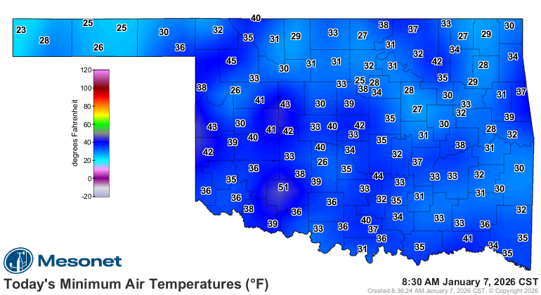
By the way, do ya notice that the Medicine Park Mesonet site only dropped down
to 51F, while those around it were in the upper-30s? Well, that's our favorite
inversion poker (and we all know just how painful that can be) in action. The
station is on high ground (it sits upon a hill in the Wichita Mountain system).
As such, it often stays "above the fray (-zing temps)" simply because it is
higher than the thin layer of cold air below. It is a well-known "inversion
poker" that often stands out (literally!) from its Mesonet neighbors.
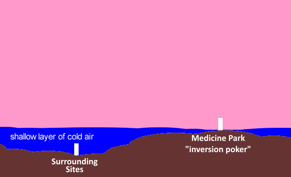
Important note to remember: there's a natural process at night where the ground
loses heat quickly by radiating it into space, so the air right next to the
ground cools off first while the air above stays warmer. That flips the normal
pattern—cool air trapped underneath warmer air—creating a temperature inversion
that tends to stick around until the sun heats the ground again the next day.
Here's a graphic that illustrates an "inversion poker." Don't laugh, this is
WITH the 48-count box of crayons:
Anyway, back to your regularly schedules and irregularly written programming.
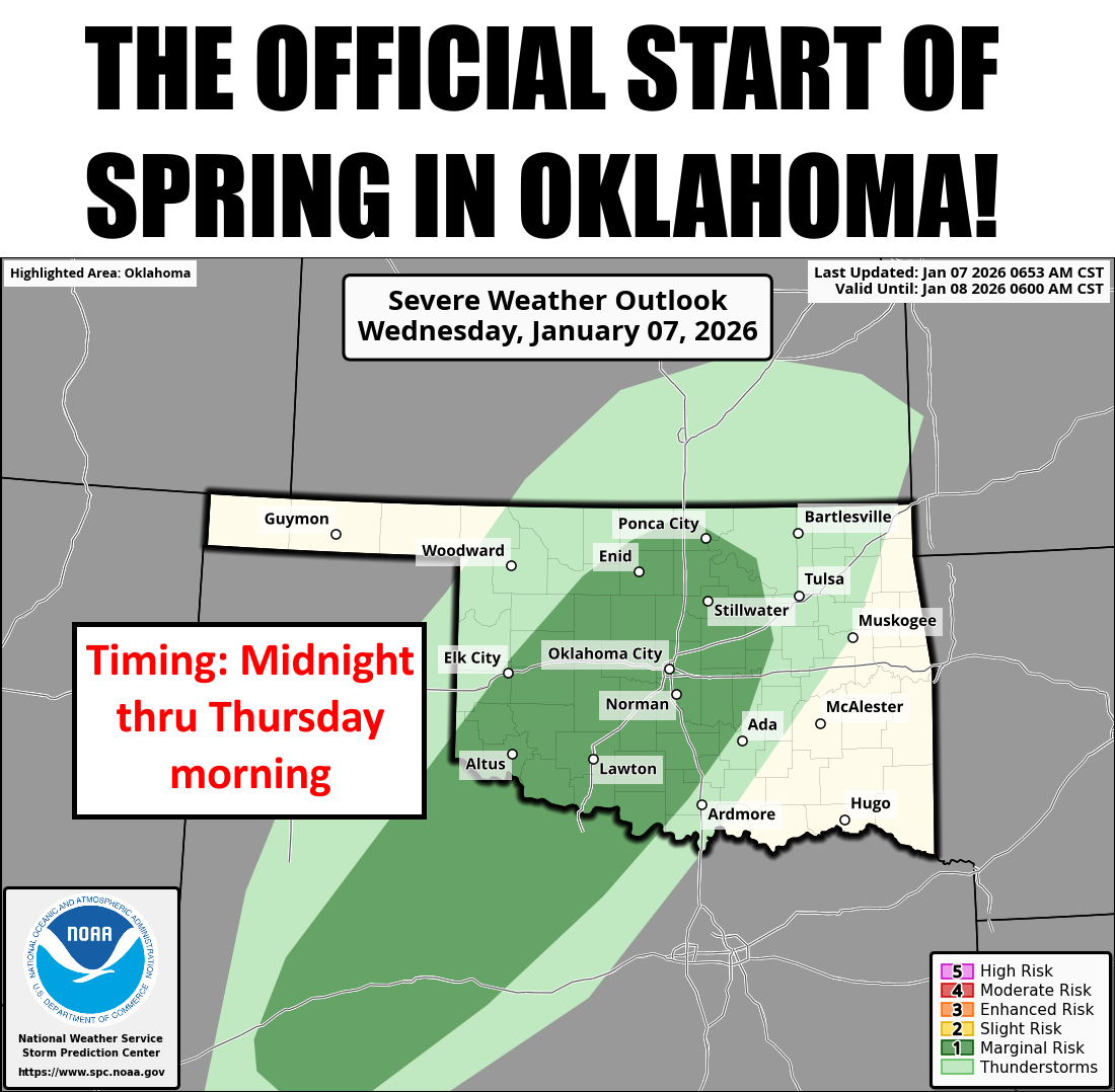
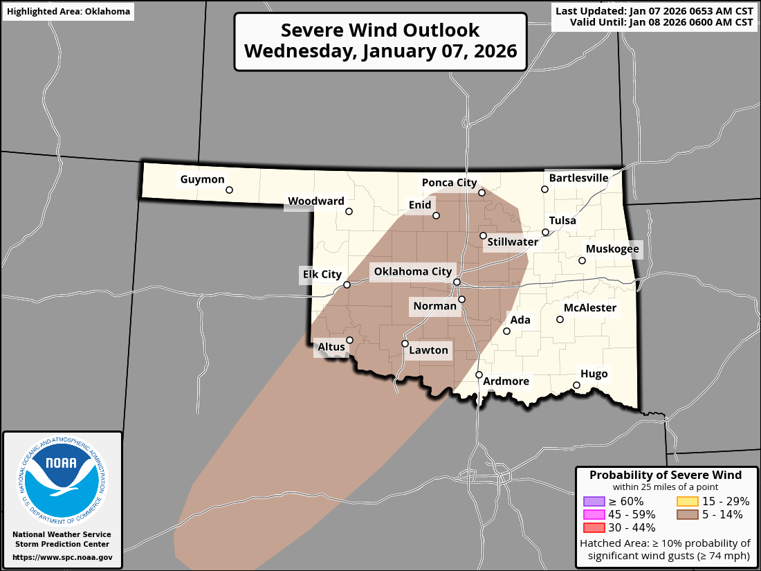
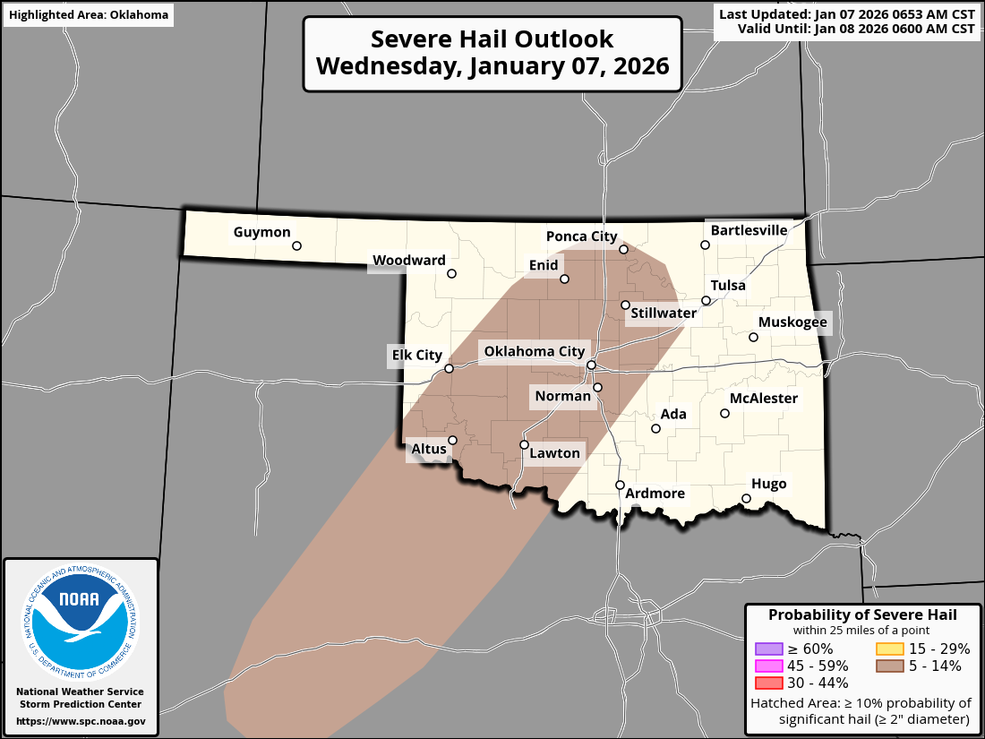
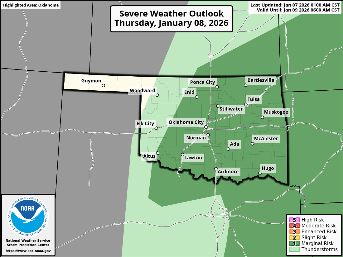
So a storm system to our west will move out way, and so will moisture from the
Gulf. Those things will interact late this evening to give us a chance of
severe storms, possibly with some hail and wind. No big whoop.
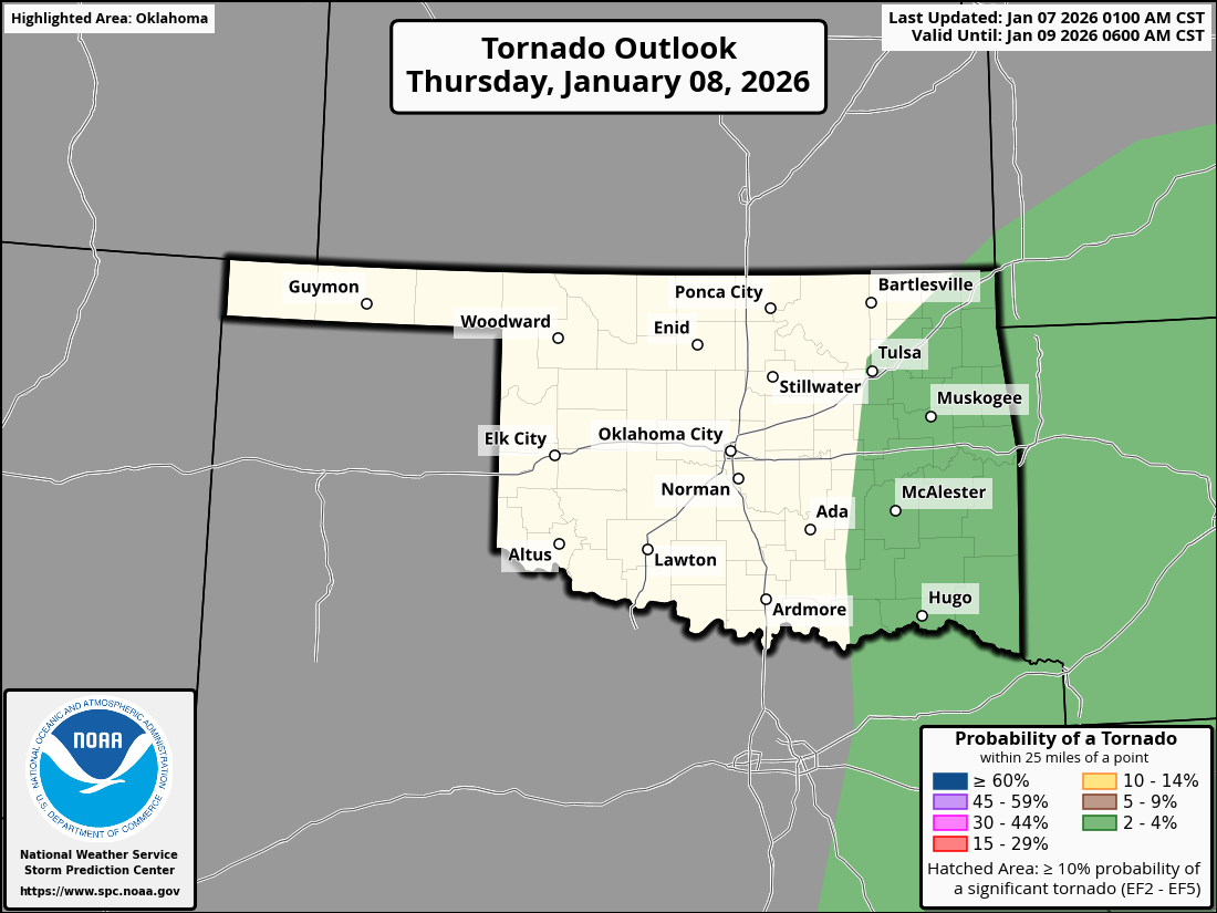
Then continue into the day on Thursday to the east, with an actual LOW tornado
threat.
But it ain't me, babe.
No, no, no, it ain't me, babe.
Whoops, a Bob Dylan moment broke out. I hate when it does that.
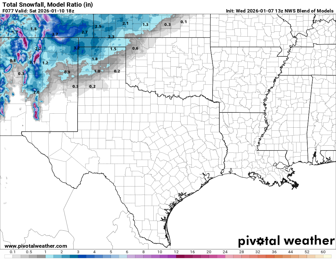
Now in the aftermath of that storm system, we'll see another wave move through
that should bring us a chance of snow up in the higher terrain on NW OK. Not a
lot, but more fun than not. Eh?
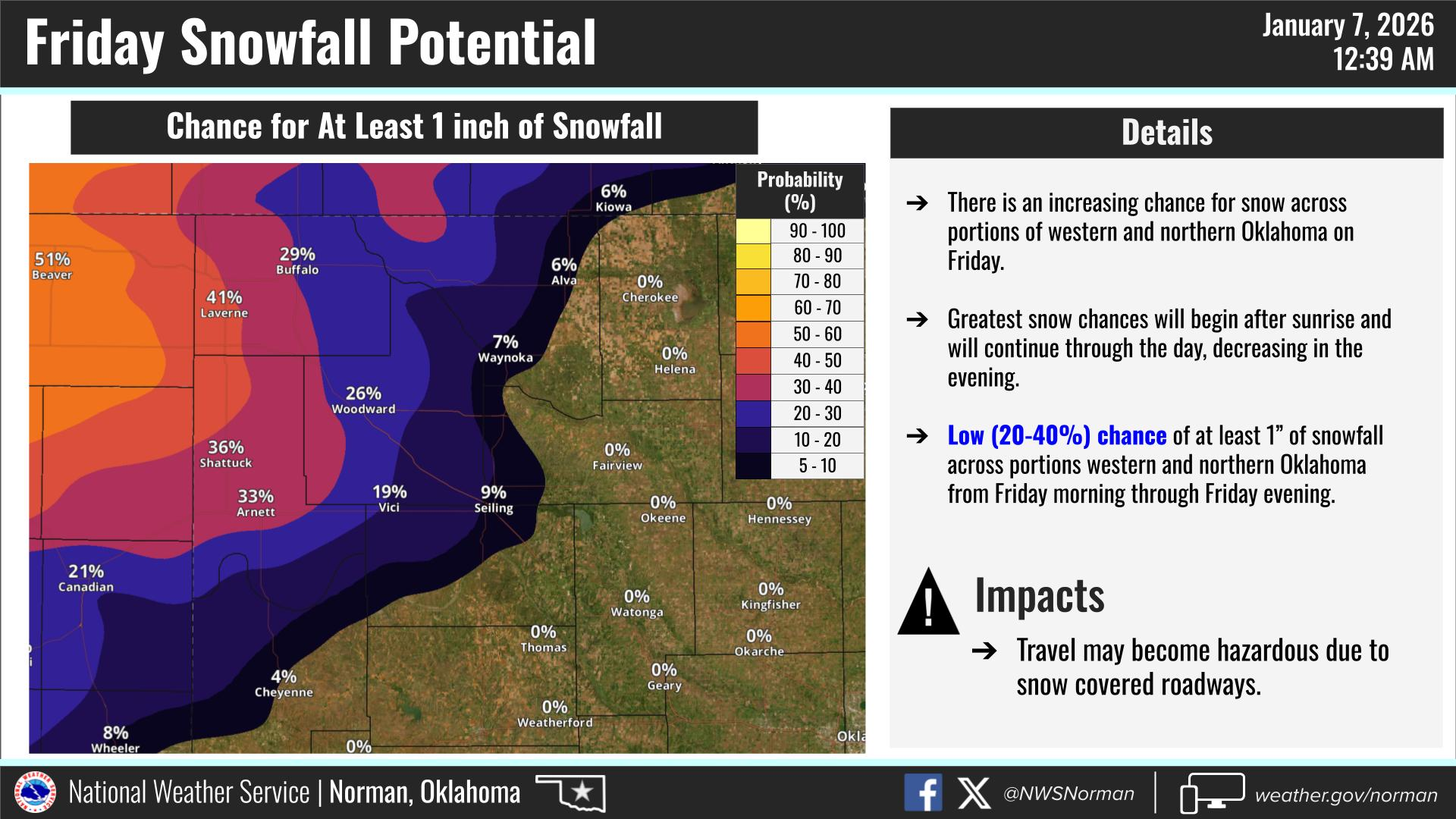
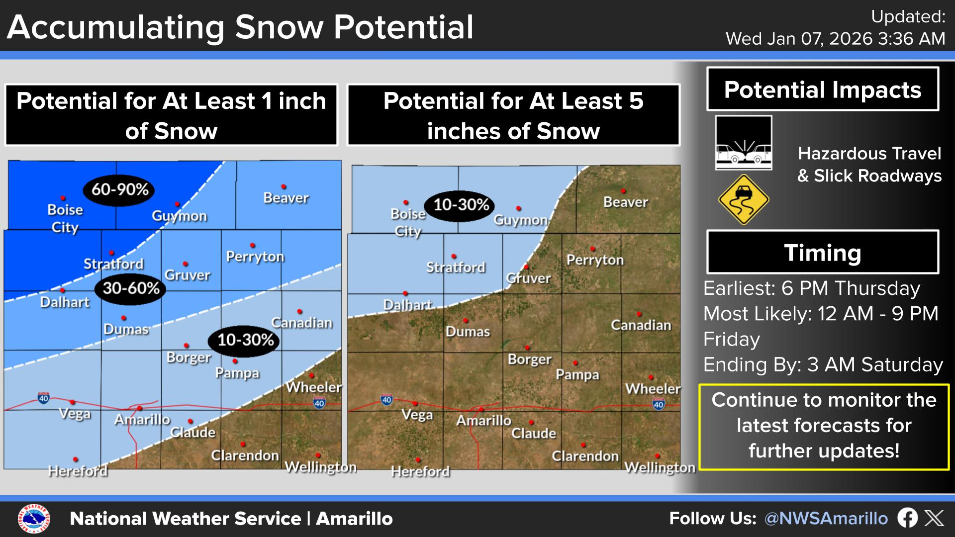
Here's a reasonable forecast attempt at snow totals.
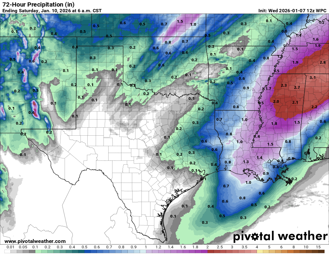
Once it's all said and done, and said again, with snow melt and storm water,
this is the 3-day moisture forecast for the state.
But come on, didn't spring start back before Christmas?
Gary McManus
State Climatologist
Oklahoma Mesonet
Oklahoma Climate Survey
gmcmanus@ou.edu
January 7 in Mesonet History
| Record | Value | Station | Year |
|---|---|---|---|
| Maximum Temperature | 85°F | WOOD | 2006 |
| Minimum Temperature | -19°F | KENT | 2017 |
| Maximum Rainfall | 2.75 inches | PORT | 2008 |
Mesonet records begin in 1994.
Search by Date
If you're a bit off, don't worry, because just like horseshoes, “almost” counts on the Ticker website!