Ticker for January 5, 2026
MESONET TICKER ... MESONET TICKER ... MESONET TICKER ... MESONET TICKER ...
January 5, 2026 January 5, 2026 January 5, 2026 January 5, 2026
2020-what?
Now where did we leave off? Oh yes, I was regaling you (and we all know just
how painful that can be) about my trip to China back in the 1950s when I
started a frozen honey candy confectionery called Carfax, LTD.
Or wait, that might have been a feverish dream after eating Taco Bell late last
night.
Hmmm, or maybe I was Tocking to you about how warm it was gonna be on Christmas
Day (it was), or how dry it was gonna be for awhile (it was, and is). You can
see more deets on all that stuff and whatnot down below in our December summary.
It was the second-driest and fifth warmest since records began in 1895. Could
have been fifth-driest and second-warmest...doesn't make much difference when
you're that low.
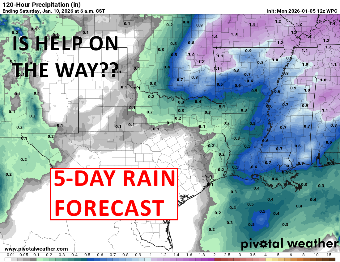
In case your scroller doesn't go down that far, here is our latest problem.
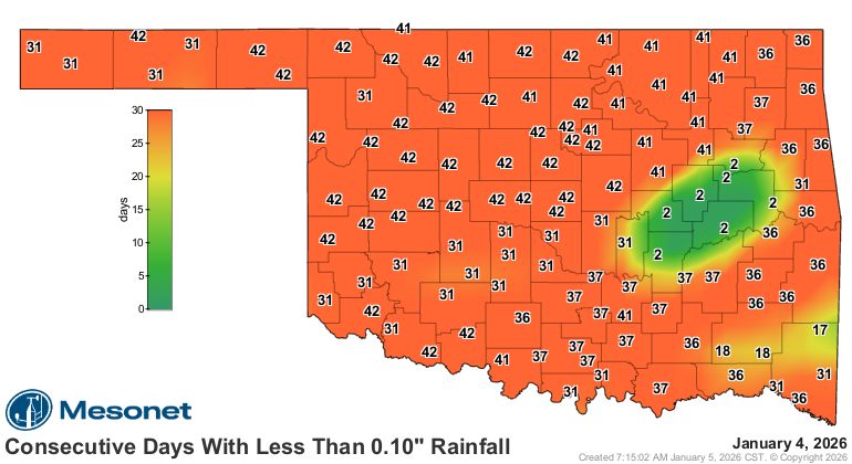
Ooh, look at Okmulgee and Eufaula over there, going on and on about how they
had a tenth a few days ago. Go on with your bad selves! But for the restovus,
it has not been a happy Festivus. And despite the forecast for some pretty
decent rain later in the week, it's gonna be mostly indecent for the western
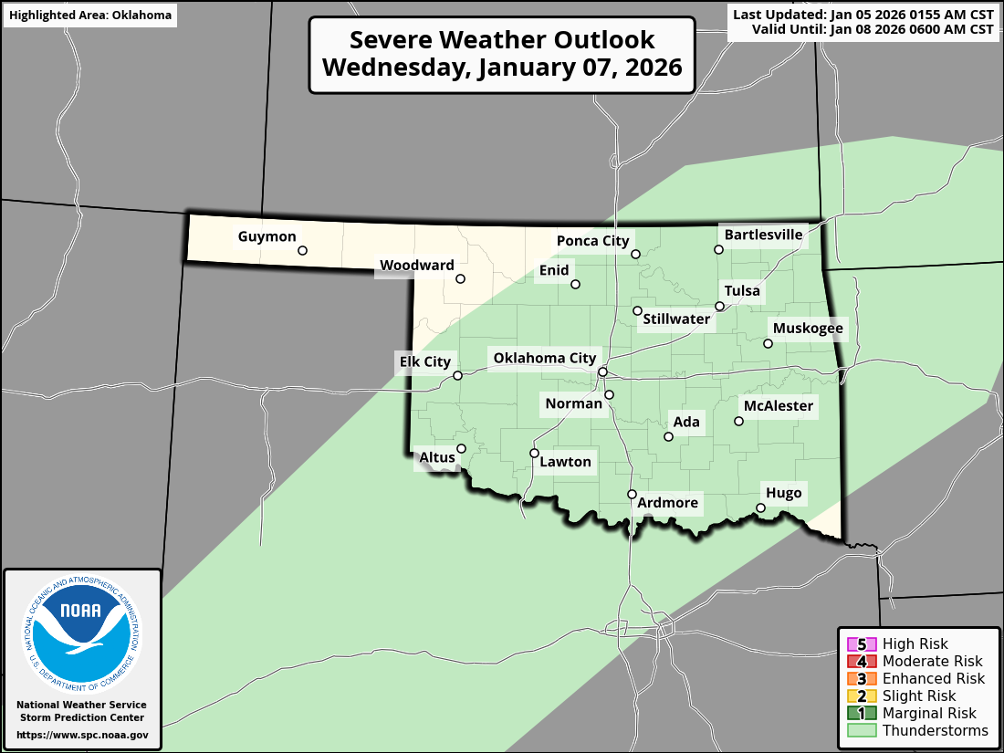
half of the state. Maybe a marginal severe-ish storm or two Wednesday or
Thursday?
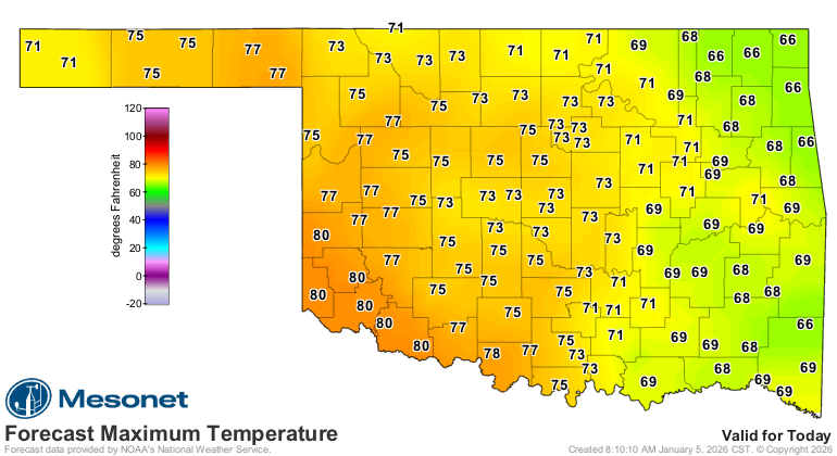
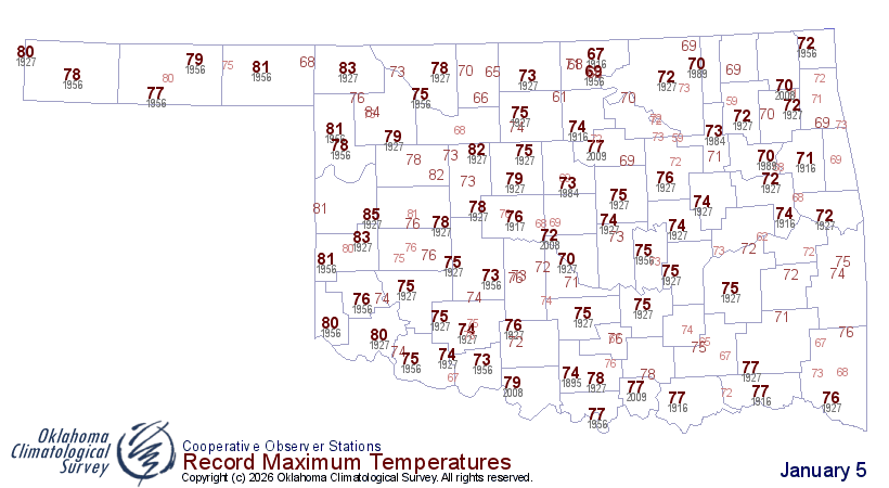
As for today, why not set some more record highs? It's in vogue, you know. I
could be in En Vogue, but my voice is scratchy.
And with heat and dead vegetation comes fire. Or is it the other way around?
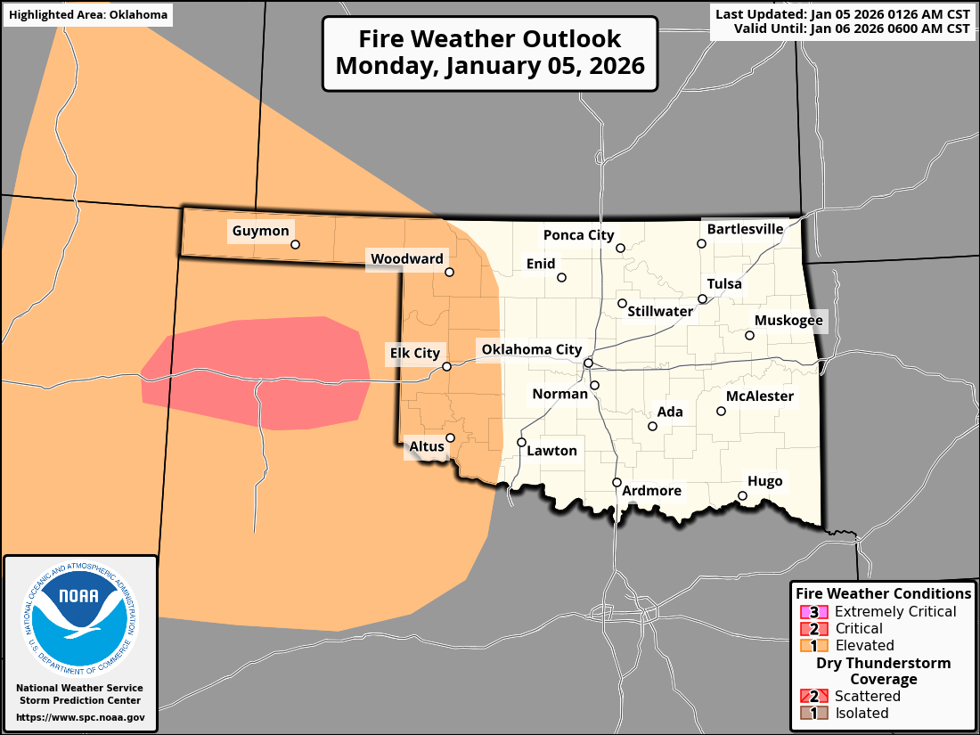
Other than that, nothing big showing up. Cooler during the weekend into next
week. Other than that (again), I don't see much to go squawking about.
Now onto and back to December, 2025!
----------------------------------------------------------------------------------
December warmth and drought punctuate 2025
Jan. 5, 2026
If moisture and cold weather topped your December weather Christmas list, you
likely didn’t enjoy the lump of coal Mother Nature delivered instead. December
2025 finished as Oklahoma’s second-driest and fifth-warmest on record, dating
back to 1895, allowing drought to flourish once again across much of the state.
The unusual warmth was especially pronounced during the week surrounding
Christmas, highlighted by the the warmest Christmas Day in Oklahoma history. The
month’s lack of meaningful precipitation and persistent warmth not only
reinforced drought conditions heading into the new year but also capped a year
marked by sharp contrasts, from historic spring rains to expanding late-year
dryness. Despite the dry December finish, 2025 featured an active severe-weather
season earlier in the year, including a preliminary total of 105 tornadoes
statewide.
December heat wave drives record-breaking warmth
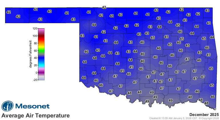
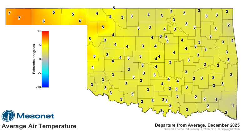
December finished with a statewide average temperature of 45 degrees, 4.9
degrees above normal. The fifth-warmest December on record began on the cool
side before high temperatures surged to 20 to 30 degrees above normal at times
during the final two weeks of the month. Oklahoma City set four daily
high-temperature records during the final nine days, while Tulsa did so five
times. On Dec. 27, several sites logged their highest December temperature on
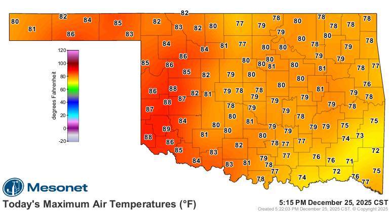
record, including Tulsa and Norman at 86 degrees and Stillwater at 85 degrees.
The Oklahoma Mesonet site at Mangum recorded 89 degrees on Christmas Day, the
highest temperature ever observed in Oklahoma on the holiday. The December
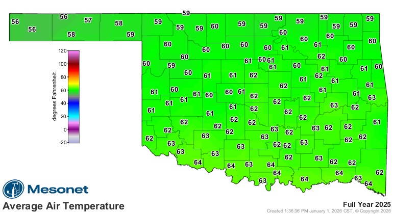
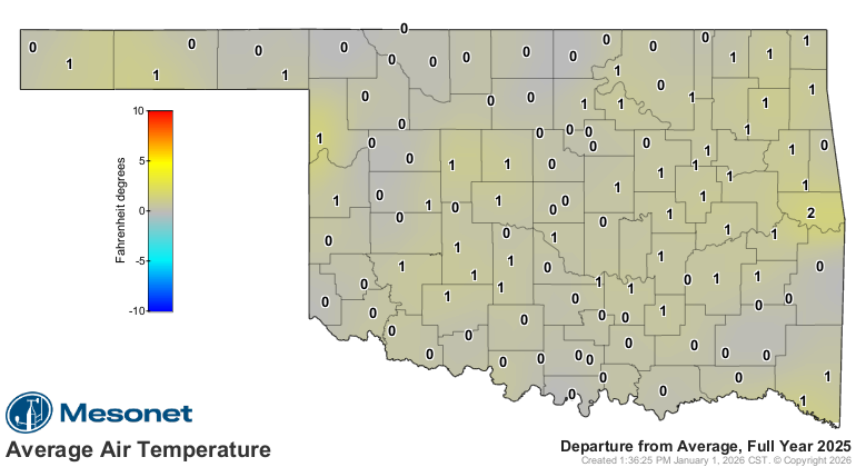
warmth helped push 2025’s statewide average temperature to 61.6 degrees, 1.2
degrees above normal, ranking the year as the 17th-warmest on record.
December ranks among Oklahoma’s driest on record
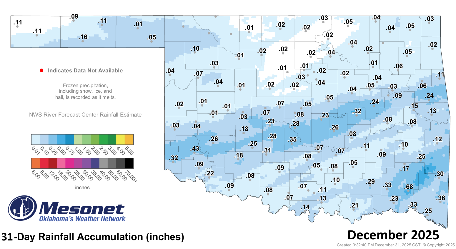
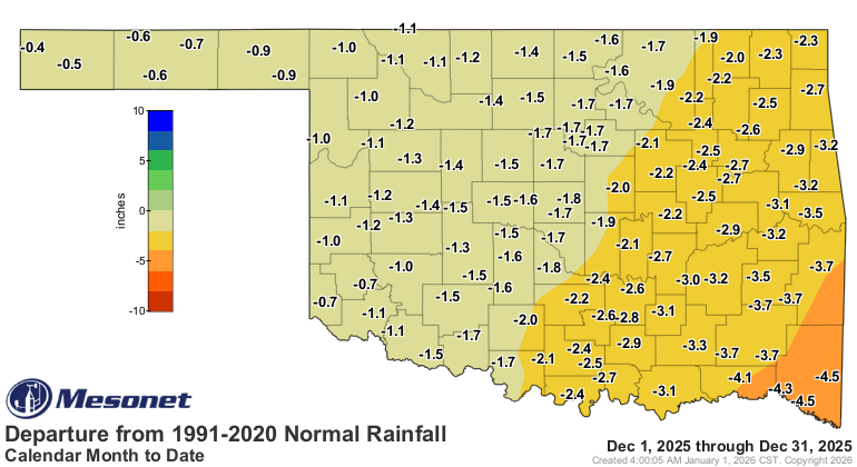
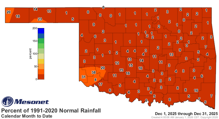
December’s statewide average rainfall totaled just 0.11 inches, finishing 2
inches below normal and narrowly missing the driest December on record. Limited
rainfall across parts of southeast Oklahoma prevented the month from surpassing
1950’s record-low average of 0.09 inches. Northeastern and east-central
Oklahoma fared even worse, each recording their driest December on record with
average totals of 0.03 and 0.12 inches, respectively. The Cloudy Mesonet site
led the state with just 0.68 inches. Seventy-seven Mesonet sites recorded a
tenth of an inch or less, and five sites reported no measurable precipitation.
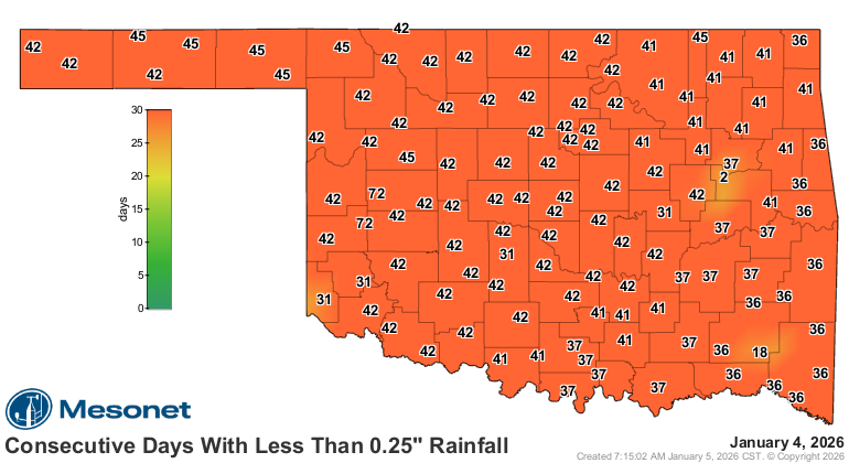
By the end of December, much of the state had gone 35 to 45 consecutive days
without receiving at least a quarter-inch of rainfall in a single day, with
some locations exceeding 70 days — a clear signal of the persistent nature of
the dryness. Despite the extreme December dryness, 2025 still finished as the
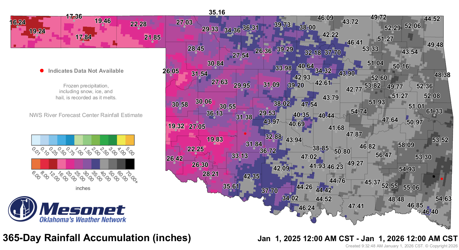
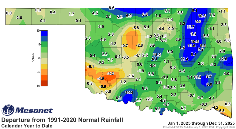
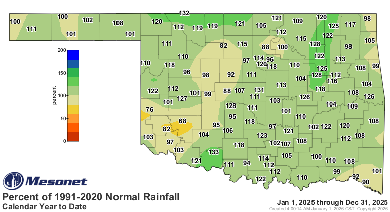
21st-wettest year on record statewide with an average of 39.3 inches, 2.94
inches above normal.
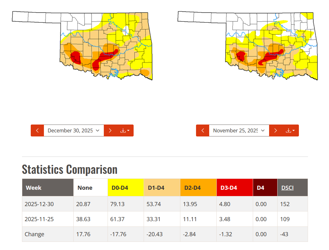
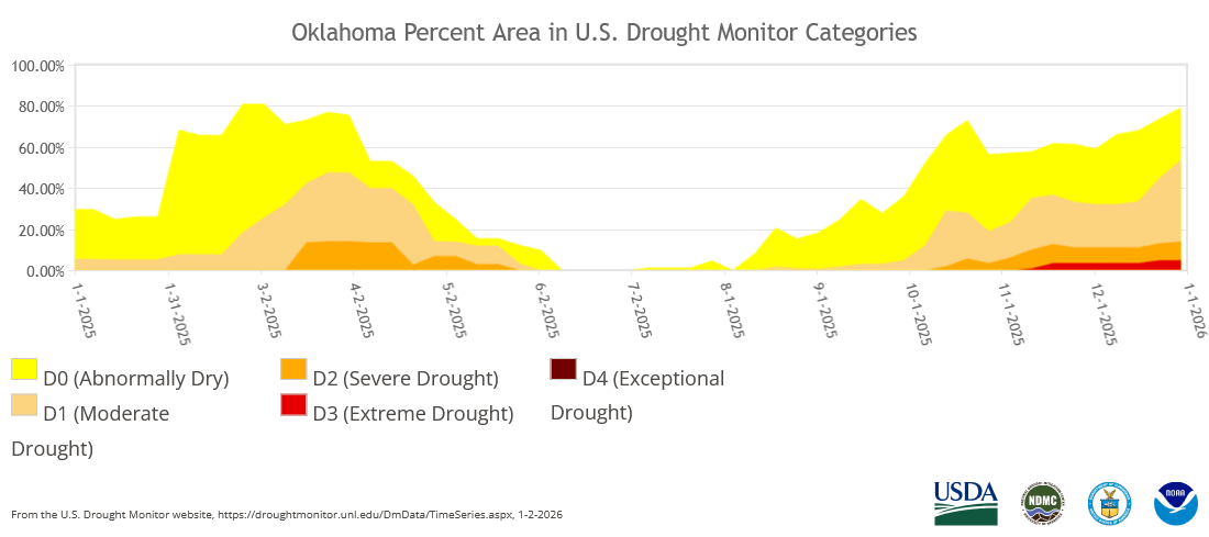
Drought coverage surges across Oklahoma
Drought expanded across Oklahoma for the third consecutive month, jumping from
33% of the state at the end of November to 54% by the end of December, up from
just 5% at the end of September. Most of that growth came from the expansion of
moderate drought, while higher-intensity drought levels increased by only about
3%. At 54% coverage, drought reached its highest extent in Oklahoma since Nov.
11, 2024, when 68% of the state was affected.
December by the numbers
• Statewide average temperature: 45°F, 4.9°F above normal — the fifth-warmest
December since records began in 1895
• Temperature extremes: High of 89°F at Mangum on Christmas Day; low of 7°F at
Kenton on Dec. 29; lowest wind chill, –4.9°F at Foraker on Dec. 14
• Warmest and coolest locations: Highest monthly average, 49.3°F at Durant;
lowest, 41.1°F at Medford
• Statewide average precipitation: 0.11 inches, 2 inches below normal — the
second-driest December on record
• Rainfall extremes: High of 0.68 inches at Cloudy; low of 0 inches at five
stations
• Rainfall totals under 0.25 inches: 105 instances recorded at the 120 Oklahoma
Mesonet sites, including 77 sites under a tenth of an inch
• Highest wind gusts: May Ranch, Dec. 18: 58 mph; Foraker, Dec. 18: 53 mph;
Camargo and Newkirk, Dec. 18: 51 mph
2025 by the numbers
• Statewide average temperature: 61.6°F, 1.2°F above normal — the 17th-warmest
year since records began in 1895
• Temperature extremes: High of 111°F at Hooker on Aug. 8; low of –17°F at
Beaver on Jan. 21; lowest wind chill, –33°F at Hooker on Jan. 21; highest
heat index, 119°F at Bristow on Aug. 19
• Statewide average precipitation: 39.3 inches, 2.94 inches above normal — the
21st-wettest year on record
• Rainfall extremes: High of 61.33 inches at Sallisaw; low of 16.24 inches at
Kenton
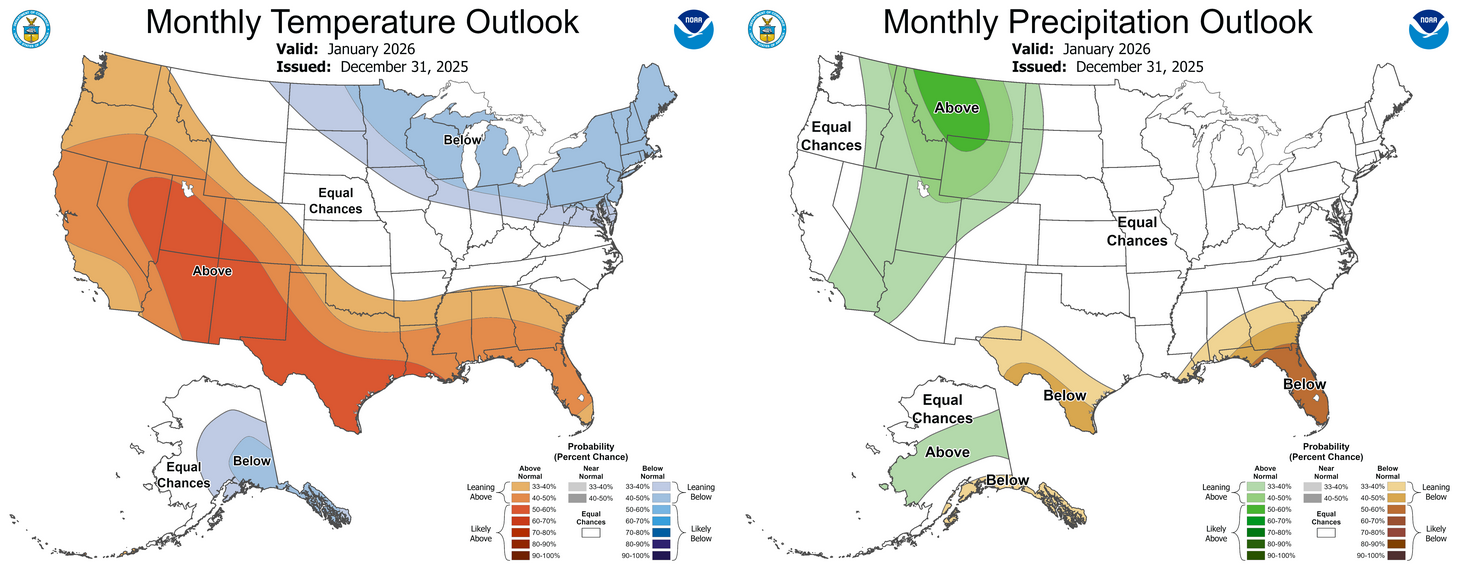
Drought likely to persist through January
The Climate Prediction Center’s (CPC) January outlook indicates equal chances
of above-, below- or near-normal precipitation across Oklahoma, along with
increased odds of above-normal temperatures across all but the northeast corner
of the state. The CPC’s January drought outlook calls for drought to persist in
areas where it existed at the end of December.

###
Gary McManus
State Climatologist
Oklahoma Mesonet
Oklahoma Climate Survey
gmcmanus@ou.edu
January 5 in Mesonet History
| Record | Value | Station | Year |
|---|---|---|---|
| Maximum Temperature | 79°F | WAUR | 2008 |
| Minimum Temperature | -3°F | KENT | 2014 |
| Maximum Rainfall | 2.19 inches | JAYX | 2005 |
Mesonet records begin in 1994.
Search by Date
If you're a bit off, don't worry, because just like horseshoes, “almost” counts on the Ticker website!