Ticker for November 14, 2025
MESONET TICKER ... MESONET TICKER ... MESONET TICKER ... MESONET TICKER ...
November 14, 2025 November 14, 2025 November 14, 2025 November 14, 2025
November to remember
Oh no, a Friday Ticker! Something bad must be happening? Well, no. Well, maybe.
I guess it depends on your perspective. If you like record warm weather, then
what a time to be alive!
If you miss actual fall weather, instead of this burst of winter...well, give it
a week or so. But for now, we start with a few record highs from yesterday.

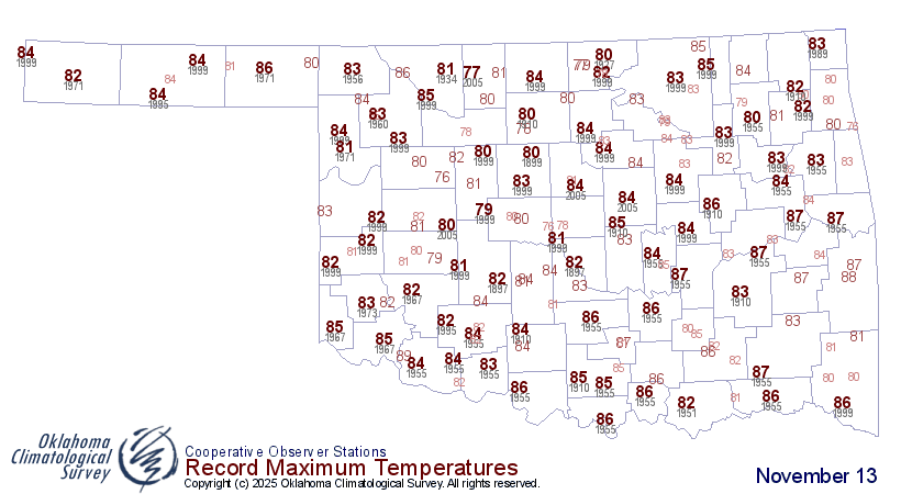
*NOTE: that record map for yesterday wasn't updated for any actual record highs
that might have been broken yesterday, you'll just have to visually compare the
two maps and see if anybody got lucky (or unlucky...again, perspectives).
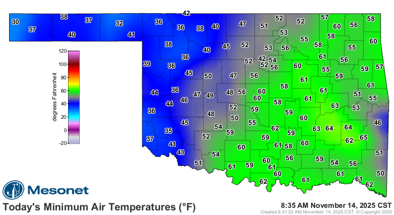
Then we undoubtedly saw some record high Tmins from this morning.

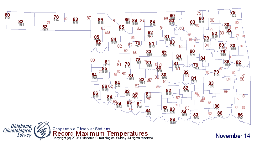
And then more record highs possible today.

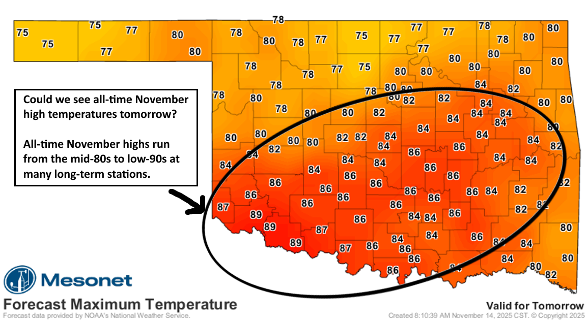
And then tomorrow is the biggie, which if we see the temperatures outkick the
forecast, like the last couple of days, then we might see some of those sites
get close to or break their all-time November high temperature records.
So for example, Stillwater's all-time highest temperature ever recorded in
November is 90F, set back on Nov. 7, 2023. Wow, that's recent! Now that one
will be a stretch. But how about OKC's 87F set on Nov. 11, 1980? Or Tipton's
91F set on Nov. 8, 2023. Wow, that's recenter (work with me) than Stillwater's
by one day!
At any rate, it all depends on the timing of the front tomorrow, and how far
it gets into the state by peak heating. If it's later in the evening, then
we could see some of that compressional heating ahead of the front that allows
temperatures to spike a few degrees higher than forecast.
By the way, the warmest November on record based on the statewide average is
November 1999's 56.1F (that's all the highs and lows across the state averaged
together for the month). Right now we're probably in at least the top-5 at
54.1F-ish, but there's more heat to go for the next few days, but more cool
weather in store for next week. So we probably won't get up there to 56.1F for
the warmest November, with half a month left to go, but still one of the warmest
November's on record looks possible.
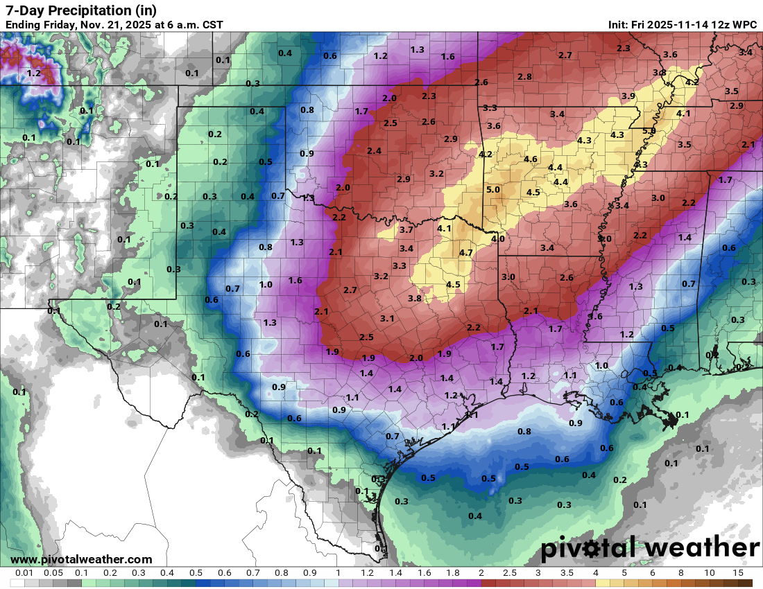
Oh yeah, it might rain next week, too. Talk about burying the lede.
Gary McManus
State Climatologist
Oklahoma Mesonet
Oklahoma Climate Survey
gmcmanus@ou.edu
November 14 in Mesonet History
| Record | Value | Station | Year |
|---|---|---|---|
| Maximum Temperature | 89°F | GRA2 | 2025 |
| Minimum Temperature | 11°F | OILT | 2018 |
| Maximum Rainfall | 4.93 inches | CLAY | 1994 |
Mesonet records begin in 1994.
Search by Date
If you're a bit off, don't worry, because just like horseshoes, “almost” counts on the Ticker website!