Ticker for October 14, 2025
MESONET TICKER ... MESONET TICKER ... MESONET TICKER ... MESONET TICKER ...
October 14, 2025 October 14, 2025 October 14, 2025 October 14, 2025
Ahhhh, Bach
Ahhhh, so THAT'S what fall is supposed to feel like, with the rain and the gray
(Okie to English translation: "grey") skies and the somewhat seasonable (for some)
temperatures and whatnot.
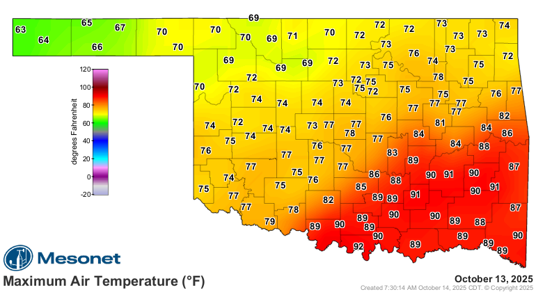
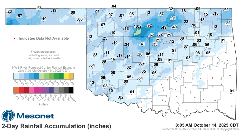
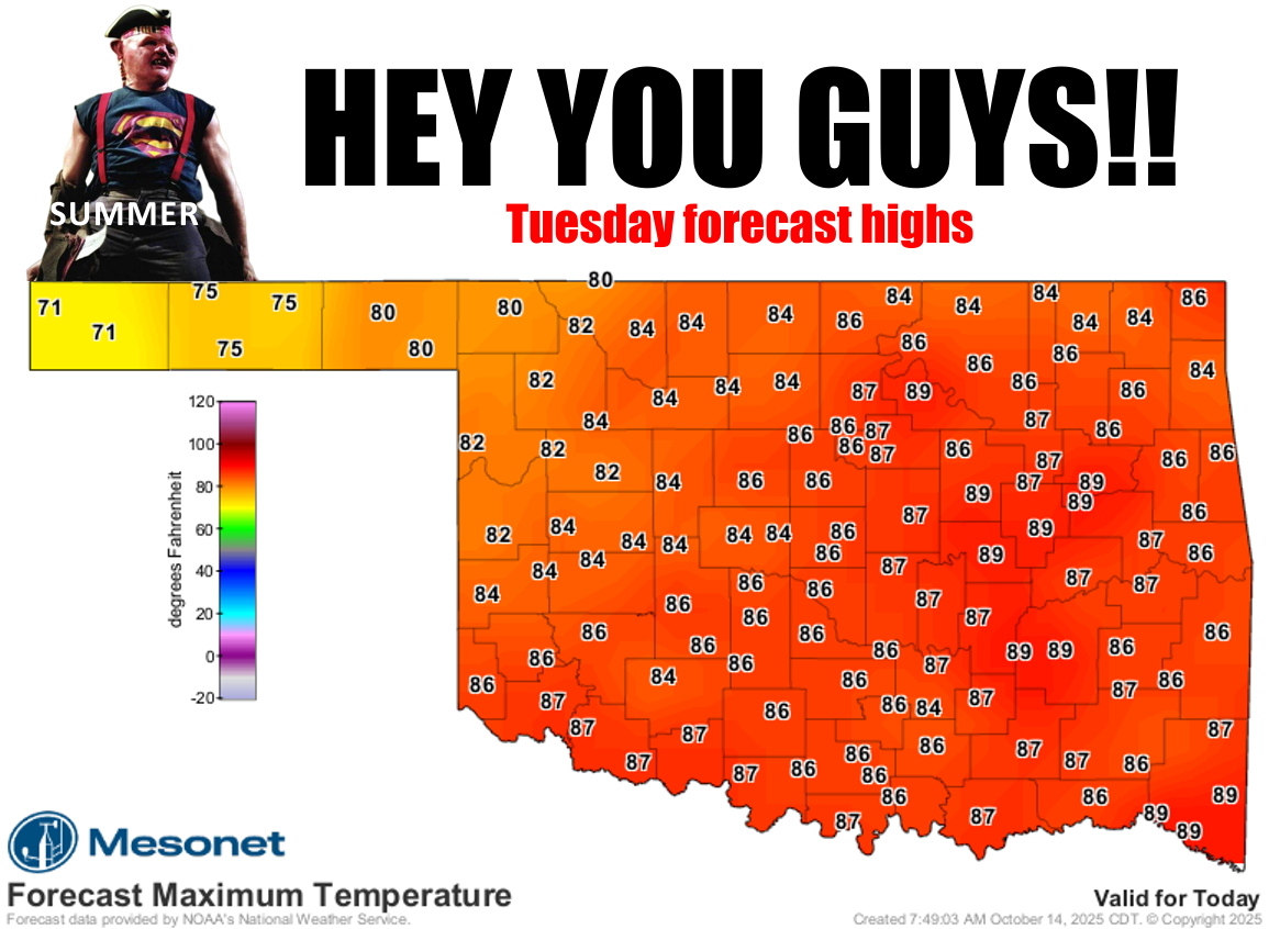
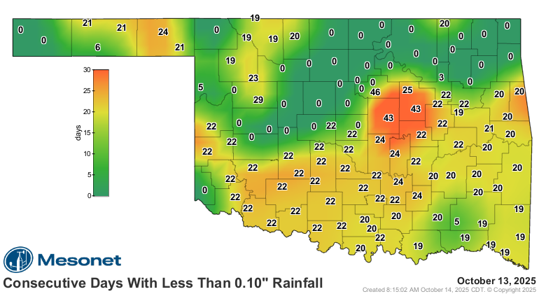
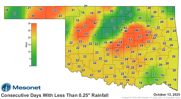
Well as you can see there, not everybody got the rain, and not everybody got the
fall. And of course we get the summery gut punch back today with highs about 10
degrees above normal.
Again!
And Mother Nature shouldn't slug us in the gut when we aren't ready. That's how
Houdini died, you know.
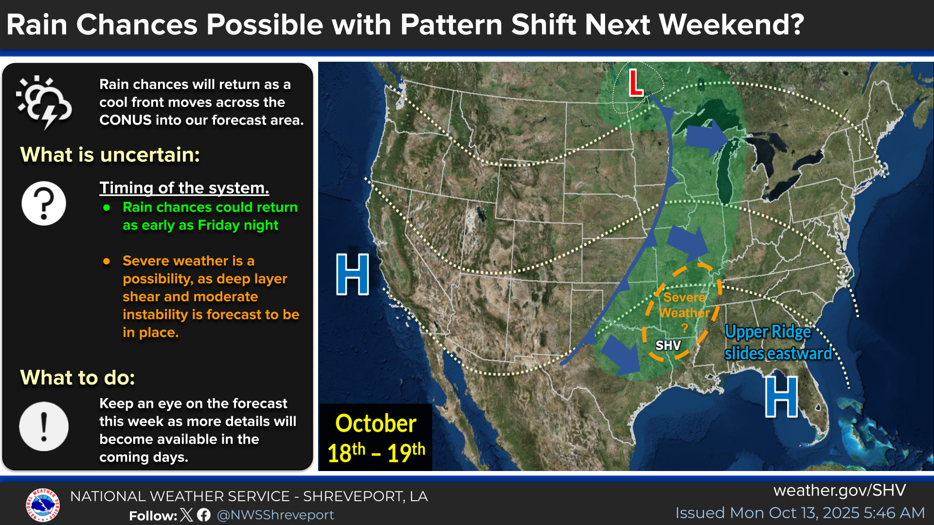
It's more of the same until this weekend when we get another front and storm
system, and this time we might get actual storms of the severe variety. As is
usually the case, you'll need to keep abreast of the situation as the weekend
draws near.
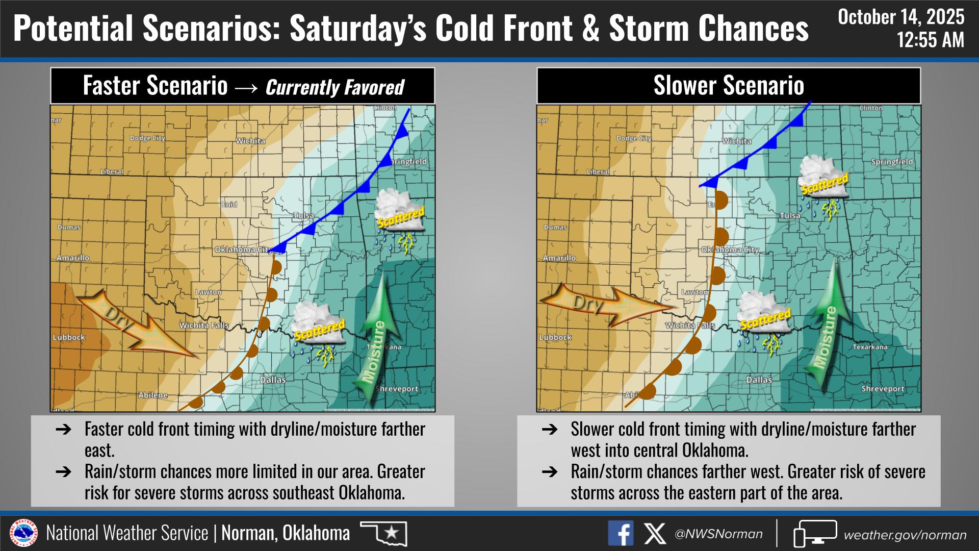
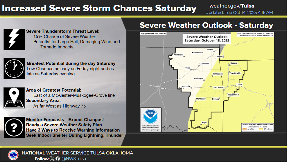
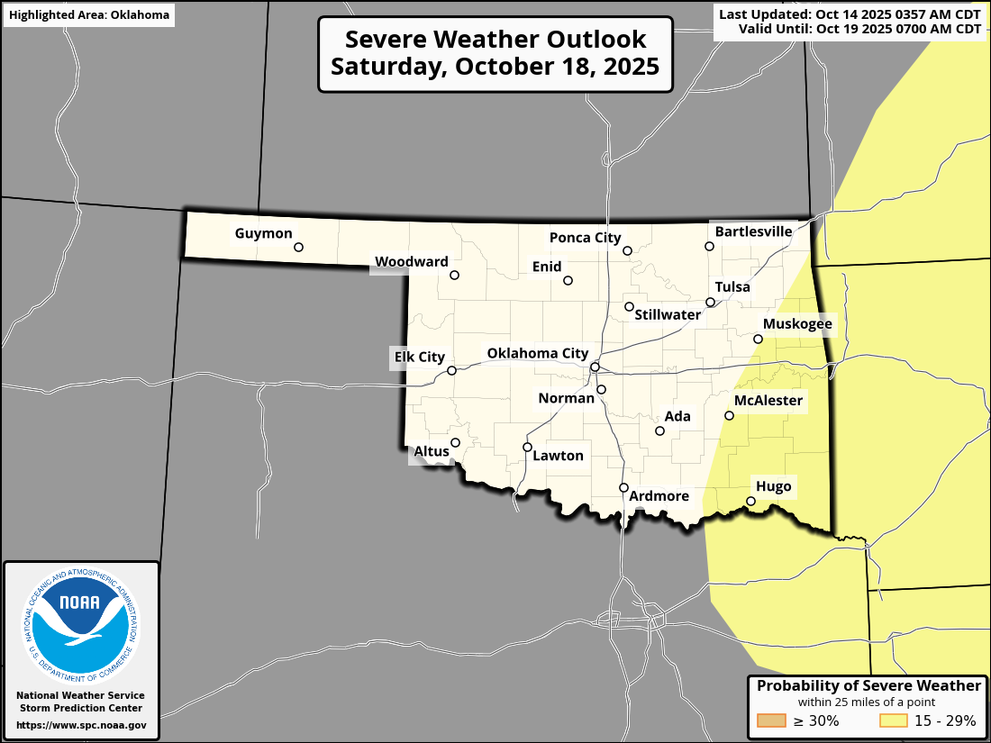
Here's the SPC outlook for Saturday. This could definitely change/shift around
a bit.
Forecast rainfall maps will be very dependent on where those storms form (if
they do), but here's what it looks like as of now.
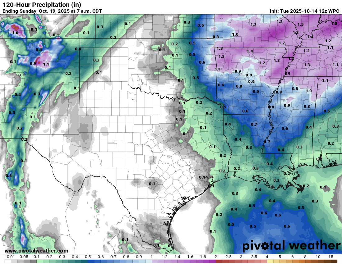
Hey, we can't have everything, but at least we reset these maps a bit.
Gary McManus
State Climatologist
Oklahoma Mesonet
Oklahoma Climate Survey
gmcmanus@ou.edu
October 14 in Mesonet History
| Record | Value | Station | Year |
|---|---|---|---|
| Maximum Temperature | 100°F | HOLL | 2020 |
| Minimum Temperature | 26°F | PRYO | 2002 |
| Maximum Rainfall | 2.83 inches | ARD2 | 2013 |
Mesonet records begin in 1994.
Search by Date
If you're a bit off, don't worry, because just like horseshoes, “almost” counts on the Ticker website!