Ticker for October 13, 2025
MESONET TICKER ... MESONET TICKER ... MESONET TICKER ... MESONET TICKER ...
October 13, 2025 October 13, 2025 October 13, 2025 October 13, 2025
Fronts and backs
Monday is trash day in my part of Norman, Oklahoma. So I dutifully gather all the
trash in the house and put it in my little green bin and move it to the curb on
Sunday night.
Exciting, ain't it?
So I forgot to empty a couple of trash cans in the house so I gathered up that
trash as well and stepped outside about 6:30 a.m., prepared for the brisk
October morning and...I was greeted with temperatures in the low 70s, which is
closer to what our normal HIGHs should be for this time of year versus what our
lows should be.
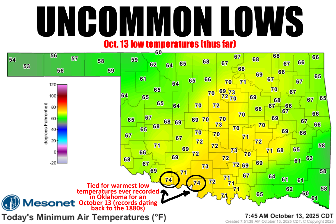
In fact, you can see above that our lows this morning for at least the I-44
corridor or so broke those record high low temps.
Yes, HIGH LOWS.
JUMBO SHRIMP.
AWFULLY GOOD.
Hey, you want a list of oxymorons, ask a moron (I HEARD THAT!!).
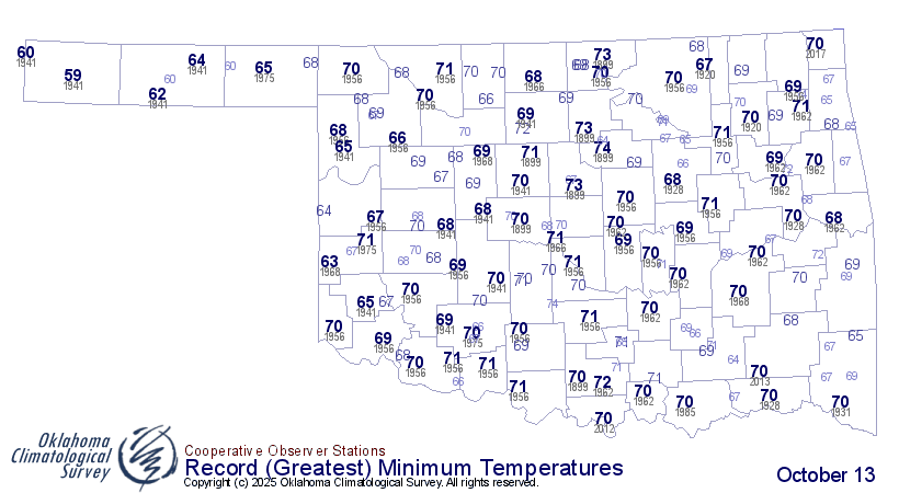
Anyway, those 74s down south at Grandfield and Waurika are actually tied for
the warmest high Tmins on record for an Oct. 13 in Oklahoma, and those records
date back to the 1880s.
Now here's the kicker.
No, not that kind of kicker! Come on, work with me here. The kicker is there's
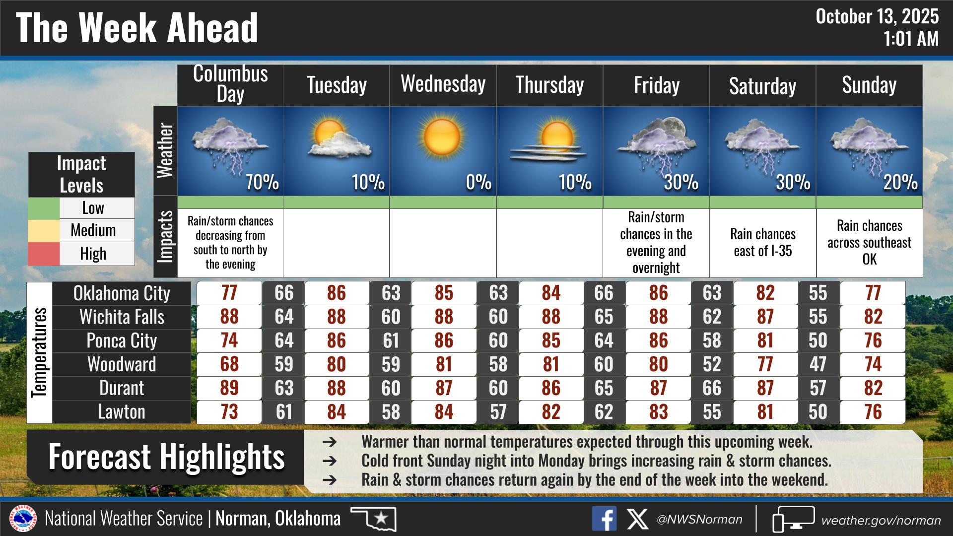
currently a cold front (cool front?) moving through the state, which will cause
those temperatures to drop as we go through the day. So when we look at the
low temperature map from today, tomorrow, those lows might have dropped from
where they are this morning. So let's say we've had record MORNING LOWS, at
least, instead of those we see at midnight tonight. That's okay, you'll be
asleep anyway.
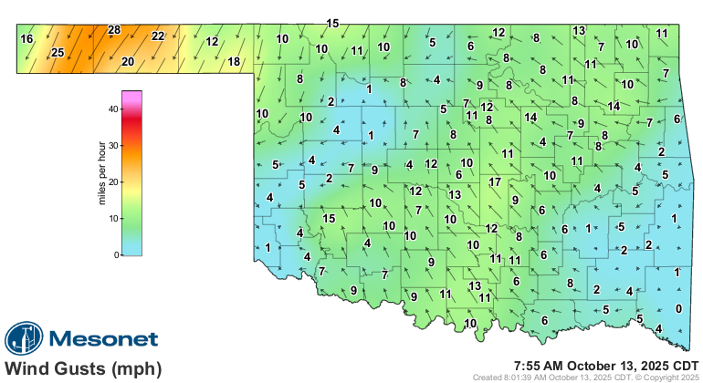
Oh, you don't believe there's a front moving through the state? Well check out
these winds and notice those NW winds in the, uhhhhhhhhh...northwest.
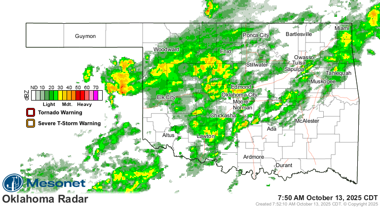
The front has also kicked off some rain overnight. Not much, but it's something.
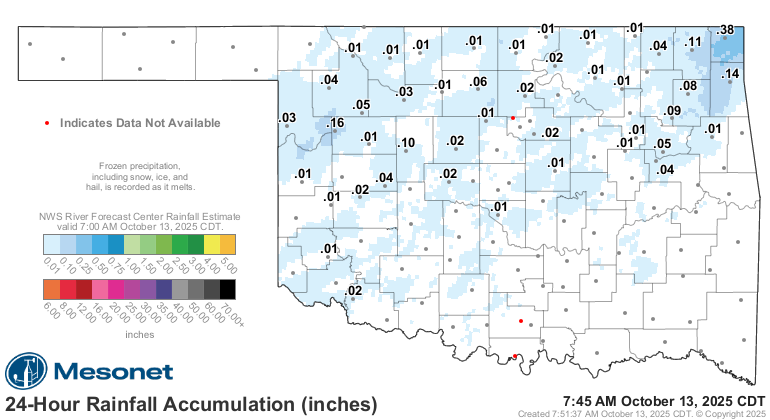
Heck, it's raining along that front right now, for crying out loud!
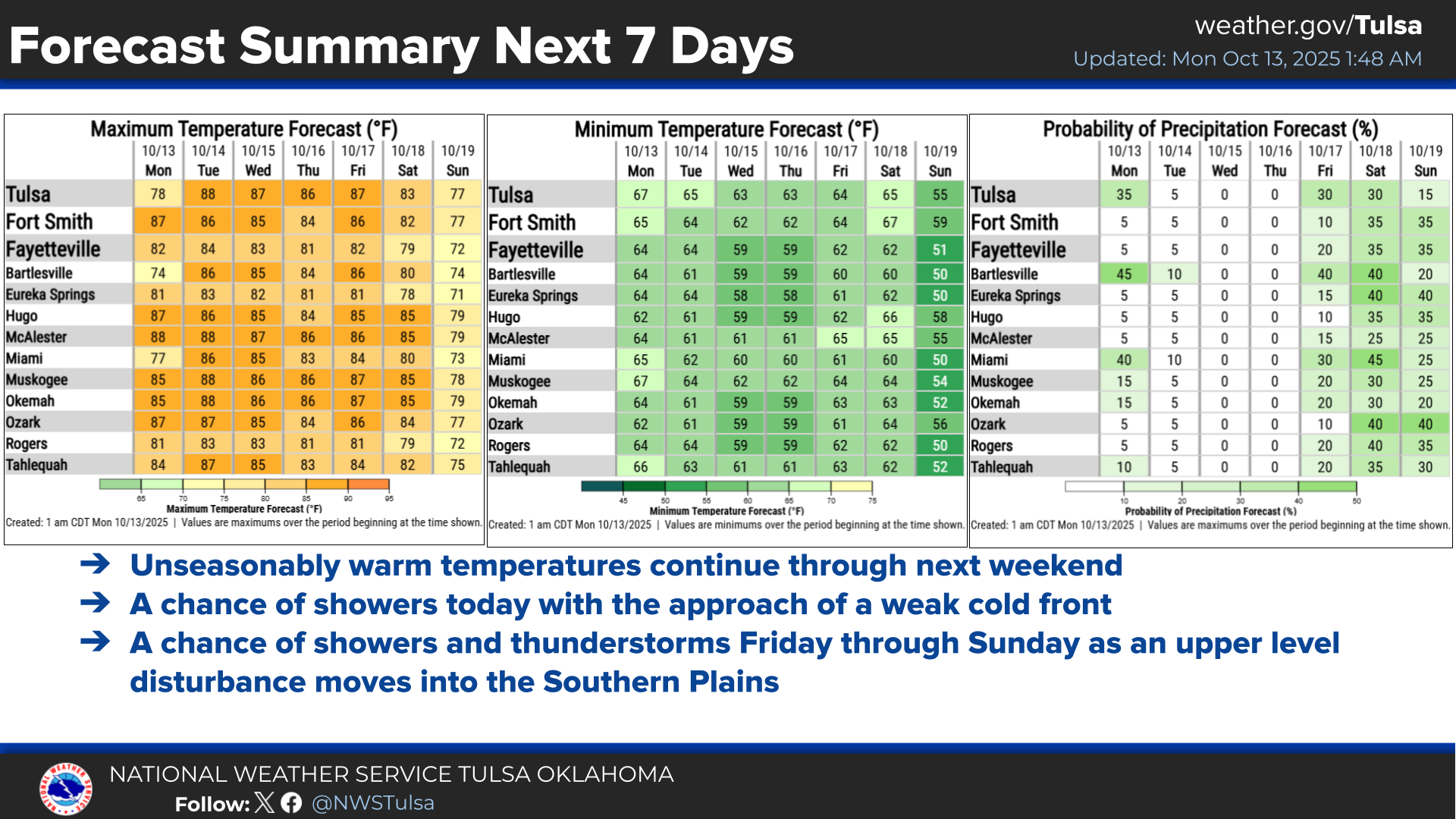
We've seen a bit of these amounts being forecast for today, but this is what
it could look like when it's all over.
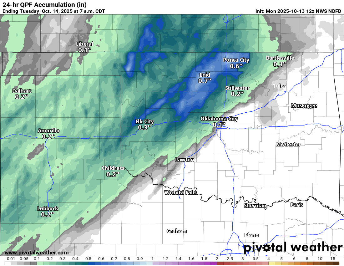
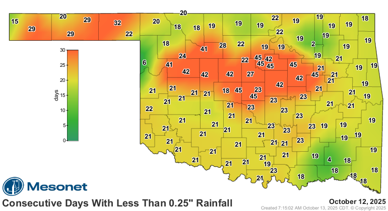
Do we need a lot more rain than that, over a much larger area? You tell me.
Despite the front, and rain, we're still gonna see some highs out of this
October world this afternoon to the southeast of that front, and then a brief
cooldown to somewhat near normal for this time of year.
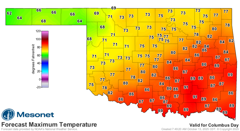
Then, back to the uncommonly uncommon warmth.
Gary McManus
State Climatologist
Oklahoma Mesonet
Oklahoma Climate Survey
gmcmanus@ou.edu
October 13 in Mesonet History
| Record | Value | Station | Year |
|---|---|---|---|
| Maximum Temperature | 93°F | FREE | 2015 |
| Minimum Temperature | 24°F | KENT | 2019 |
| Maximum Rainfall | 4.60 inches | OILT | 2012 |
Mesonet records begin in 1994.
Search by Date
If you're a bit off, don't worry, because just like horseshoes, “almost” counts on the Ticker website!