Ticker for October 6, 2025
MESONET TICKER ... MESONET TICKER ... MESONET TICKER ... MESONET TICKER ...
October 6, 2025 October 6, 2025 October 6, 2025 October 6, 2025
Augtober?
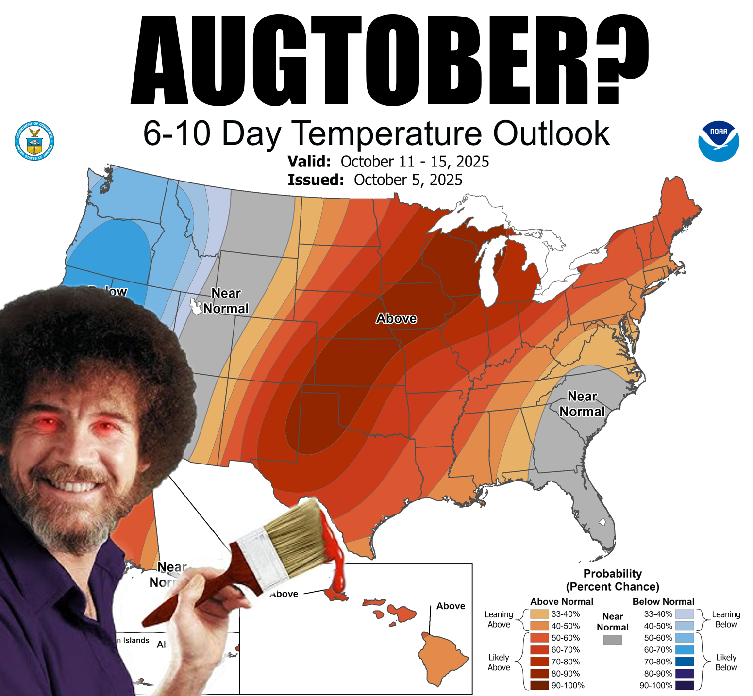
Can I legally use "Augtober" again since I already used it back in August when it
felt like October? Surely you remember this (we did the Shirley joke last time...
sorry), when we had 2 weeks of fall to end August and begin September?
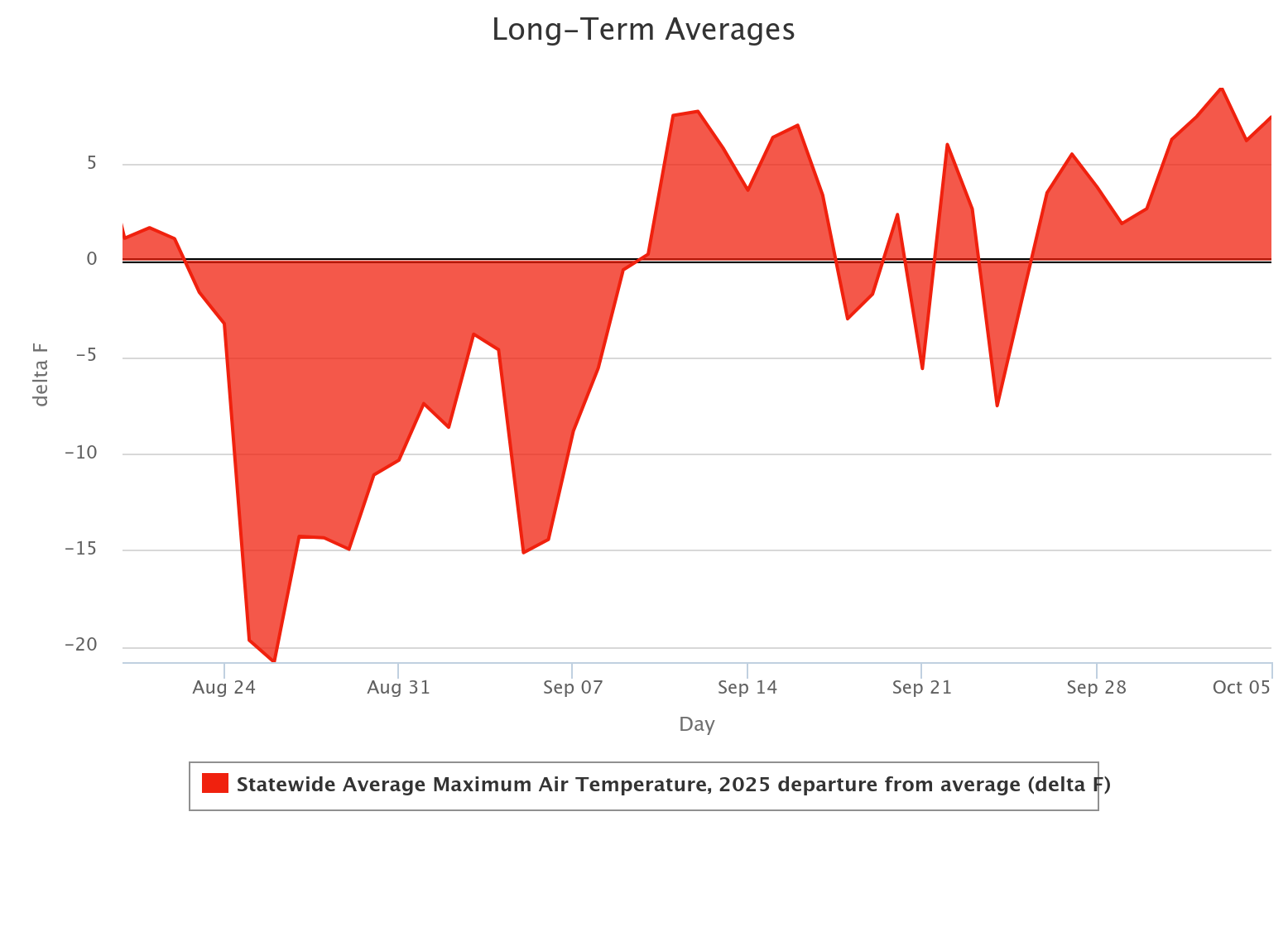
Pretty clear that we already had our fall back then, and now we've just been in
late-summer mode every since, with a few bumps downward every now and again (and
we all know just how painful that can be).
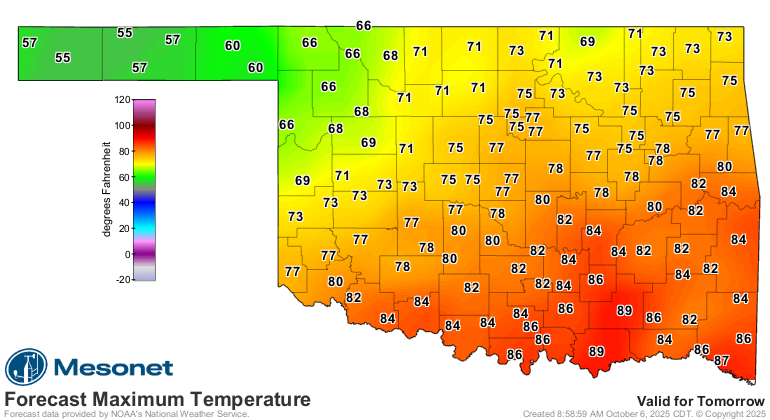
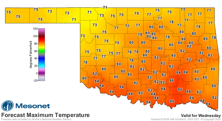
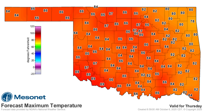
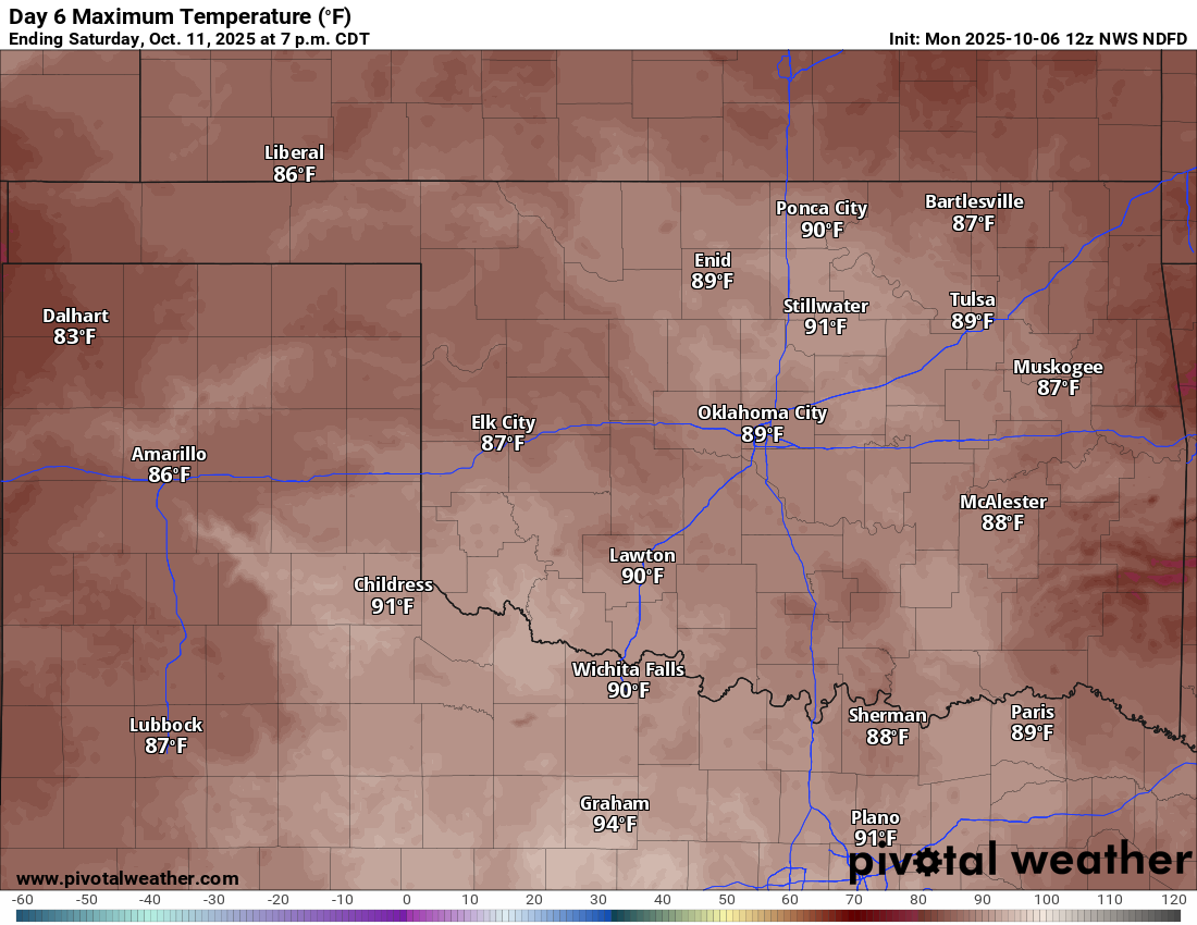
Well get ready for another of those bumps downward, but don't expect it to last
as we'll be back up into the 80s in no time. And some will remain in the 80s,
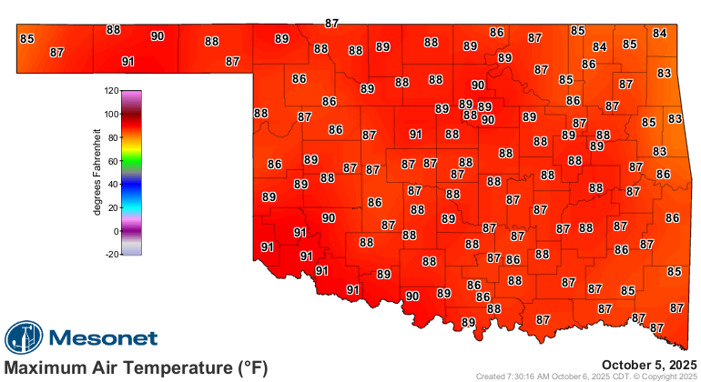
of course. We'll continue to see an occasional 90 here and there as well. Today
included. Yesterday too.
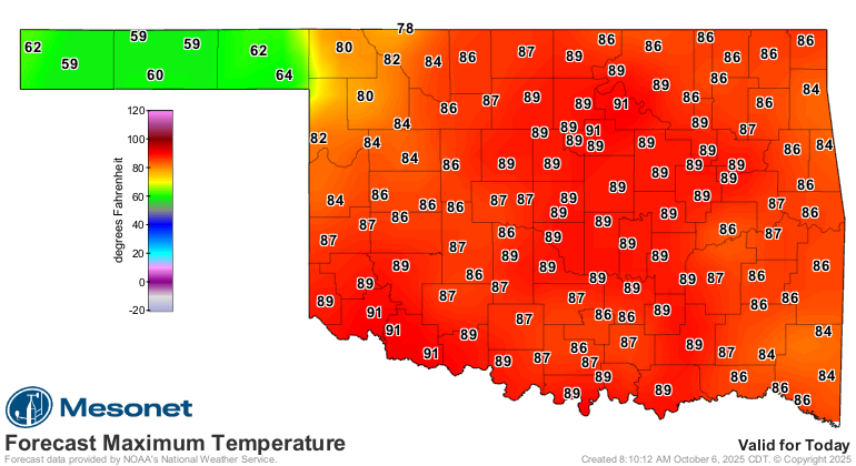
Whoa, look out there in the Panhandle though! 60s and 70s? Are you serious, Pvt.
Pyle? Incredible. And those are forecast HIGHS. For the rest of us, we'll get
two of those bump downward days, then back to the frying pan...at least
relatively speaking for this time of year.
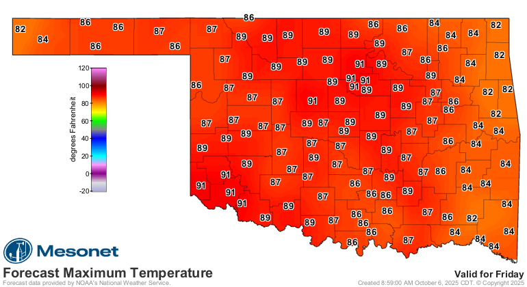
Whoa, look at Saturday. Augtober indeed!
Rain, you ask? Sure, if you're in NW OK the next couple of days.
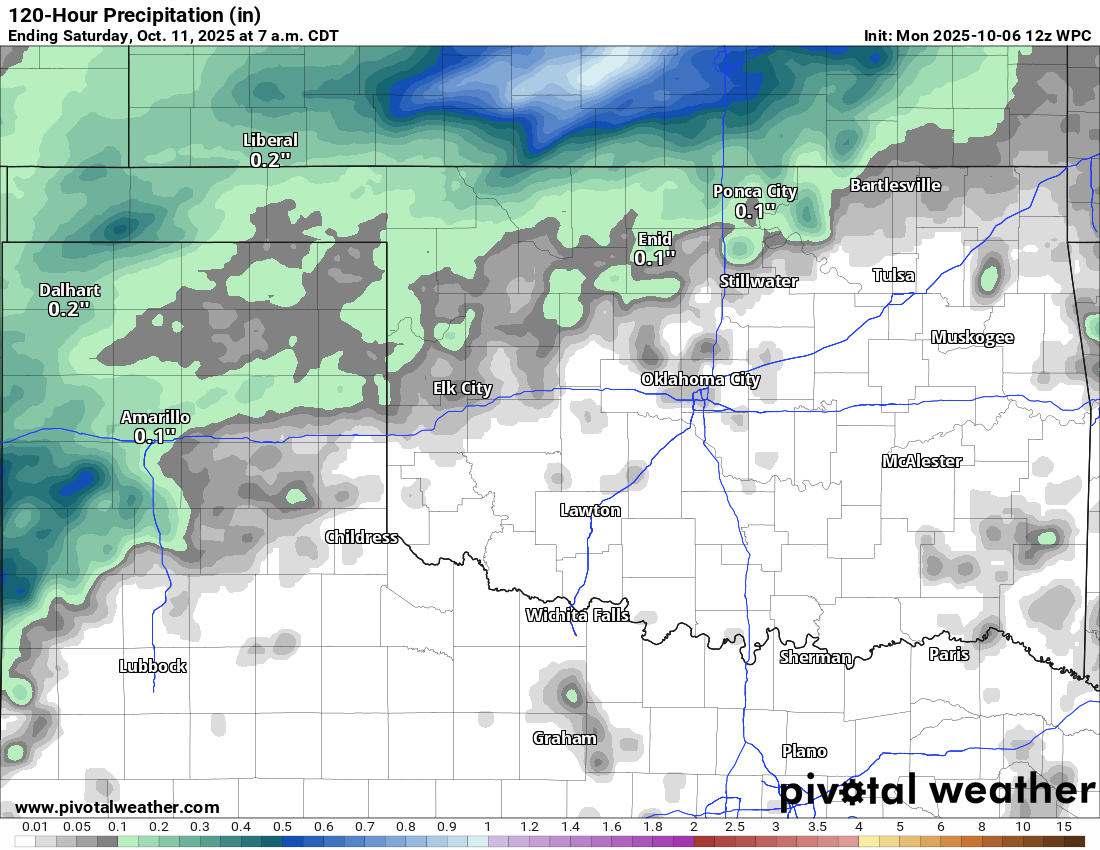
For everybody else? LOL! Get out of here with that stuff!
Gary McManus
State Climatologist
Oklahoma Mesonet
Oklahoma Climate Survey
gmcmanus@ou.edu
October 6 in Mesonet History
| Record | Value | Station | Year |
|---|---|---|---|
| Maximum Temperature | 95°F | FREE | 2016 |
| Minimum Temperature | 27°F | KENT | 2013 |
| Maximum Rainfall | 7.75 inches | JAYX | 2019 |
Mesonet records begin in 1994.
Search by Date
If you're a bit off, don't worry, because just like horseshoes, “almost” counts on the Ticker website!