Ticker for August 20, 2025
MESONET TICKER ... MESONET TICKER ... MESONET TICKER ... MESONET TICKER ...
August 20, 2025 August 20, 2025 August 20, 2025 August 20, 2025
Glubbbbb glub
I'm currently matriculating (English to Okie translation: going to school at) my
least favorite educational institution, Colonoscopy Prep, but that's not enough
to stop me from Tocking about the upcoming changes to our weather pattern as we
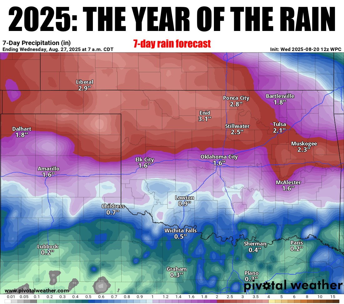
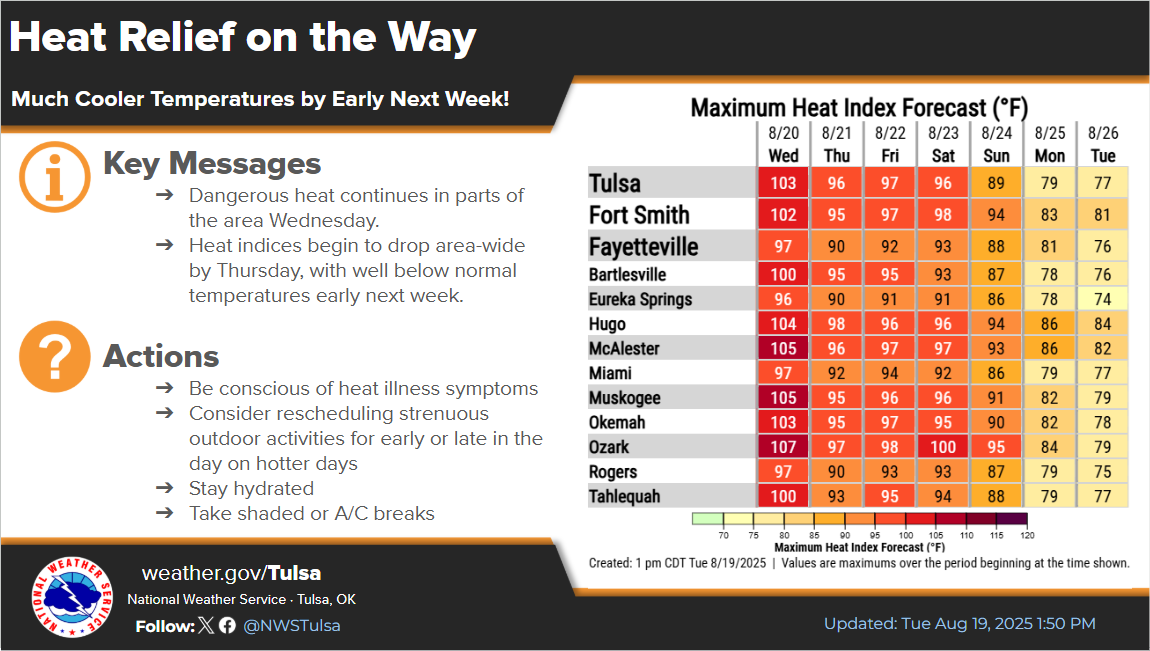
approach the weekend into early next week (and beyond). How does (more) heavy
rain and highs in the 70s, lows in the 50s and 60s sound?
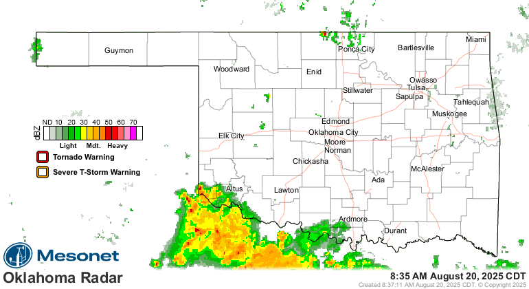
Heck, it's raining right now for crying out loud!
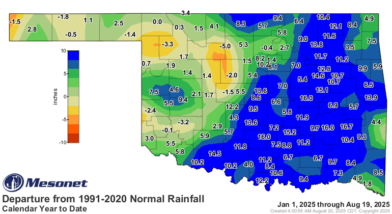
Speaking of those pattern changes, check this out!
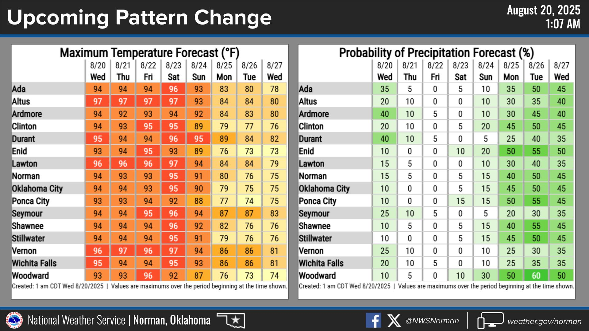
Dang, that looks good. TAKE THAT 2012 KIA OPTIMA! Soon, I shall be basking in
October'ish weather, surely to bask in August'ish weather afterwards, but I'll
take what I can get.
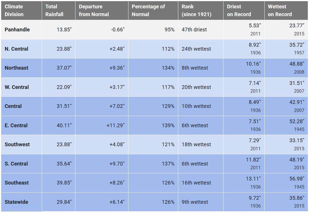
We're already in the top-10 wettest Jan. 1 through Aug. 19 periods on record
for at least the last 100 years, based on our statewide average rainfall, and
now we're gonna add another blast of heavy rains to the mix early next week?
Well go on with your bad self, Mother Nature!
Resist the urge to say "we've had our last..." because September can get hot
here in Oklahoma. REALLY hot. But we'll take 70s at the end of August, thank
you very much!
Gary McManus
State Climatologist
Oklahoma Mesonet
Oklahoma Climate Survey
gmcmanus@ou.edu
August 20 in Mesonet History
| Record | Value | Station | Year |
|---|---|---|---|
| Maximum Temperature | 111°F | WAUR | 2023 |
| Minimum Temperature | 47°F | ELRE | 2015 |
| Maximum Rainfall | 3.45 inches | MAYR | 1996 |
Mesonet records begin in 1994.
Search by Date
If you're a bit off, don't worry, because just like horseshoes, “almost” counts on the Ticker website!