Ticker for August 5, 2025
MESONET TICKER ... MESONET TICKER ... MESONET TICKER ... MESONET TICKER ...
August 5, 2025 August 5, 2025 August 5, 2025 August 5, 2025
Easy going
2025 has been the year without a summer, although summer summered some already,
and is about to summer again.
Bummer.
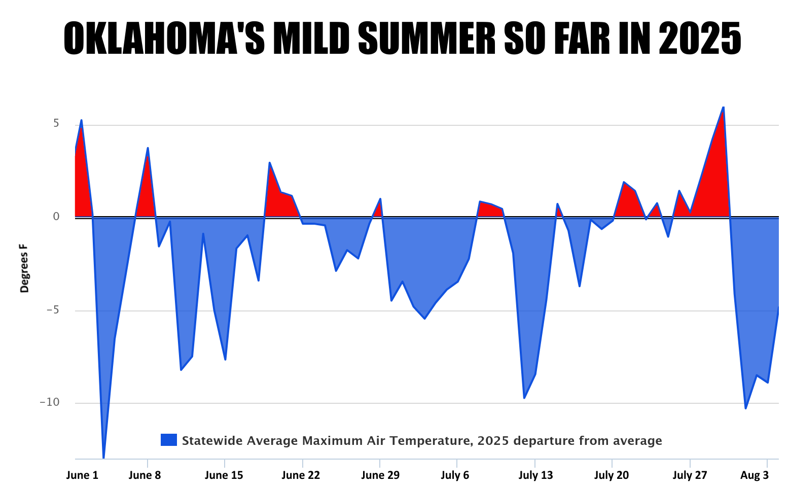
But you can see from the top graph of statewide average departure from average
max temps, as measured by the Oklahoma Mesonet, we've been pretty darned lucky
thus far. The normal statewide avg. high temperature for June 1 through Aug. 4
is 91.6F, and we've been somewhere around 89F. Now taking ought from not, carry
to 1 and divide by zero, and you get a very nice heat deficit. At least for
an Oklahoma summer.
Weird thing is, and this graph ain't as purty as the one above...oops, slipped
back into Okie there (I'M FROM HERE, I CAN SAY IT!).
This is a bit perplexing, and while this graph isn't quite as polished as the
top one, it does show that the low temps have been somewhat above normal through
the same time frame...more often than not.
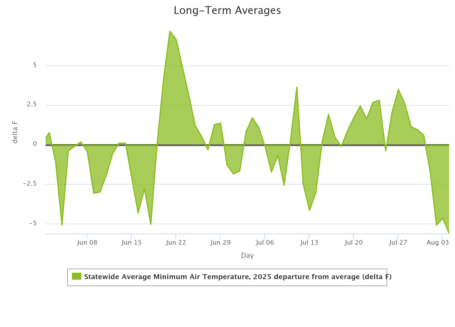
I'd take that as a sign that all that moisture we've had has kept those low
temperatures a bit higher. That moisture keeps the heat the surface emits
overnight closer to the ground since it's a great absorber of sensible heat
energy. Kind of a blanket effect, in a very simplified way. Same thing for
clouds, although that's more noticeable during the cool seaeason.
Anyway, fun time's over.
So's this Ticker.
Gary McManus
State Climatologist
Oklahoma Mesonet
Oklahoma Climate Survey
gmcmanus@ou.edu
August 5 in Mesonet History
| Record | Value | Station | Year |
|---|---|---|---|
| Maximum Temperature | 113°F | KIN2 | 2011 |
| Minimum Temperature | 52°F | KENT | 2021 |
| Maximum Rainfall | 4.57 inches | NEWK | 2017 |
Mesonet records begin in 1994.
Search by Date
If you're a bit off, don't worry, because just like horseshoes, “almost” counts on the Ticker website!