Ticker for July 21, 2025
MESONET TICKER ... MESONET TICKER ... MESONET TICKER ... MESONET TICKER ...
July 21, 2025 July 21, 2025 July 21, 2025 July 21, 2025
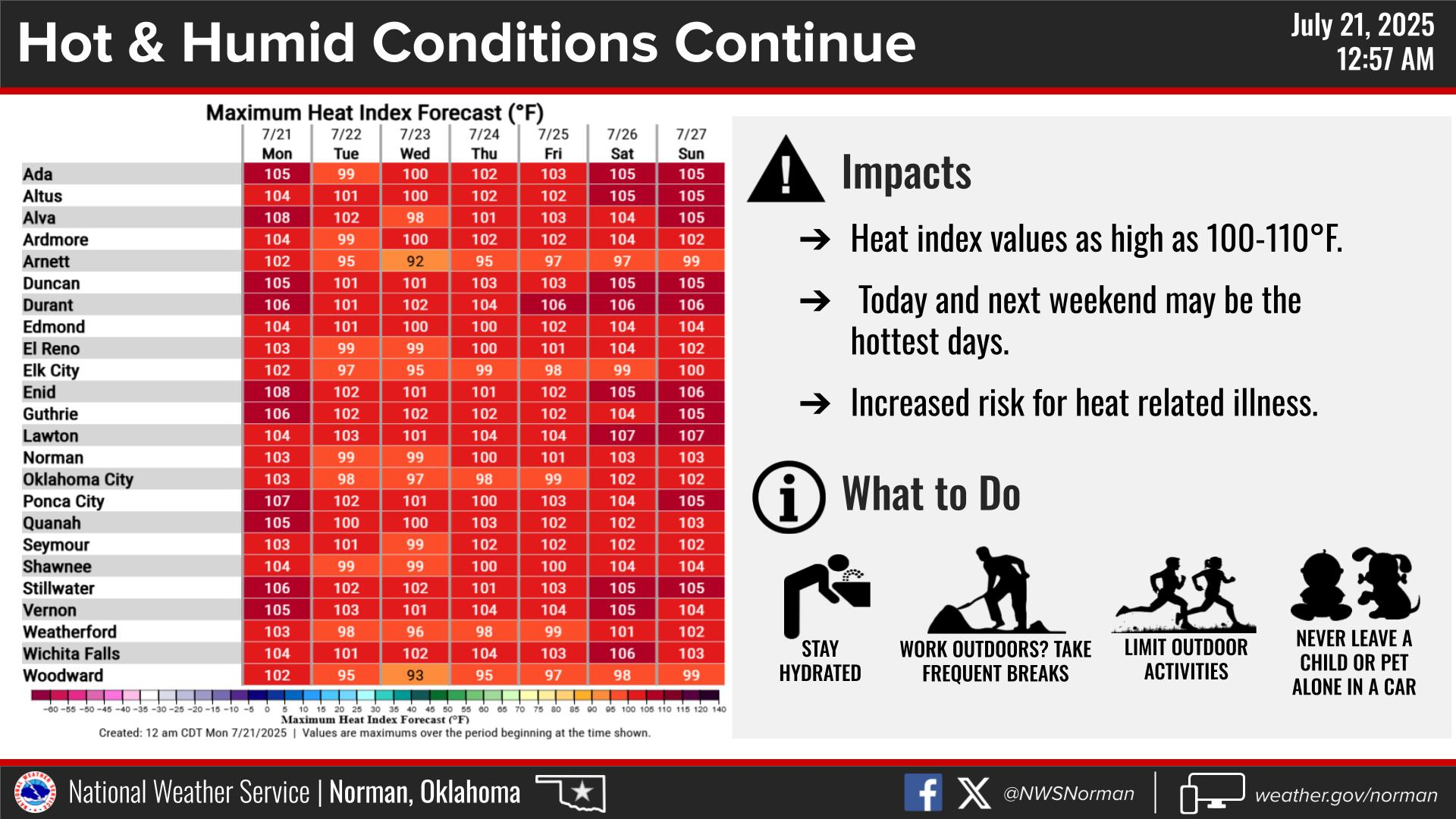
Broiler time
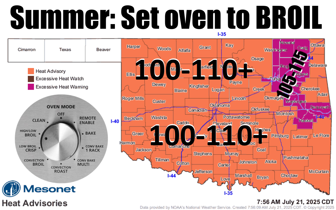
Yeah, I'm late to the party as usual (hey, "Late to the Party" was my band's name
in 7.5th grade!), because we already saw this dangerous heat over the weekend.
And much like my mirror says to me every morning (and afternoon, and night),
sorry, but this is what you're gonna see here on out. Well, at least until we
get our next cold front sometime in...November?
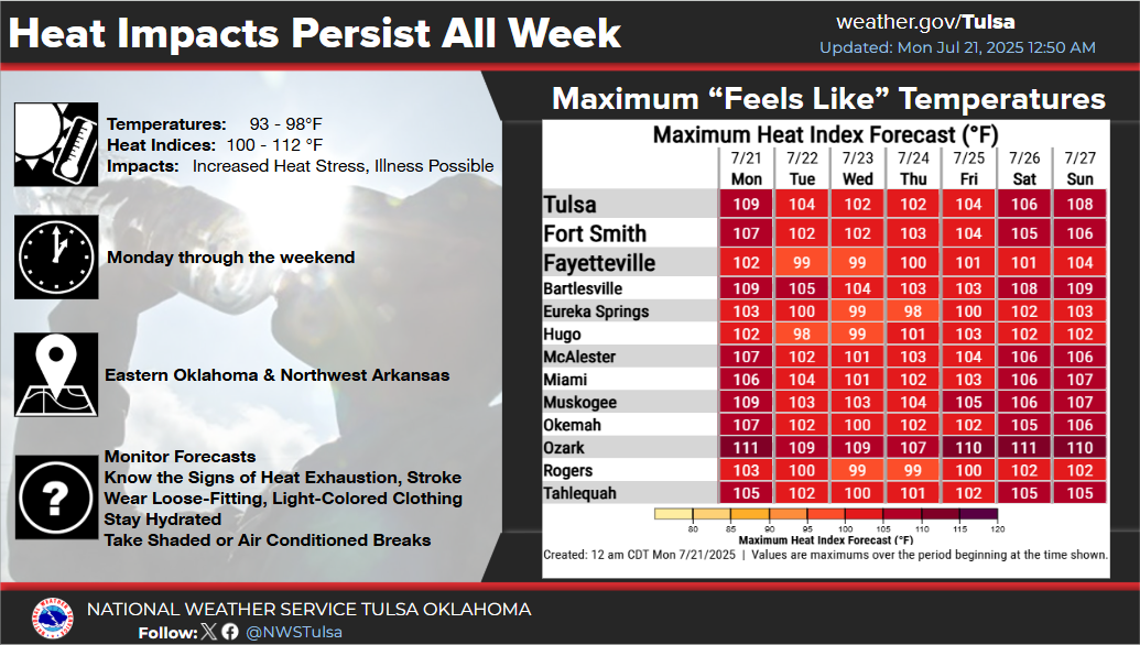
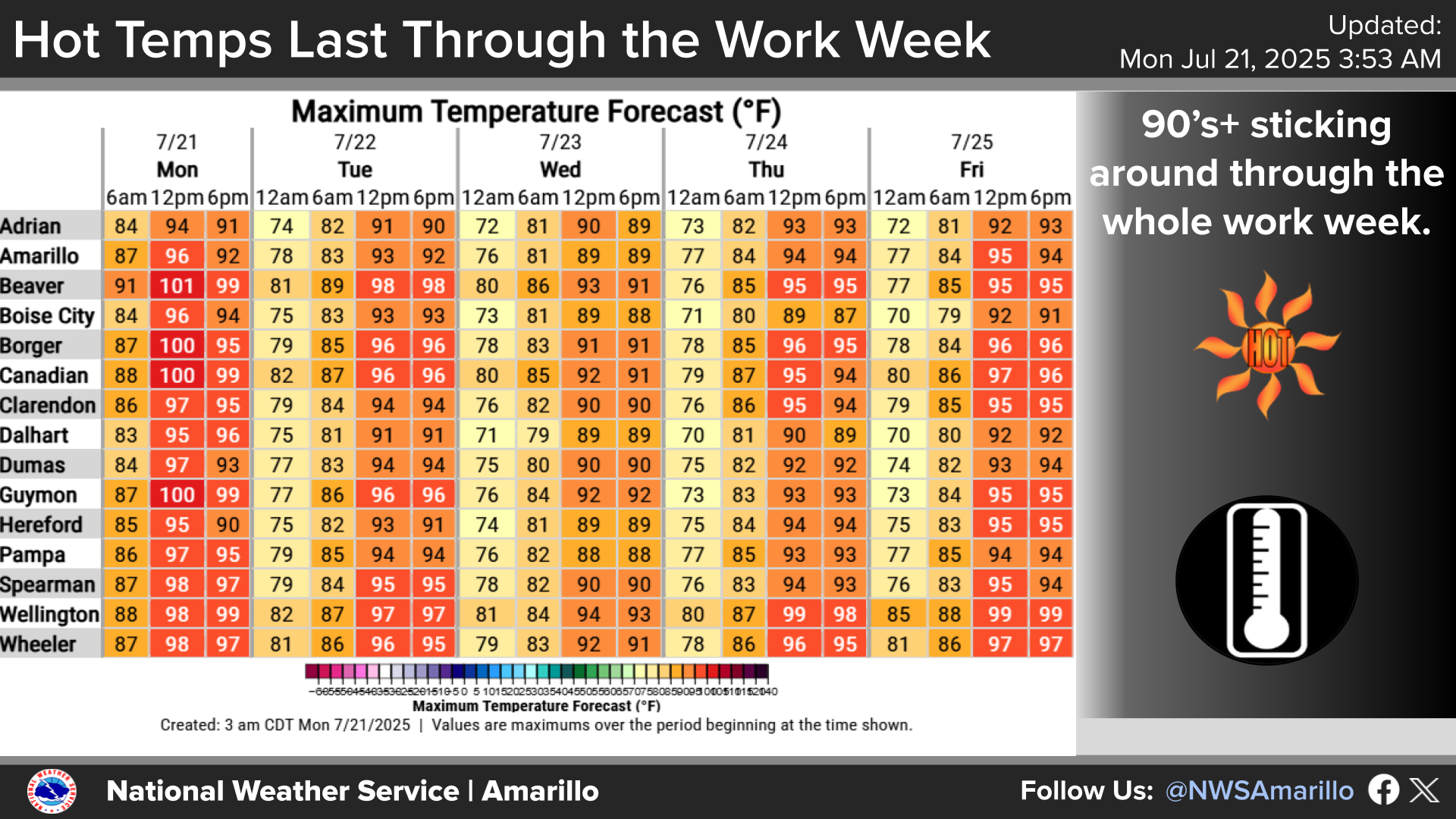
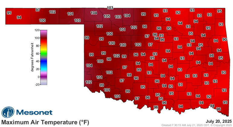
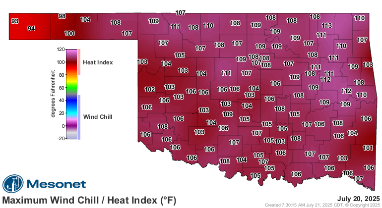
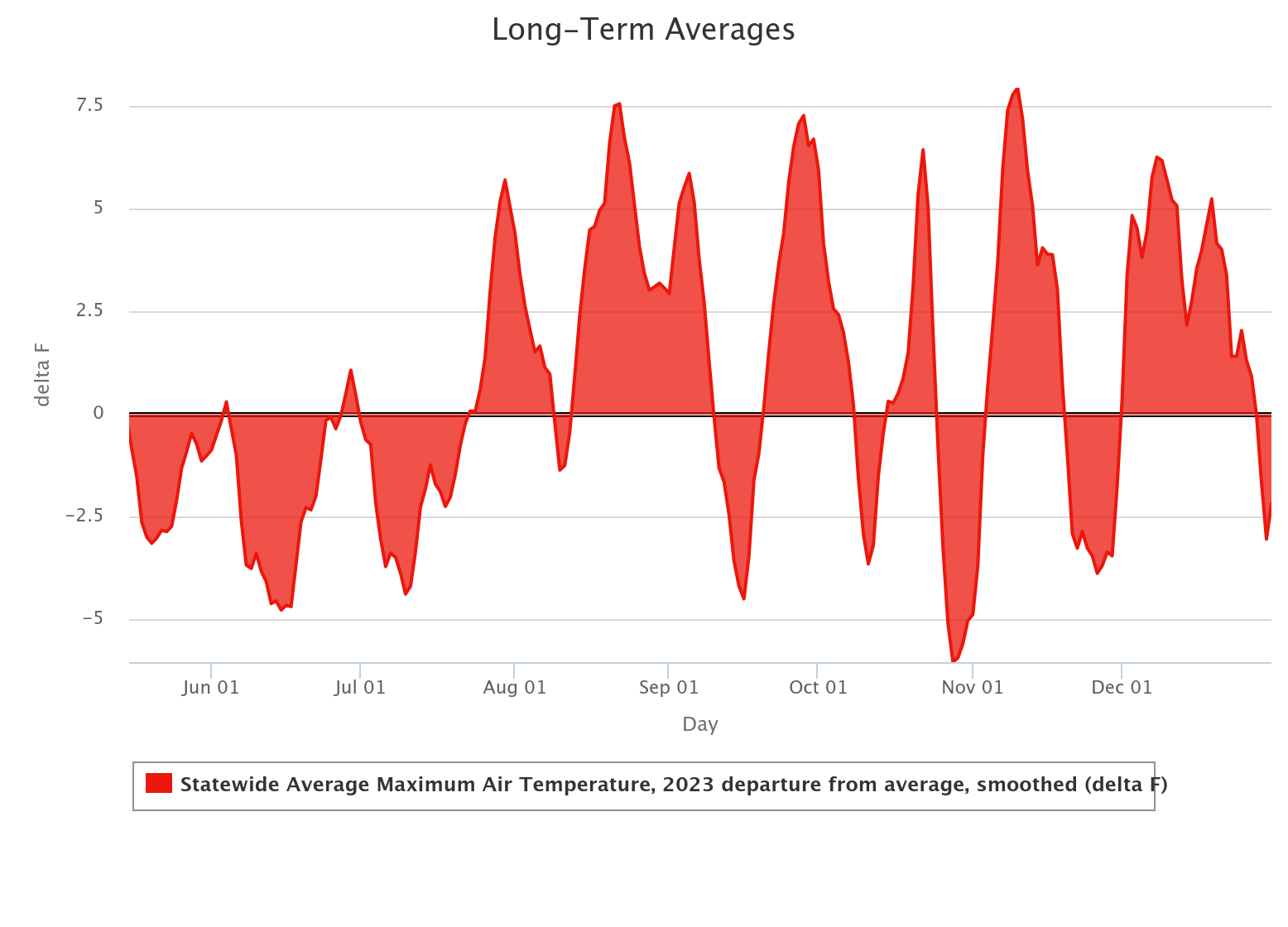
This is very reminis...remenis...looks a lot like what we saw in 2023, when
exactly on this date 2 years ago, the heat struck with a vengeance for the
first time that summer, and flash drought developed across the state. And it
stayed warmer than normal for much of the rest of 2023.
Not saying that's gonna happen here, just eerily similar (hey, "Eerily Similar"
was my band's name in HVAC school!). The rain is definitely not showing up
just yet, but maybe a few showers and storms along the periphery of that heat
dome overhead.
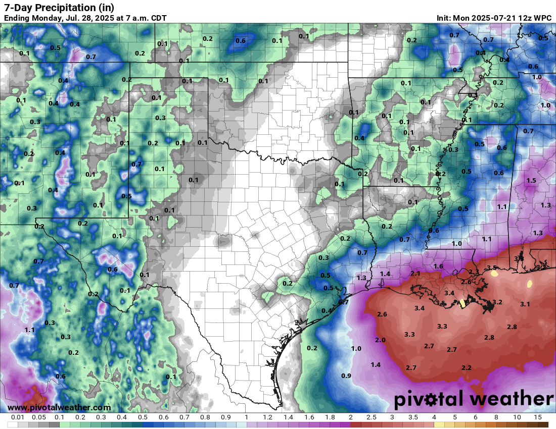
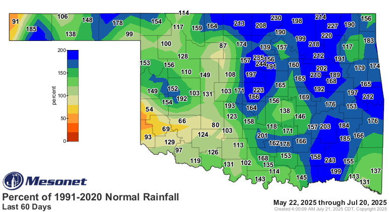
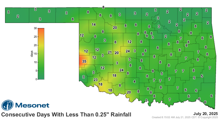
We'll be watching for any flash drought trying to develop. It's definitely
getting dry again across parts of the state. We see you SW OK!
Gary McManus
State Climatologist
Oklahoma Mesonet
Oklahoma Climate Survey
gmcmanus@ou.edu
July 21 in Mesonet History
| Record | Value | Station | Year |
|---|---|---|---|
| Maximum Temperature | 111°F | GRA2 | 2018 |
| Minimum Temperature | 54°F | EVAX | 2021 |
| Maximum Rainfall | 5.92 inches | SALL | 2022 |
Mesonet records begin in 1994.
Search by Date
If you're a bit off, don't worry, because just like horseshoes, “almost” counts on the Ticker website!