Ticker for July 9, 2025
MESONET TICKER ... MESONET TICKER ... MESONET TICKER ... MESONET TICKER ...
July 9, 2025 July 9, 2025 July 9, 2025 July 9, 2025
Glubber Lang
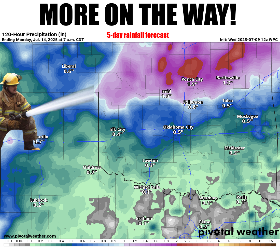
We got very little time to Tock, but I just had to Tick about this continued
rainy pattern we're seeing here in the Swooner State (hey, you can Soon, I'm
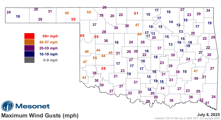
Swooning!). Well, let's call it "stormy" pattern, after last night's non-fun
with the usual suspect when it comes to summertime severe weather.
Yeah, you guessed it. Scott Baio. But also WIND.
Now one of the good things about summertime storms, other than the rain if you
need it, is if you gotta mow the lawn. Sooner (no, no Swooning here) or later,
you're gonna get an outflow boundary so you can mow in some nice cool, dry air.
Why yes, yes I did do that exact thing last night. But you definitely don't want
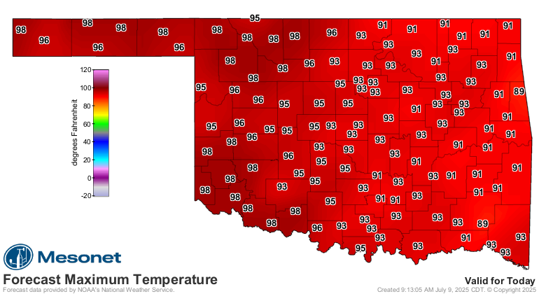
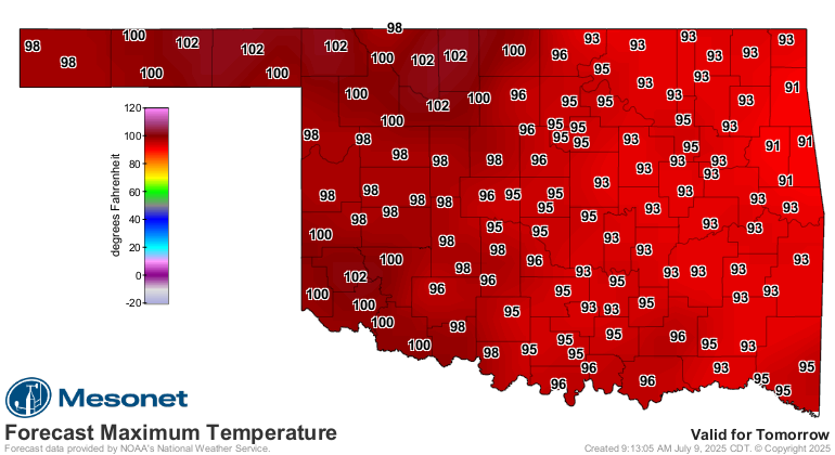
any 60 mph winds. At least we're gonna get a break, if you call no rain or clouds
and highs busting 100 a break, before the rains start back up again for the
weekend.
Here comes the heat.
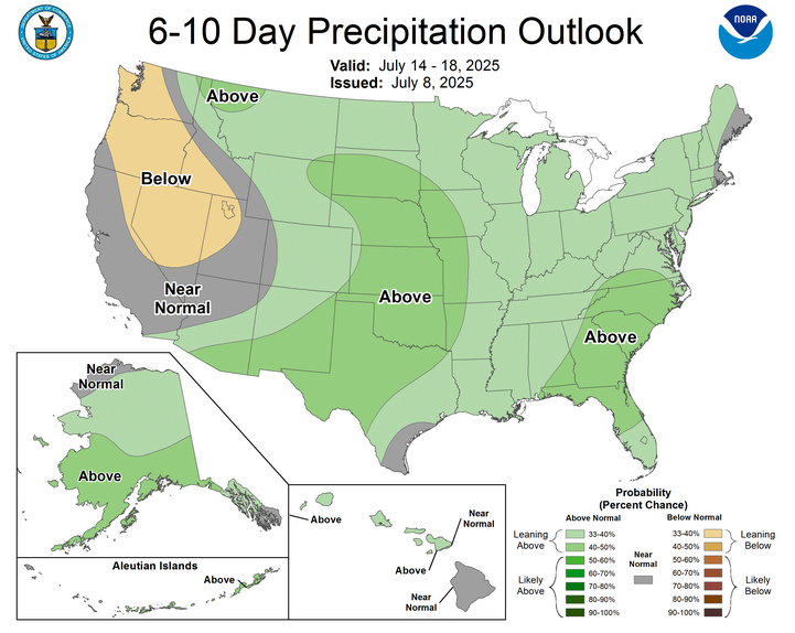
Now if you see a temperature outlook like this one for next week, in the summer,
then that probably means even more rain. Because about the only way to get a
below-normal signal like that is with rain, and the clouds that come with it.
And trust me, I know below normal! I live it everyday...IQ, hair, patience, etc.
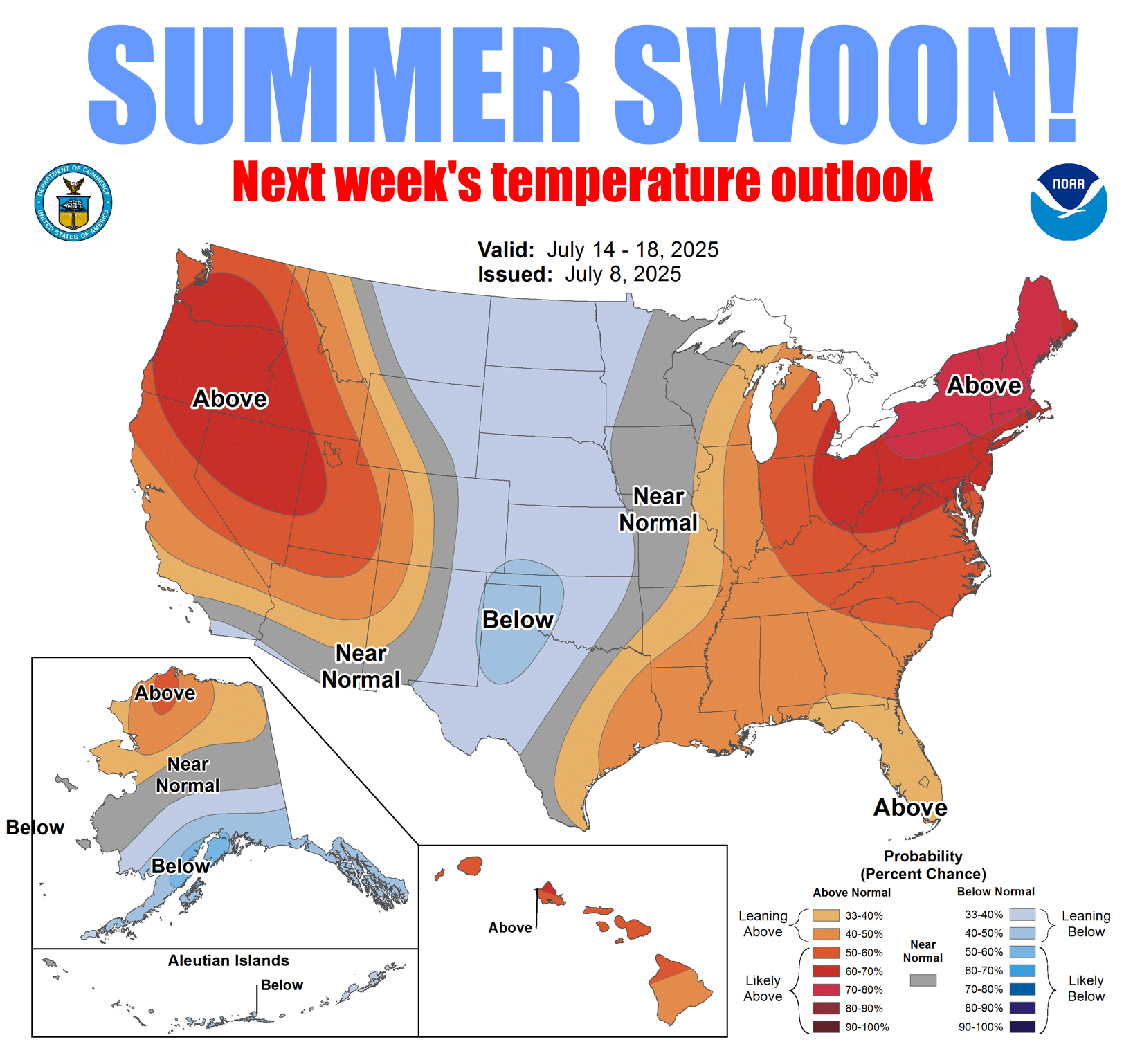
So enjoy?? your two days of summer before we return to another bout with
summer swooning this weekend, and apparently into next week as well.
Gary McManus
State Climatologist
Oklahoma Mesonet
Oklahoma Climate Survey
gmcmanus@ou.edu
July 9 in Mesonet History
| Record | Value | Station | Year |
|---|---|---|---|
| Maximum Temperature | 115°F | BUFF | 2009 |
| Minimum Temperature | 55°F | KENT | 2015 |
| Maximum Rainfall | 3.91 inches | OKCE | 2014 |
Mesonet records begin in 1994.
Search by Date
If you're a bit off, don't worry, because just like horseshoes, “almost” counts on the Ticker website!