Ticker for May 1, 2025
MESONET TICKER ... MESONET TICKER ... MESONET TICKER ... MESONET TICKER ...
May 1, 2025 May 1, 2025 May 1, 2025 May 1, 2025
10.6 trillion jigawatts
I barely have time to Tock today because I'm working on another project (no,
not that Alan Parsons deal), but I just had to Tick to Tock about what's in
store for our already-waterlogged state (save for NW OK and the Panhandle...you
know who you are, and if you don't you might be in a 1970s sitcom and about to
step in quicksand). Yes, we had lots of momentous numbers to report yesterday,
and those are down below in the April summary, but here's one NOT reported.
10.6 trillion.
No, that's not my bank account (but it'd be pretty cool if it was!), that's how
many trillion gallons of water that fell on Oklahoma as rain during April.
Heck, that's 13 Lake Texomas, for crying out loud!
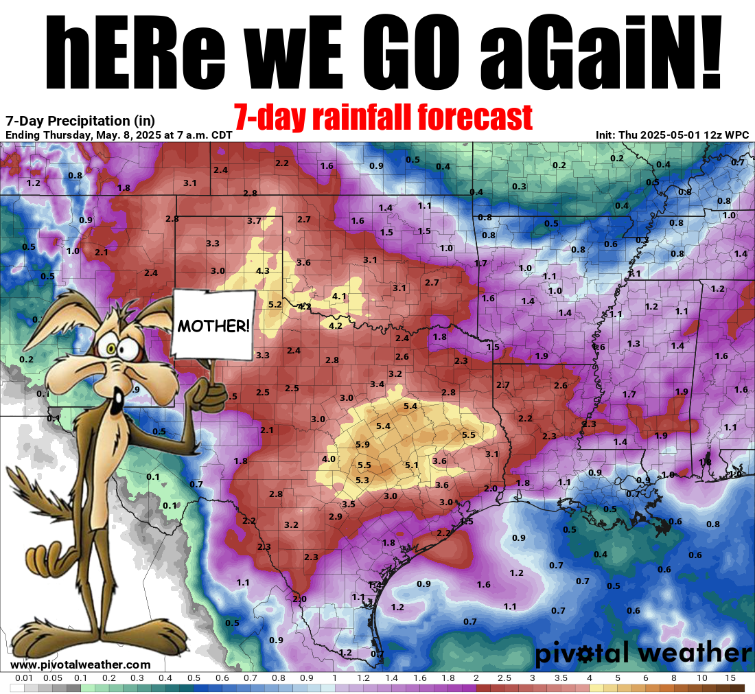
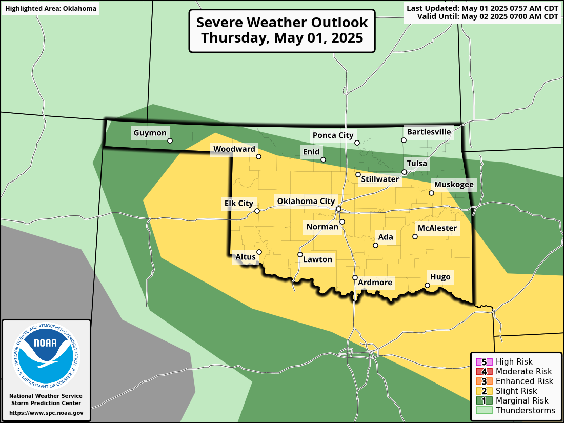
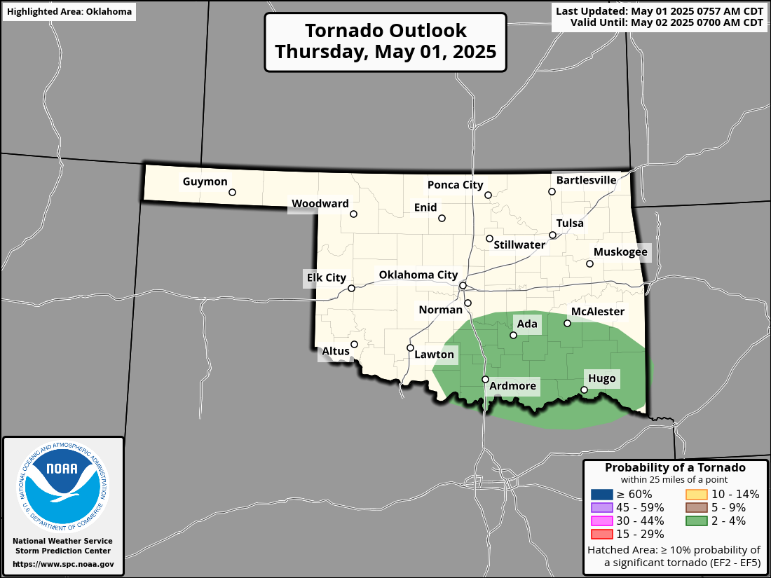
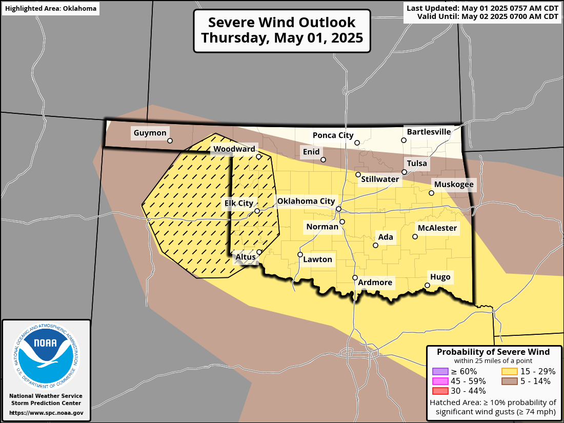
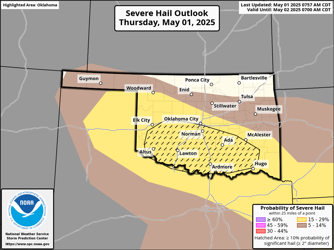
And now we're gonna get 3-4 more inches over the next week? And starting
tonight WITH severe weather again?
How about no (except for folks in the Panhandle and far NW OK, HOW ABOUT YES)!
The worst of it all? I don't see a high temperature above 80 degrees in the
next week. Oh, the humanity!
Okay, I'm all Tocked out. Stick around below for all those April numbers.
---------------------------------------------------------------------------------
April Deluges Shatter Records
May 1, 2025
Just four months after Oklahoma shattered its all-time November rainfall record,
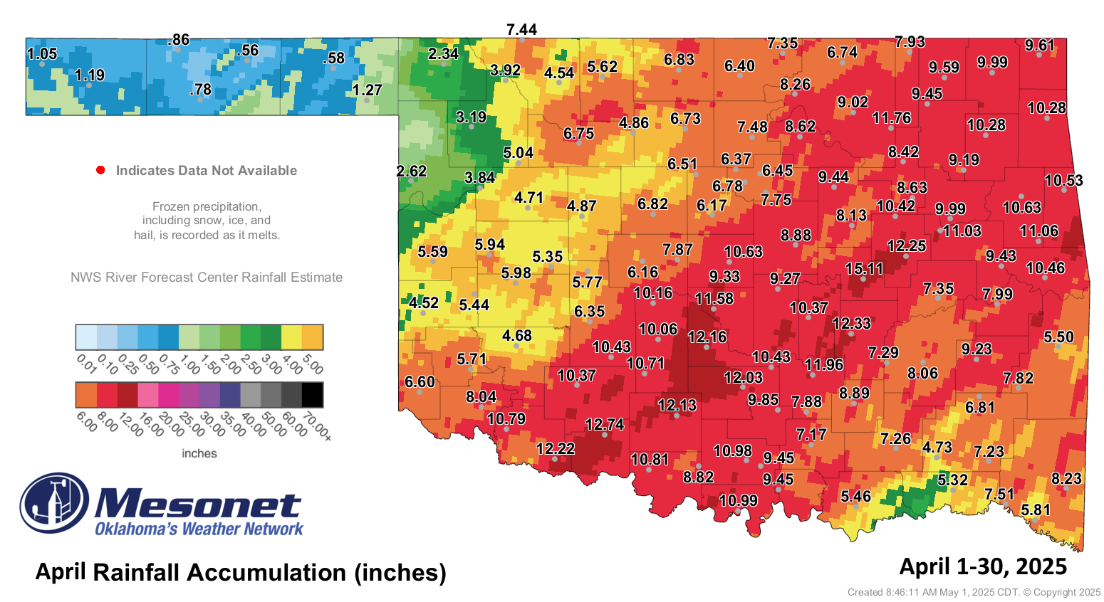
the state did it again—this time in April. The statewide average rainfall
totaled 8.74 inches, surpassing the previous April record of 8.32 inches set in
1942, with data dating back to 1895. Numerous locations posted similar records,
including Oklahoma City, where 12.55 inches of rain fell, topping April 1947’s
11.91 inches and ranking as the city’s sixth-wettest calendar month since
records began in November 1890.
Other April 2025 rainfall records (asterisk denotes wettest calendar month on
record):
• *Duncan: 19.63 inches
• Lawton: 14.25 inches
• Edmond: 14.14 inches
• Apache: 13.04 inches
• Norman: 12.67 inches
• Shawnee: 11.88 inches
Flooding Claims Seven Lives
Widespread flooding was an inevitable result of the historic rainfall,
especially during the final two weeks of the month. Nearly all areas of the
state—except far western Oklahoma and the Panhandle—experienced flooding of
some kind, inundating homes and prompting water rescues of stranded motorists.
The severe flooding claimed at least seven lives. On April 19–20, a powerful
storm system triggered flash floods, killing a 12-year-old boy and his 39-year-
old mother in Moore when their vehicle was swept away by raging water. In rural
Leonard, a 47-year-old woman and her 7-year-old daughter died after their car
was overtaken by floodwaters. On April 26, a 67-year-old man drowned in Lawton
when his vehicle was submerged in a flooded creek. On the final day of the
month, an adult male in Pottawatomie County drowned after his vehicle was swept
off a roadway. Another driver drowned northwest of Prague in Lincoln County
when their vehicle became trapped in floodwaters along a rural highway.
Tornadoes and Hailstorms Cause Widespread Damage
A tornado in Spaulding on April 19 claimed one life, according to Hughes County
officials, and was one of at least 16 tornadoes that struck Oklahoma during the
month. Two EF2 twisters also touched down near Courtney in Love County and
Little City in Marshall County. The preliminary tornado count for 2025 stood
at 31, according to National Weather Service figures, though that number and the
total for April were expected to rise as additional assessments were conducted.
In addition to the tornadoes, Oklahoma faced a series of damaging hailstorms,
with multiple rounds of severe weather producing hailstones as large as
baseballs. The storms caused significant damage to homes, vehicles, and crops,
particularly in central and eastern parts of the state. Norman, Stillwater, and
Broken Arrow were among the hardest-hit areas, where shattered windows and roof
damage were widespread. The storms also resulted in thousands of insurance
claims and prompted temporary closures of schools and businesses.
April by the Numbers:
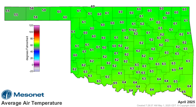
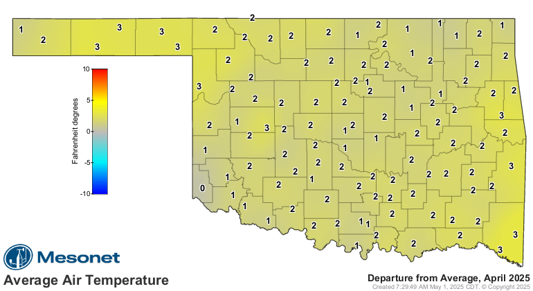
• Statewide average temperature: 61.5°F (2°F above normal), the
33rd-warmest April since records began in 1895.
• Temperature extremes: High of 101°F at Alva on April 17, marking 2025's
first triple-digit high temperature; low of 22°F at Eva on April 6.
• Statewide average precipitation: 8.74 inches (5.15 inches above normal),
ranking as the wettest April on record.
• Rainfall extremes: High of 19.63 inches at Duncan; low of 0.62 inches
at Beaver.
• Rainfall totals greater than 5 inches: 106 instances recorded at the
119 Oklahoma Mesonet sites, including 52 above 10 inches and six above
15 inches.
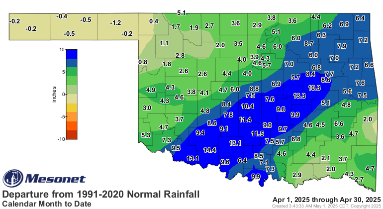
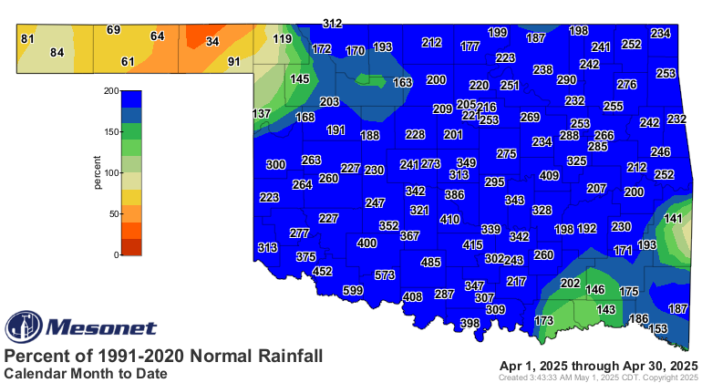
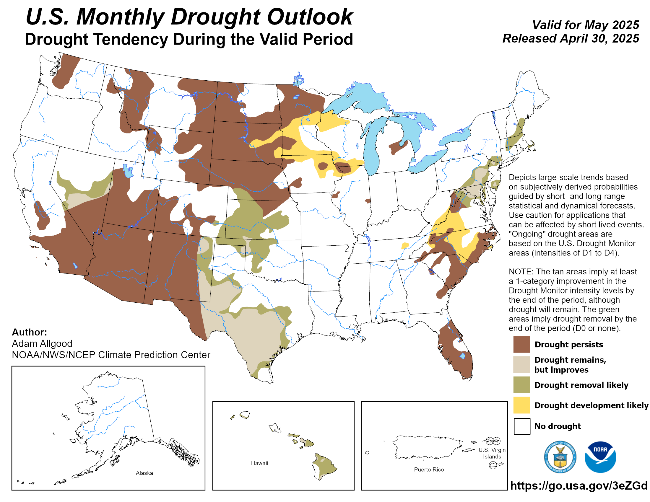
Drought Conditions Improve, May Outlook Promising
Drought coverage in Oklahoma fell from 48% to just over 14% through April,
according to the U.S. Drought Monitor, with severe drought dropping from 14% to
approximately 7%. By month’s end, only the Panhandle and the far northwestern
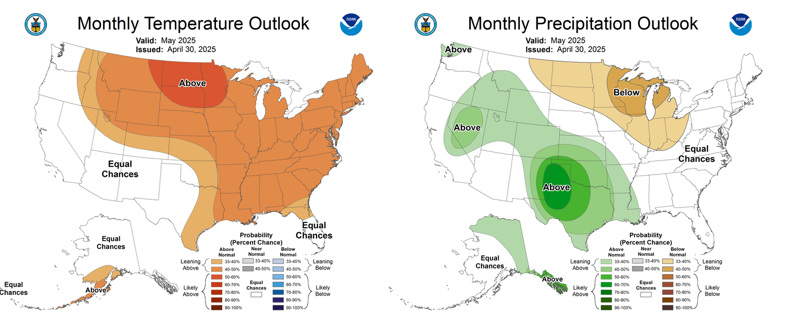
corner of the state remained in drought. The Climate Prediction Center’s
outlook for May indicates increased odds of above-normal temperatures across
the eastern two-thirds of Oklahoma, as well as above-normal rainfall across the
entire state, especially in the western half. The CPC’s drought outlook for May
shows drought being removed across the state, with the exception of the far
northwestern corner and a small portion of the eastern Panhandle, where drought
is expected to improve but remain.
###
Gary McManus
State Climatologist
Oklahoma Mesonet
Oklahoma Climate Survey
gmcmanus@ou.edu
May 1 in Mesonet History
| Record | Value | Station | Year |
|---|---|---|---|
| Maximum Temperature | 101°F | ALTU | 2002 |
| Minimum Temperature | 28°F | BOIS | 2011 |
| Maximum Rainfall | 7.70 inches | PRYO | 2009 |
Mesonet records begin in 1994.
Search by Date
If you're a bit off, don't worry, because just like horseshoes, “almost” counts on the Ticker website!