Ticker for April 29, 2025
MESONET TICKER ... MESONET TICKER ... MESONET TICKER ... MESONET TICKER ...
April 29, 2025 April 29, 2025 April 29, 2025 April 29, 2025
No thanks!
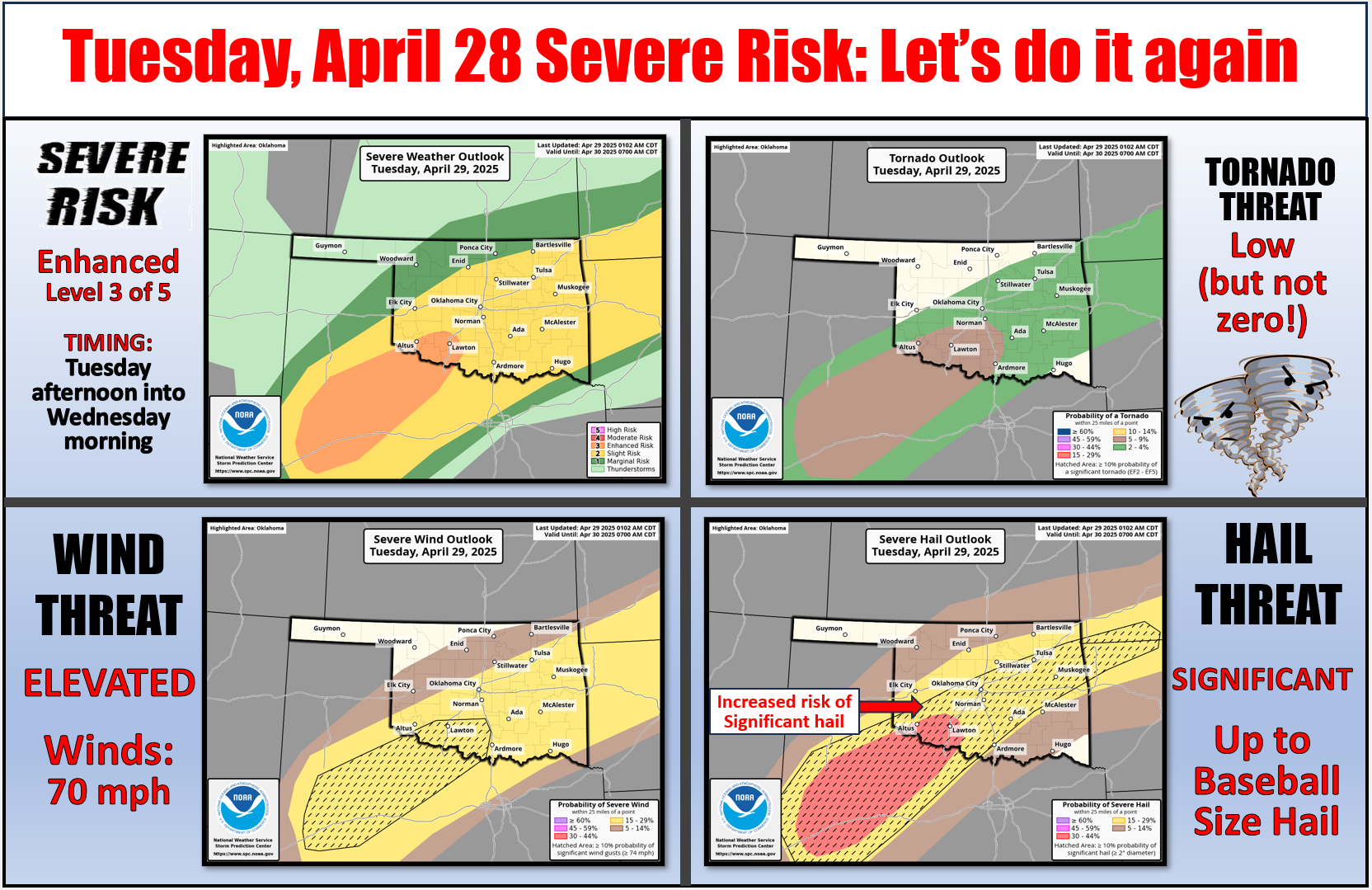

Sometimes the fun is in OVERDOING it, am I right Ladies and Gentlemen (and the
rest of you hooligans)? Fresh off the fun of Mother Nature's baseball game last
night...the frozen kind down in SW OK...we get to do it all over again this
afternoon, apparently. This time we'll call it "The Cold Front Edition" as storms
fire this afternoon along a cold front sagging into our area (and we all know just
how painful that can be!).
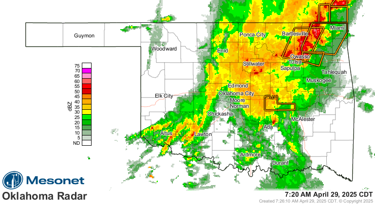
This afternoon? Heck, it's severe storming right now for crying out loud!
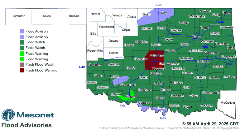
Still, the threat of flash flooding is possibly the worst hazard coming our
way, unless you have those frozen baseballs coming your way...maybe.
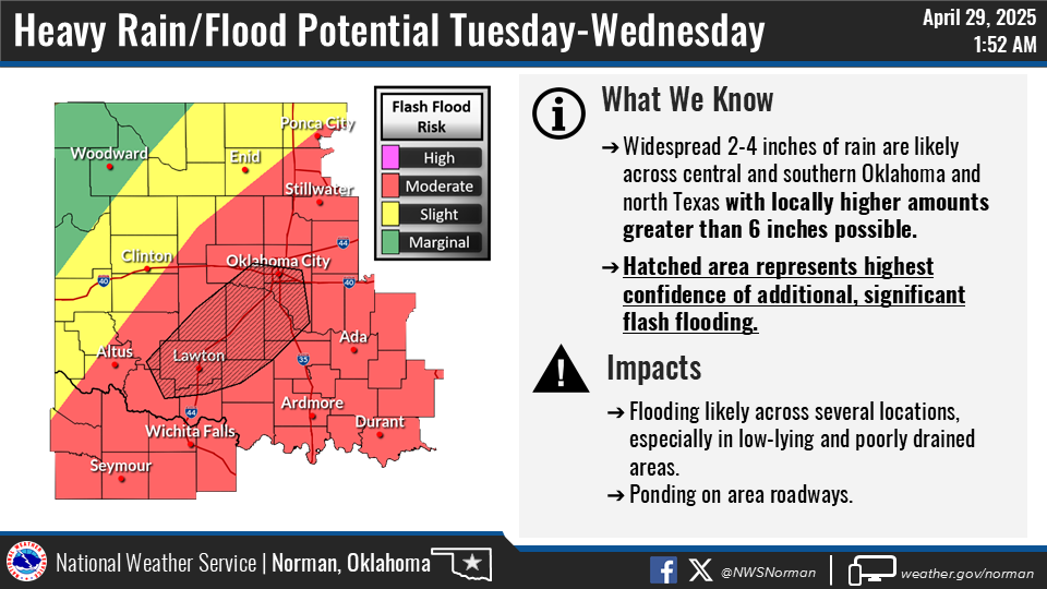
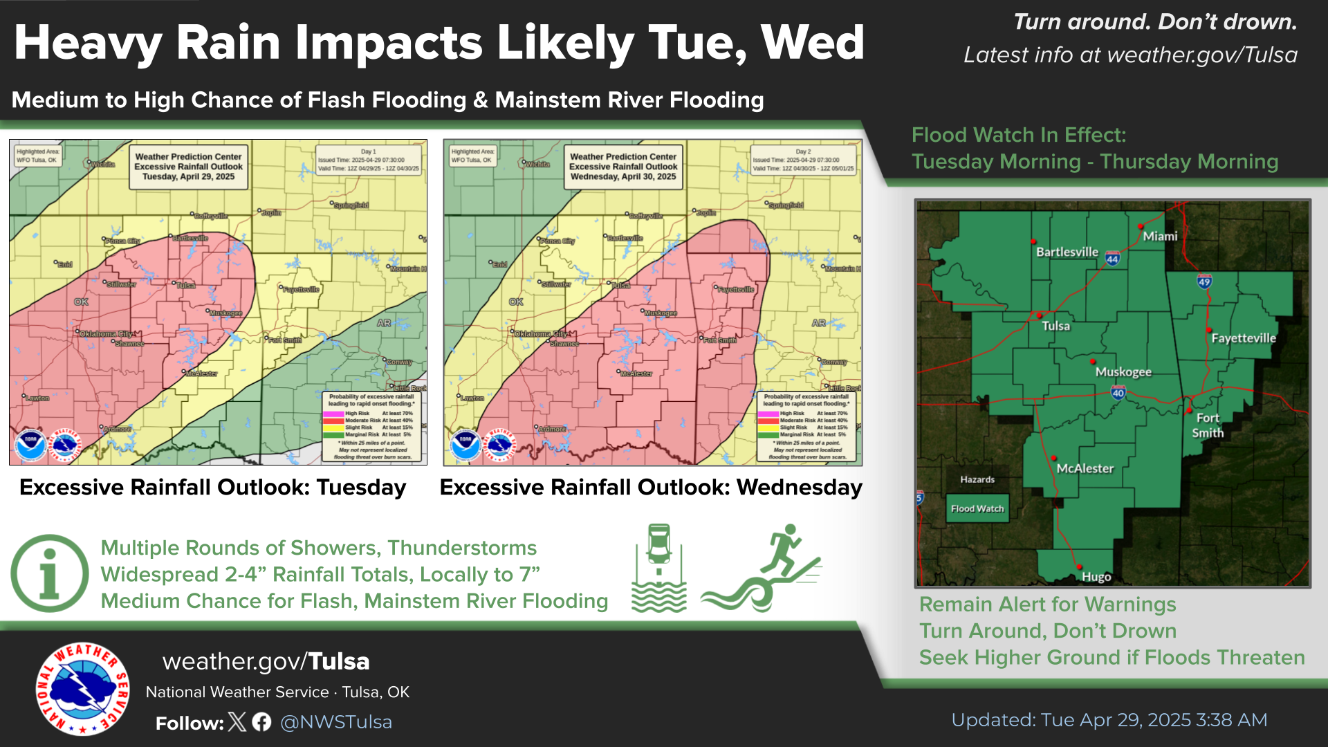
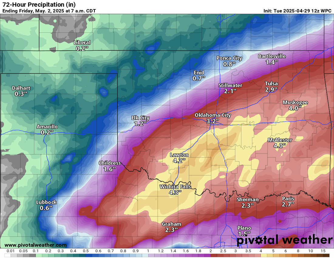
Wait, how much rain in the next couple of days, and by "couple" I mean "three"?
The key to tranquility today is to be on the north side of that cold front,
which will limit your severe weather potential, as well as the flash flood
potential.
Stay weather aware, folks. And flooded roadway aware. It could save your life.
Gary McManus
State Climatologist
Oklahoma Mesonet
Oklahoma Climate Survey
gmcmanus@ou.edu
April 29 in Mesonet History
| Record | Value | Station | Year |
|---|---|---|---|
| Maximum Temperature | 100°F | ALTU | 2022 |
| Minimum Temperature | 31°F | KENT | 2017 |
| Maximum Rainfall | 12.42 inches | BURN | 2009 |
Mesonet records begin in 1994.
Search by Date
If you're a bit off, don't worry, because just like horseshoes, “almost” counts on the Ticker website!