Ticker for February 25, 2025
MESONET TICKER ... MESONET TICKER ... MESONET TICKER ... MESONET TICKER ...
February 25, 2025 February 25, 2025 February 25, 2025 February 25, 2025
Droughtification
There was a pretty good "98 Degrees" meme in there, but I didn't want to highlight
that I knew who that boy band (or any boy band) is. Or was. I think more was than
is...nobody wants to see those Dad bods dancing around on a stage. I couldn't even
tell you their biggest songs, like "I Do," or "The Hardest Thing."
But wait, I've said too much.
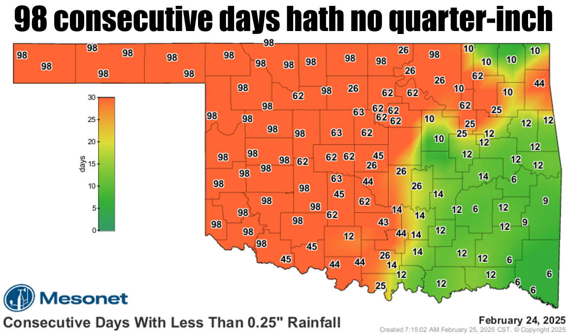
How about that consecutive day stretch without at least a quarter-inch of rain in
a single day? That dates back to late-November, after the gulluwashers ended.
Those toad-stranglers for the first 2.5 weeks of November are the only reason
we're not having bigtime significant drought in Oklahoma, but those rains are
getting more and more dated, as the stats show.
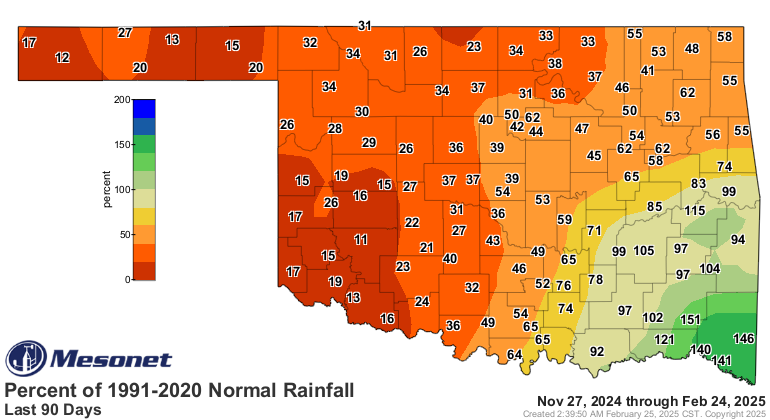
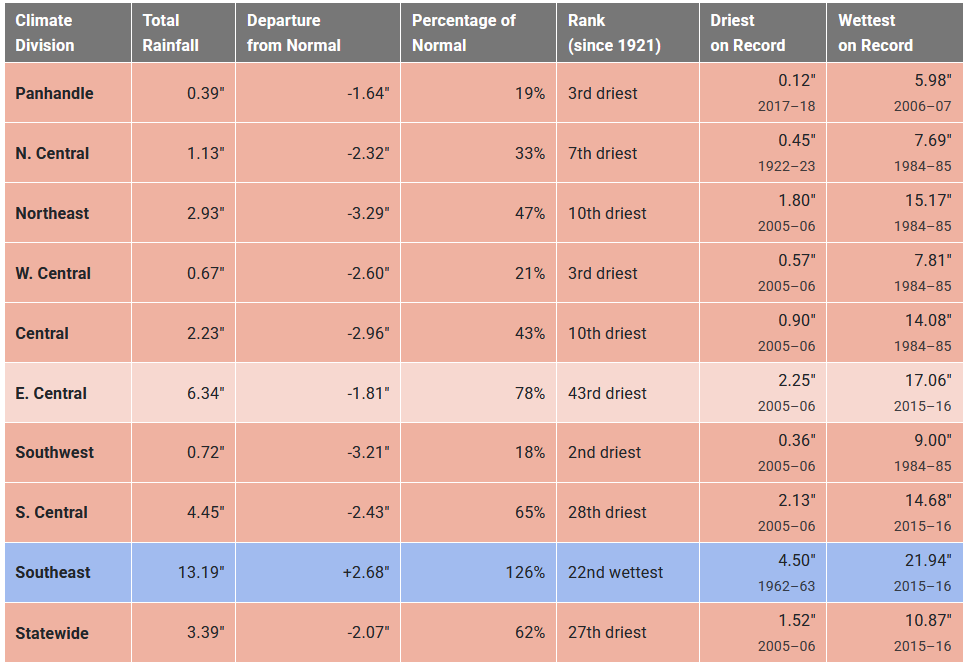
Yeeeikes (Okie to English translation: "Yikes")! Seeing the western parts of
the state experiencing top-5 driest last-90-days periods is pretty alarming.
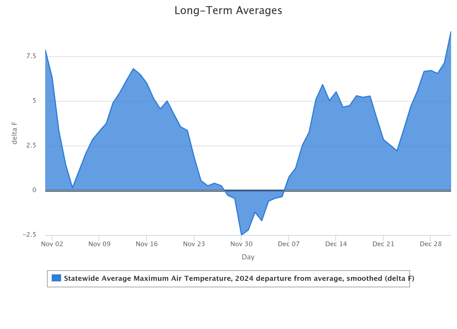
Luckily for us, part 2, is that it's been pretty cold for most of that period
as the rains have waned.
Well, sorta. It was as significantly warm in November and December as it has
been significantly cold in January and February.
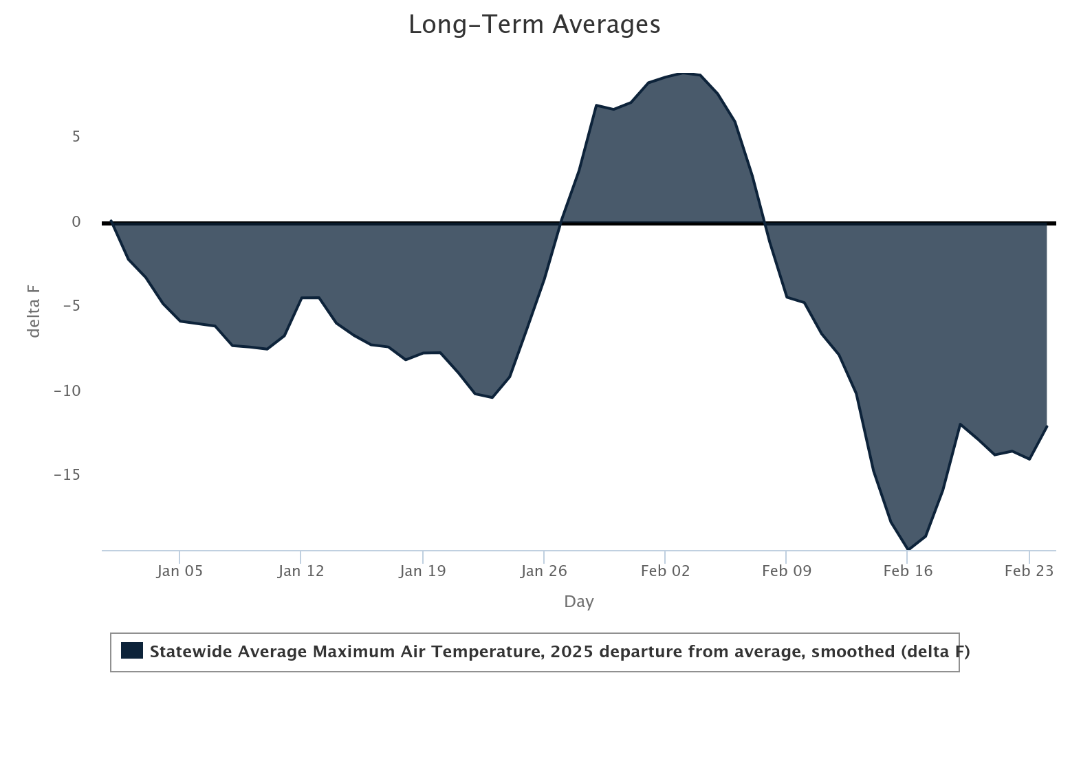
Again though, we're lucky that latter period wasn't as warm as the previous
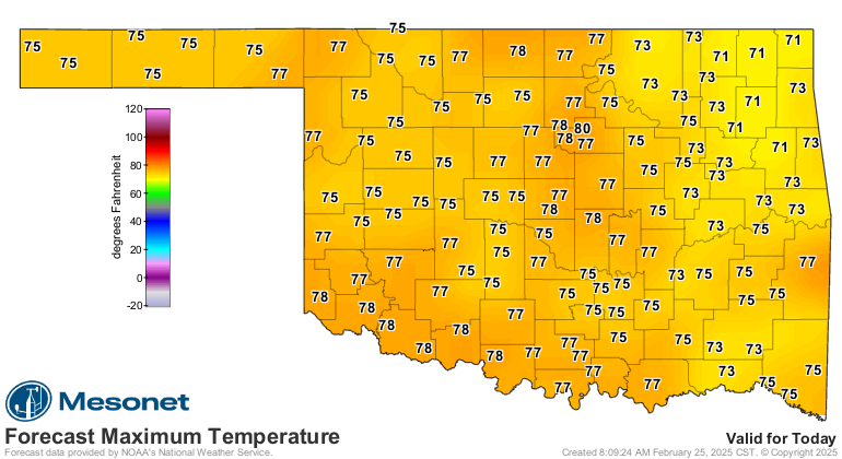
one. However, it's getting warm now. yesterday we were 20 degrees above
normal, and much of the next week or so looks to be above normal--sometimes
significantly, sometimes not significantly.
Today = significantly.
Like it or not, spring will soon be upon us. Vegetation will be waking up and
wanting a drink, people will be watering lawns and washing cars and filling up
swimming ools (notice there is no "p" in our pool...try and keep it that way).
We do need it to actually rain going forward, and there are signs of at least
some moisture in the next week.
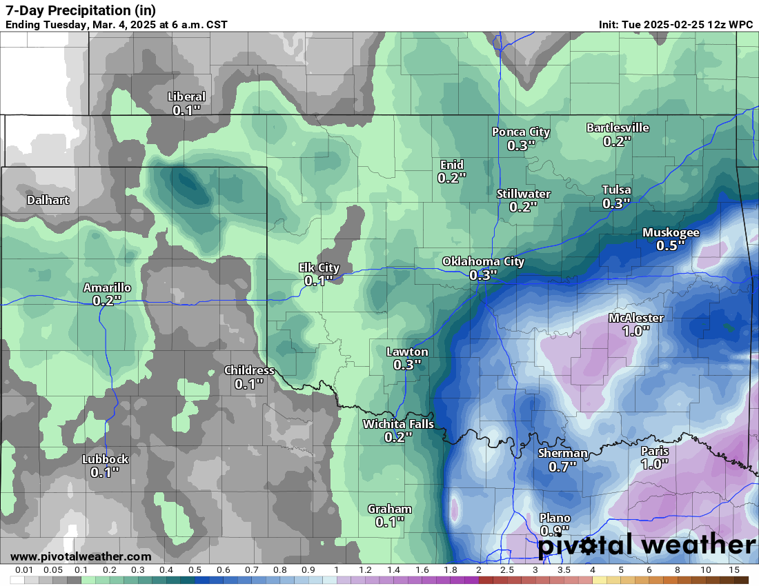
That's not nearly enough across western OK to forestall more colors appearing
on the Drought Monitor map, but it's better than Zero. Point. Zero.
A wet signal is still showing up on the extended outlook, so there's that at
least.
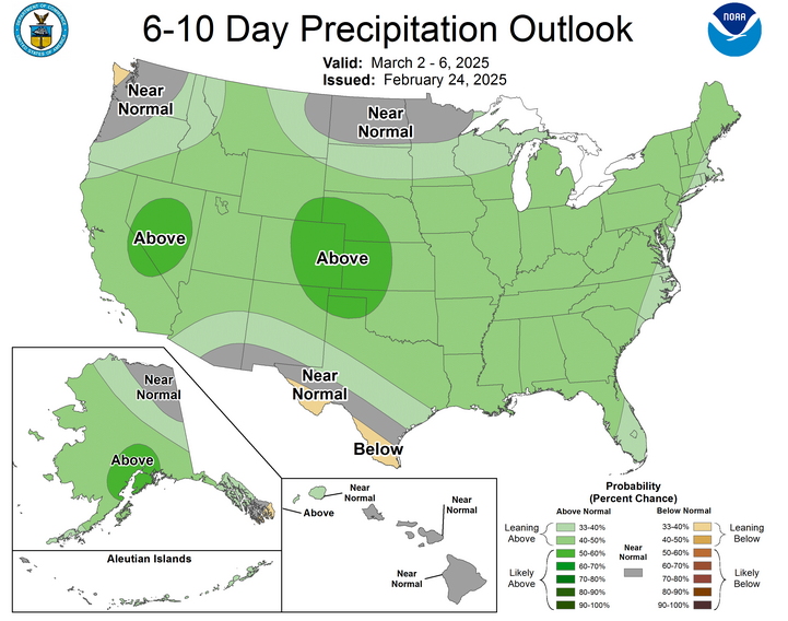
For a bit more added context, that shows increased odds for above normal
precipitation, but it doesn't show HOW MUCH above normal. Given that we're in
the driest time of the year...results may vary.
Still, better than nothing!
Gary McManus
State Climatologist
Oklahoma Mesonet
Oklahoma Climate Survey
gmcmanus@ou.edu
February 25 in Mesonet History
| Record | Value | Station | Year |
|---|---|---|---|
| Maximum Temperature | 85°F | HOLL | 1999 |
| Minimum Temperature | -2°F | CHER | 2003 |
| Maximum Rainfall | 1.79 inches | KIN2 | 2013 |
Mesonet records begin in 1994.
Search by Date
If you're a bit off, don't worry, because just like horseshoes, “almost” counts on the Ticker website!