Ticker for February 17, 2025
MESONET TICKER ... MESONET TICKER ... MESONET TICKER ... MESONET TICKER ...
February 17, 2025 February 17, 2025 February 17, 2025 February 17, 2025
Frozen tundra
So you wake up this morning feeling like it's the last day of class (pick any
class...Basketweaving 101) and you haven't been all semester, or done any of the
homework.
Come on, you know you've had that dream!
What you're actually feeling is that of impending frozen doom, killing all hopes
of sunshine, flip-flops, and non-chapped lips. Some folks call it "winter," but
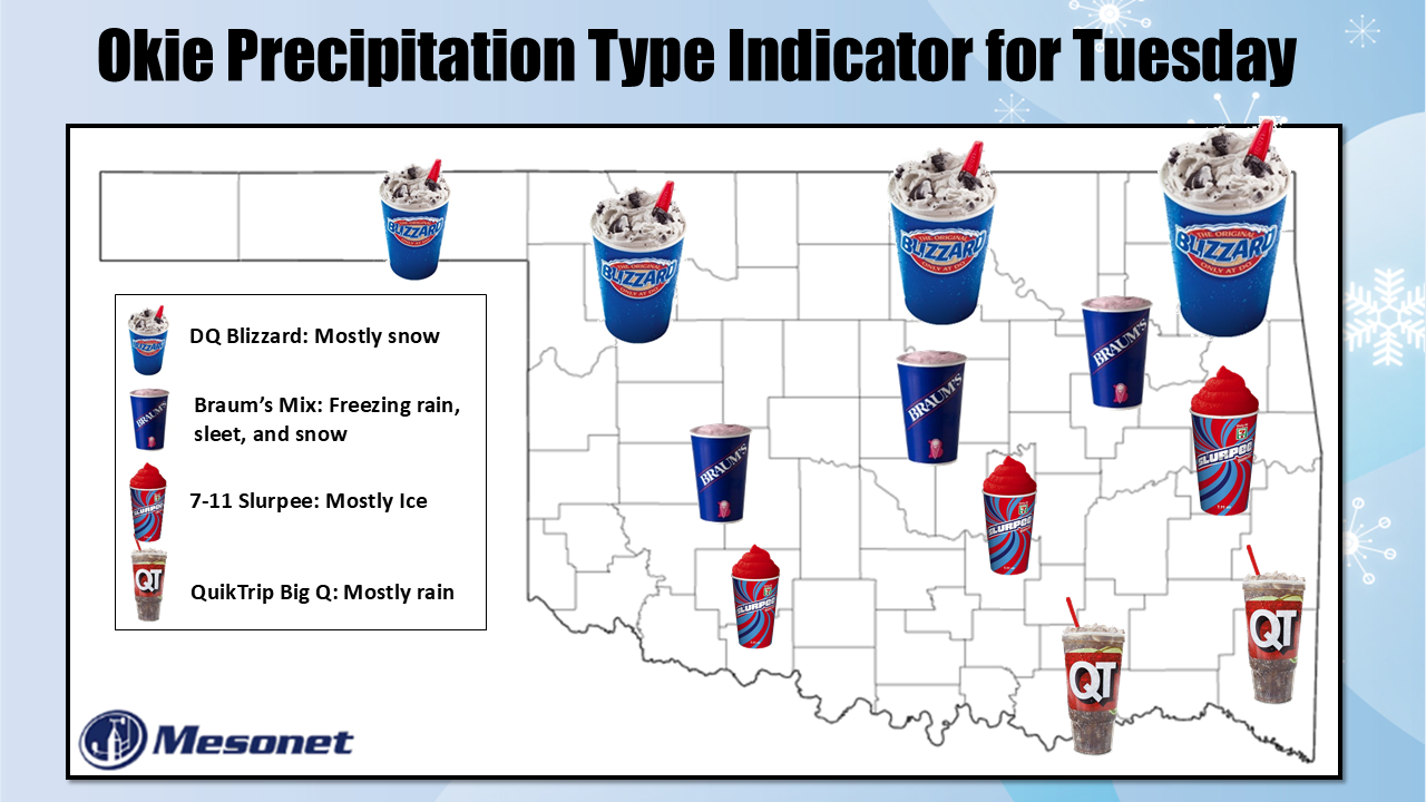
this is actually winter on steroids. There are still some fine-tunings to occur,
mostly with precipitation types and amounts, and locations, and whatnot, but
the models have been pretty consistent over the last couple of days with a good
general picture of heavy snow up in NE and NC OK, complete with high winds making
blizzard-like conditions possible.
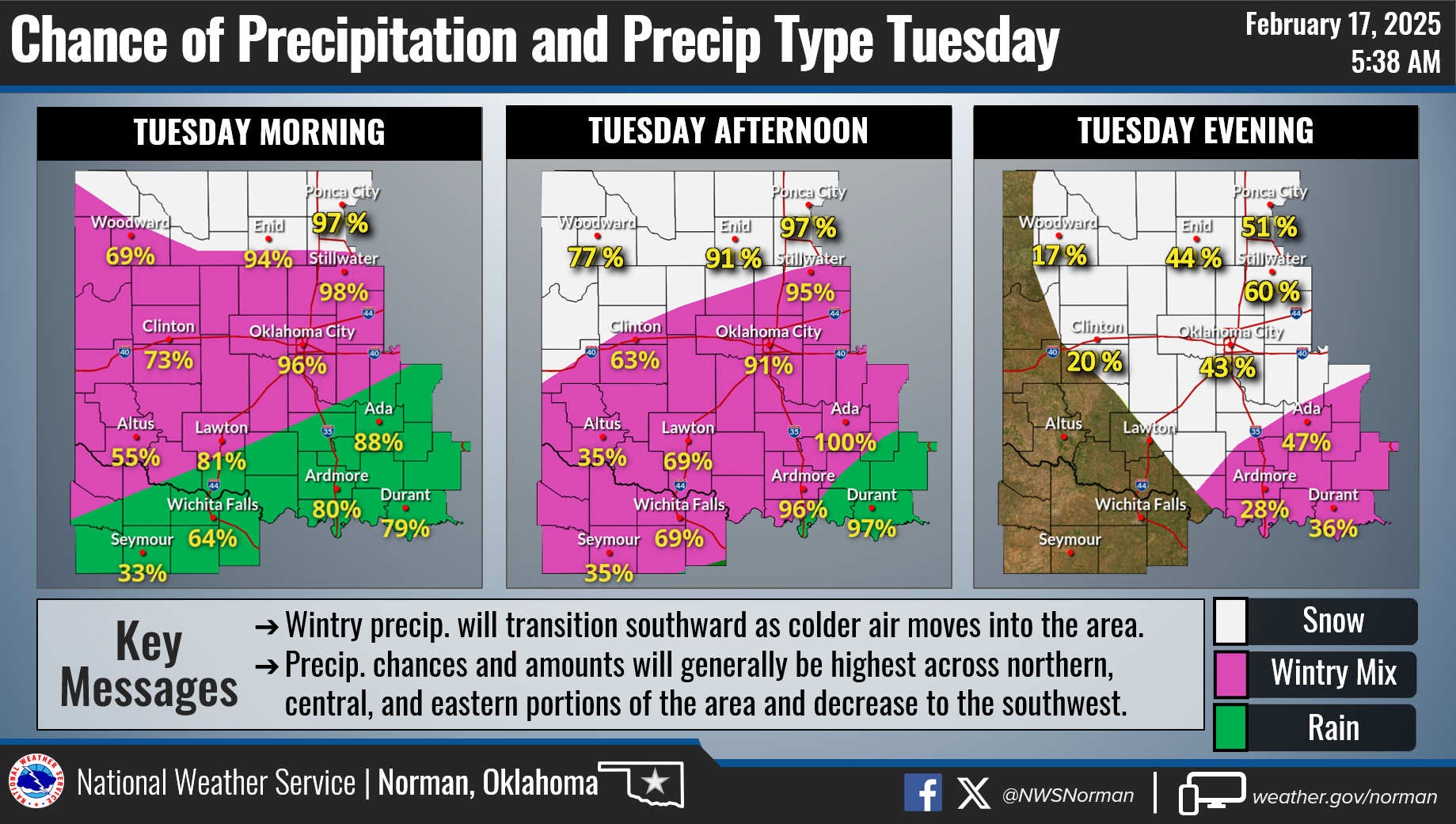
Then farther south a mix of freezing rain and sleet, with a bit of snow on
top.
Farther south, I'd expect more freezing rain and sleet.
Finally, in far southern OK, especially far SE OK, look for mostly a cold rain.
They should get a bit of frozen precip later on tonight and early tomorrow,
however.
The Panhandle and far SW OK should mostly escape the most impactful precipitation
types and amounts. The good news is this is a bigtime winter storm very small
in stature for the state. The bad news is far NE and NC OK will get those
bigtime impacts.
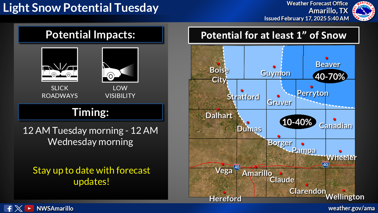
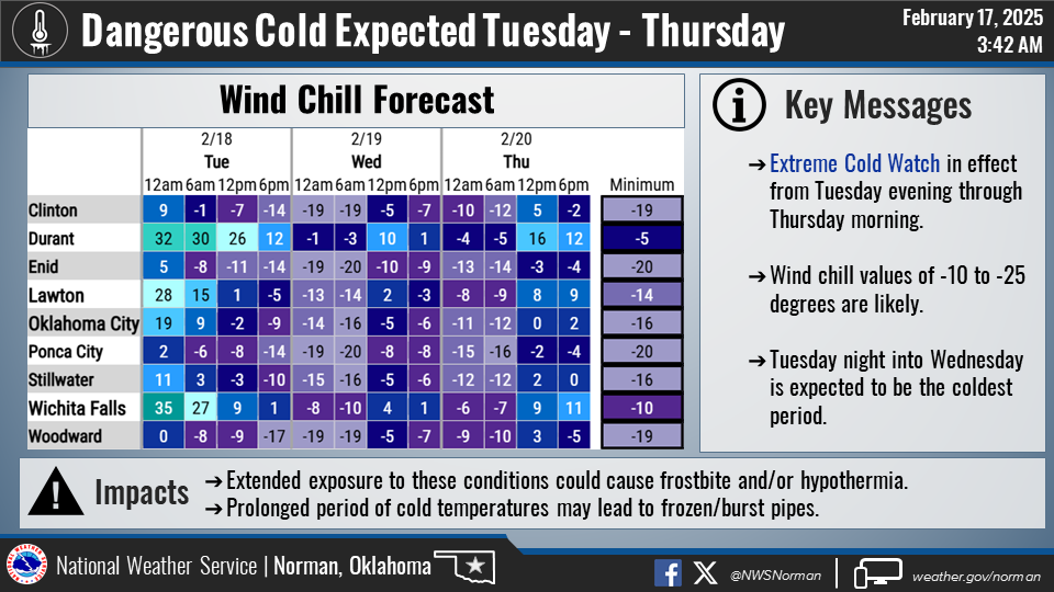
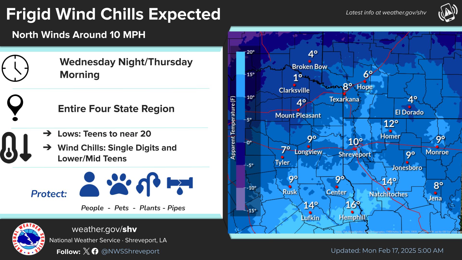
Here's some more info from our local NWS friends. We have the entire state
covered with the four NWS offices.
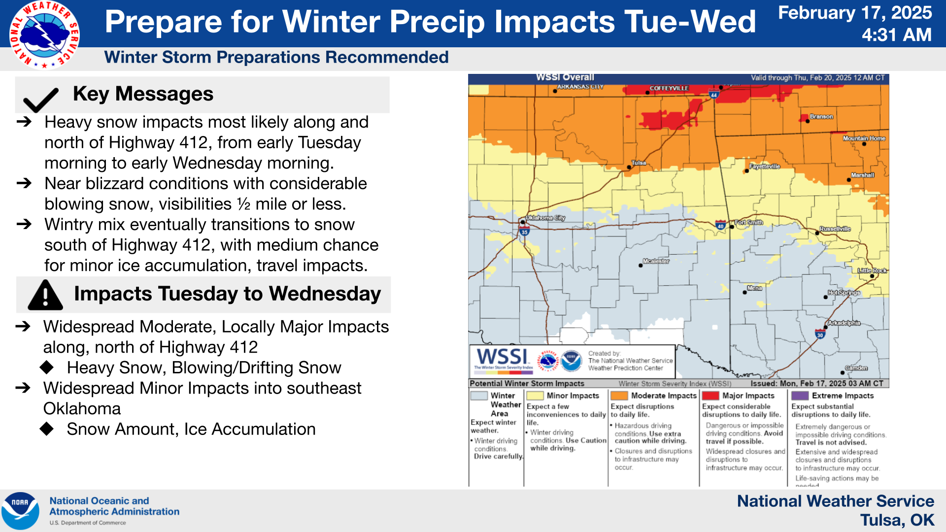
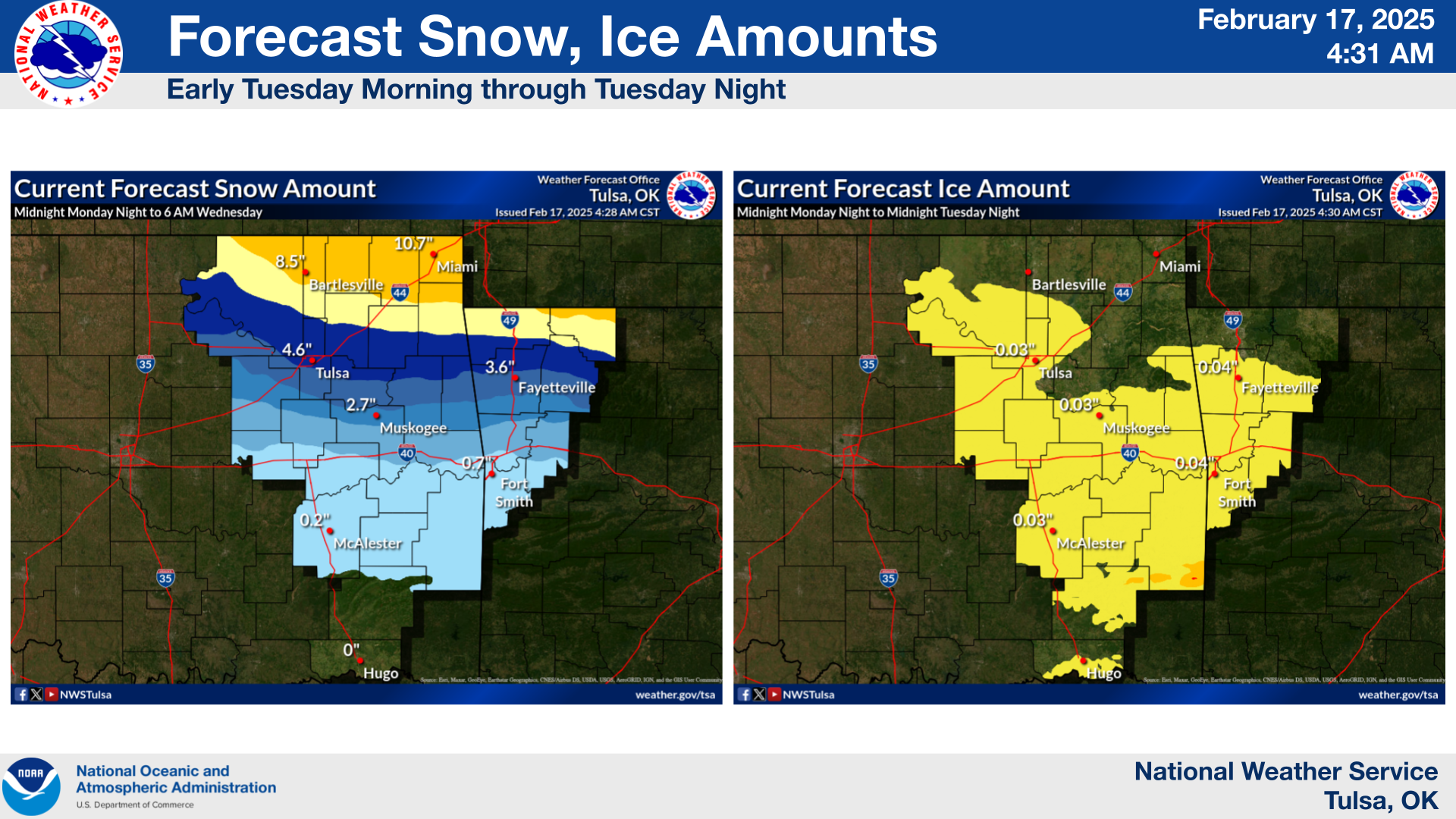
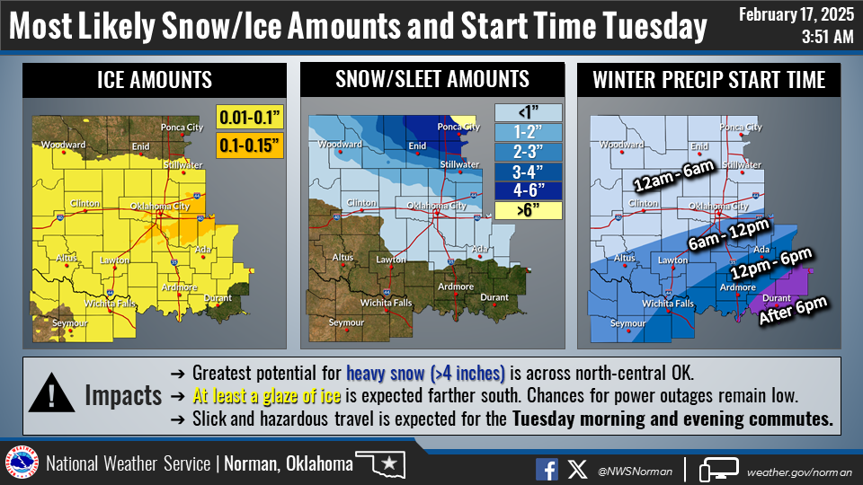
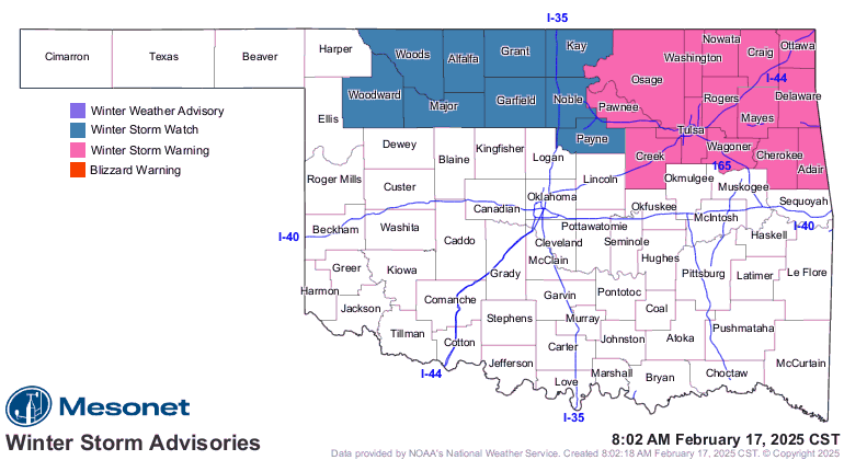
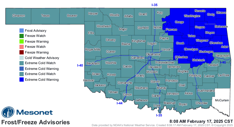
As for advisories, we currently are seeing a winter storm warning for 4+ inches
of snow up in NE OK, and a winter storm WATCH to the west of there for the
same potential amounts.
Not so iffy is the actual arctic air with this system. You can see it looming
to our north like a GREAT COLOSSUS OF YORE (and we all know just how painful
THAT can be)!
Yeah, I heard ya gulp. No, not a Gulp, a Big Gulp. That's nasty looking, and
it's headed this way. We currently have an Extreme Cold Warning for NE OK, and
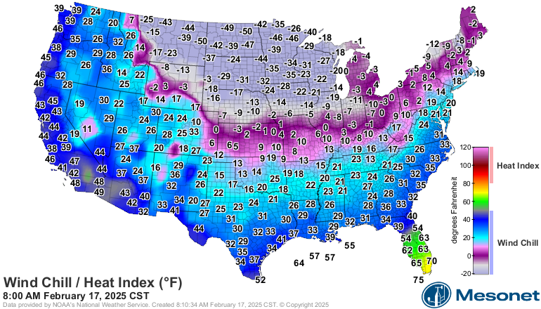
an Extreme Cold Watch for the rest of us, for wind chills over the next few
days of -15 degrees in far southern OK to as low as -30 degrees in northern
OK. I do think we could see values lower than that, but why call down that
COLOSSUS OF YORE?
Here's more on (no, not "moron,"...I can hear ya, ya know!) those wind chills
to come.
So here's the deal...even if you don't have a lot of frozen precip in your area,
you'll probably have enough to impact your driving, so stay home because THIS
AIN'T THE WEATHER YOU WANT TO GET STUCK OUTSIDE IN.
Screaming intended.
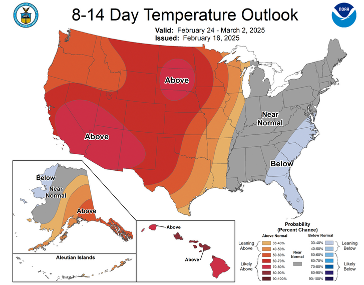
Now for some good news...in the past, when we've seen these bigtime mid-February
arctic blasts, it has ushered in spring. A week after Nowata reached an
Oklahoma all-time low temperature of -31 degrees on Feb. 10, 2011, a week later
it was 79 degrees for a 110-degree swing. Same thing occurred right after the
Deep Freeze event of Feb. 2021, where we were in the 60s a few days after it
ended. We could see that again this time around with widespread 50s and 60s by
this weekend.

After that, it looks like above normal temperatures until March!
Spring will be here soon, so we have that to look forward to. And 2 days after
that...summer!
Gary McManus
State Climatologist
Oklahoma Mesonet
Oklahoma Climate Survey
gmcmanus@ou.edu
February 17 in Mesonet History
| Record | Value | Station | Year |
|---|---|---|---|
| Maximum Temperature | 85°F | ALTU | 2011 |
| Minimum Temperature | -2°F | HOLL | 2021 |
| Maximum Rainfall | 1.56 inches | TULN | 2022 |
Mesonet records begin in 1994.
Search by Date
If you're a bit off, don't worry, because just like horseshoes, “almost” counts on the Ticker website!