Ticker for February 5, 2025
MESONET TICKER ... MESONET TICKER ... MESONET TICKER ... MESONET TICKER ...
February 5, 2025 February 5, 2025 February 5, 2025 February 5, 2025
Argh?
Ya know, everybody thought Dalton would be bigger.
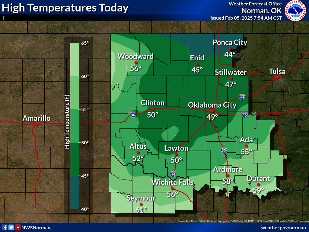
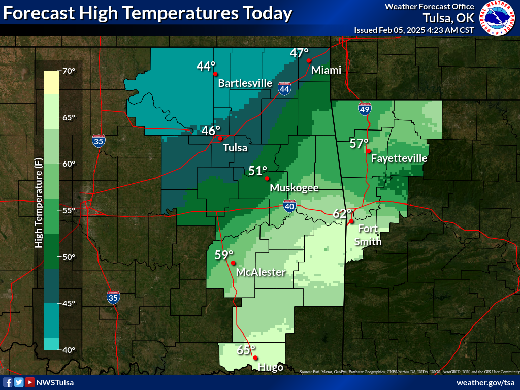
And I thought it would be warmer today.
Opinions vary.
I thought the forecast said 60s and 70s today, but then again my mind ain't what
it used to be. It must be the Pop-Tarts! At any rate, this is what we have today,
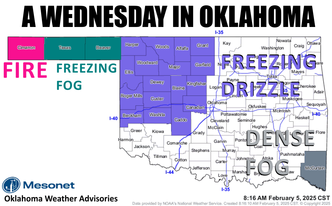
freezing fog and freezing drizzle up in the NW, Red Flag Fire Danger in the western
Panhandle, dense fog in the far SE, and darned cold for everybody else! You see,
it's this cold air that oozed down over us. It's so dense and slow-moving (much
like your favorite State Climatologist...yeah, I heard ya!) that it's stubbornly
gonna hang around for awhile longer than first thought.
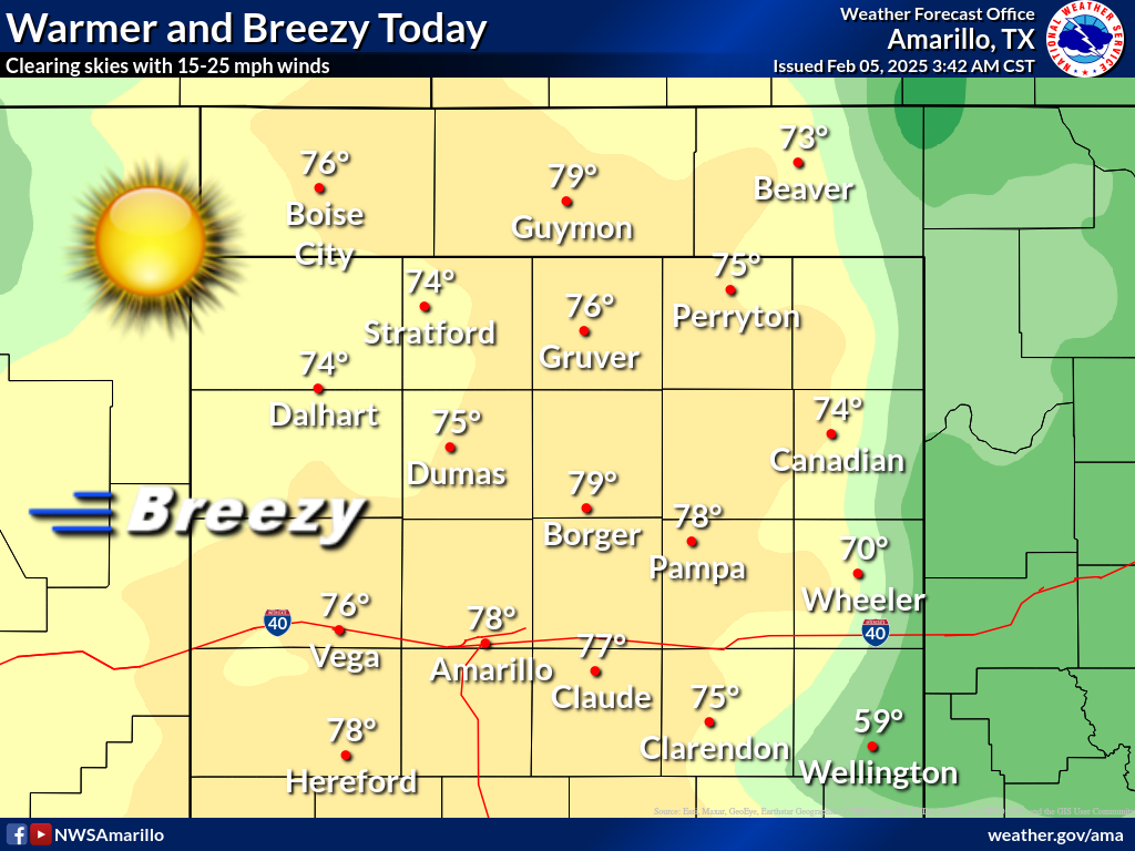
So our 60s and 70s, for most of us, have become 40s and 50s. The exception is
the Panhandle, which should see those skies clear up later and strong SW winds
gusting to over 40 mph creating that fire danger. And also down in SE OK,
because...well, geography.
So a slower, more muted warm up over the next few days, and then that bigtime
cold comes next week, and the chance for more wintry weather (i.e., snow).
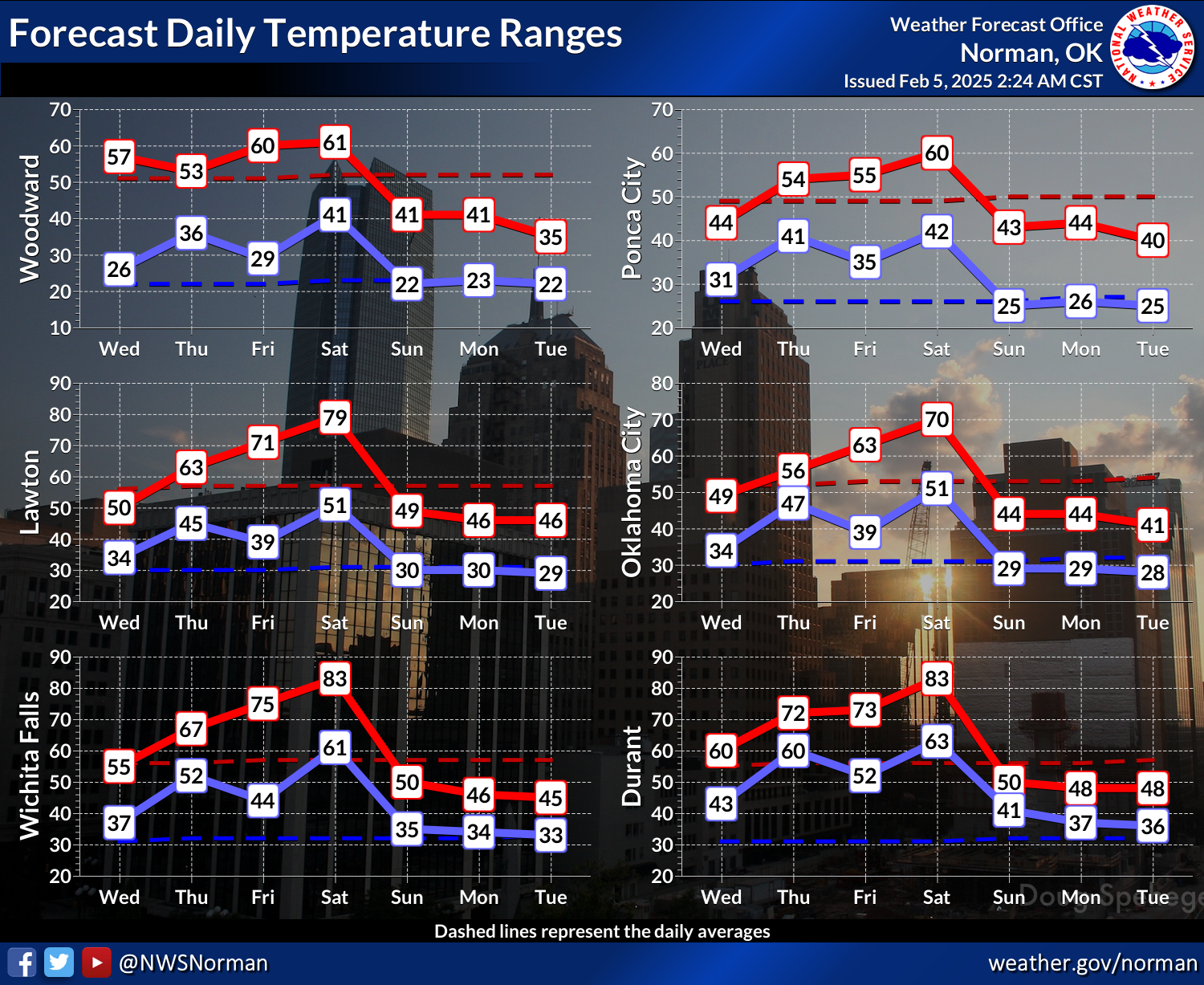
The key to this forecast, ALL parts of it really, is embracing uncertainty.
Hey, I embrace entropy everyday and I'm okay!
Well, sorta okay.
Gary McManus
State Climatologist
Oklahoma Mesonet
Oklahoma Climate Survey
gmcmanus@ou.edu
February 5 in Mesonet History
| Record | Value | Station | Year |
|---|---|---|---|
| Maximum Temperature | 84°F | GOOD | 2025 |
| Minimum Temperature | -2°F | BEAV | 2014 |
| Maximum Rainfall | 1.40 inches | MTHE | 2008 |
Mesonet records begin in 1994.
Search by Date
If you're a bit off, don't worry, because just like horseshoes, “almost” counts on the Ticker website!