Ticker for January 7, 2025
MESONET TICKER ... MESONET TICKER ... MESONET TICKER ... MESONET TICKER ...
January 7, 2025 January 7, 2025 January 7, 2025 January 7, 2025
Middle Name: Danger
I've been told giraffes like me because of my pleasant disposition, so I have that
going for me. However, I've also been told I'm dangerous because I demand an
8-track tape player be installed in all my vehicles. Google it, kids.
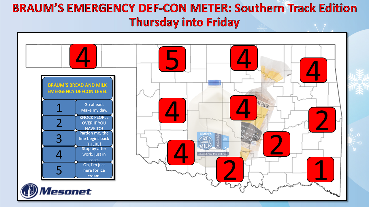
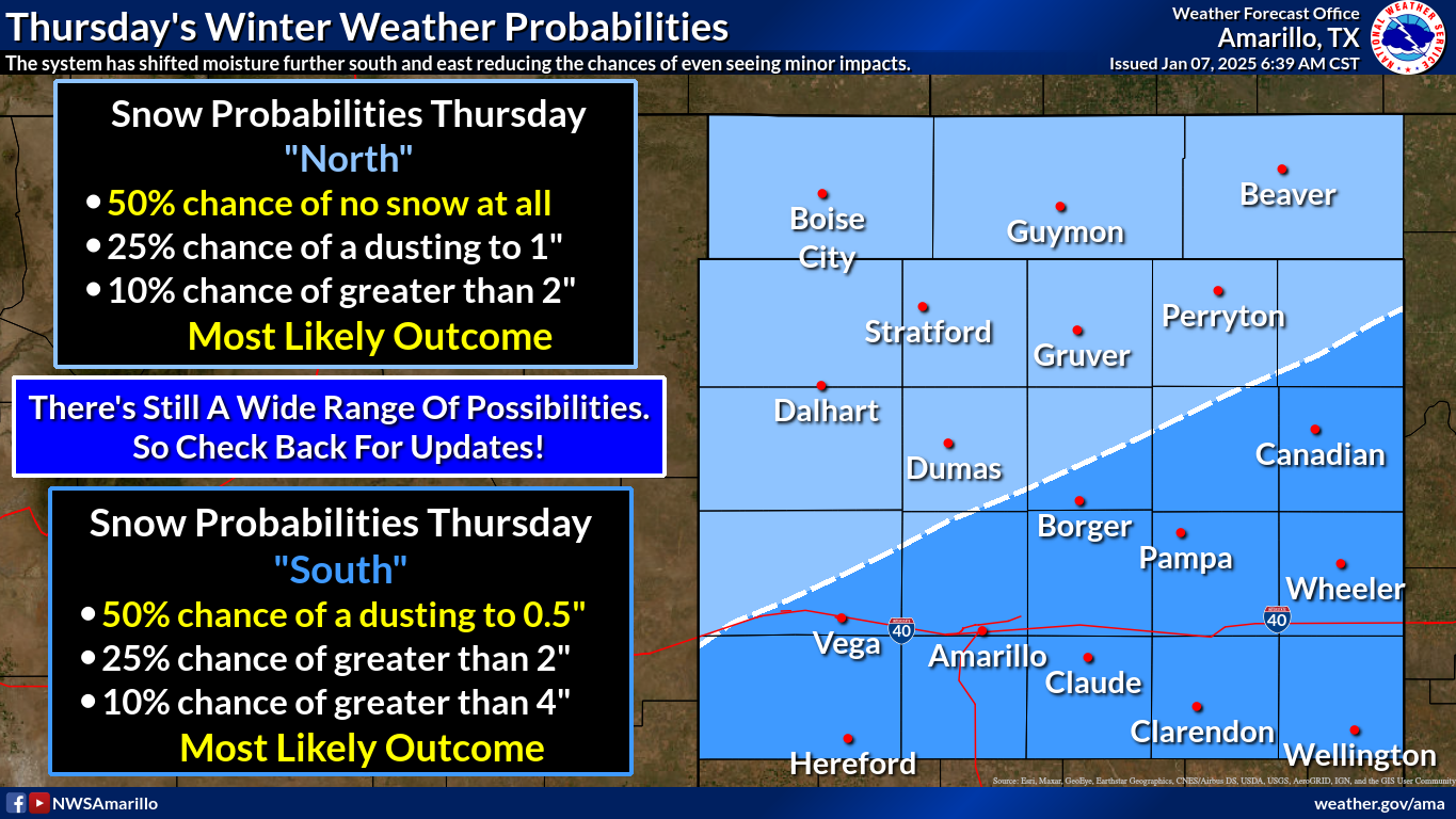
Now what does all that have to do with our current weather situation? Well,
nothing...the same as the Braums-DEFCON map, other than to act as a warning:
1. I'm apparently unstable,
2. Still lots of uncertainty in the track, the NW cutoff, and transition to snow
with Thursday's system,
4. 8-tracks are coming back!
Yeah, as the Master of All Time and Space (trademark), I've also banned 3s.
I put the 1 down in far SE OK because the Shreveport NWS Office that covers
McCurtain County notes the possibility for 6-8 inches of snow in that area, and
also a bit of ice beforehand. To me, that seems a tad dangerous on all those
mountain roads. The 2s just to the NW of there are for the possibility of 3-6
inches of snow.
Now listen, I'm not trying to be "that guy,"...heck, I can't even be THIS guy
very well, but snow and southern OK drivers DO NOT MIX! So get to Braum's on
Wednesday, before it's too late. There does appear to be a sharp truncation line
(Hey, "Sharp Truncation Line" was my band's name in the Merchant Marines!)
setting up as you go to the NW, and the current data suggests that this will
largely be an I-44 to the southeast storm. And remember, there's always that
pesky vertical temperature profile problem.
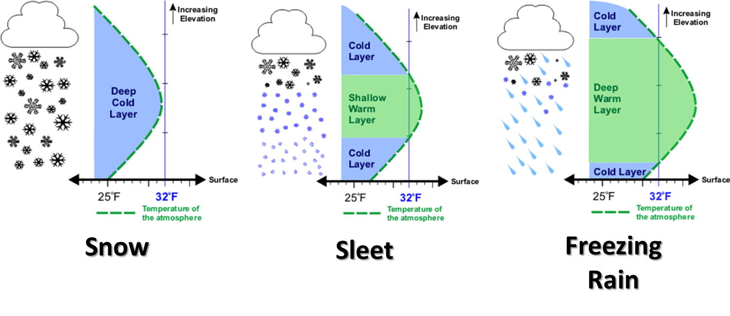
Any sort of shenanigans going on above us with above-freezing layers can cause
something OTHER than snow to fall. And we will also be close to the freezing
point down at the surface, so some melting will probably occur as it falls.
HOWEVER, in an almost singular voice in the void, I will warn once again that
frozen precipitation falling onto roadways that have been cooled down almost
an entire week before will not take much to start accumulating snowfall.
See, I tricked you. I had you read all that, and only NOW do I give you the
outlooks from the actual experts.
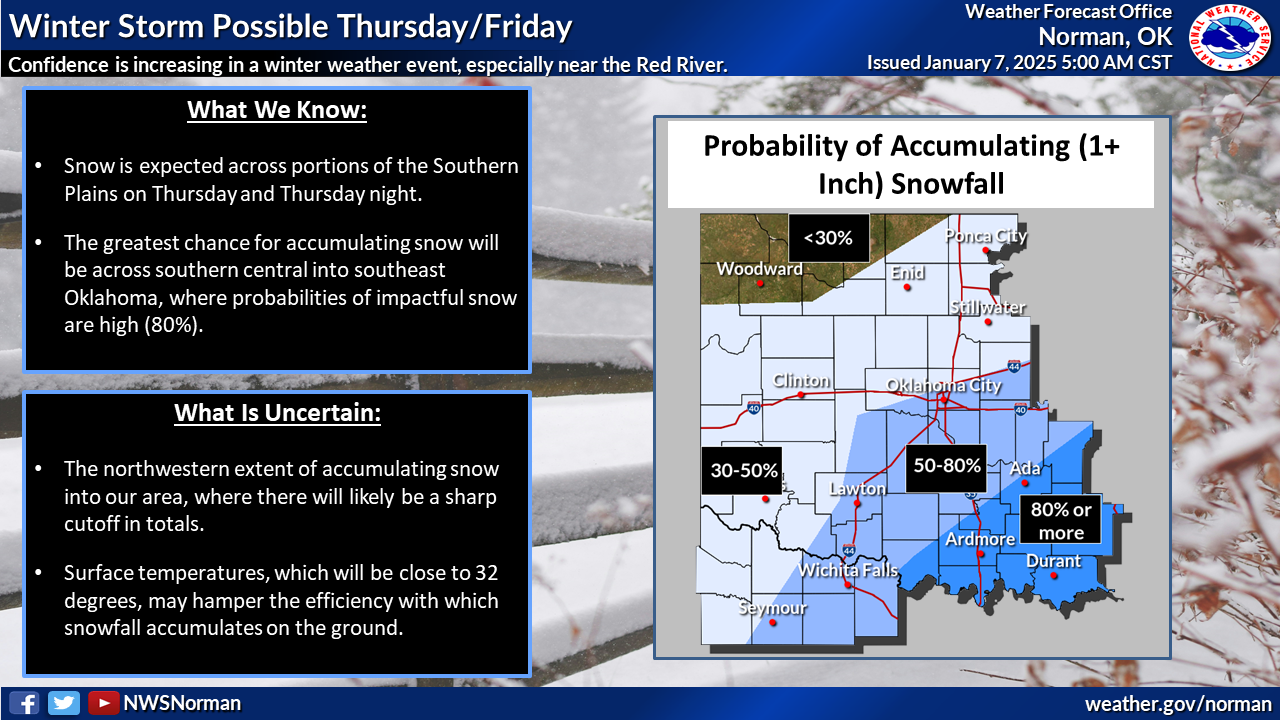
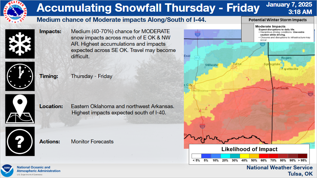

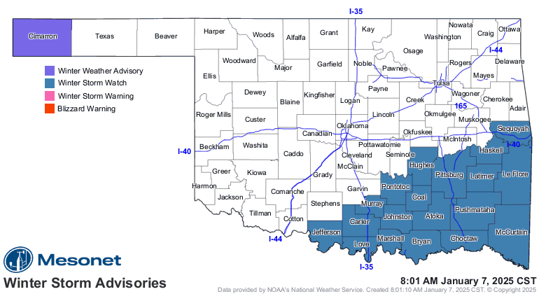
A winter storm watch has been issued for that area in SE OK where the 3-8 inches
of snow is possible. Due to the uncertainty, it's a watch thus far, but I'd
expect to see a change to a winter storm warning if things continue on track as
they are now. And we still can't rule out things shifting, either north or
south, as we go forward. I don't think we will see much of a spread vs. a shift,
however.
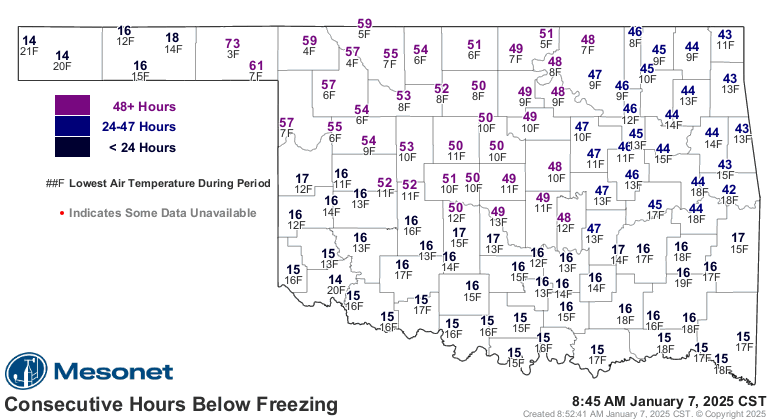
So sit back and enjoy the ride in this burst of winter, now going strong for
60 hours or so.
Warmer days are ahead.
Gary McManus
State Climatologist
Oklahoma Mesonet
Oklahoma Climate Survey
gmcmanus@ou.edu
January 7 in Mesonet History
| Record | Value | Station | Year |
|---|---|---|---|
| Maximum Temperature | 85°F | WOOD | 2006 |
| Minimum Temperature | -19°F | KENT | 2017 |
| Maximum Rainfall | 2.75 inches | PORT | 2008 |
Mesonet records begin in 1994.
Search by Date
If you're a bit off, don't worry, because just like horseshoes, “almost” counts on the Ticker website!