Ticker for November 14, 2024
MESONET TICKER ... MESONET TICKER ... MESONET TICKER ... MESONET TICKER ...
November 14, 2024 November 14, 2024 November 14, 2024 November 14, 2024
Free November!
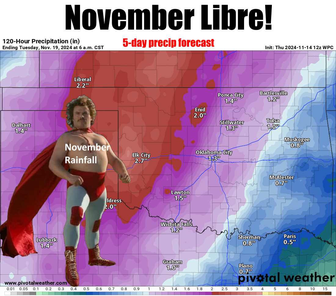
No, it doesn't make sense, but neither does lettuce on a hamburger. By the way,
since you brought it up, remember when it was kosher to put potato chips DIRECTLY
ON the burger? If you did that now, you'd be flogged! Hoisted from the tallest
yardarm in the Lake Hefner Navy. Tomatoes? That's a subject for another Ticker.
Here's the setup...big upper-level low pressure system approaching from the west,
lots of return moisture from the Gulf (which is still unusually warm), ipso facto
and yada yada yada later, we have heavy rainfall across western Oklahoma. Yes, it
could still shift or change and all that other stuff Oklahoma weather does between
now and Sunday-Monday. We're still dealing with chaos in these here forecast
models, after all, as I remind you for the 1348th time.
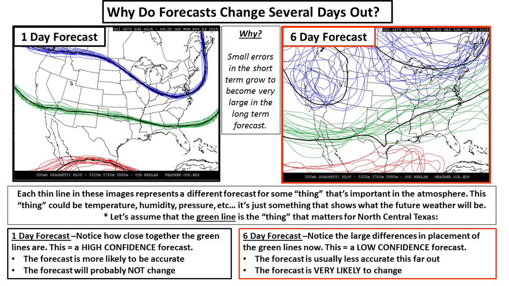
However, these have been fairly consistent as we've gotten within the magic 5-day
reliability window, which is even more magical within 72 hours, but becomes
darned near Gandalf-level magical within 24 hours. But we're not within 24 hours,
are we, so we go with what we got. And what we got now if a failure to
communicate.
Oops, a "Cool Hand Luke" interruption again, which is always welcomed.
So as the storm system approacheth (and we all know just how painful that can
be!), we'll see strong southerly winds and much above normal temperatures. Maybe
a bit of severe weather on Monday, which bears will watch (get it..."bears
watching?" Oh never mind. Then a big cold front afterwards and cold Canadian
air plunges in and gives us a visit from winter.
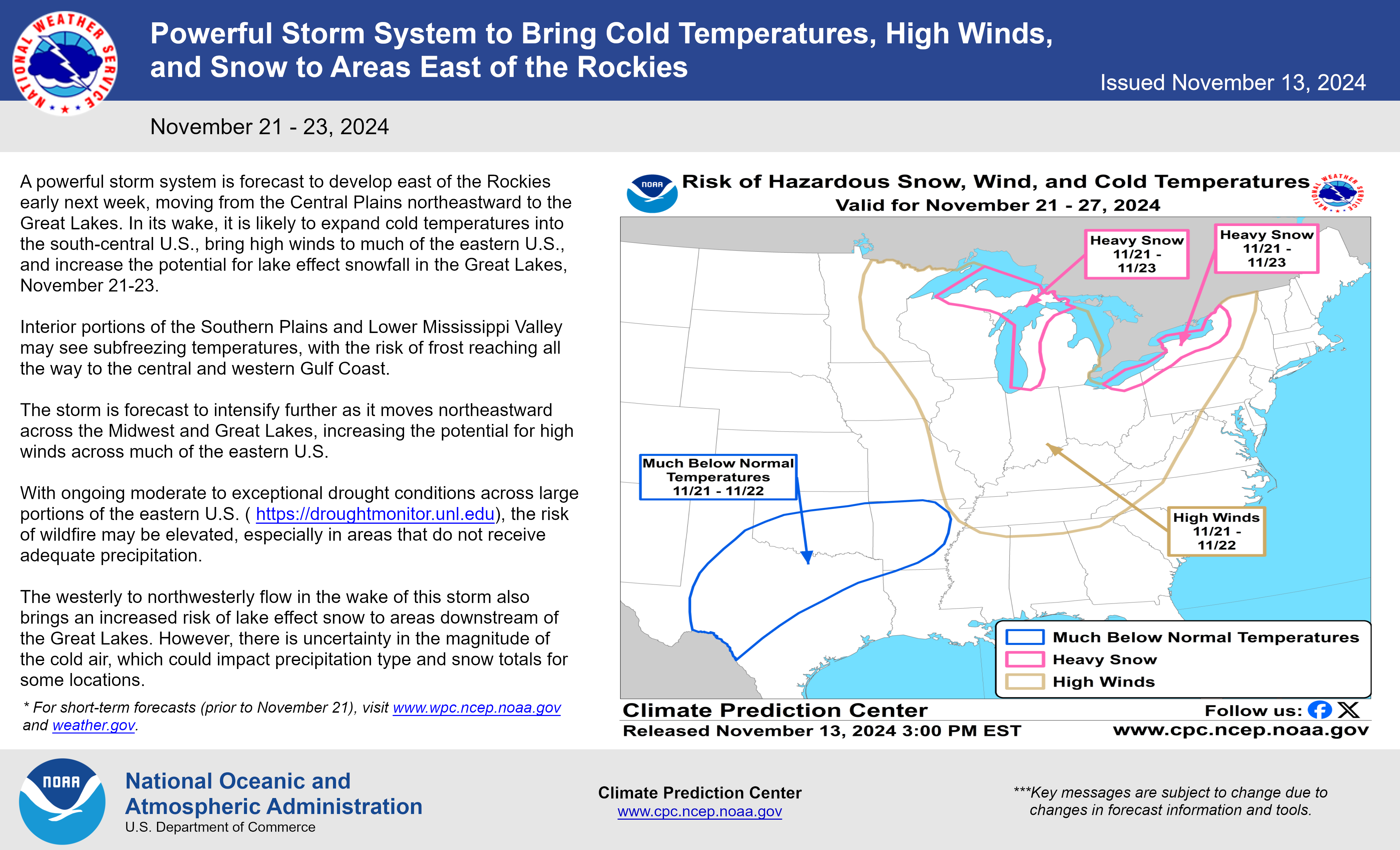
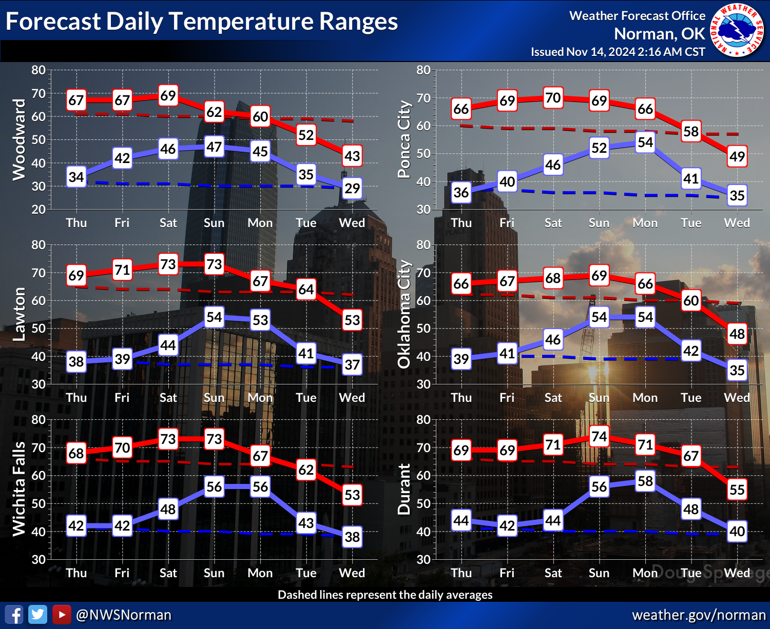
I'm talking by next Thursday maybe seeing those wind chills down into the 20s
and 30d and possibly a bit of snow here and there (and in between, maybe). Still
too far out for anything snow-related other than Fantasy-casting, but the
possibility is there 7-8 days out. That's Samwise Gamgee-level magic.
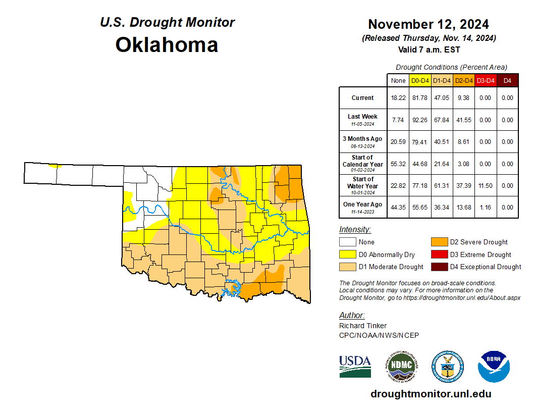
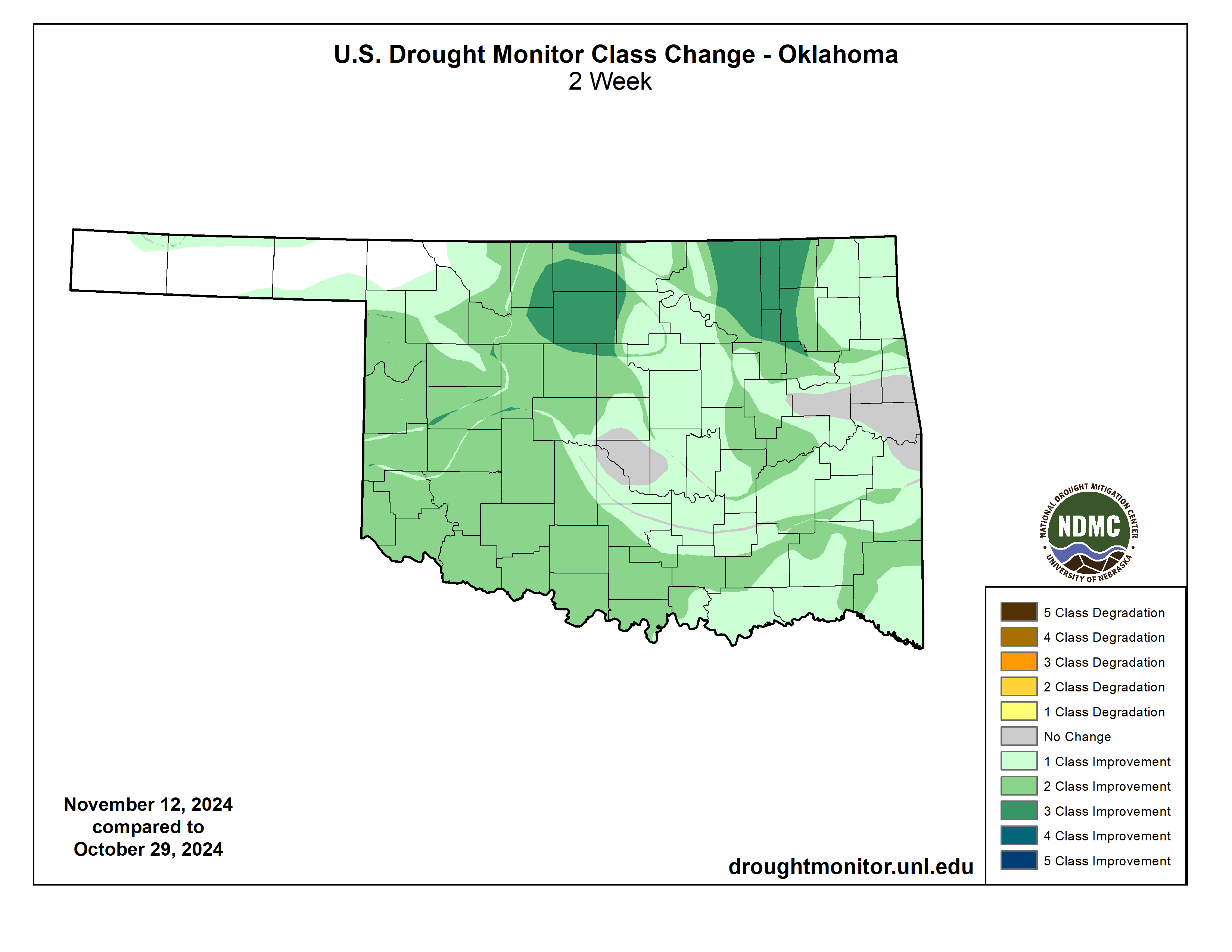
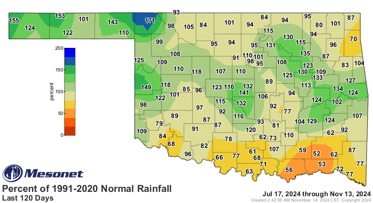
Before that, though, the rainfall will help erase more drought as that hazard
continues to dwindle in the state. Don't be too upset at all this color on the
USDM map...we have to ratchet the intensity down one level per week as the
USDM's guidelines indicate: "Drought is slow to develop, so slow to leave" type
of a deal.
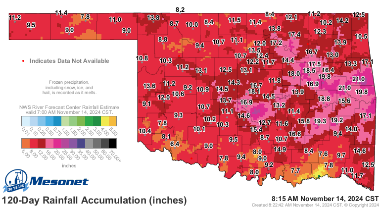
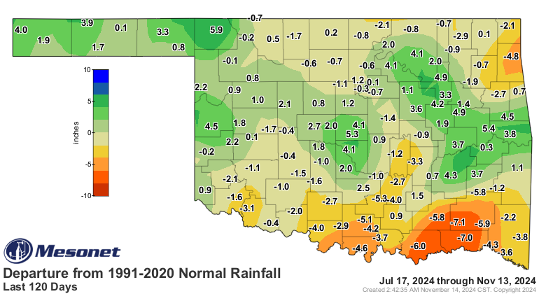
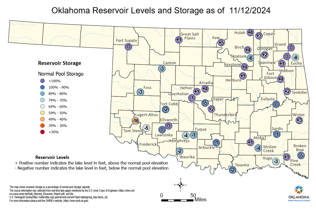
We do have to be mindful of those longer-term deficits that are still lurking
in our soils and reservoirs.
Believe it or not (not, usually), we still have lakes that are significantly
low out there.
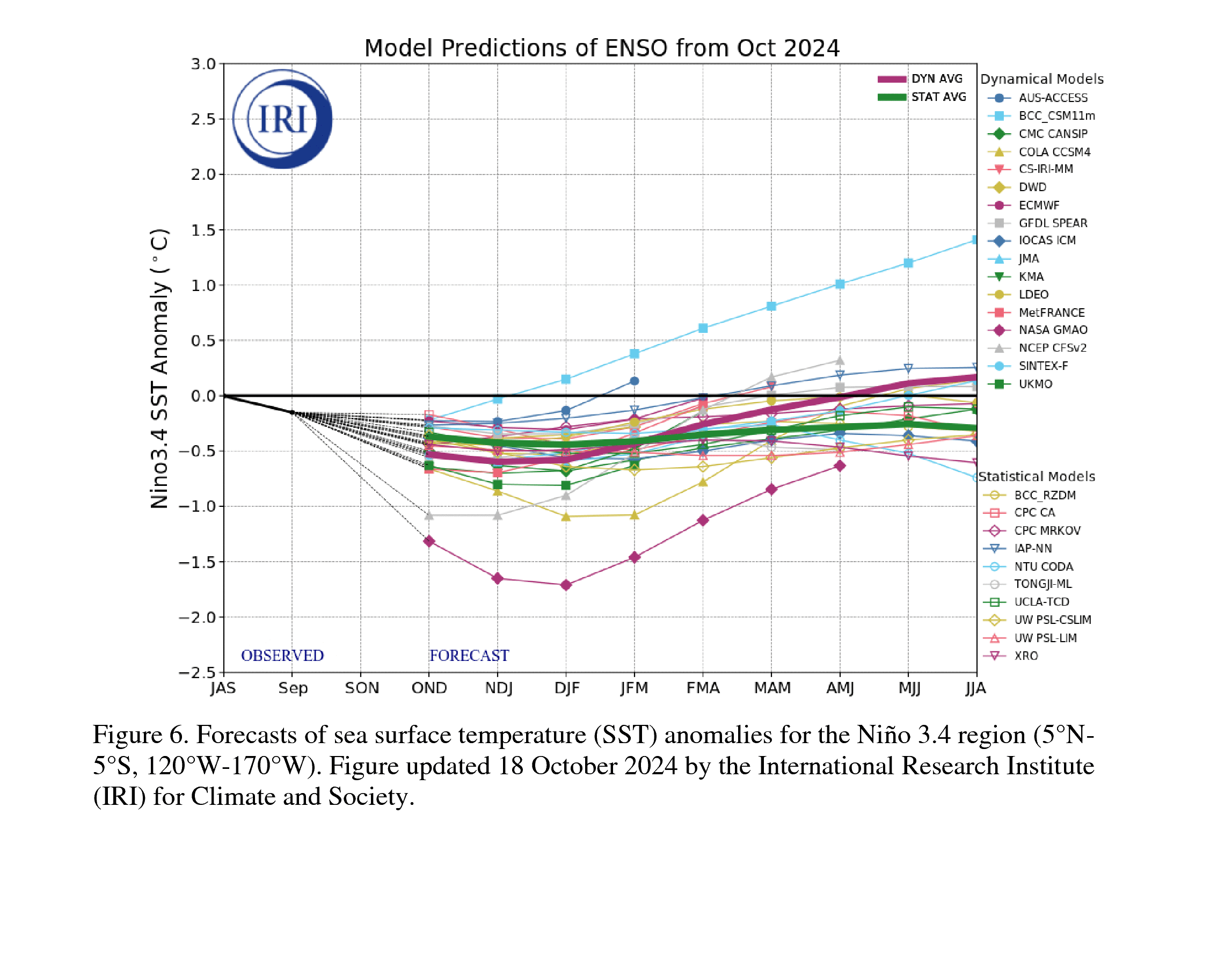
Now let's talk about La Nina. Sorry, no gossiping allowed. Let's stick to the
science. We STILL haven't seen those SST anomalies consistently below -0.5C to
trigger the ocean component, and the wind anomalies over the equatorial pacific
are still not fully in La Nina territory yet:
"For the monthly average, low-level wind anomalies were easterly over
a small region of the east-central equatorial Pacific, and upper-level
wind anomalies were near average. Convection was suppressed over the
Date Line and was weakly enhanced over eastern Indonesia."
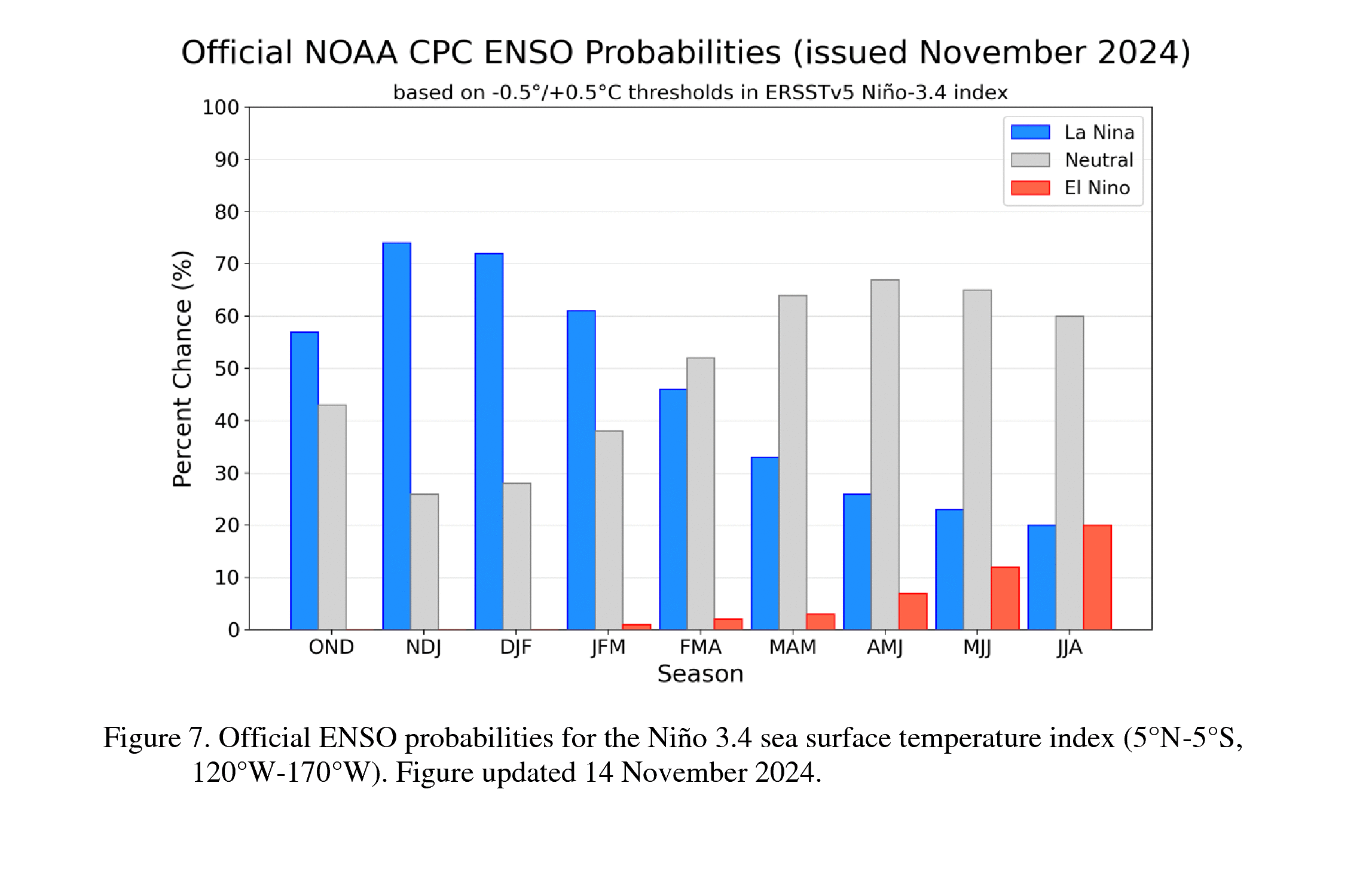
In other words, still no oceanic-atmospheric coupling to generate an official
La Nina episode. It is still favored to develop through December, but be weak
and short-lived.
Remember, it's that atmospheric coupling that can change our circulation
patterns up our way.
I don't know how to change your circulation patterns...jog maybe? Dammit Jim,
I'm a climate guy, not a cardiologist!
Now if we do get a weak La Nina, all the normal impacts might occur, they will
just be less likely. For us, it tilts the odds towards warmer and drier. As I
shouted from the rooftops...NO, our flash drought previous to November wasn't
due to La Nina. There wasn't even a La Nina present, nor was there any sort
of strong atmospheric coupling.
Besides...we prefer El Nino. Gossip away!
Gary McManus
State Climatologist
Oklahoma Mesonet
Oklahoma Climate Survey
gmcmanus@ou.edu
November 14 in Mesonet History
| Record | Value | Station | Year |
|---|---|---|---|
| Maximum Temperature | 89°F | GRA2 | 2025 |
| Minimum Temperature | 11°F | OILT | 2018 |
| Maximum Rainfall | 4.93 inches | CLAY | 1994 |
Mesonet records begin in 1994.
Search by Date
If you're a bit off, don't worry, because just like horseshoes, “almost” counts on the Ticker website!