Ticker for November 5, 2024
MESONET TICKER ... MESONET TICKER ... MESONET TICKER ... MESONET TICKER ...
November 5, 2024 November 5, 2024 November 5, 2024 November 5, 2024
Pump you up
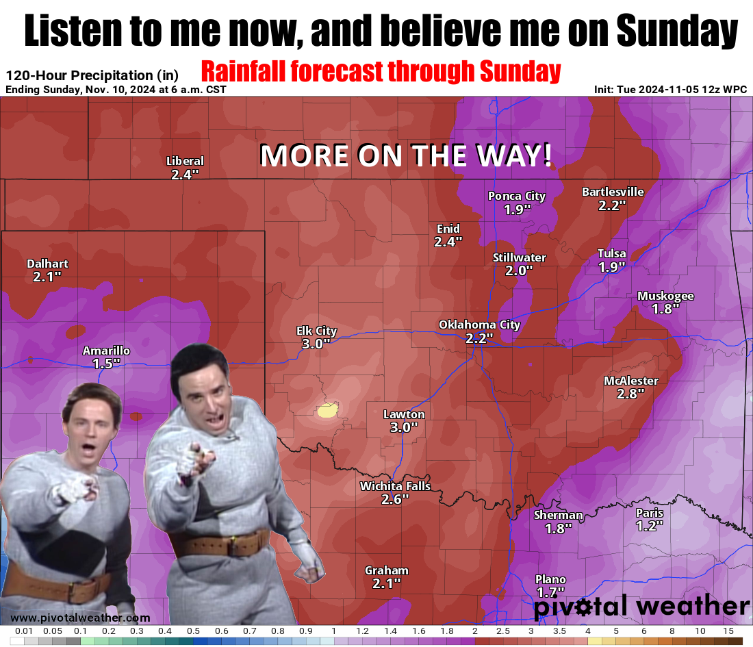
Whoa, I actually got to sleep through the night last night...no tornado warnings
in the wee hours of the morning! Well, I slept between my usual night terrors,
which usually consist of nightmares with me dreaming I'm eating Strawberry
Pop-Tarts behind a slow left-lane driver, having just gotten onto the Interstate
after going through a 5-minute 4-way stop where everybody was trying to wave
each other through. But I digress...
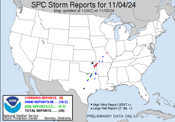
That about covers the tornadoes for November, okay? Some really bad ones (are
there good ones?) yesterday across the state, and eastern OK got hit hard.
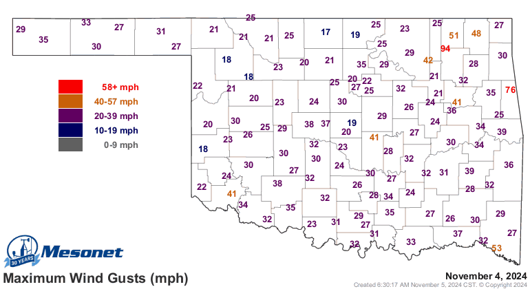
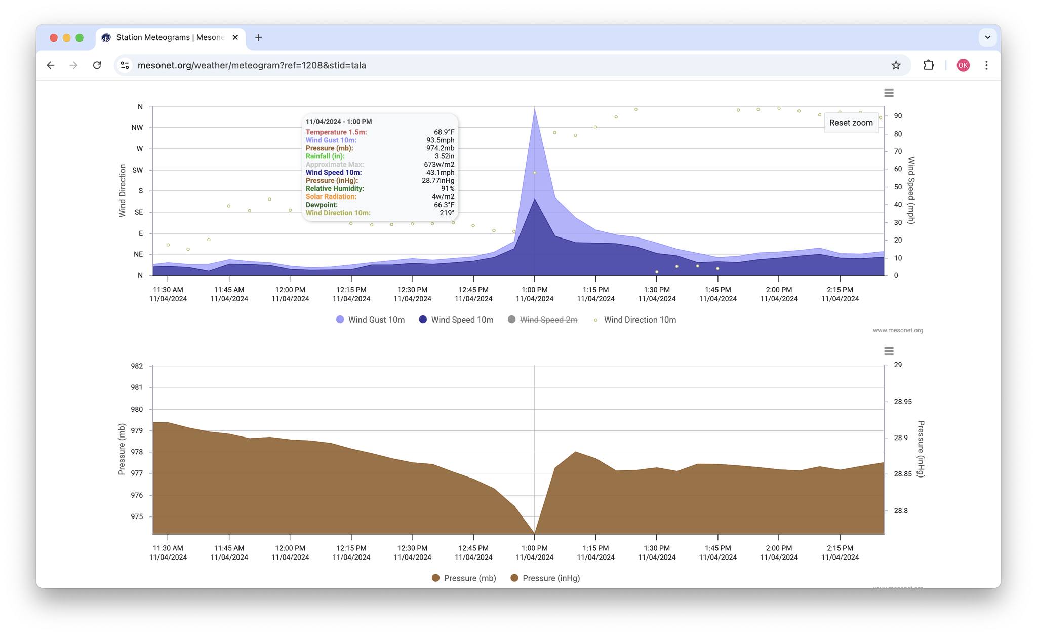
Including our Mesonet sites, for crying out loud! Talala and Westville both had
close encounters with tornadic circulations, it seems. What the heck did we
do to you, Mother Nature?
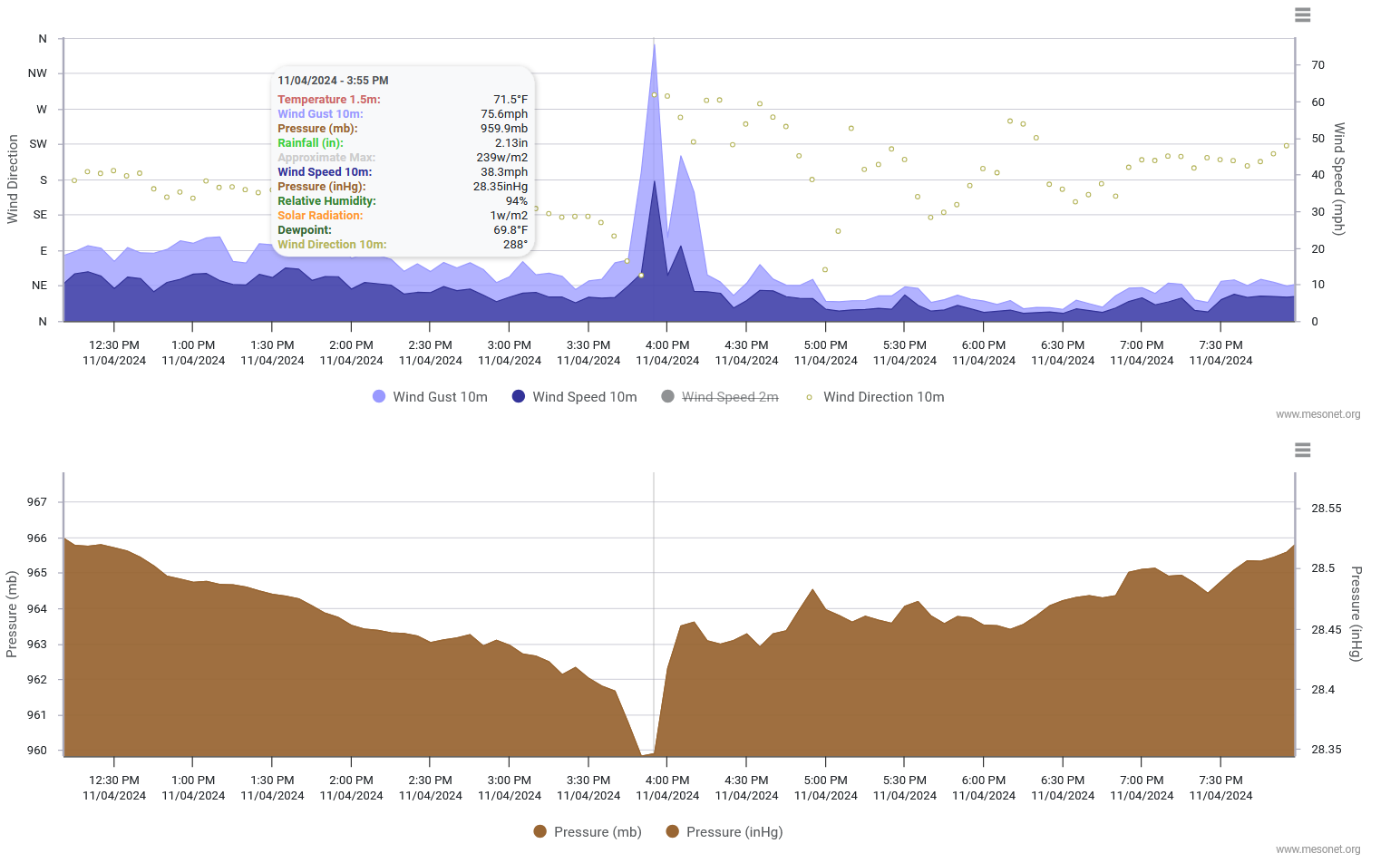
By the way, Westville is a lovely place, and in true Okie fashion, it's located
NEAR THE OK-ARKANSAS BORDER IN FAR EASTERN OKLAHOMA!
That makes about as much sense as me using conditioner. Anyway, enough self-
praise...so we probably are gonna break that November tornado record (12 from
1958) like I talked about yesterday. Everything is still very preliminary, and
5 official twisters have been identified from what I can tell, including 3
EF3s. That's pretty incredible for this time of year. So stay tuned as those
tornado counts will undoubtedly go up over the next few days as NWS folks go
out and investigate those damage paths.
Here's our rainfall map for November thus far, as we also try and zoom up the
all-time November rain charts.

So right now, we have a statewide average rainfall total of 4.34 inches, which
is already up to the 14th-wettest November since records began in 1895, with
25 days left in the month (and those big rains this weekend coming as well)!
November 2015 (of Godzilla El Nino fame) has the top spot at 6.05 inches. If
you'll remember (you don't have to because I do!), December 2015 was also
the wettest on record, so doubting we match that famous El Nino Noah's Ark
exercise. Still, big rains already with more on the way. Here are a few select
totals and the network they came from:
-***-
Seminole 9.68" CoCoRaHS (volunteer observer)
Retrop 8.52" NWS COOP (volunteer observer)
Macomb 8.52" CoCoRaHS
Tecumseh 4W 8.25" CoCoRaHS
Tecumseh 3.7WNW 8.02" CoCoRaHS
Lexington 7.76" C0CoRaHS
Tishomingo 7.72" OK Mesonet
Pauls Valley 7.69" Mesonet
Shawnee 7.68" Mesonet
McAlester 7.65" Mesonet
-****-
Along with the big rains, we also see some big snows out in the western
Panhandle, which also saw snow yesterday into the overnight hours. This time,
a good half-foot could fall with the possibility of white-out conditions as
we get into Thursday and Friday.
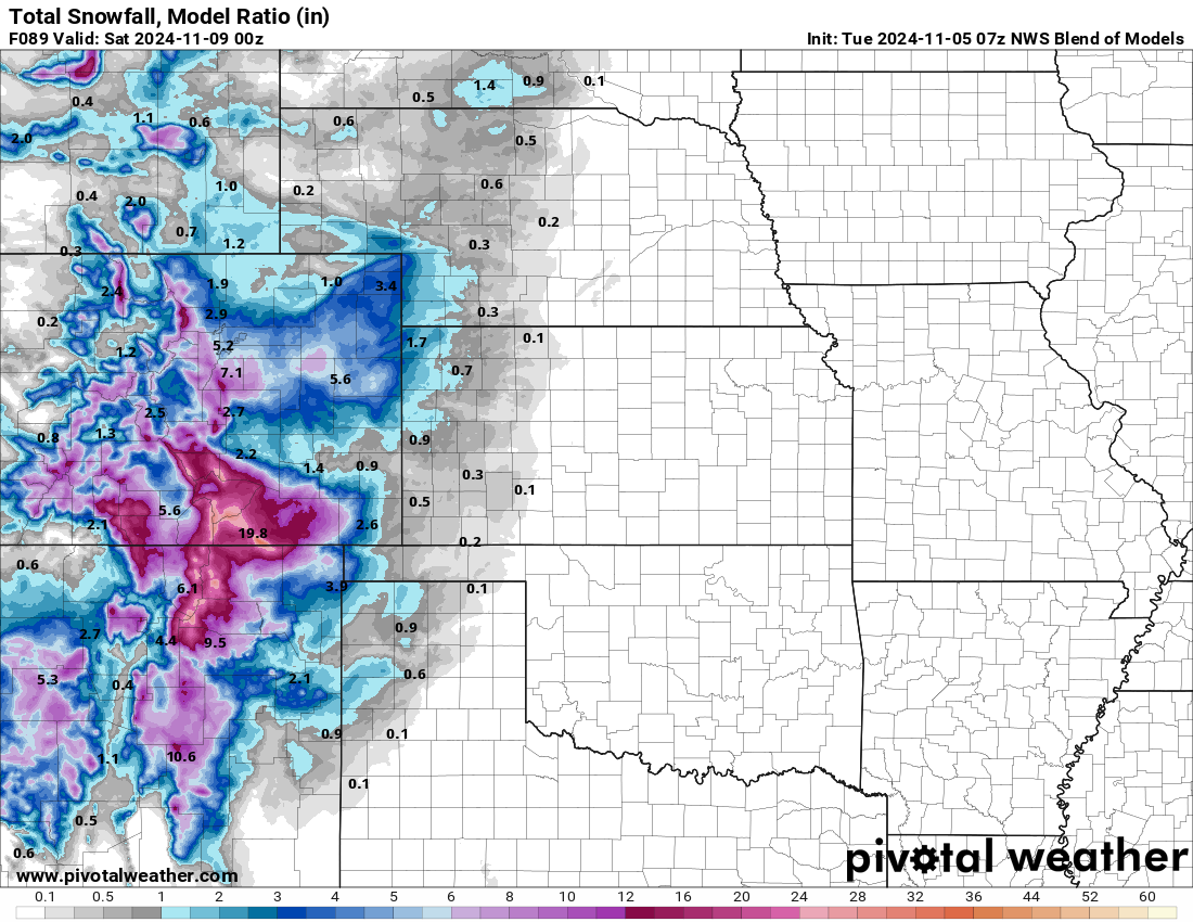
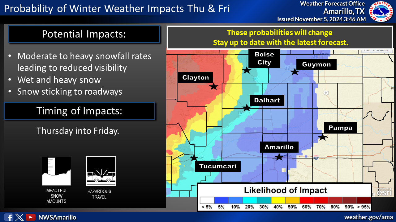
More snow, less tornadoes please.
Gary McManus
State Climatologist
Oklahoma Mesonet
Oklahoma Climate Survey
gmcmanus@ou.edu
November 5 in Mesonet History
| Record | Value | Station | Year |
|---|---|---|---|
| Maximum Temperature | 91°F | BURN | 2017 |
| Minimum Temperature | 20°F | BEAV | 2010 |
| Maximum Rainfall | 4.60″ | IDAB | 2000 |
Mesonet records begin in 1994.
Search by Date
If you're a bit off, don't worry, because just like horseshoes, “almost” counts on the Ticker website!