Ticker for October 24, 2024
MESONET TICKER ... MESONET TICKER ... MESONET TICKER ... MESONET TICKER ...
October 24, 2024 October 24, 2024 October 24, 2024 October 24, 2024
Brownification
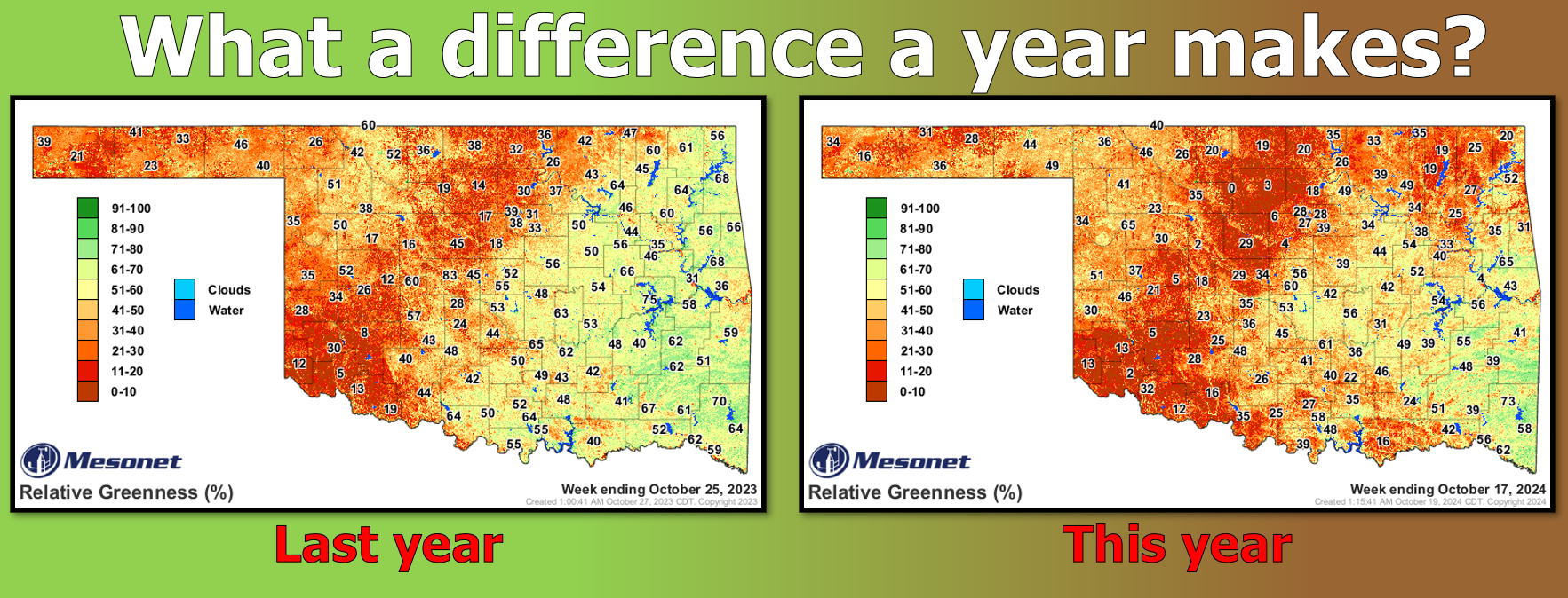
Retired (whereas I'm ALWAYS tired) OK-FIRE Program Manager Dr. J.D. Carlson of
OSU alerted us to these images earlier this week, showing how the current relative
greenness map of the state looks so starkly different than at last year at this
time. The Mesonet's OK-FIRE program uses the relative greenness maps to help
gauge fire danger (the "browner" it is, the more combustible things will be, in
simple terms). Now the greenness maps show how green (or not) things are relative
to the greenest things have been over a longer period of time. Again, in simple
terms...I could explain it further but then I'd have to bore ya.
Well okay then.

Now the most obvious "big" difference between the two maps is just how bad things
are up in northeast OK, where drought--and deficits--are at their worst. Take a
look at the same drought maps over that same time frame, last year at this time
vs. this year.
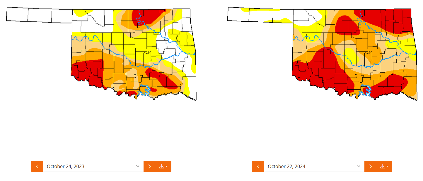
Obviously drought is much worse this October, and that worse drought is more
widespread. The differences also show up in the soil moisture from the two
periods.
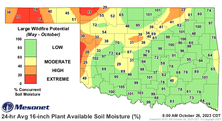
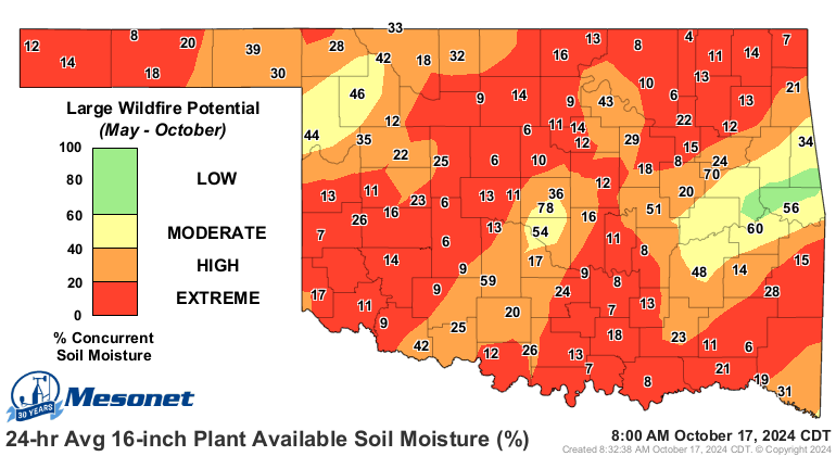
Holy desiccated soils, Ratman (Batman is so last year)! Yeah, that's also a huge
year-over-year difference. But there's also a huge difference in what led up
to that drought/greenness/soil moisture snapshot from last year vs. this year
as well. We'll just take a look at the 90-day rainfall maps from the two
periods as an example. Last year first:
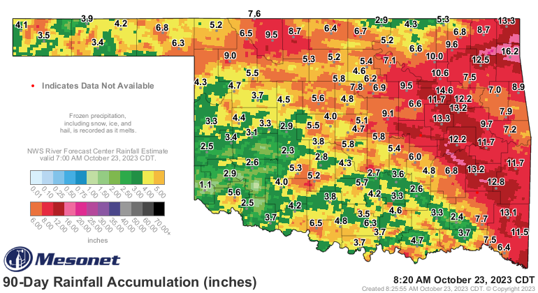
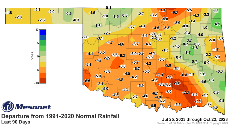
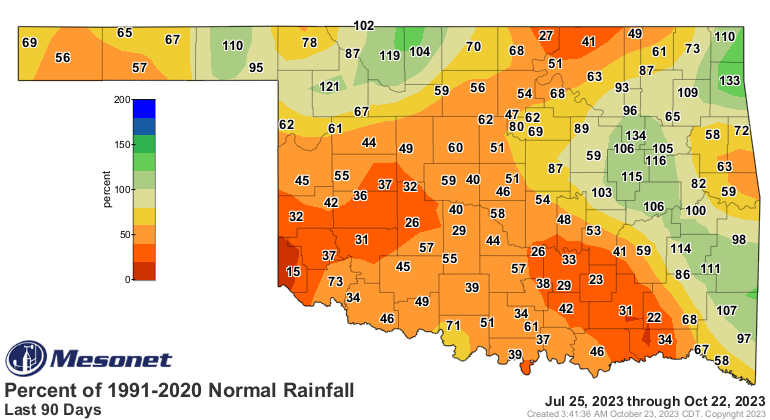
And you know what else was happening at this time last year? Hello (remnants of)
tropical storm Norma (Jean).

Now this year:
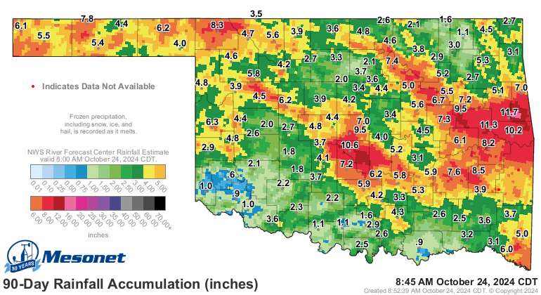
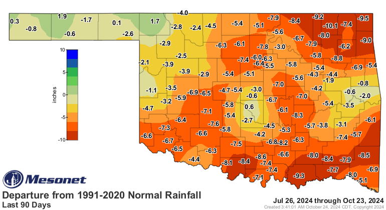
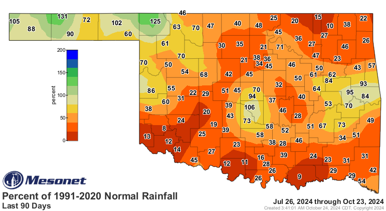
Unfortunately, no Norma Jean.
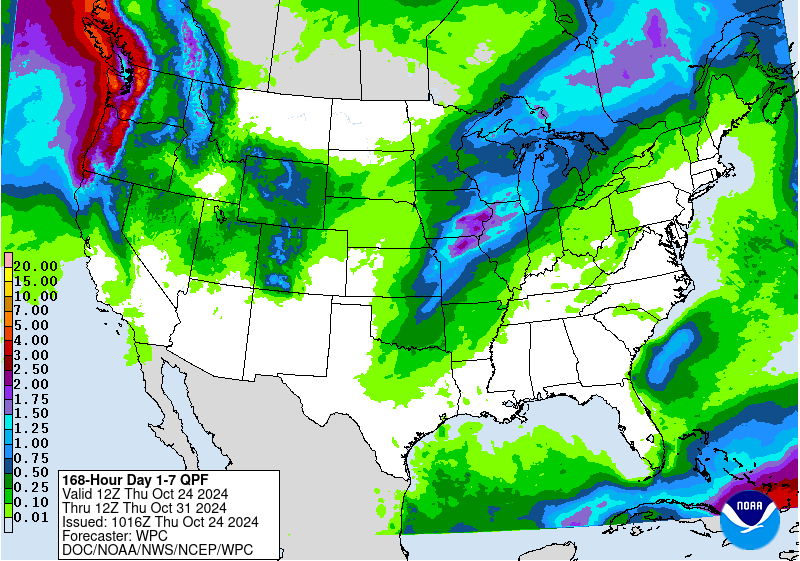
So it's a start, maybe? And things are looking up for next week, maybe?
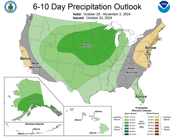
So here's the thing, though. No, not THAT thing, THIS thing...normal rainfall
ain't exactly May'ish this time of year, so seeing increased odds for above-
normal rainfall doesn't mean drought-busters. It could be, but it's not looking
like that as of now, and you're not going to get me to forecast bigtime rains
during a drought until I see it on the 7-day forecast map.
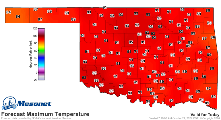
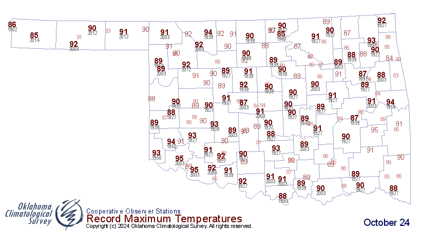
Back to reality, we're seeing our sixth "last day of summer" this year today
ahead of a cold front that will cool us down...not cold us down, but we'll get
close to seeing some record heat this afternoon, again.
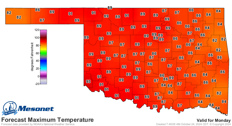
But don't worry, we'll see our seventh "last day of summer" on Monday, in case
you like "last days of summer."
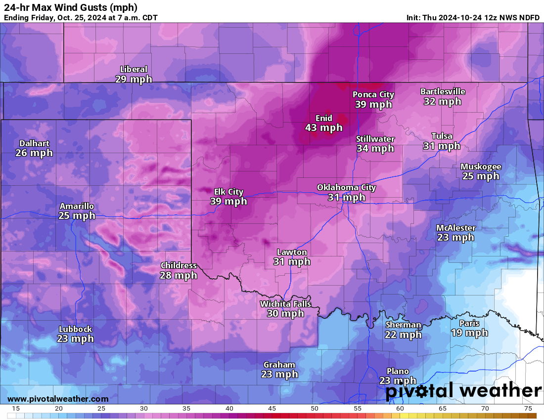
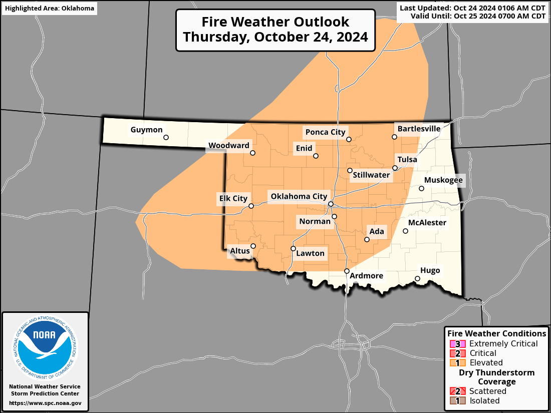
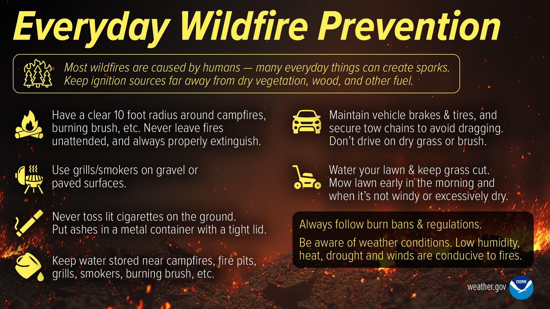
With today's heat and comes fire danger, so practice those non-sparking safety
tips.
Where's Norma Jean when you need her?
Gary McManus
State Climatologist
Oklahoma Mesonet
Oklahoma Climate Survey
gmcmanus@ou.edu
October 24 in Mesonet History
| Record | Value | Station | Year |
|---|---|---|---|
| Maximum Temperature | 96°F | GRA2 | 2003 |
| Minimum Temperature | 20°F | BEAV | 2005 |
| Maximum Rainfall | 6.72 inches | MCAL | 2019 |
Mesonet records begin in 1994.
Search by Date
If you're a bit off, don't worry, because just like horseshoes, “almost” counts on the Ticker website!