Ticker for September 20, 2024
MESONET TICKER ... MESONET TICKER ... MESONET TICKER ... MESONET TICKER ...
September 20, 2024 September 20, 2024 September 20, 2024 September 20, 2024
Uncommon
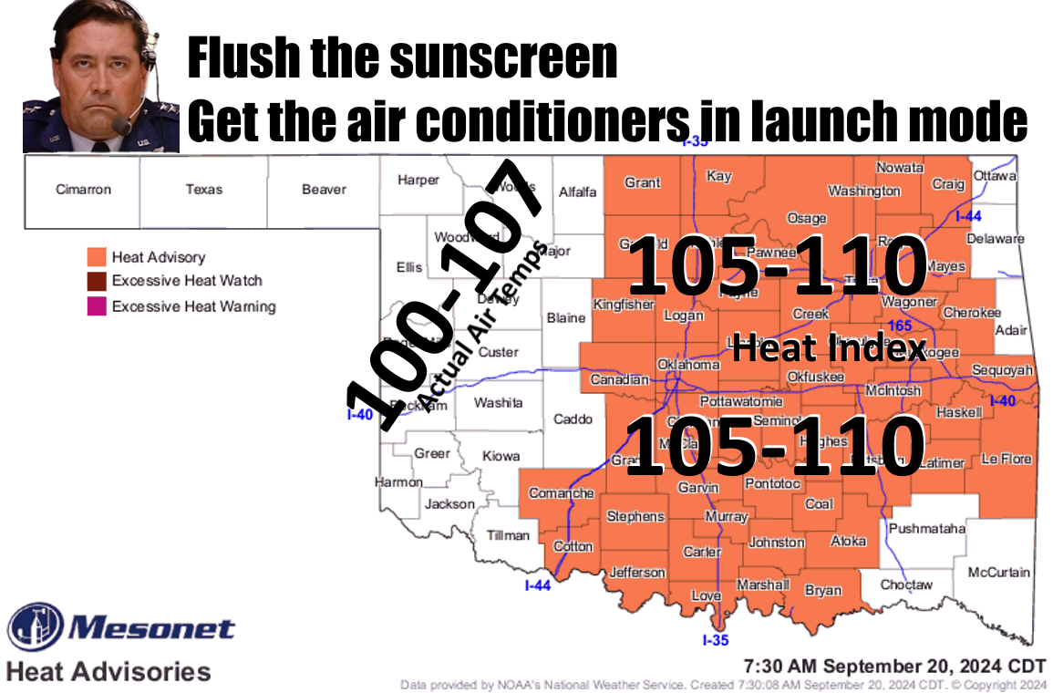
Oh yeah, well same to you! I don't control the weather (or do I! insert evil
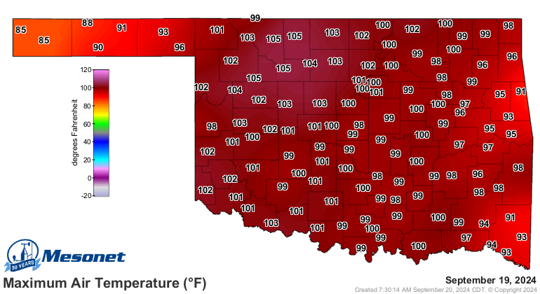
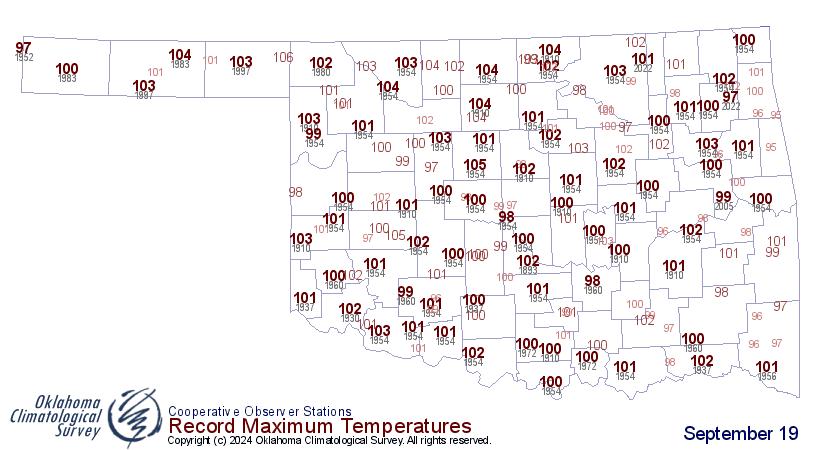
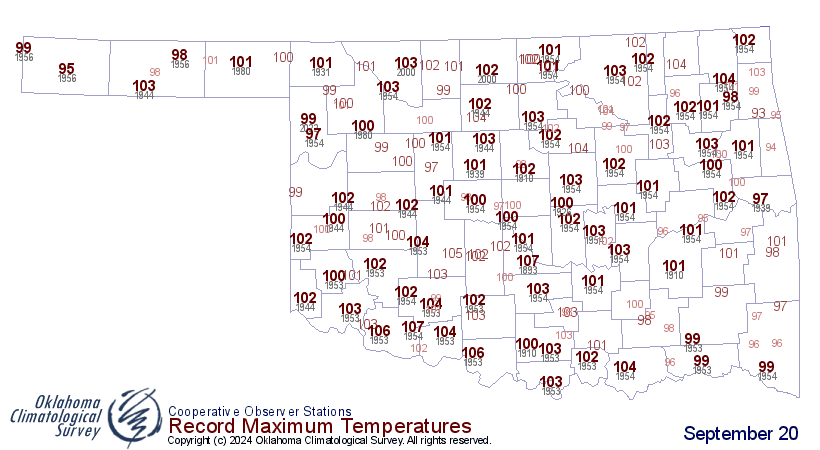
laughter here). Hey, did ya know that yesterday was the second hottest Sept. 19
on record in the State of Oklahoma, going back to the late 1800s? With a statewide
average (highs + lows) of 85 degrees, we fell short of beating the old record set
back in 1954 of 87.1 degrees. We also tied for the second highest temperature
ever recorded on a Sept. 19 with several 105s, just behind the 106 at Gate back
in 1997.
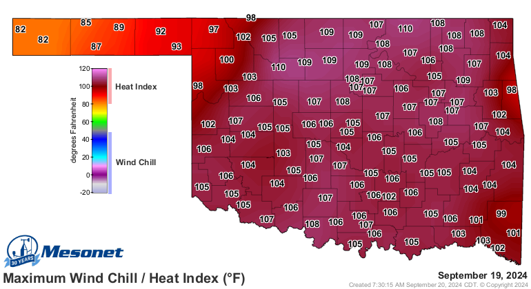
Not to mention (okay, I'm mentioning it) the heat index and wet bulb globe
temperature risk, which were both ridiculous.
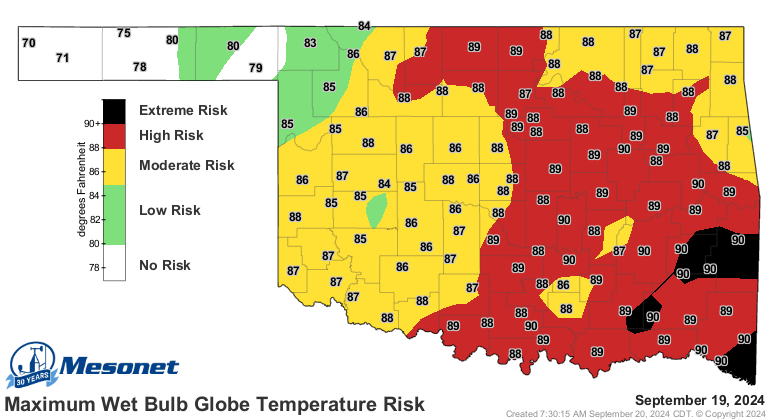
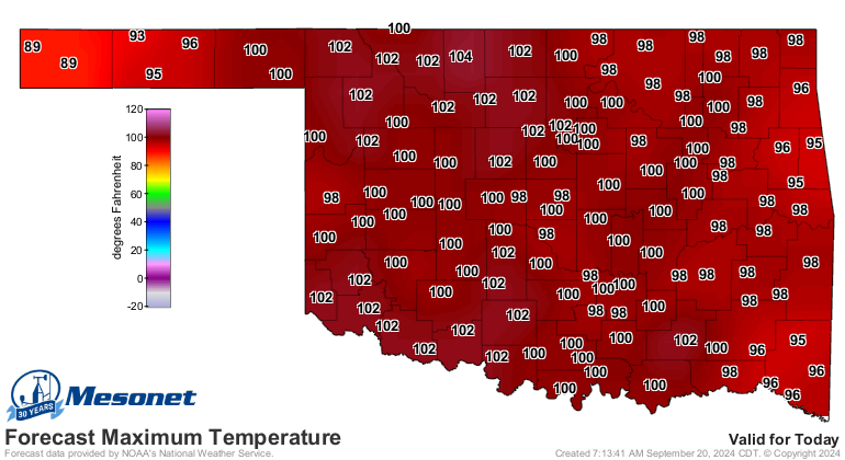
Well, watch these numbers, because we are probably going to do it all over
again today (clouds and rain notwithstanding).
AND tomorrow.
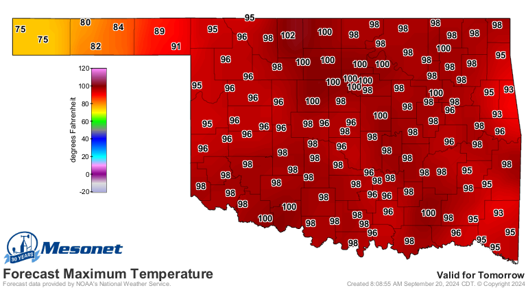
A loooooooooooooooooong (or is that lonnnnnnnnnnnnnnnnnnnnnng?) two days before
we get cold frontal action.
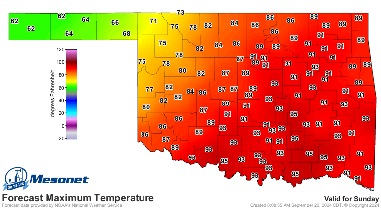
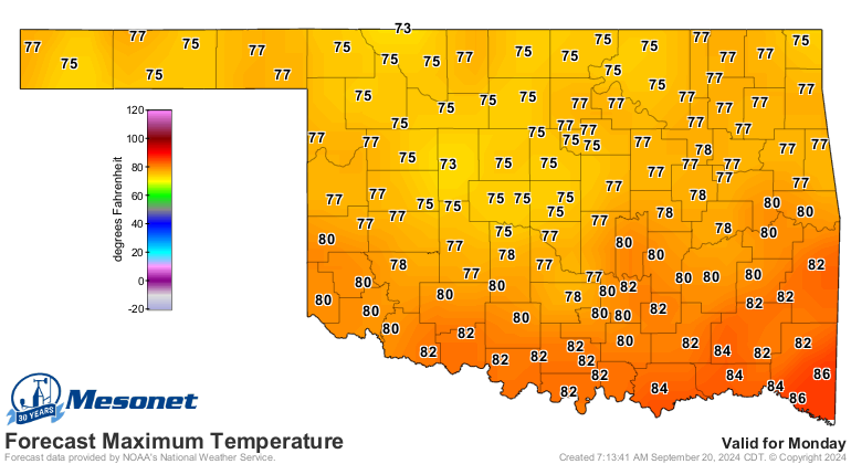
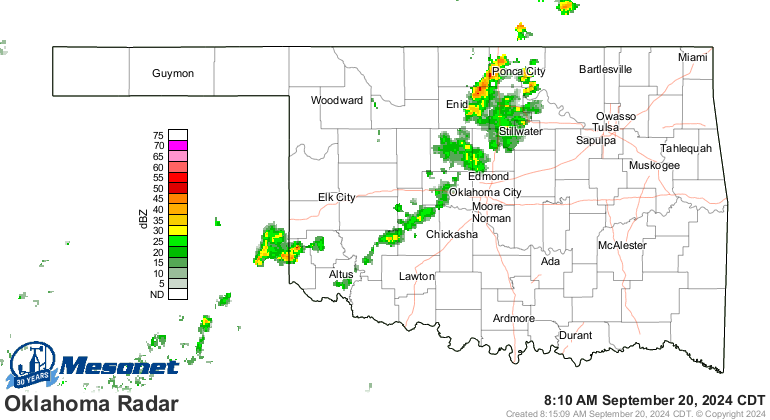
So yes, things will get bett...wait, did you say "rain?"
Heck, it's raining right now for crying out loud!
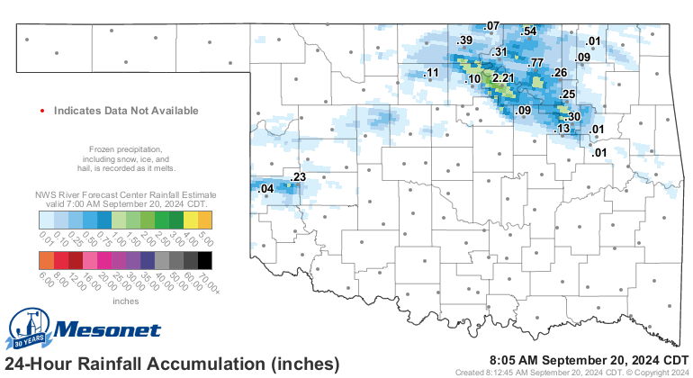
AND some folks got a good dose last night. Check out Pawnee with it's 2.21 inches
of rain!
AND check out the 7-day rain forecast!
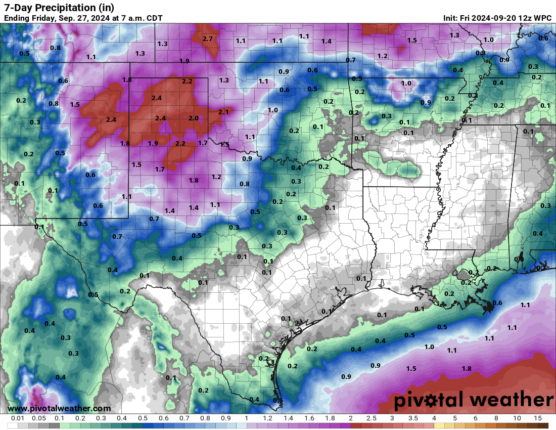
I'm starting to believe it when I'm seeing it!
Gary McManus
State Climatologist
Oklahoma Mesonet
Oklahoma Climate Survey
gmcmanus@ou.edu
September 20 in Mesonet History
| Record | Value | Station | Year |
|---|---|---|---|
| Maximum Temperature | 107°F | FREE | 2024 |
| Minimum Temperature | 41°F | NOWA | 2003 |
| Maximum Rainfall | 5.83″ | MTHE | 2019 |
Mesonet records begin in 1994.
Search by Date
If you're a bit off, don't worry, because just like horseshoes, “almost” counts on the Ticker website!