Ticker for September 17, 2024
MESONET TICKER ... MESONET TICKER ... MESONET TICKER ... MESONET TICKER ...
September 17, 2024 September 17, 2024 September 17, 2024 September 17, 2024
Too long
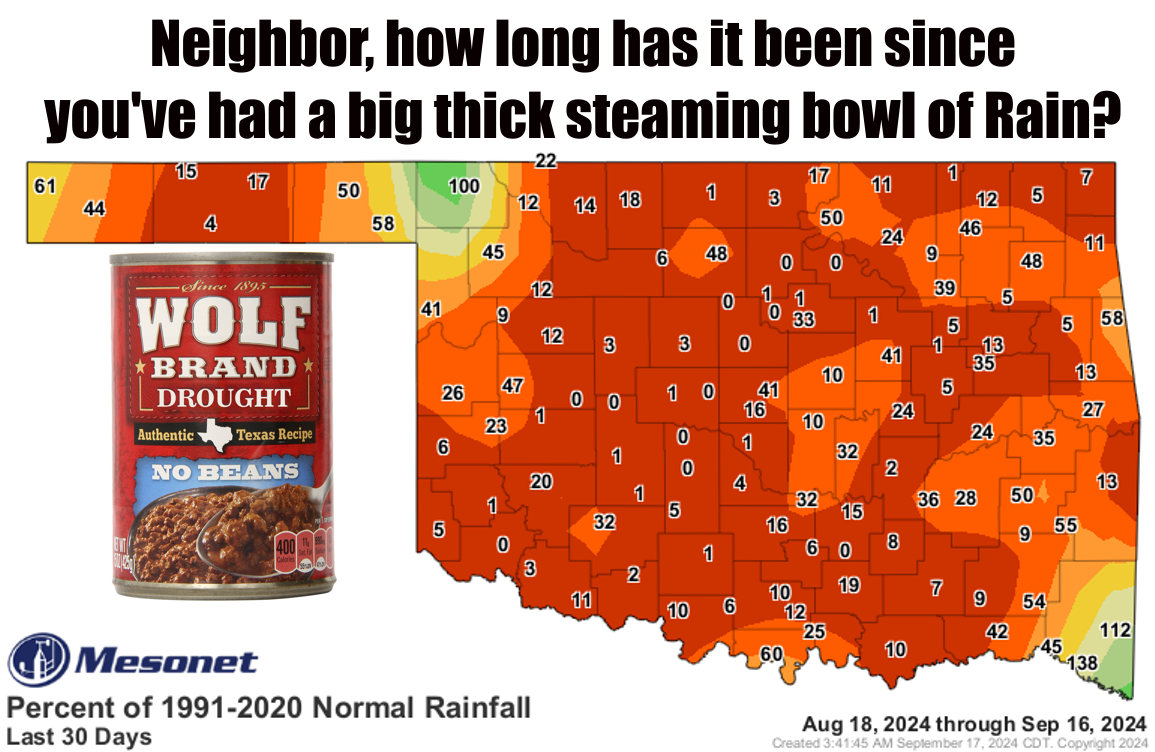
The Ticker was delayed today due to unforeseen circumstances (hey, Unforeseen
Circumstances was my band's name in the Skull and Bones Society!), but I just
had to have a quick Tock about this miserable rain situation (hey, mis...oh never
mind).
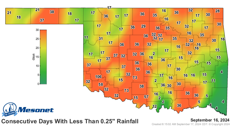
That top graphic says it all...the dryness we saw over the summer has accelerated
during September to go along with plenty of heat. You look over that last 30 days,
which stretches into the second half of August, and you see lots of forlorn
rain totals.

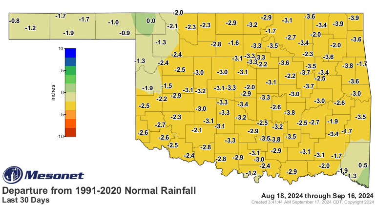
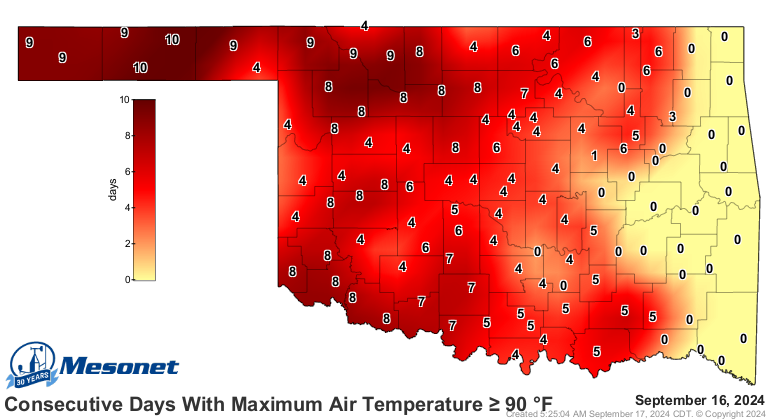
And the numbers on these maps keep going up by the day.
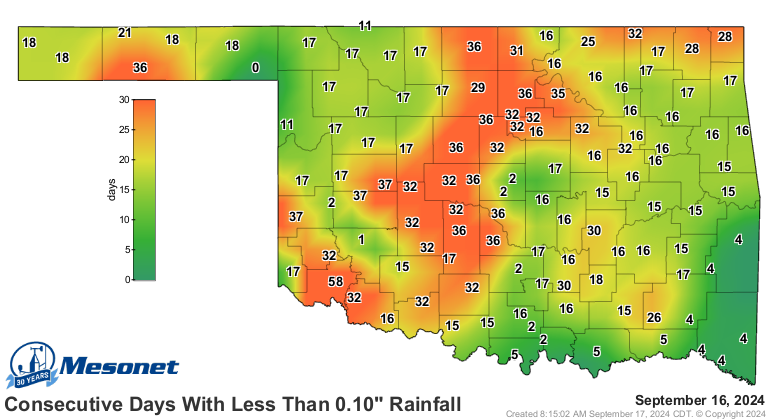
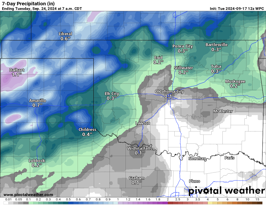
"Relief is on the way!" I keep telling you that, but the rainfall keeps getting
pushed to the latter parts of the 7-day forecast, which makes it darned near
fantasy-cast territory. Now we're looking at a dimmed rainfall forecast through
the weekend, with our hopes switching to just after that period.
That should give you pause.
(Pause).
Like I keep saying...believe it when you see it! I learned that the hard way
when I bought that Hair Growth Cream from Checkosl...Czeckoslo...Latvia.
Gary McManus
State Climatologist
Oklahoma Mesonet
Oklahoma Climate Survey
gmcmanus@ou.edu
September 17 in Mesonet History
| Record | Value | Station | Year |
|---|---|---|---|
| Maximum Temperature | 105°F | GRAN | 1997 |
| Minimum Temperature | 37°F | BOIS | 2006 |
| Maximum Rainfall | 4.15″ | APAC | 2006 |
Mesonet records begin in 1994.
Search by Date
If you're a bit off, don't worry, because just like horseshoes, “almost” counts on the Ticker website!