Ticker for August 5, 2024
MESONET TICKER ... MESONET TICKER ... MESONET TICKER ... MESONET TICKER ...
August 5, 2024 August 5, 2024 August 5, 2024 August 5, 2024
Kinda
"Kinda" is a great word for clodhoppers like myself. For example: I'm kinda dumb,
as demonstrated by my wearing of two different shoes yesterday to the OKC Outlet
Mall, which escaped me EVEN WHEN I WAS TRYING ON SHOES. "Kinda" might be being
kind(a), admittedly. I've also been described as kinda smelly, kinda goofy,
kinda funny looking, and kinda awesome.
That last one comes from me, but it's allowed because I'm kinda delusional. But
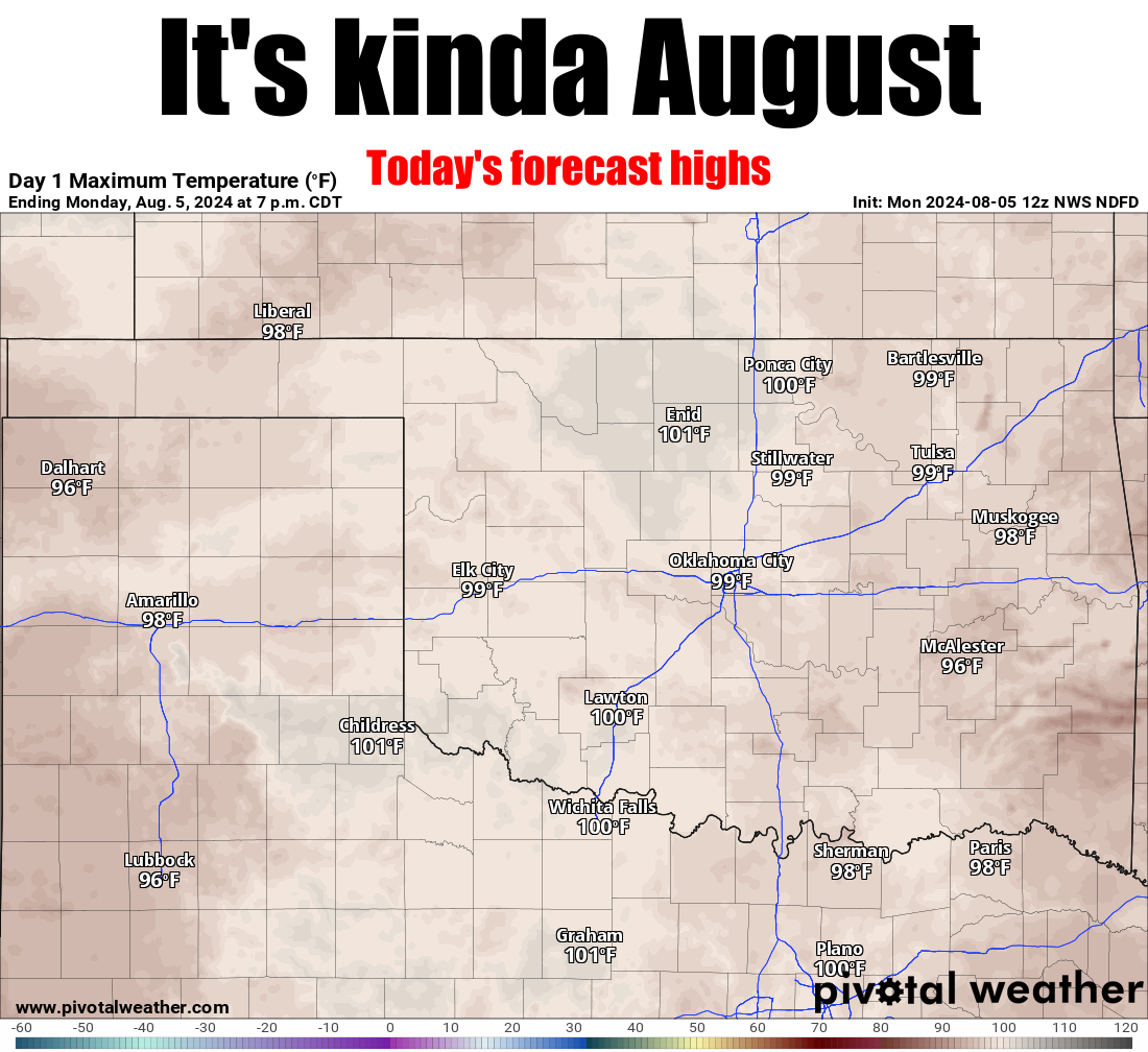
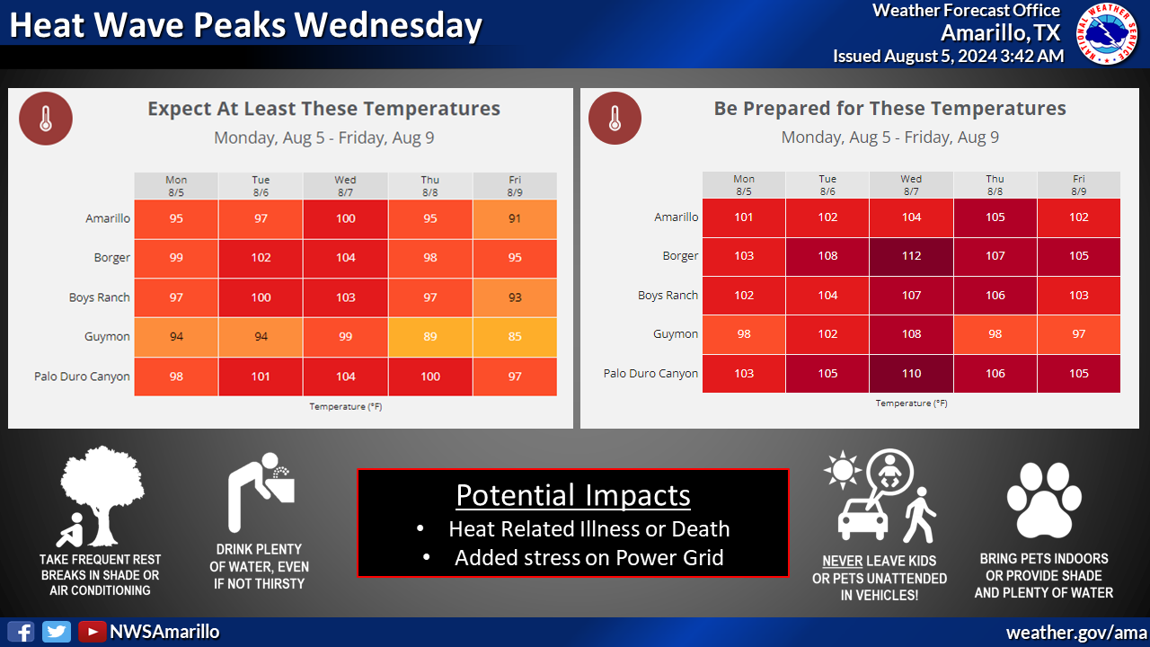
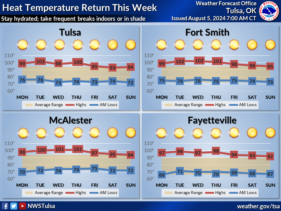
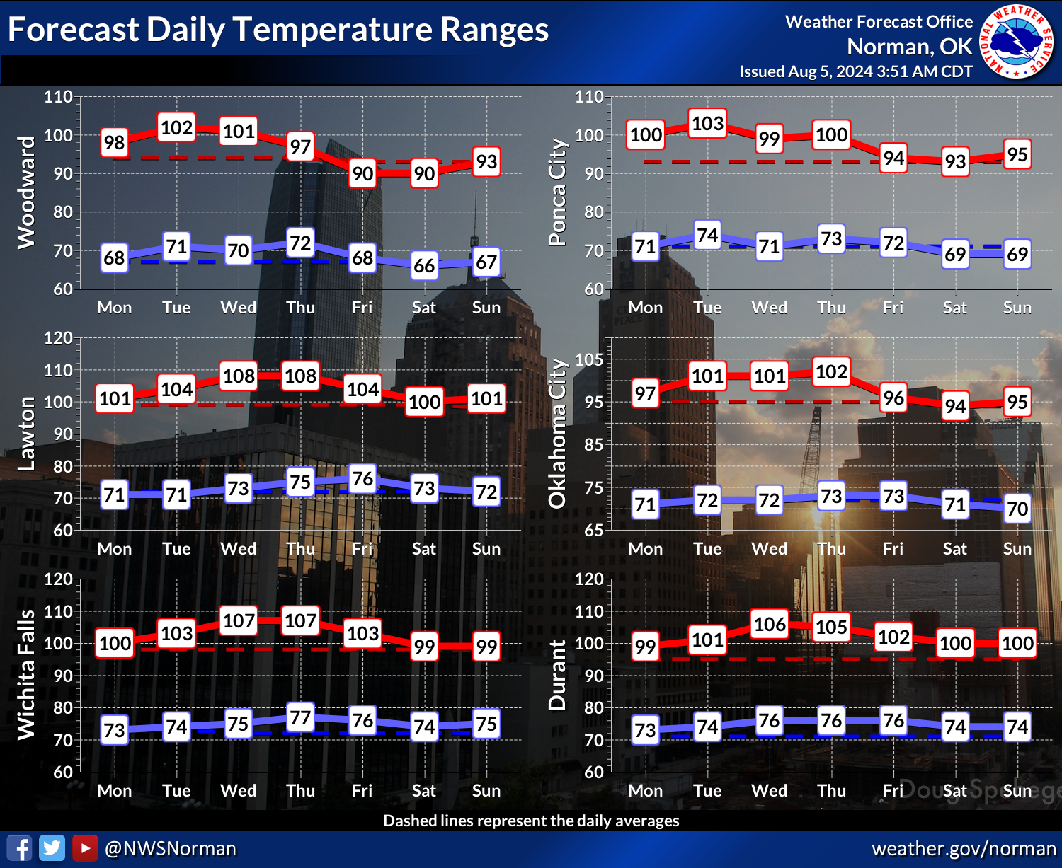
kinda is a good word for this week as we deal with "kinda" hot weather, but also
very much "kinda" like August. The best part is we don't see heat index values
up into the 110s, which is a welcome change. Not saying they won't be elevated,
but at least not sky high.
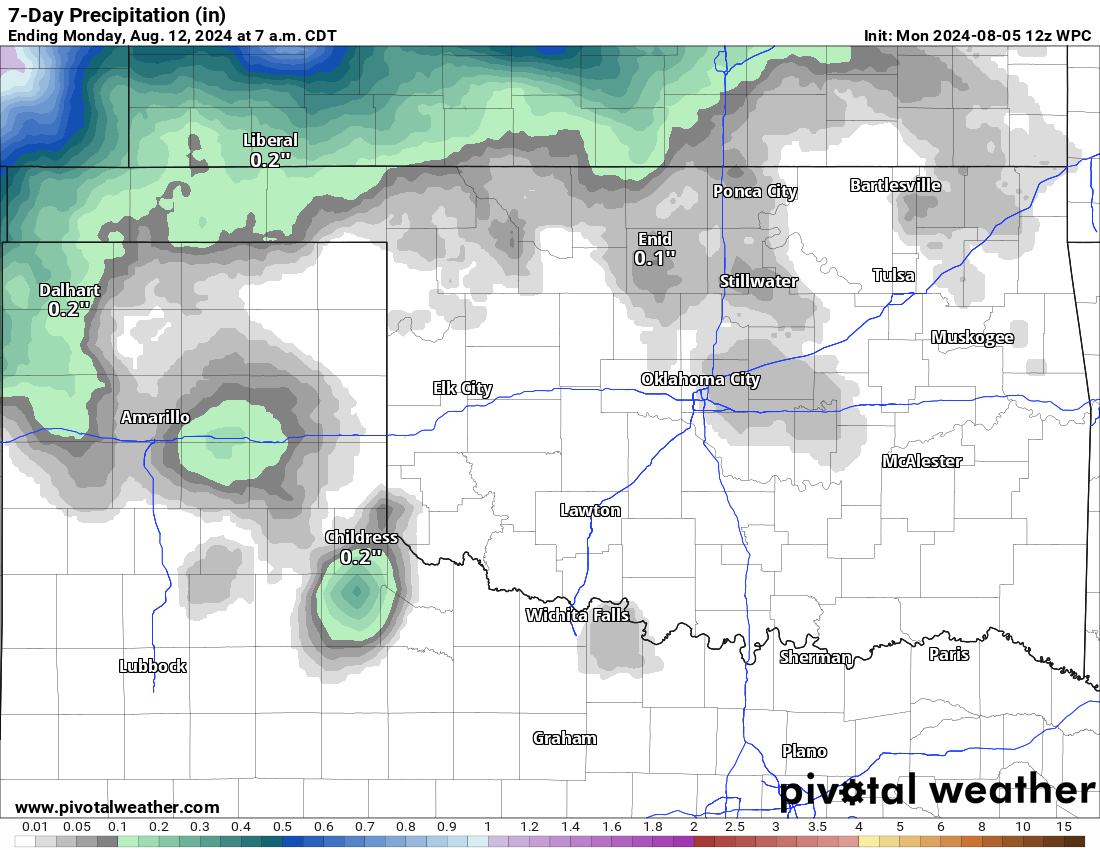
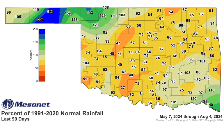
"Kinda" goes out the window when we talk about rain chances, though, because
it's gonna be "really" dry this week, save for maybe the Panhandle and NW OK
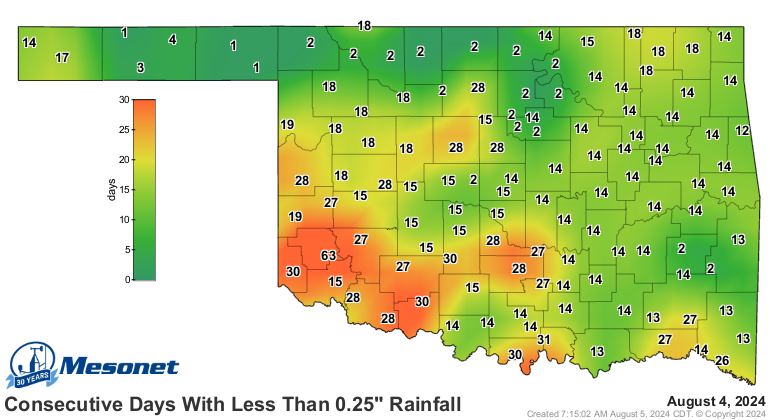
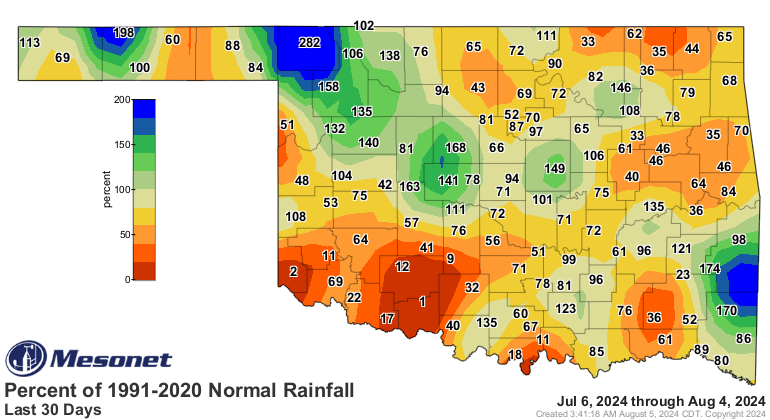
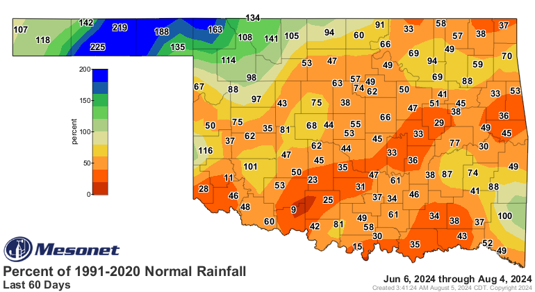
later on with some minor rain chances. We are definitely starting to dry out
significantly again. August being August, you know.
Okay, this Ticker is kinda finished. Really.
Gary McManus
State Climatologist
Oklahoma Mesonet
Oklahoma Climate Survey
gmcmanus@ou.edu
August 5 in Mesonet History
| Record | Value | Station | Year |
|---|---|---|---|
| Maximum Temperature | 113°F | KIN2 | 2011 |
| Minimum Temperature | 52°F | KENT | 2021 |
| Maximum Rainfall | 4.57 inches | NEWK | 2017 |
Mesonet records begin in 1994.
Search by Date
If you're a bit off, don't worry, because just like horseshoes, “almost” counts on the Ticker website!