Ticker for February 21, 2024
MESONET TICKER ... MESONET TICKER ... MESONET TICKER ... MESONET TICKER ...
February 21, 2024 February 21, 2024 February 21, 2024 February 21, 2024
How Green Is Your Valley
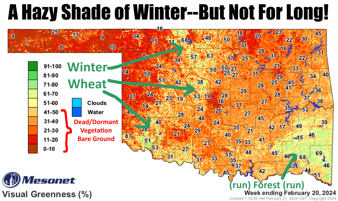
You gotta love late February...because if YOU don't, nobody else will. It's that
time of year when we start to see the transition between winter (or as we call
it in Oklahoma, winter/spring/summer/fall) and spring. The sun gets a bit higher
in the sky, which leads to more heating, which leads to more heating differential
between the Polar region and the mid-latitudes, which draws that jet stream
southward a bit more, which means more storm systems, which means at times more
DRY storm systems, which means more wind, which means more heat ahead of those
frontal passages, which means lower relative humidity at times, which means more
fire danger.
Which means (okay, CUT IT OUT!)...
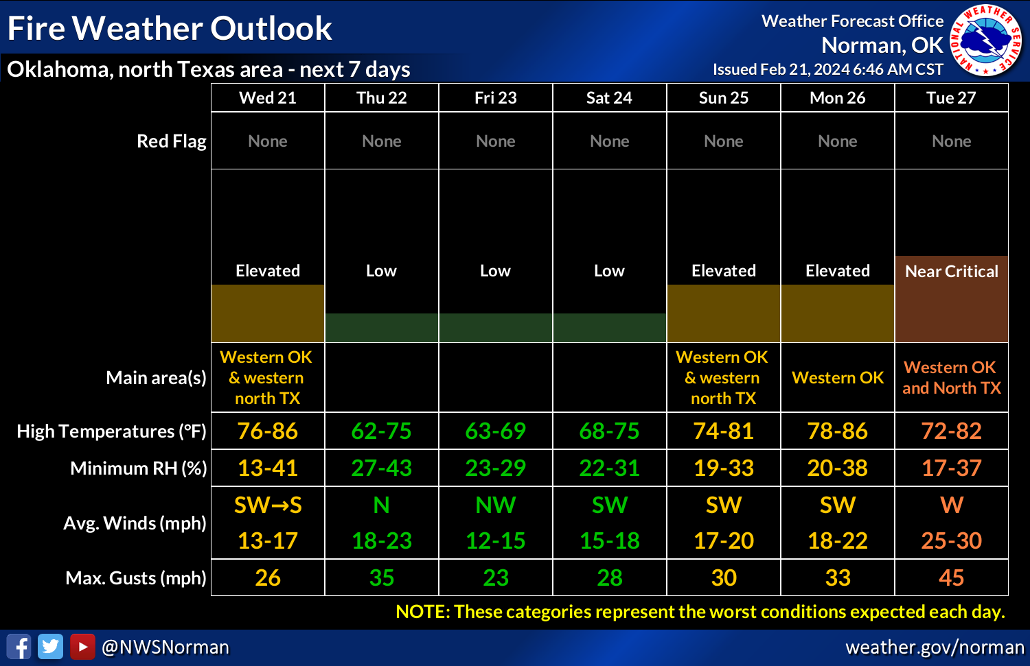
Fire danger, you say? Well, as a matter of fact we will see more fire danger
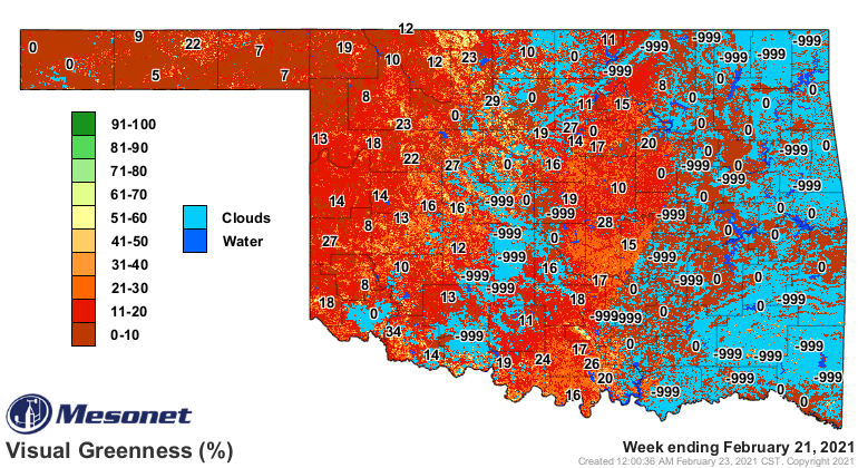
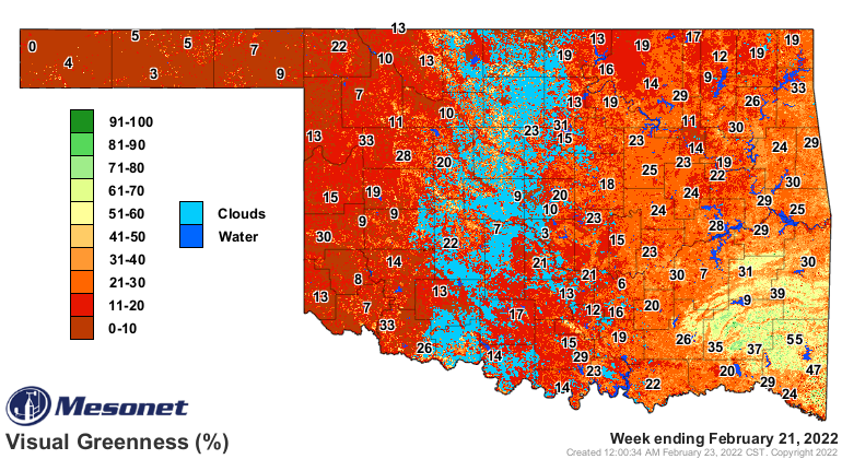
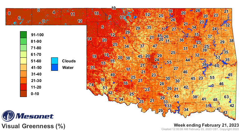
today, as well as later this week. Ya see, we have all this dormant and/or dead
vegetation out there (see top graphic), waiting for a spark.
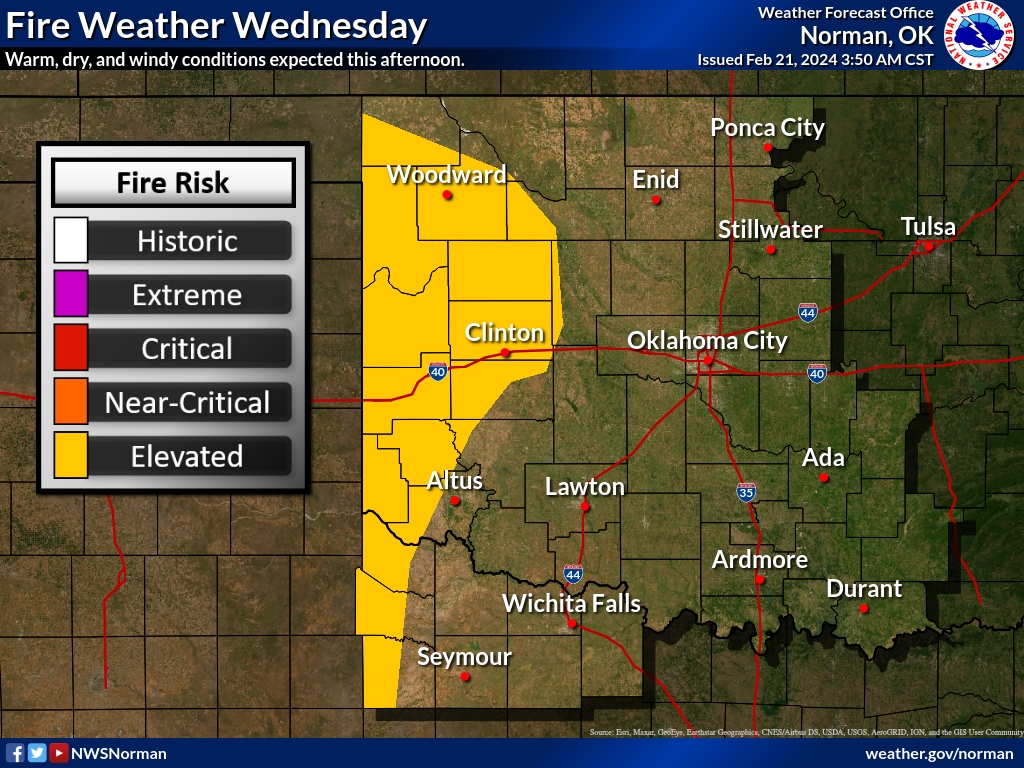
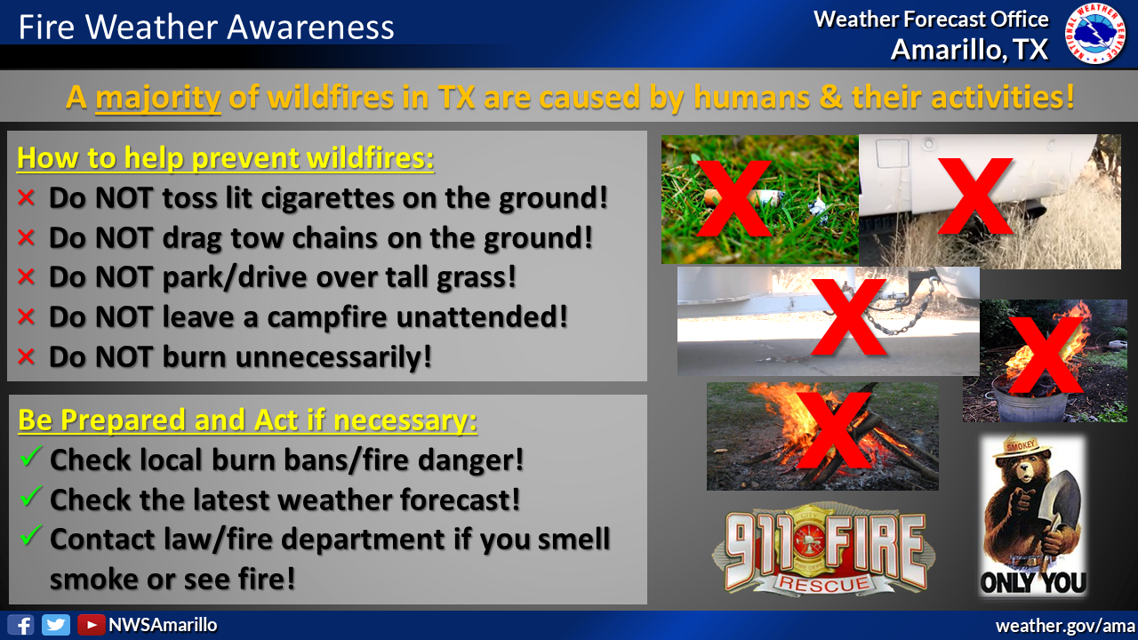
So don't be that spark.
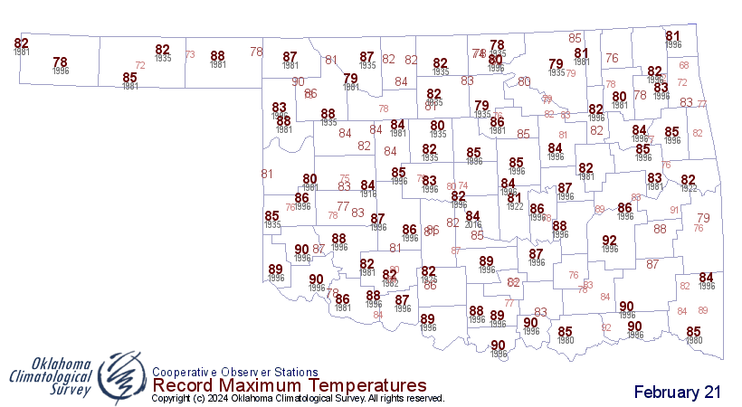
Winds won't be too ferocious, at least by Oklahoma's standards, getting up
to 25-30 mph, but we will have the heat. We'll have to see if we can approach
some record highs in places, but we're up in that territory.

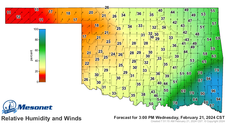
You can see from this forecast wind/RH map from the Mesonet's OK-Fire program
that this afternoon will see the highest danger.
But wait.
Okay, long enough.
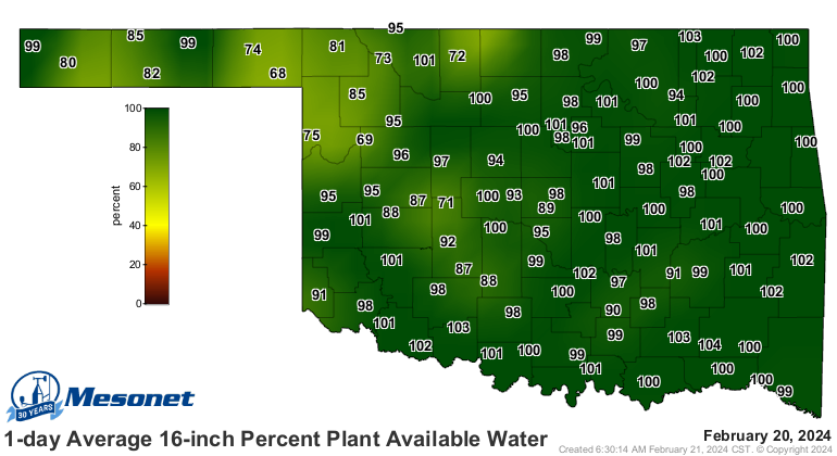
What did the "Not for long" mean on the top graphic? Well, as opposed to the
last 3 years of La Nina winters, this year we have lots of soil moisture
in place.
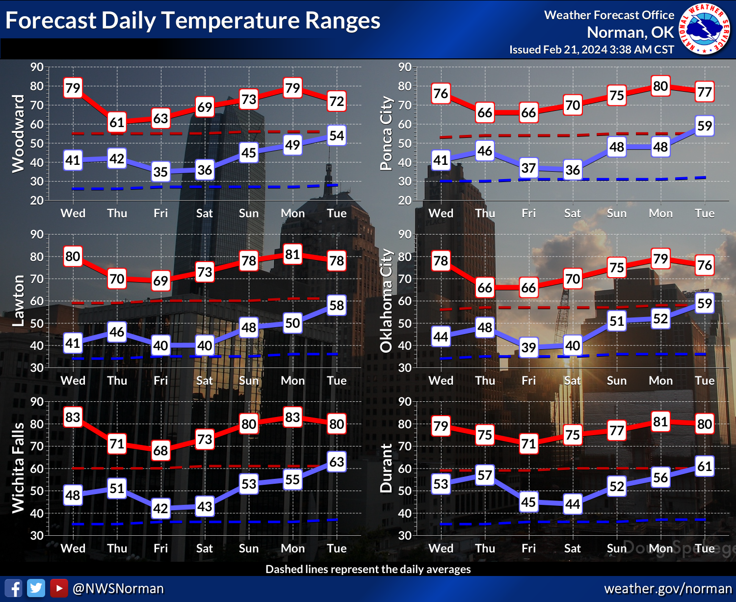
We have lots of above normal heat coming up over the next week to 10 days.

So we SHOULD see much more favorable green up than what we've seen during
the last few years of La Nina unfavorable conditions. Quite a difference
starting out this year with El Nino in place, vs. that triple-dip La Nina.
All of this carefully crafted (HA!) good news can be thrown asunder (English
to Okie translation: "apart") by an extended dry period, a killing cold snap
(because things ARE gonna start to come to life in the next week or two), and
Tony Danza (have you seen "Who's the Boss"???).
Now, Bradford Pears...ACTIVATE!
Gary McManus
State Climatologist
Oklahoma Mesonet
Oklahoma Climatological Survey
gmcmanus@mesonet.org
February 21 in Mesonet History
| Record | Value | Station | Year |
|---|---|---|---|
| Maximum Temperature | 87°F | BURN | 2023 |
| Minimum Temperature | 2°F | HOOK | 2013 |
| Maximum Rainfall | 2.90 inches | BROK | 2018 |
Mesonet records begin in 1994.
Search by Date
If you're a bit off, don't worry, because just like horseshoes, “almost” counts on the Ticker website!