Ticker for February 6, 2024
MESONET TICKER ... MESONET TICKER ... MESONET TICKER ... MESONET TICKER ...
February 6, 2024   February 6, 2024   February 6, 2024   February 6, 2024


Of Super Bowl snows and atmospheric rivers


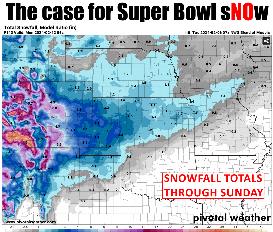
So we continue on our model-induced roller-coaster-possible-snow-event-but-hard-
to-say-now. Looks like the NWS blend of models output shows NW OK possibly having
the best chance for a nice, snowy Super Bowl Sunday, right after we declared an
early spring (somebody break it to Poteau Pete...I ain't gonna do it!). But here's
the deal, and we've taught this lesson before...the storm system that could bring
us our Super Bowl Snow Globe is still out over the Pacific, and it's not being
sampled by our dense observation network we have on land so all that "better" data
isn't being fed into the computer forecast models, AND the storm system still has
to go over two mountain ranges and reorganize, AND it still has to tap into a new
moisture source after it gets past the Rockies after all the moisture has been
squeezed out, AND then we have to see the exact path the storm will take because
a deviation of 50-100 miles (and we all know just how painful that can be) will
make all the difference in possible precip amounts, AND we still don't know the
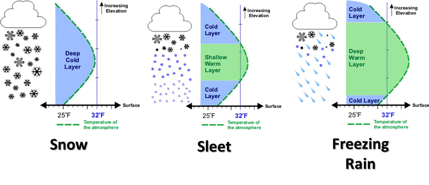
vertical temperature profile of the atmosphere Super Bowl Sunday because any
the models don't always do a great job with that and a melting layer above the
surface can turn snow into sleet or a cold rain, AND I've found if you just keep
saying "AND" you can quickly lose your audience AND look like a complete fool.

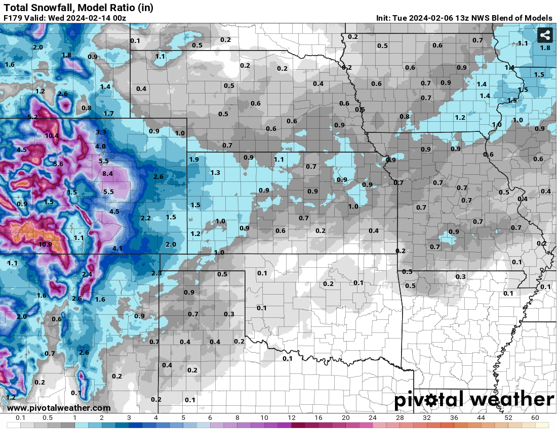
However, if'n you're still here, here (hear hear!) are a couple of oft-used
graphics we like to show that demonstrate the difficulty of predicting a storm
system's path in advance, and the difficulty in predicting wintry weather types
in, uhhhhhhhh, winter. It's chaos I tell ya!


I mean, the storm is still 3500+ miles away, for crying out loud (and heck no,
it's not raining right now!). Which way will it go? How much moisture will it
have to work with? Will it be cold enough?

WAIT! The 7am model run just came in and the forecast has shifted slightly.


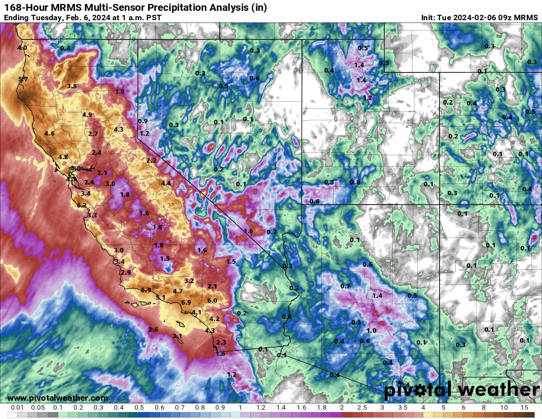
And what about all those "Atmospheric Rivers" they're getting out in California?
What's that do for us? Well, not a lot, actually. I'm certainly not an expert
on atmospheric rivers. I'm from the High Plains of Oklahoma, after all. Our
rivers usually need mowed in the summer ("hey" to the Cimarron!).

An atmospheric river is basically a tendril or filament of moisture super-charged
air originating in the Tropics (usually) that gets caught up in the atmosphere.
No this tendril or filament is properly sized, obviously...put it on a proper
scale. When these tendrils, filaments..."RIVERS" if you will, of moisture run
up against something that causes the air to rise and condense that water vapor
into rain or snow, you get the types of rainfall and snowfall amounts they see
out along our West Coast, like the last 7 days.


You notice not much makes it past the mountain ranges of Cali, right? Those
orographic effects send that river of air upwards, leeching out the lower-level
moisture along the coast, then the inner mountain ranges leech out the rest
of the mid-level and upper-level moisture.

We don't see that moisture farther east. We have to wait until a storm system
can tap into the Gulf of Mexico (mostly...there's a tiny bit that can make it
over the mountains). You can see the interrupt in the High Plains.


All of that is a very simplified explanation of an extremely complicated topic,
as told to you in a very complicated way from a very simplified brain. In order
to better clear things up, check out this NASA video about atmospheric rivers
from folks that actually ARE experts on the subject.

Hit the lights, and no goofing around during the film. Be sure to smell your
mimeographed copies of the homework when I hand them out, too (youngsters,
google it).

https://www.youtube.com/watch?v=w3rtYM0HtIM

Gary McManus
State Climatologist
Oklahoma Mesonet
Oklahoma Climatological Survey
gmcmanus@mesonet.org
February 6 in Mesonet History
| Record | Value | Station | Year |
|---|---|---|---|
| Maximum Temperature | 84°F | BEAV | 2009 |
| Minimum Temperature | 0°F | CAMA | 2014 |
| Maximum Rainfall | 2.59″ | PRES | 1999 |
Mesonet records begin in 1994.
Search by Date
If you're a bit off, don't worry, because just like horseshoes, “almost” counts on the Ticker website!