Ticker for January 17, 2024
MESONET TICKER ... MESONET TICKER ... MESONET TICKER ... MESONET TICKER ...
January 17, 2024 January 17, 2024 January 17, 2024 January 17, 2024
Burn it down!
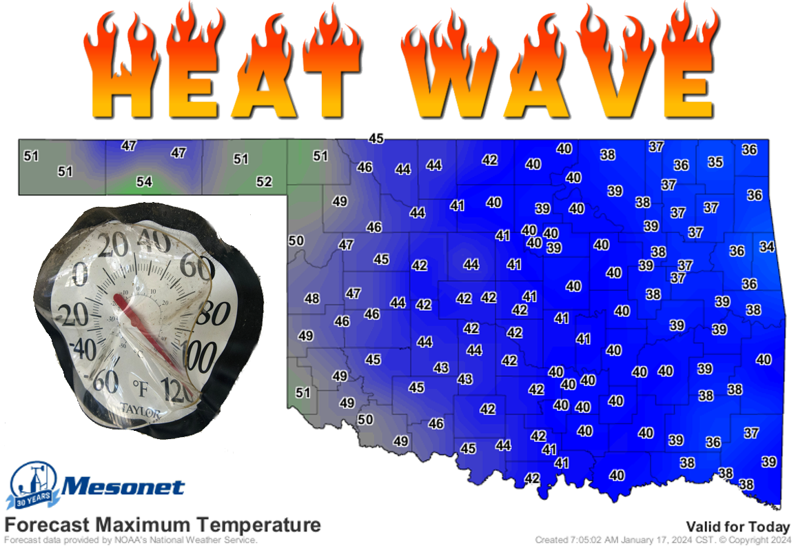
Highs in the 40s? AND 50s? You're crazy. No, I'M crazy! NO, YOU'RE CRAZY!
Yes, all of this conversation occurred this morning in the mirror, but that just
proves I'm NOT crazy because a crazy person wouldn't know they were talking to
themselves in the mirror. But the point remains that I am actually crazy.
Now ain't that crazy?
The cold has been crazy, no? Here we are on day 5-6 of our Arctic deep freeze
event (have to go lower-case letters because Feb. 2021 still gets the capitals).
Technically, we had 5 sites up in NW OK and the Panhandle hit the above freezing
mark yesterday, but in general we are on our 80-130 consecutive hours at or
below freezing (and we all know just how painful that can be). Looks like Medford
leads the way at 131 hours as I type this.
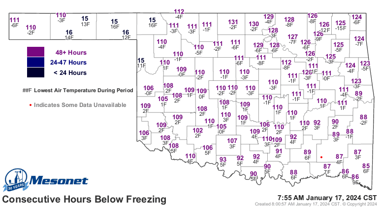
Again, tho...no comparison with Feb. 2021.
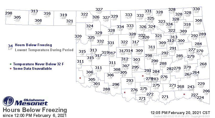
How about REALLY cold air? Let's pick a REALLY COLD reading...20 degrees? How
does this event compare to Feb. 2021? Again, not hardly.
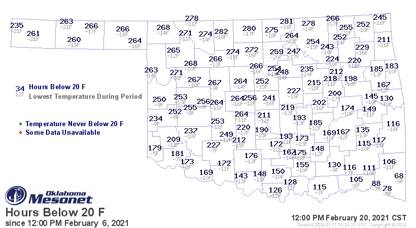

Still, plenty of record-breaking cold to go round over the last few days,
and yesterday's -15 degrees at Vinita is the lowest min temp we've seen since
that February 2021 abomination.
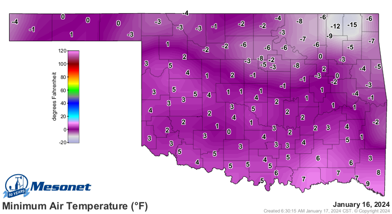
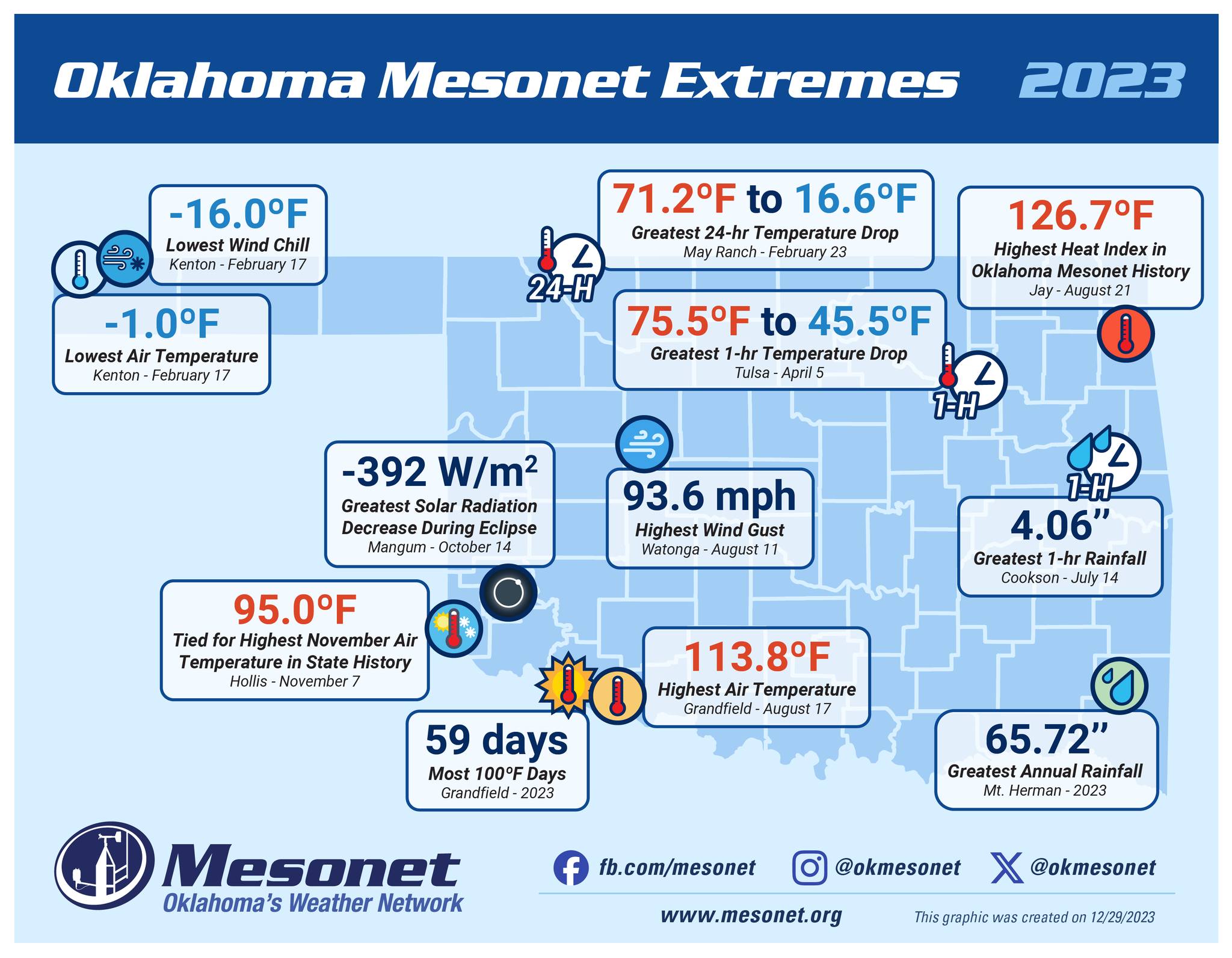
Still (part 2), this was a shock to the system, so to speak. Heck, last year's
lowest minimum temperature was a balmy -1!
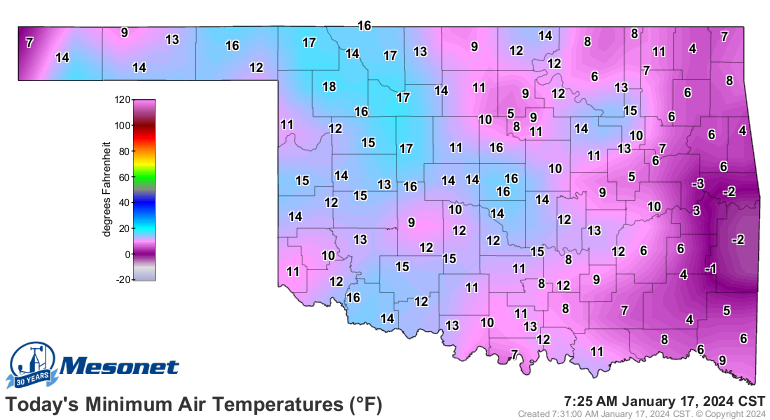
And this morning was nothing to write home about either, but that won't stop
me from writing about it in the Ticker!
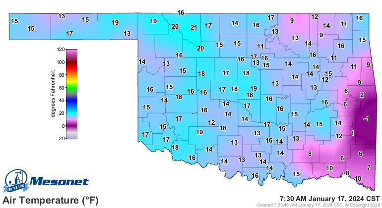

Now, enjoy your 2-day heat wave, because we have another Arctic front coming
down for Friday through the weekend. Not as cold as this last one, but cold
nevertheless.
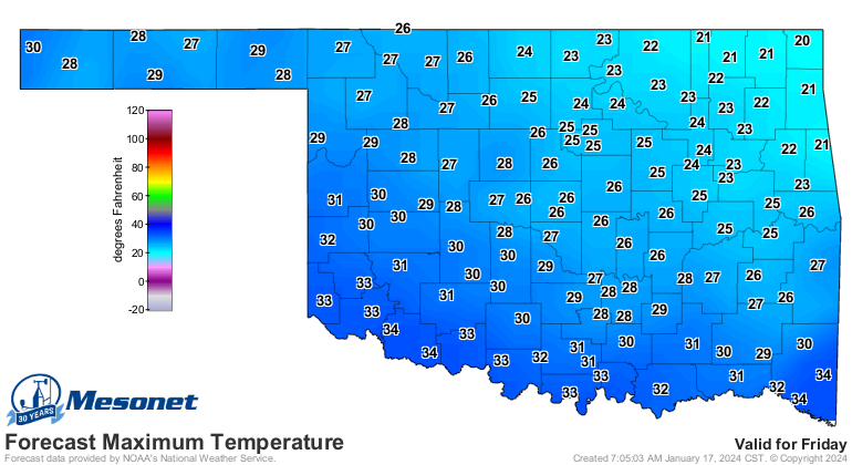
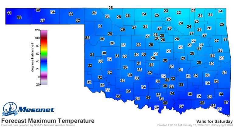
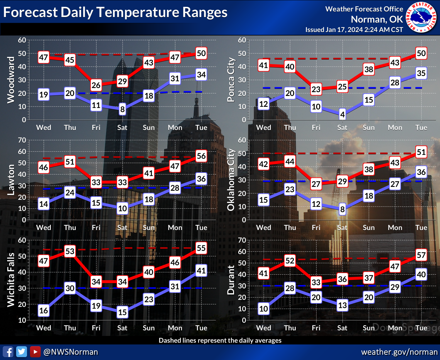
And we're looking at some wet weather AND warmer weather as we get into next
week, especially wetter across the SE half of the state.
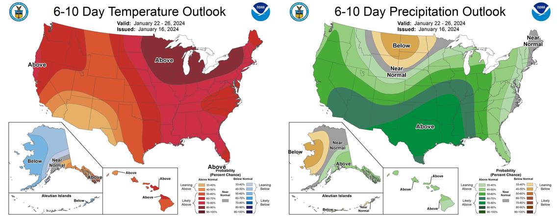
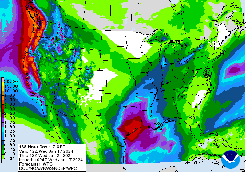
Here's the kicker though...

NO! The other kicker. There might be just enough shallow cold air left on
Sunday night into Monday morning to allow for a little bit of freezing rain or
sleet (looks more like freezing rain). There will be a short window for this,
but maybe just enough to cause problems Monday morning. Here are some sample
forecast model outputs for freezing rain accumulation through that period.

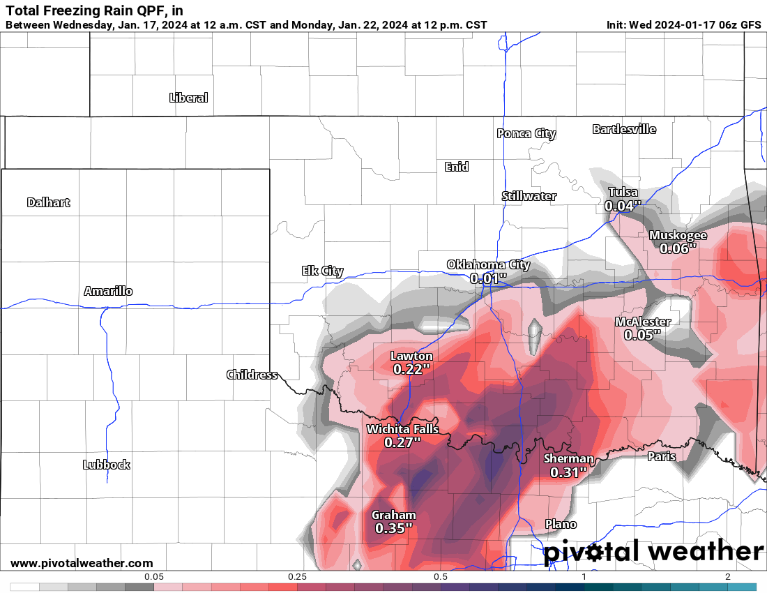
Probably a bit overdone, and that forecast will probably change. But remember,
it could change for the worse vs. for the better. How do I know this?
The mirror.
Gary McManus
State Climatologist
Oklahoma Mesonet
Oklahoma Climatological Survey
gmcmanus@mesonet.org
January 17 in Mesonet History
| Record | Value | Station | Year |
|---|---|---|---|
| Maximum Temperature | 76°F | WAUR | 2000 |
| Minimum Temperature | -8°F | MIAM | 2018 |
| Maximum Rainfall | 2.39″ | PRYO | 1996 |
Mesonet records begin in 1994.
Search by Date
If you're a bit off, don't worry, because just like horseshoes, “almost” counts on the Ticker website!