Ticker for December 11, 2023
MESONET TICKER ... MESONET TICKER ... MESONET TICKER ... MESONET TICKER ...
December 11, 2023 December 11, 2023 December 11, 2023 December 11, 2023
Grinchmas
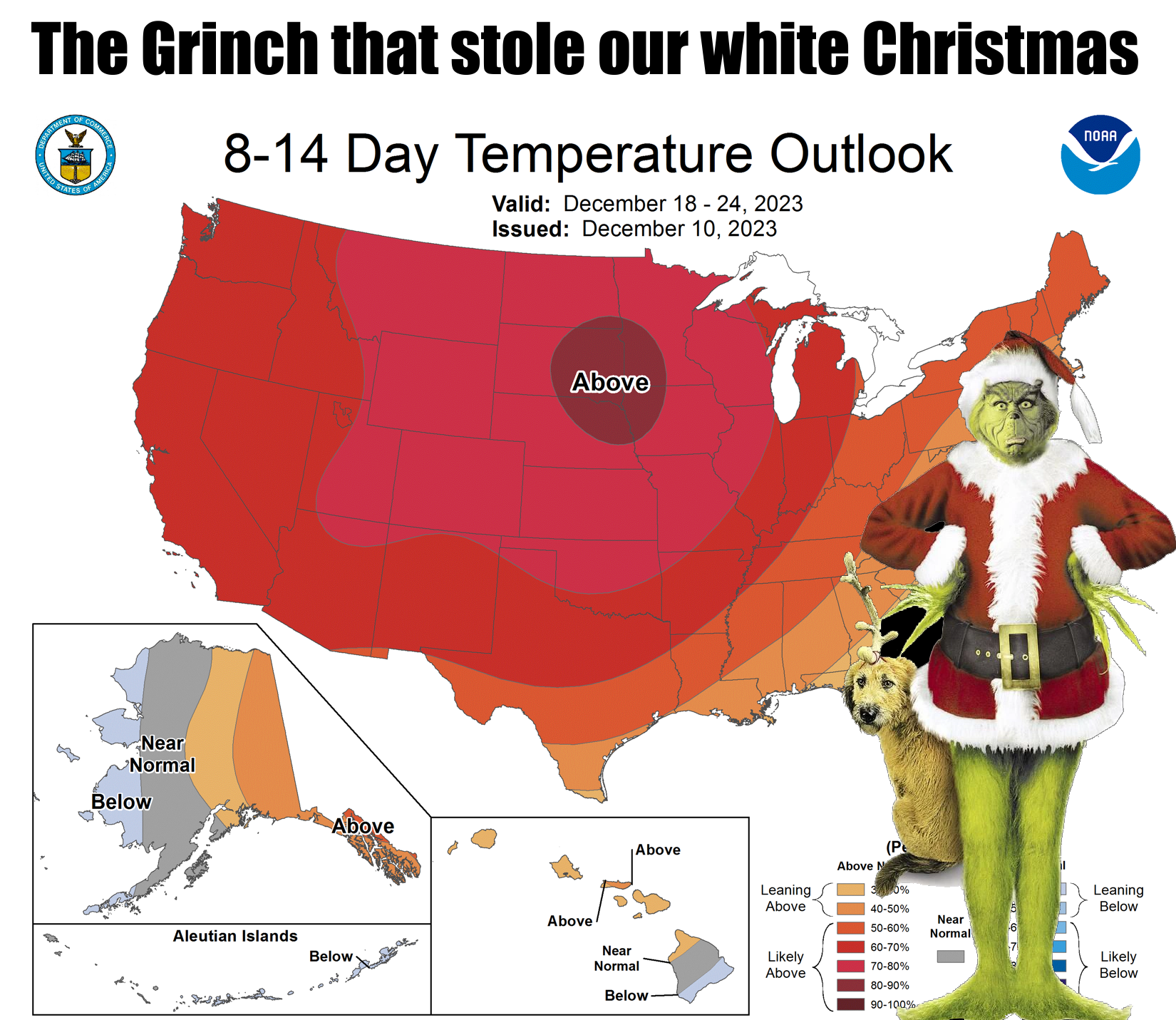
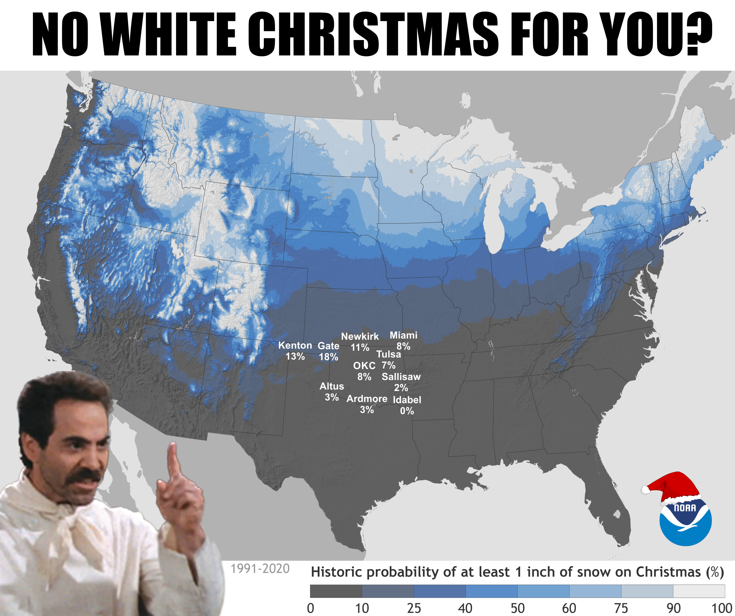
Our chances for a white Christmas are starting to transition from climatology
(which ain't good)
to weather (see top image), which also ain't good. In fact, we're starting to get
a first look at Christmas Day at the very edge of some forecast models, and while
it's not "bad," if'n you want snow...it ain't good. However, in this fantasy-cast
mode, there is at least some moisture around, so if we could just get some cold
air...OH COME ON, it just isn't gonna happen. No worries, we don't live in
Oklahoma expecting a white Christmas, but it'd be nice, wouldn't it?
Okay, if you are still holding out hope, we still have time for a big pattern
change, but as I always say, Taco Bell makes good colonoscopy prep. Not pertinent
here, but what I ALSO say is that pattern change could be for the "worse" OR
"better." Quotes are used around worse and better because weather is in the eye
of the beholder (and with Oklahoma, it's usually a punch in the eye). We could
change it to cold and snowy, but we could also change it to dry with highs in the
80s.
For the time being, we'll just stick with this week and save the bah humbugs
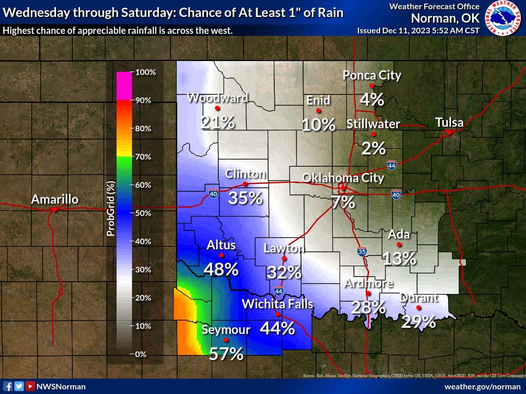
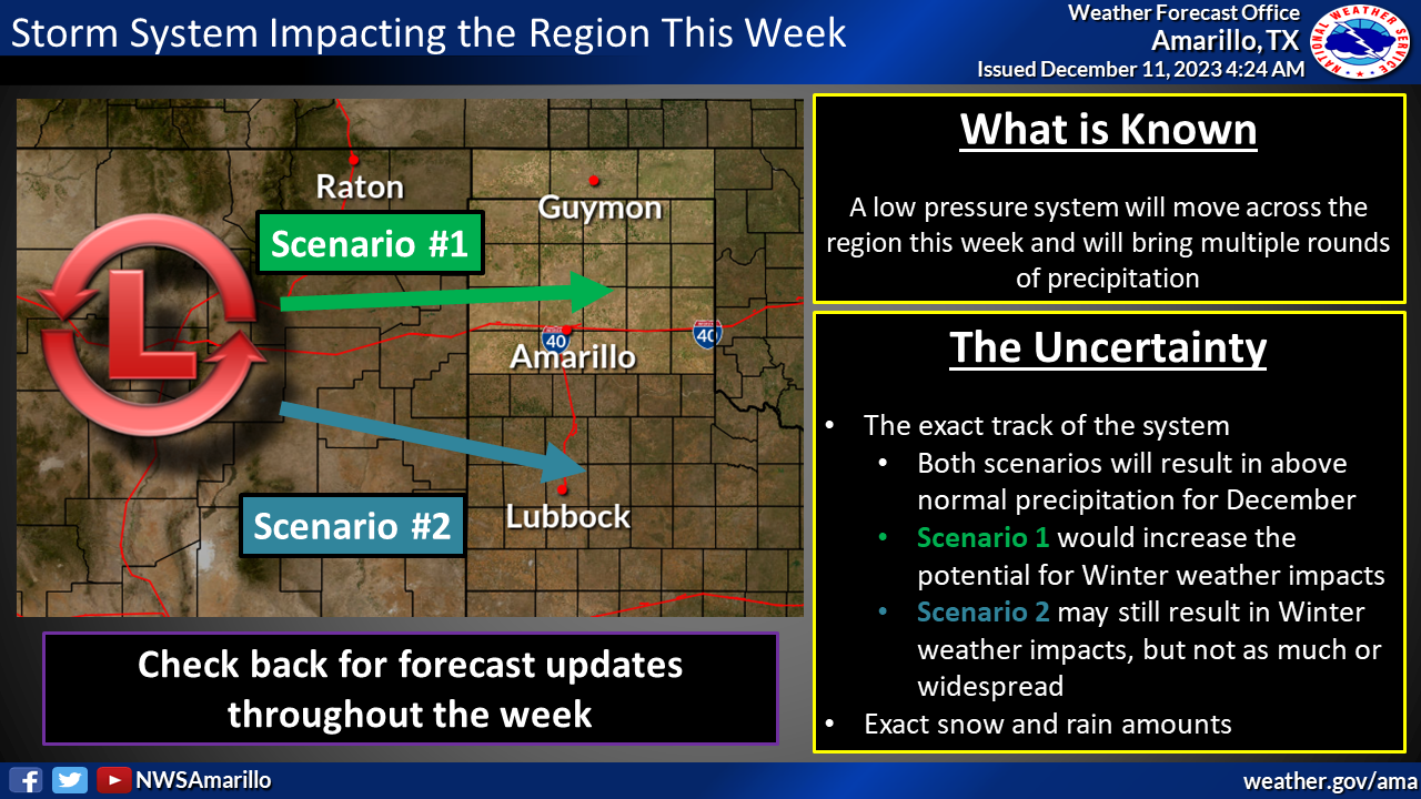
for later. We are expecting a big storm system to drop into the southerly
track and give southern OK a chance for rain later this week, but still lots
of uncertainty with the system just now coming ashore out west. Our NWS offices
for the state are thinking southwest OK is looking good for rain, but wait and
see if this system shifts north (better rain chances scoot north with it), or
south (rain chances dwindle).
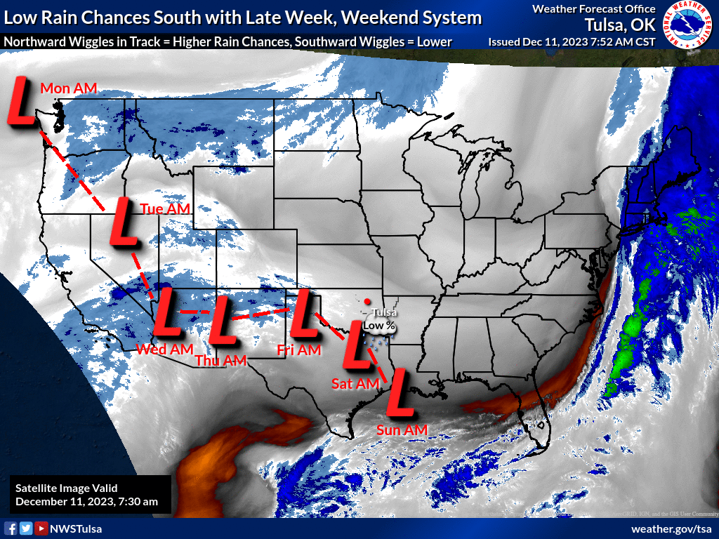
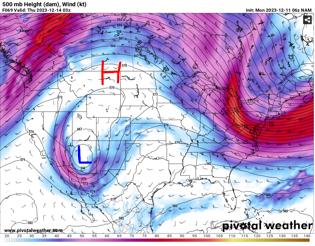
The forecast models are seeing a classic cutoff low as the storm progresses,
which is famously (if you run in our nerd circles, and we all know just how
painful that can be) termed "Cutoff low, weatherperson's woe" because they
can be a bit erratic. Check it out for later this week in the upper-levels
(around 500 mb) where we see the closed low pressure system below an upper-level
ridge of high pressure. In other words, it is cutoff from the predominant flow
of the atmosphere.
Get it? "Cut off." See, I'm not just making crap up here! Oh, it's crap alright,
but I'm not making it up.
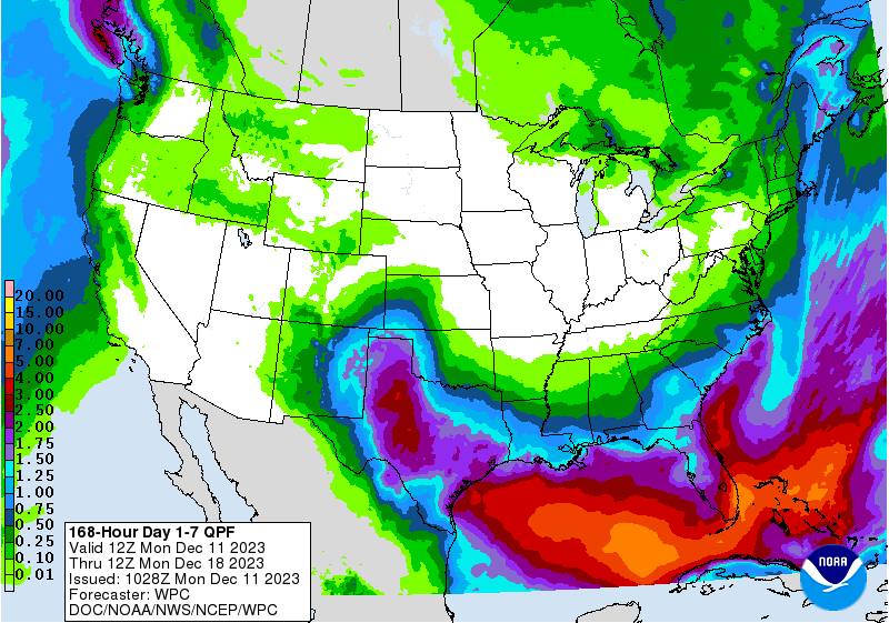
So FOR NOW, some good rain chances and amounts for extreme far SW OK, and maybe
some snow out in the Panhandle, but this could definitely change.
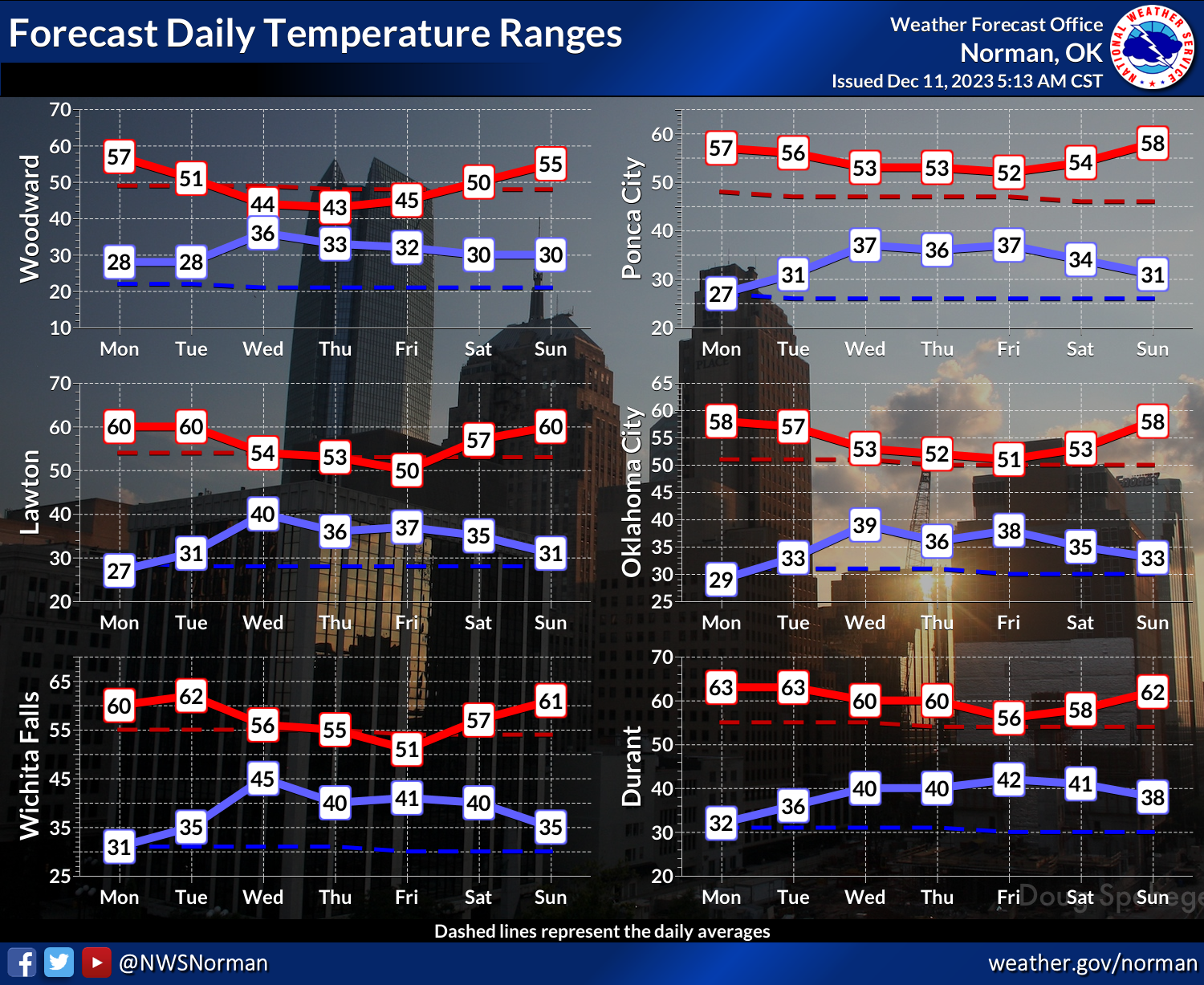
Now I don't know about you...no, seriously, I don't know about you. What's your
deal, exactly? Do you like rain? Well, you had better hope for a shift north
in the storm this week or you will probably be out of luck. As for temperatures,
nothing major for this time of year, obviously.
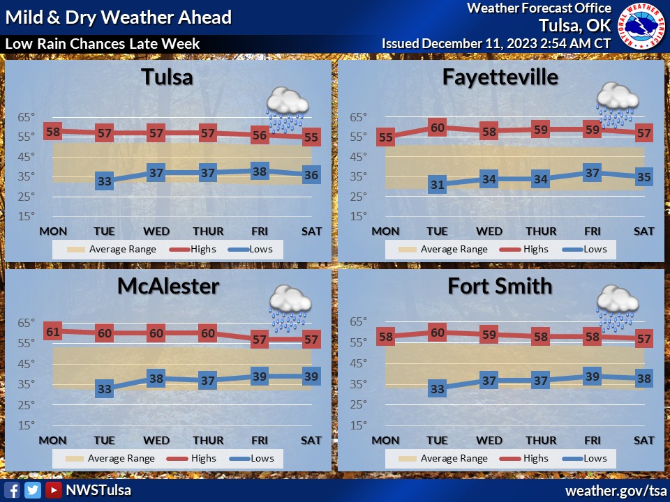
Folks in the Panhandle should be on the lookout for some impactful winter
weather this week...or maybe not?
Cutoff low, weatherperson's woe I'm telling ya!
Gary McManus
State Climatologist
Oklahoma Mesonet
Oklahoma Climatological Survey
gmcmanus@mesonet.org
December 11 in Mesonet History
| Record | Value | Station | Year |
|---|---|---|---|
| Maximum Temperature | 84°F | BEAV | 2025 |
| Minimum Temperature | 3°F | BOIS | 2000 |
| Maximum Rainfall | 2.54 inches | NRMN | 2007 |
Mesonet records begin in 1994.
Search by Date
If you're a bit off, don't worry, because just like horseshoes, “almost” counts on the Ticker website!