Ticker for November 28, 2023
MESONET TICKER ... MESONET TICKER ... MESONET TICKER ... MESONET TICKER ...
November 28, 2023 November 28, 2023 November 28, 2023 November 28, 2023
tisn't the season?
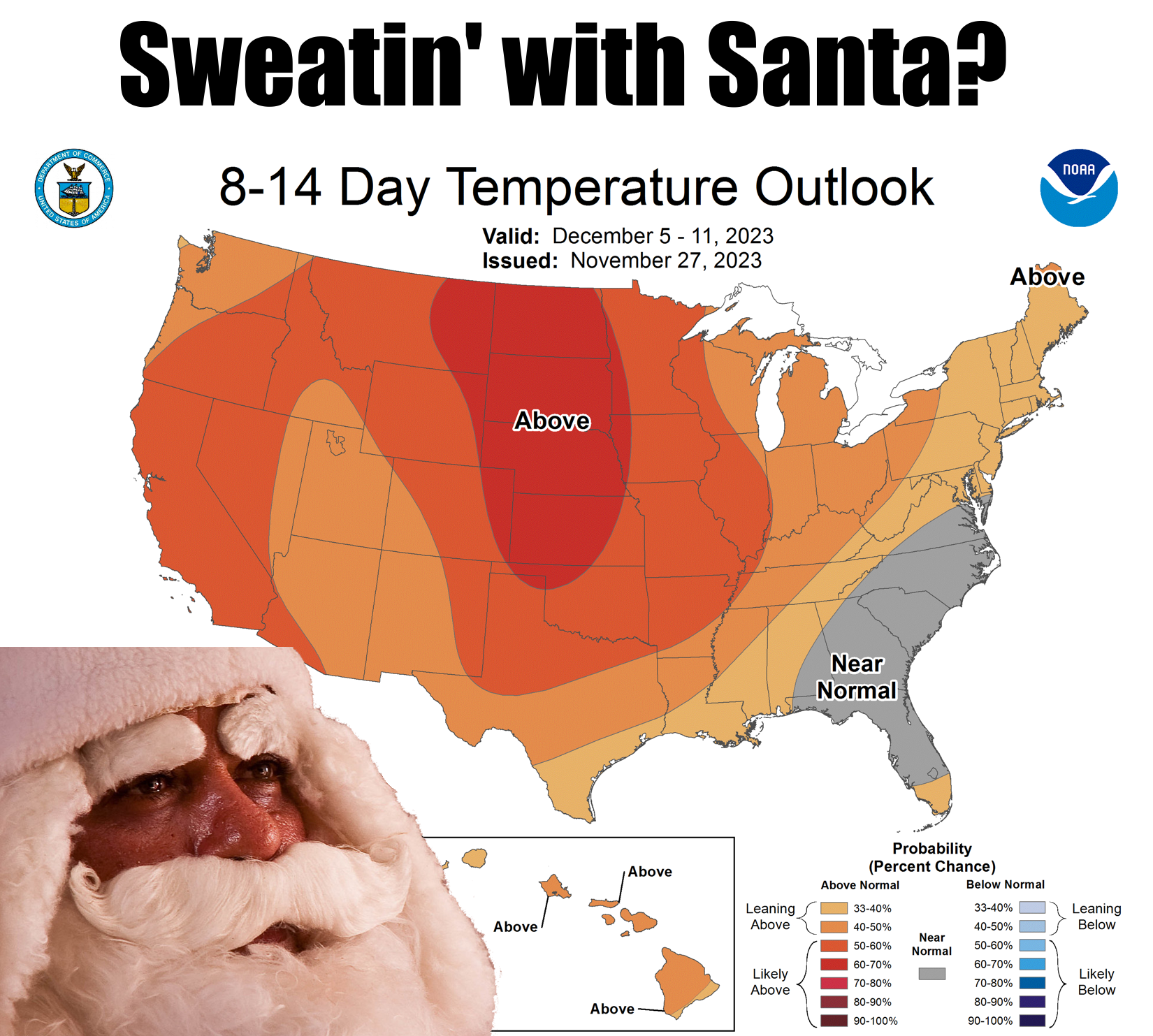
Does Santa's sleigh come with vinyl seats? If so, at least he will have all that
clothing on to insulate his rear and back from the searing hot lava rock known
as a vinyl seat. Kids today (BAH HUMBUG!) will never know the pain and agony (hey,
"Pain and Agony" was my banjo duet's name in reform school!) of innocently
walking to your parent's car (think Pontiac Bonneville...color doesn't matter as
it is hideous in its own right) and throwing open the door on a hot summer day,
only to be assaulted and lulled into a dull stupor from the noxious vapors
generated by the sun's rays baking the inside of that car and all its plastic
and vinyl to about 170 degrees. Blindly sliding into the seat, you would
immediately feel the skin of your bare legs melt into the seat as all your nerve
endings screamed out for mercy as you melded into the scalding vinyl. Oh, but it
wasn't over even then, was it? No, you had the seat belt latch thingy, hanging
down like a sun-baked ninja, patiently waiting to brand your bare upper arm like
molten iron.
Ah, the good ol' days of summer and second-degree burns, wrapped up in a
Pontiac Bonneville package of hideousness. Those were the days!
Wait wait wait. Okay, obviously some PTSD going on here since the December sun
ain't all that fierce. And I'll leave the opposite trauma--think vinyl seats on
a cold January morning--for another day.
But let's remember about that upper graphic, it merely shows the odds of above
or below normal (and near normal) temperatures next week, NOT how hot or cold
it will be. So those greatly increased odds of above normal temperatures don't
(doesn't?? Darn it Jim, I'm a climatologist, not a grammaticist!) mean we're
gonna be basking in 80s and 90s. From the long-term model fantasy-casts...maybe
upper 50s and 60s?
Let's stick to things we DO know.
(crickets)
Okay, let's stick to things we have a generally better idea about. This week,
we'll be in that near-normal category for a bit longer until we see another
system move through on Thursday. At that point, we should see enough moisture
return for some rain, and maybe even a bit of snow across western OK.
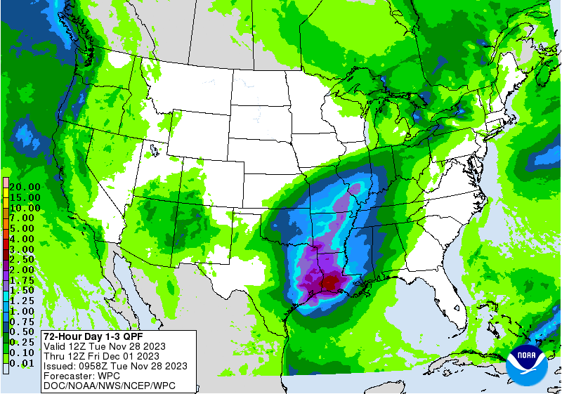
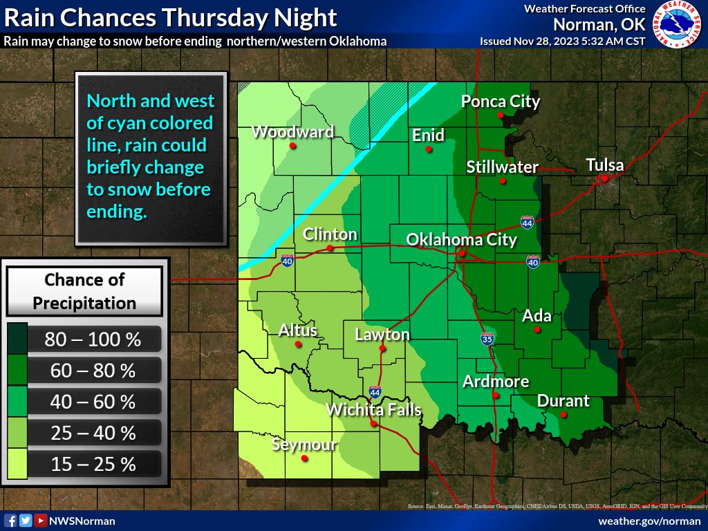
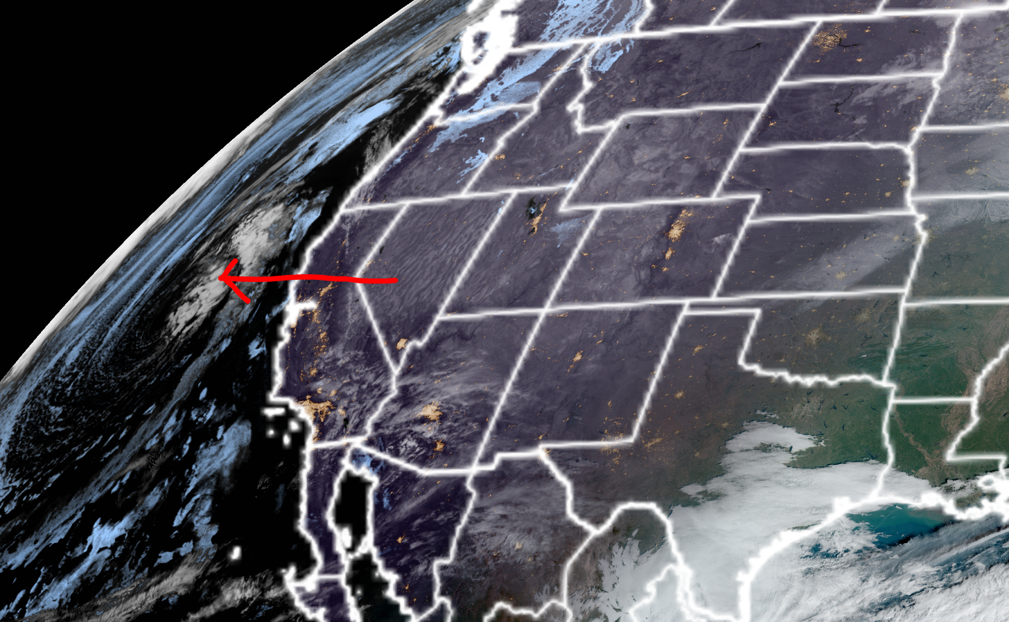
So while the chances for that snow out west look iffy right now, it's just like
last week's storm that ended up much more significant than previously thought...
the forecast COULD and probably WILL change, but it could change for the worse
just as easily as for the better, considering that storm system is still out
over the ocean.
Other than that, we'll continue with the mild afternoons and cold mornings.
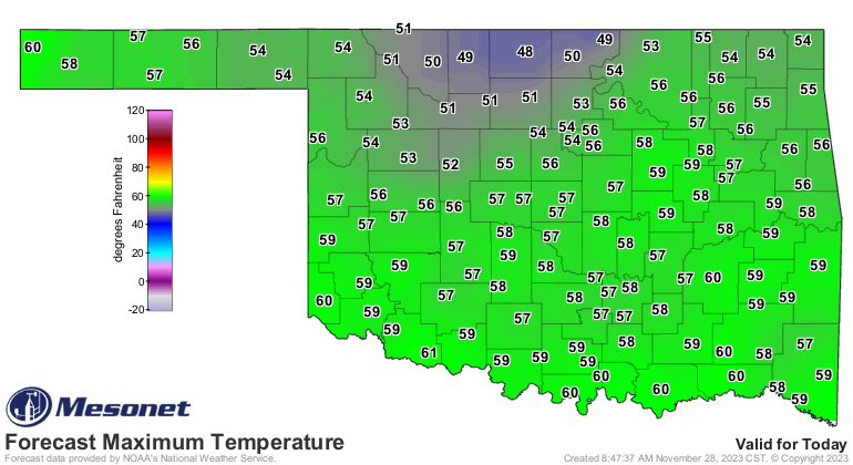
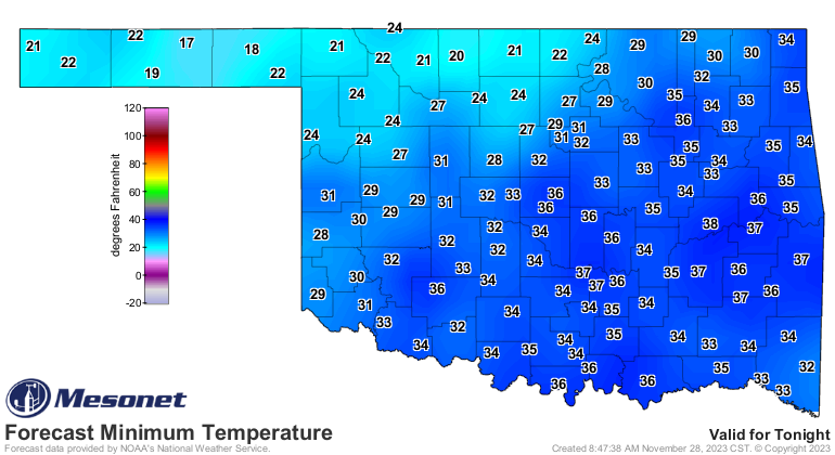
Hey, notice those high temps today are a bit lower up across north central OK?
Well, that's because they have a big of extra refrigeration going on up that
way due to the remaining snowpack from last week's storm...not only in OK but
also from the bigger snows in south central KS.
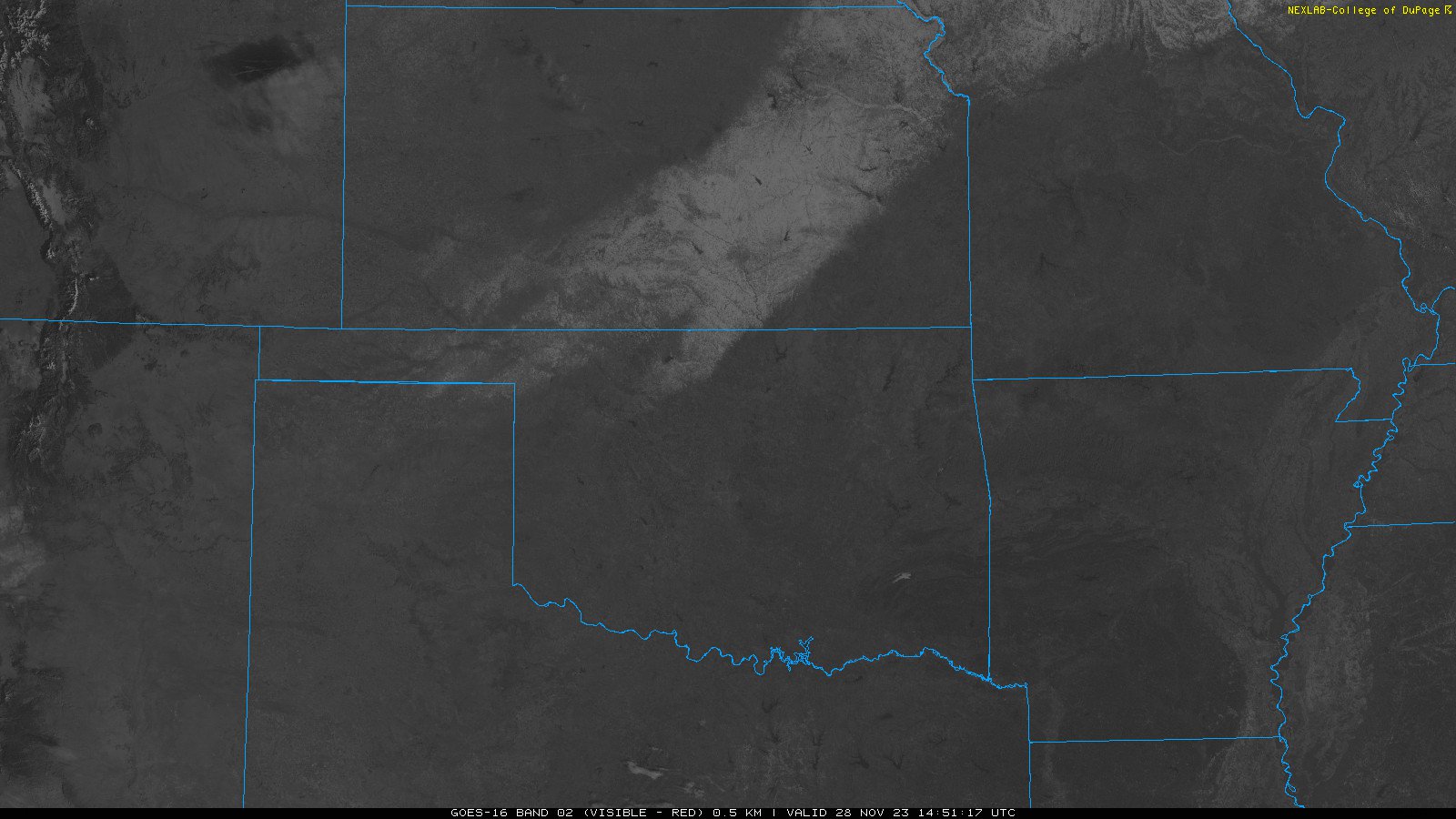
A bit more reflection (albedo) from that white snow surface as well, sending
the sun's rays back up into the atmosphere instead of warming the surface.
By the way, don't count on remaining in that warm pattern through all of
December. Oh, it definitely could...but we're talking Oklahoma weather here.
By the way, some rich folk could afford those fancy wool seat covers. For us
peasants though...PTSD.
Gary McManus
State Climatologist
Oklahoma Mesonet
Oklahoma Climatological Survey
gmcmanus@mesonet.org
November 28 in Mesonet History
| Record | Value | Station | Year |
|---|---|---|---|
| Maximum Temperature | 83°F | GOOD | 2014 |
| Minimum Temperature | 8°F | KENT | 2001 |
| Maximum Rainfall | 2.71″ | IDAB | 2016 |
Mesonet records begin in 1994.
Search by Date
If you're a bit off, don't worry, because just like horseshoes, “almost” counts on the Ticker website!