Ticker for November 8, 2023
MESONET TICKER ... MESONET TICKER ... MESONET TICKER ... MESONET TICKER ...
November 8, 2023 November 8, 2023 November 8, 2023 November 8, 2023
Augvember?
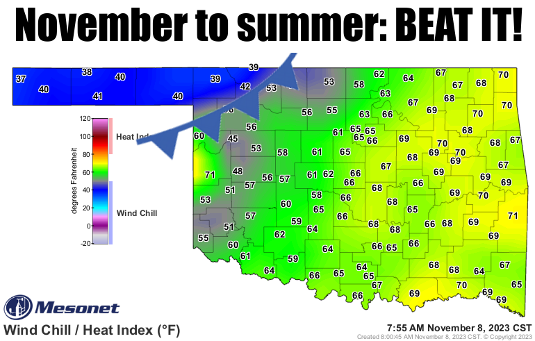
If'n you were around our Facebook page yesterday, this is already old news (like
Japan bombs Pearl Harbor, the U.S. lands on the moon, my head of full hair),
but yesterday was rather momentous for temperature records. It's a bit obscure
(darn, I should have saved the hair joke for this one!), but the 95 at Hollis
yesterday was only the second time we've seen that high of a temperature in
November or December (first was at Coalgate on Nov. 1, 1937), and that also makes
it the LATEST in the calendar year we've ever seen that high of a temperature.
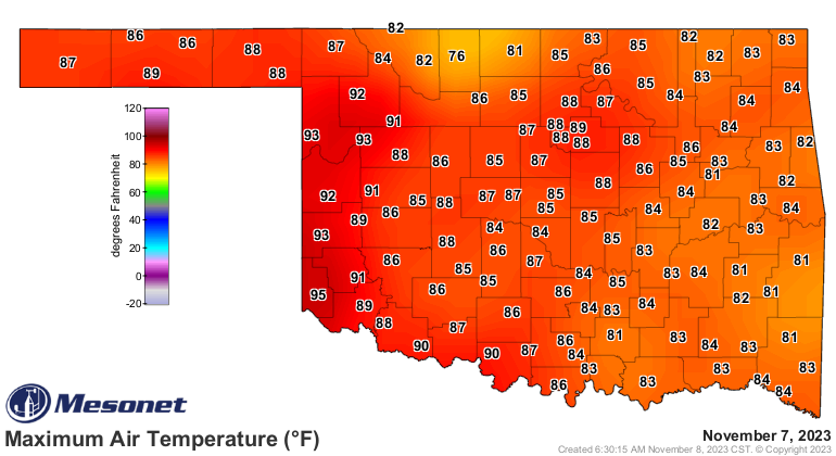
Now we start the day with a few more record high-low (ELVIS LYRICS TRIGGER!)
"Hi-lo-do-si-dosy-do
Stay single and save a dollar
Come Saturday night I'll court a pretty girl
With a cane and a high starched collar"
Ugh, I hate when that happens. Let's try again, we start with some high-low
temp records this morning.
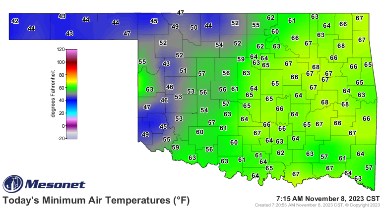

And while the cold front is coming to our rescue (or demise for us warm weather
fans), we'll still see record temps ahead of the front...again mostly in SW OK.
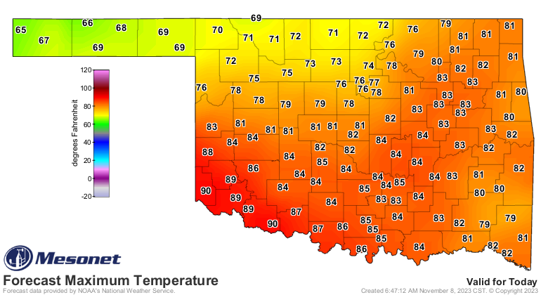
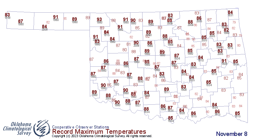
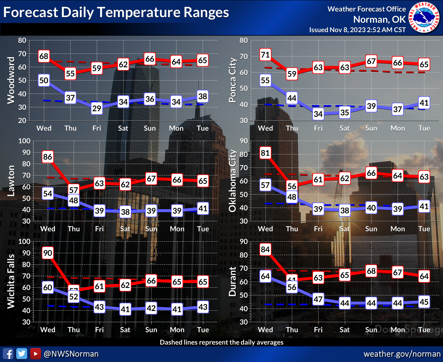
So we're still looking at a cooldown to more seasonable weather later today
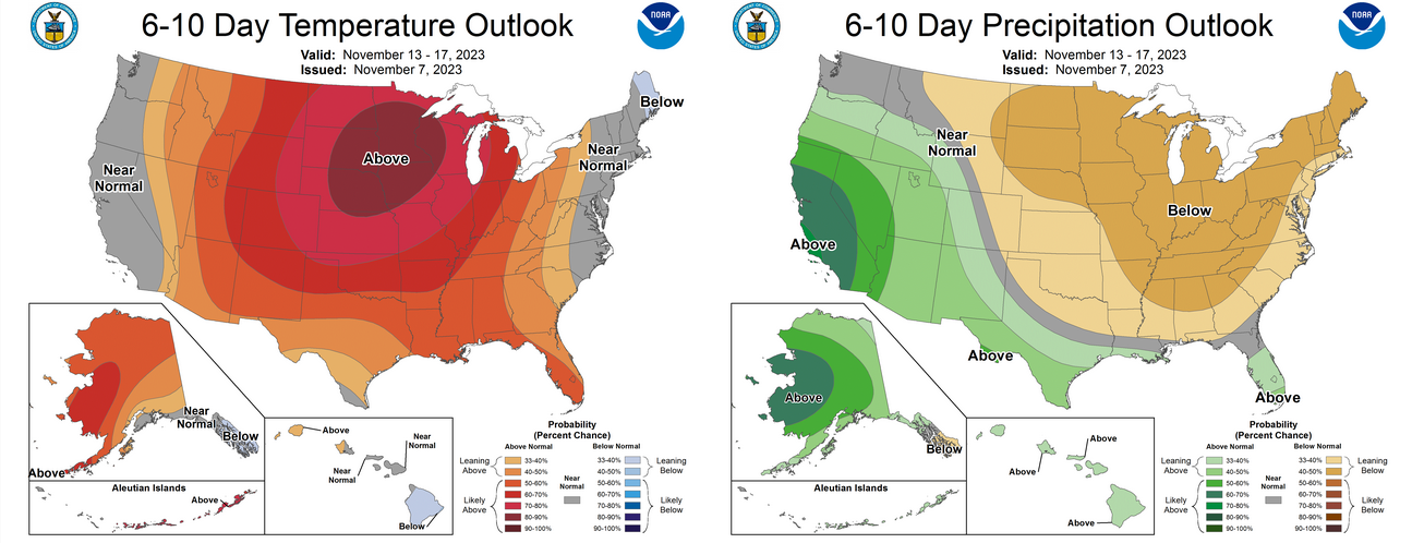
through the weekend, then back to the warm side (and we all know just how
painful that can be) next week. A bit of rain in the SE third of the state,
but mostly dry for the rest of us through most of next week it appears.
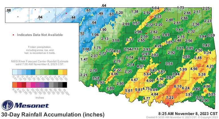
The trouble is we're working on another extended dry spell for NW OK and the
Panhandle, which dates back to early September for some folks, but for most
more than 30 days.
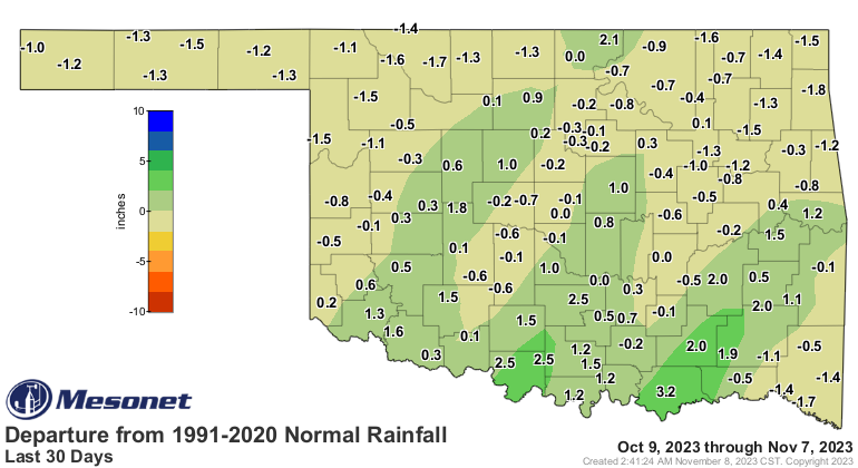
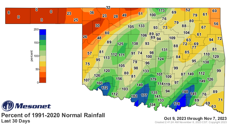
I'm still not seeing much for the NW half of the state through Thanksgiving.
That pattern could change in a hurry, of course, but it could also NOT change.
The hot weather doesn't help either, even though we've already had a killing
freeze (Killing Freeze was my band's name in the Boy Scouts!) over much of the
state, but definitely NW OK.
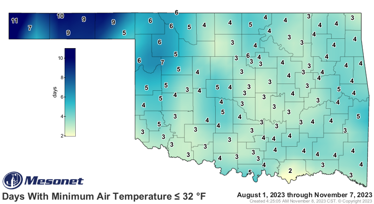
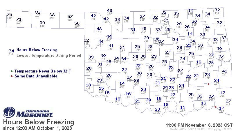
As the climate turns continues tomorrow...
Gary McManus
State Climatologist
Oklahoma Mesonet
Oklahoma Climatological Survey
gmcmanus@mesonet.org
November 8 in Mesonet History
| Record | Value | Station | Year |
|---|---|---|---|
| Maximum Temperature | 92°F | FREE | 2006 |
| Minimum Temperature | 19°F | BOIS | 2000 |
| Maximum Rainfall | 3.96 inches | TALI | 2011 |
Mesonet records begin in 1994.
Search by Date
If you're a bit off, don't worry, because just like horseshoes, “almost” counts on the Ticker website!