Ticker for July 6, 2023
MESONET TICKER ... MESONET TICKER ... MESONET TICKER ... MESONET TICKER ...
July 6, 2023 July 6, 2023 July 6, 2023 July 6, 2023
Happy accidental rainfall
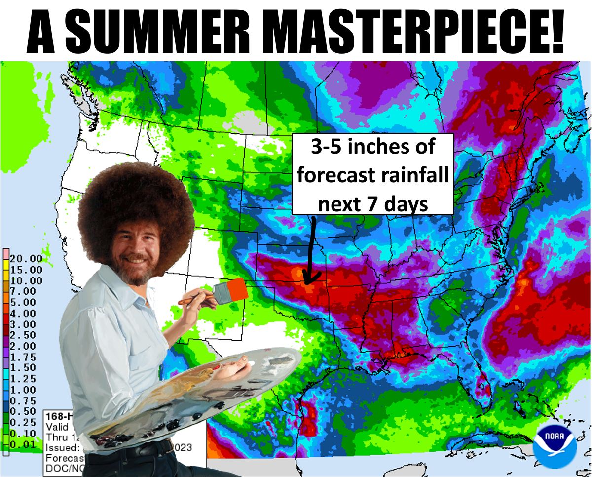
Wow, will you look at all that! I mean, I know some people will be envious, but
for those without, it's like beyond envy, bordering on rage. And people with all
that luck have no clue what they have until they go without.
What?
NO! Not the rain...the hair! I mean, come on. And to poof it up like that to show
off is just downright vanity, am I right?
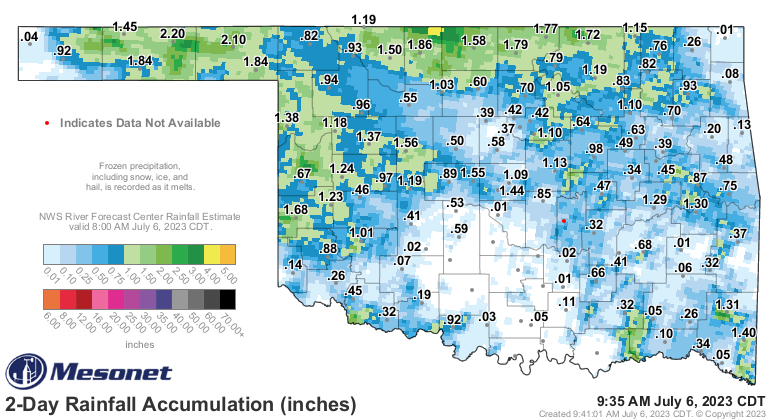
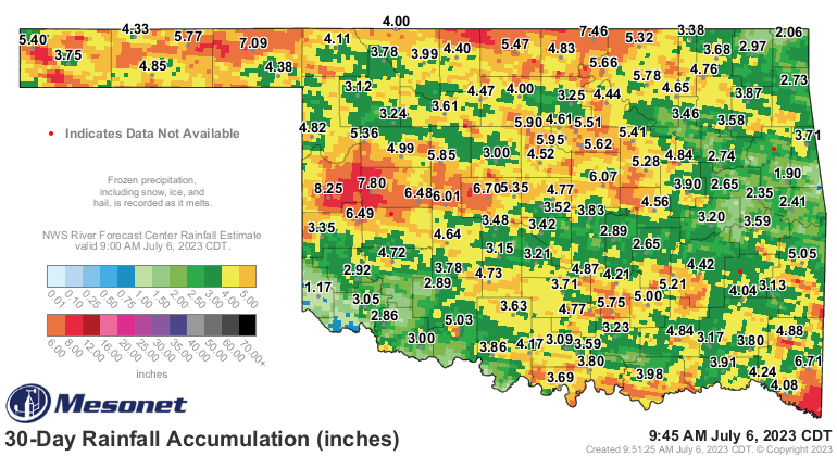
Oh, and the rainfall. Yes, we're already seeing a good dose of this with repeated
classical summer scenarios with MCS thunderstorm globs (SCIENCE!) building up in
the High Plains to our NW and then heading SE, providing us with giant gobs of
rain spitters (not SCIENCE!).
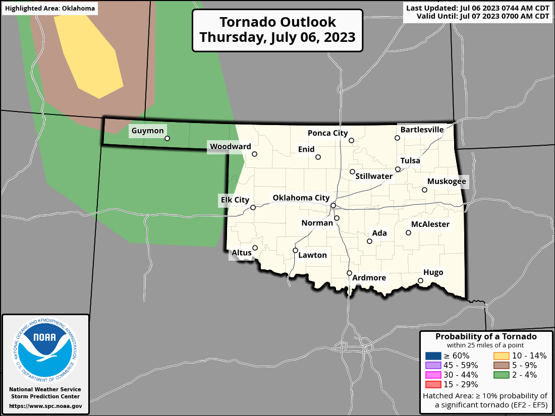
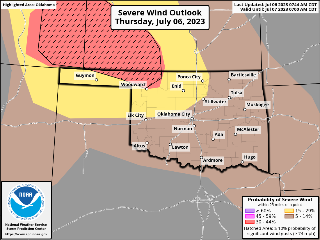
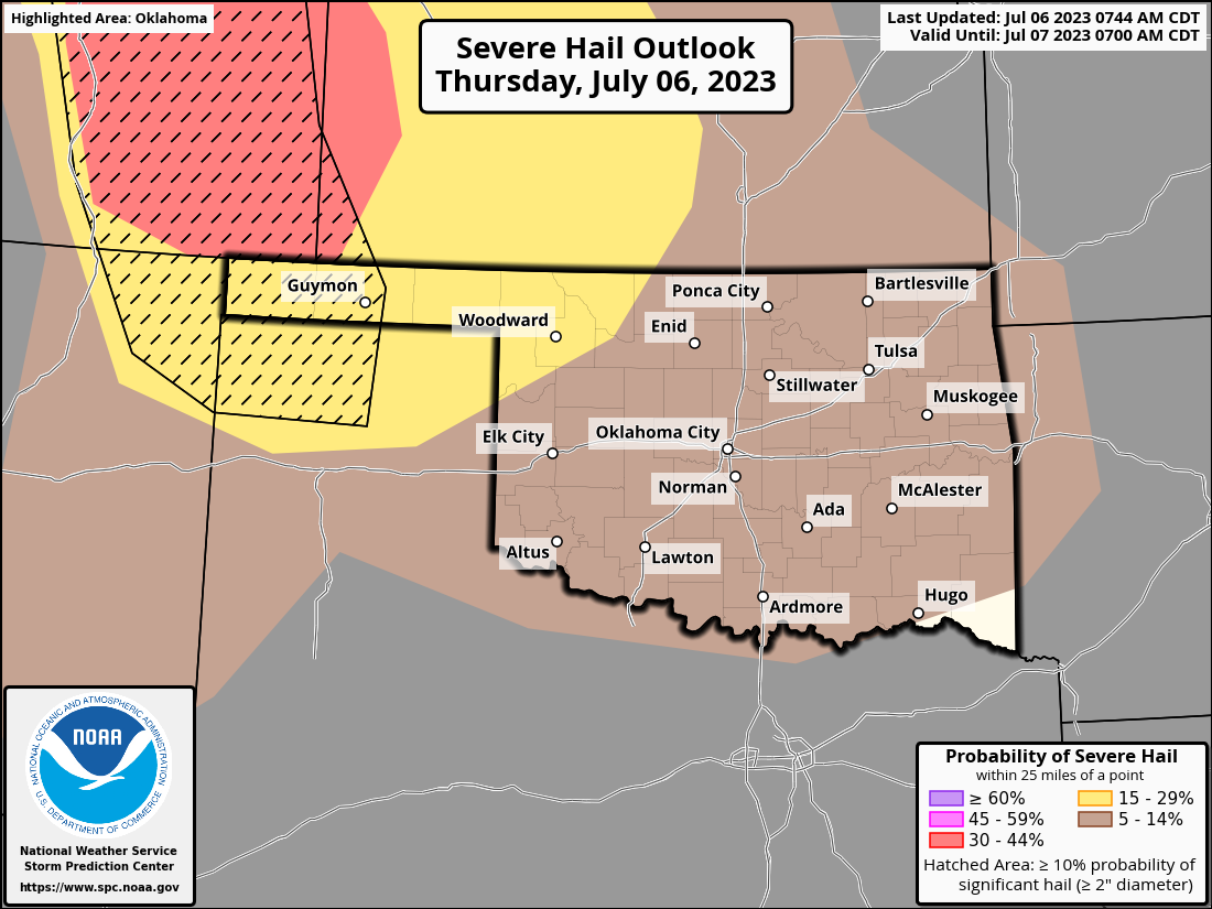
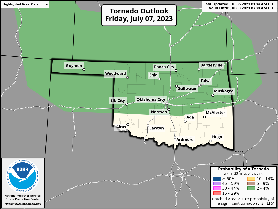
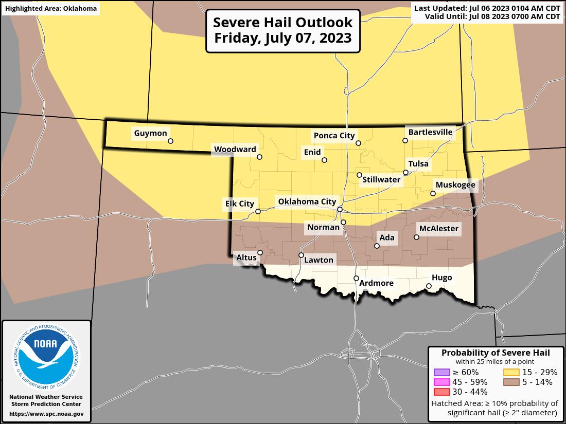
And then repeated rain chances will continue through the next week or so. And also
severe weather chances. Tornado odds will be low, but not zero for parts of the
state over the next 2 days.
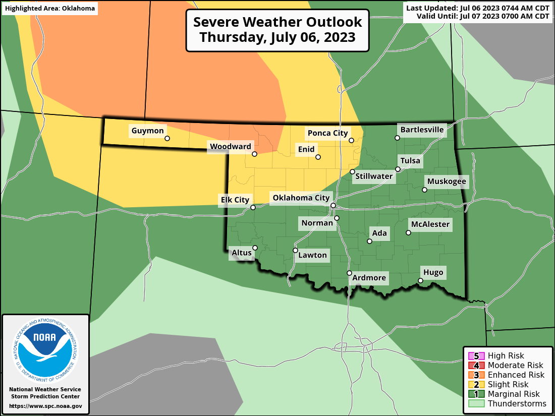
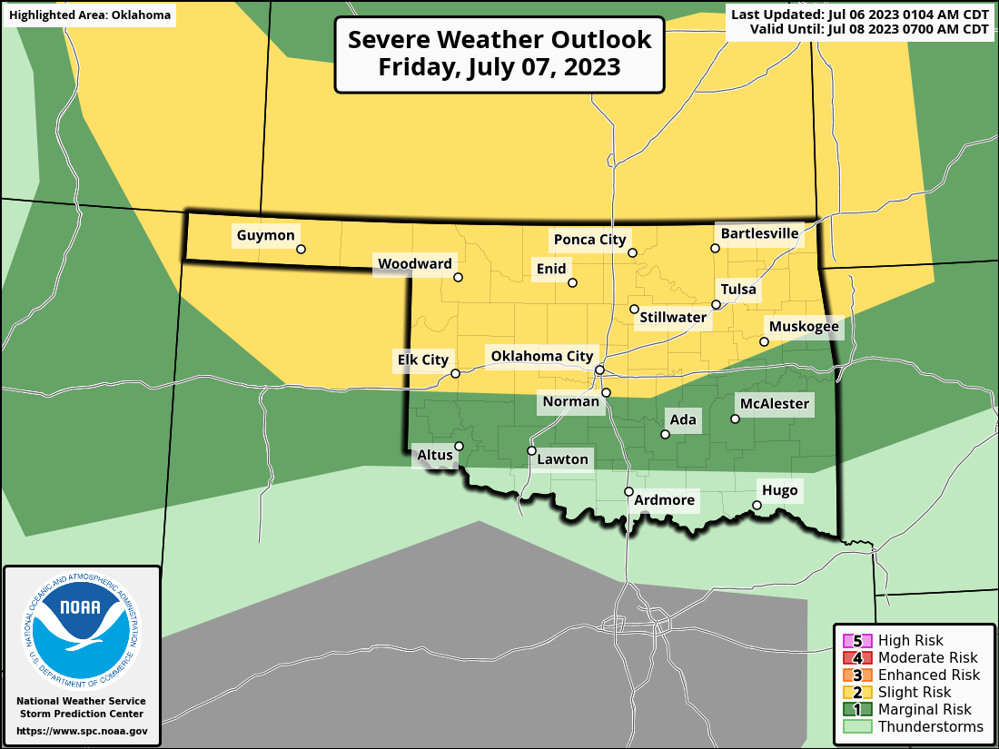

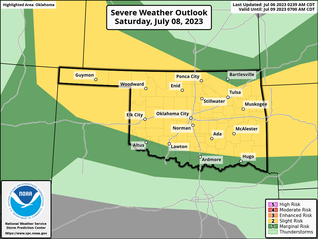
And AGAIN on Saturday!
Hey, don't blame me...I didn't order it. If'n I did, I sure would have asked
for more in SW OK, who continues to miss out on these bigtime rains. East
central OK too, but I think they'll get theirs here in the next few days, as
well as today!
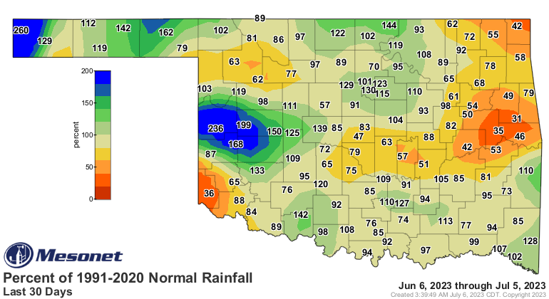
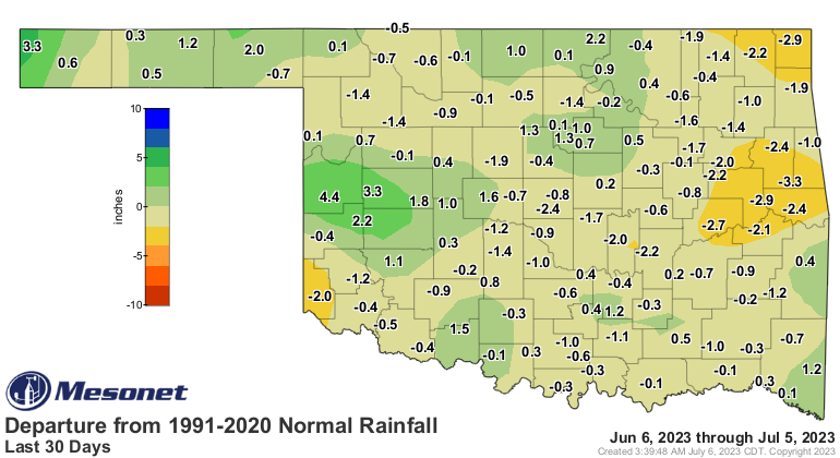
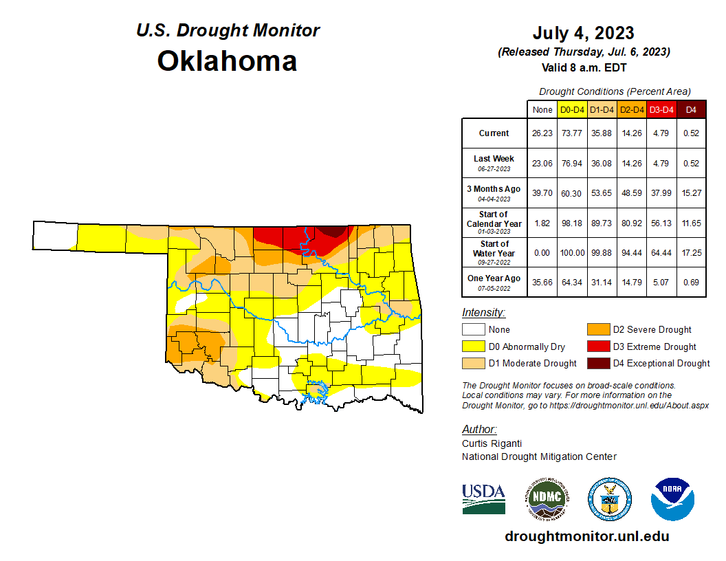
That should leave us with some good drought improvements over much of the state
with what has fallen after Tuesday's 7am cutoff point for consideration in
the new Drought Monitor, and what will come between now and next Tuesday at 7am.
The showers must have been wild.
NO, not the rain...with that hair!
Gary McManus
State Climatologist
Oklahoma Mesonet
Oklahoma Climatological Survey
gmcmanus@mesonet.org
July 6 in Mesonet History
| Record | Value | Station | Year |
|---|---|---|---|
| Maximum Temperature | 108°F | GRA2 | 2011 |
| Minimum Temperature | 53°F | GOOD | 1997 |
| Maximum Rainfall | 3.57 inches | WATO | 2015 |
Mesonet records begin in 1994.
Search by Date
If you're a bit off, don't worry, because just like horseshoes, “almost” counts on the Ticker website!