Ticker for July 5, 2023
MESONET TICKER ... MESONET TICKER ... MESONET TICKER ... MESONET TICKER ...
July 5, 2023 July 5, 2023 July 5, 2023 July 5, 2023
Spice it up!
Well did ya have a good 4th? I hope so because your 5th might require an actual
fifth of something (I prefer chocolate milk...Braum's, of course) because of
several rounds of possible severe weather.
Heck, it's storming right now for crying out loud! And raining.
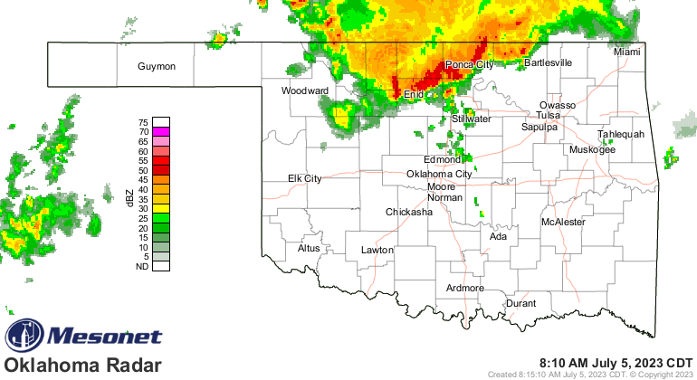
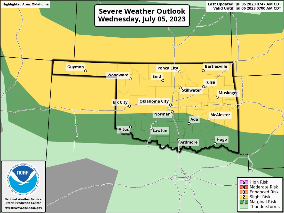
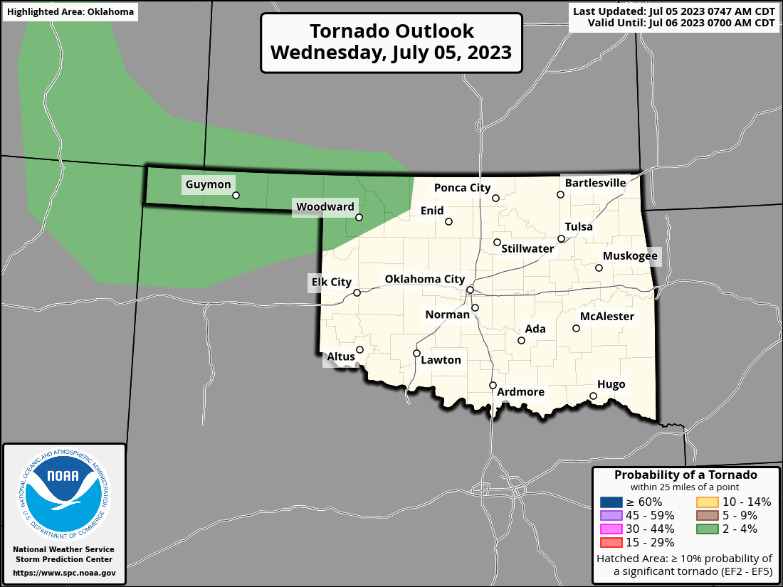
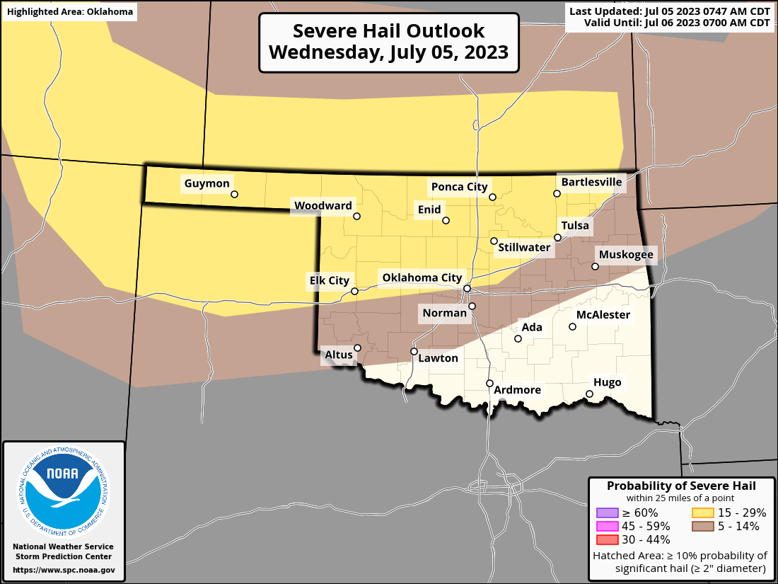
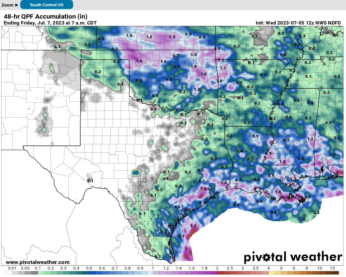
And then we have a chance later today for storms in northern OK on a cold front
dropping down (see top graphic, and we'll get to that later), enhanced by an
outflow boundary from the current storms. Then we should see a classic MCS
develop from thunderstorms forming in the High Plains to our NW that will rush
SE overnight into the main body of the state. So a 3-for-1 of the dreaded variety.
High winds, big hail, and a tornado or three are possible...depending on where
you're at.
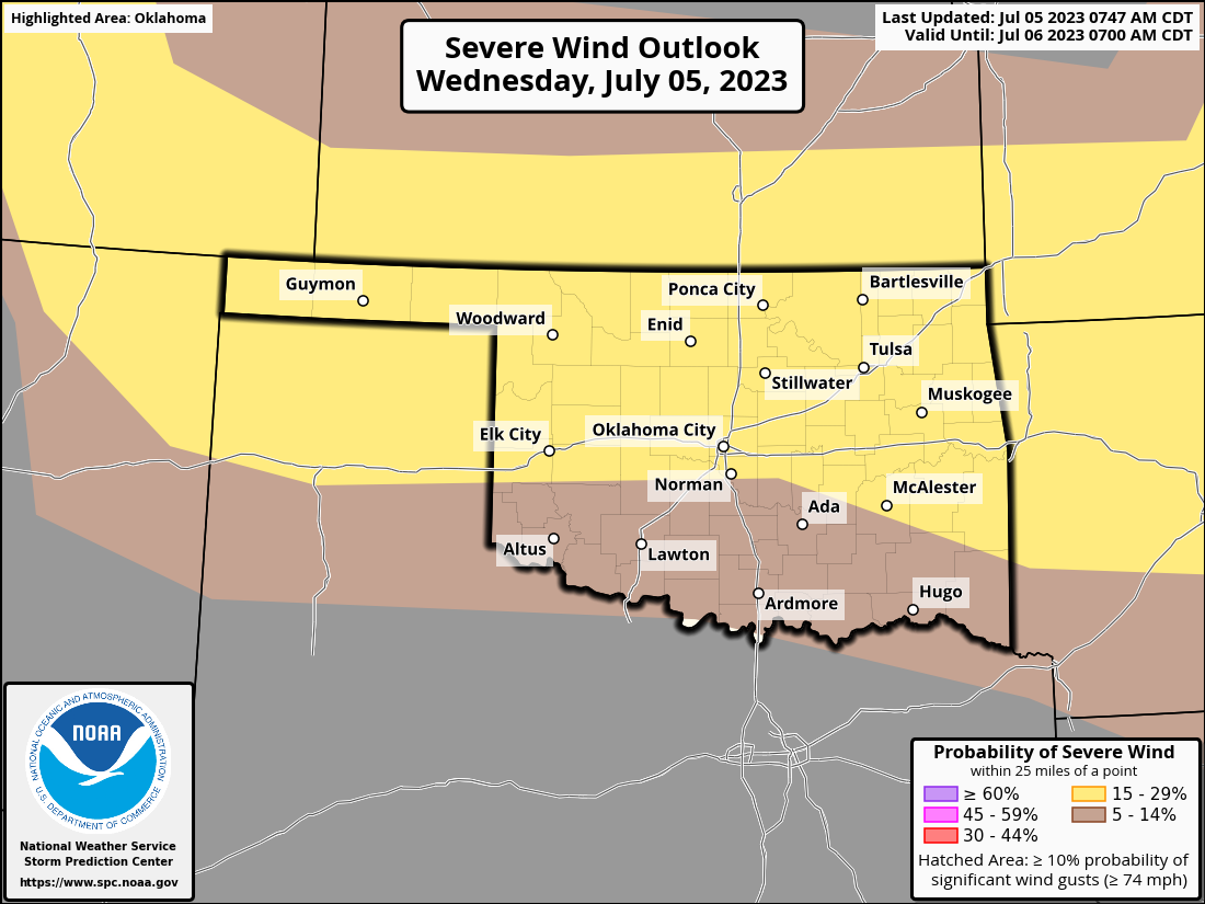
Could see the same thing Friday, by the way.
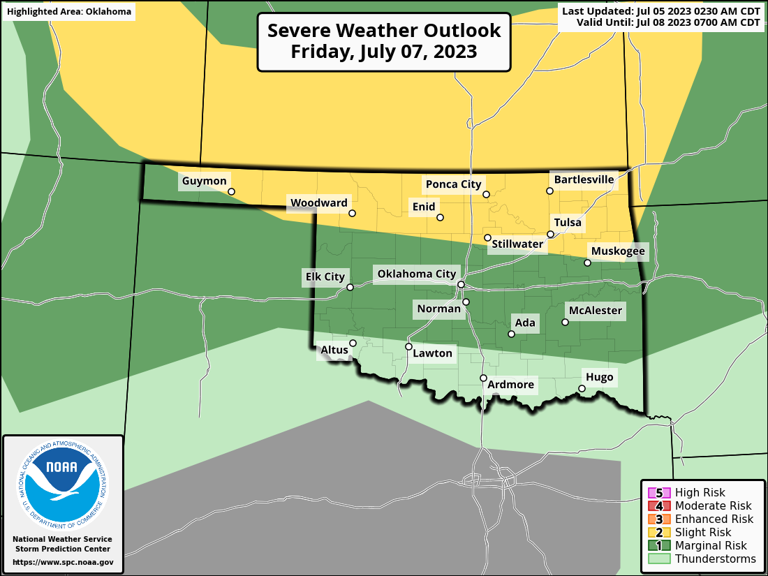
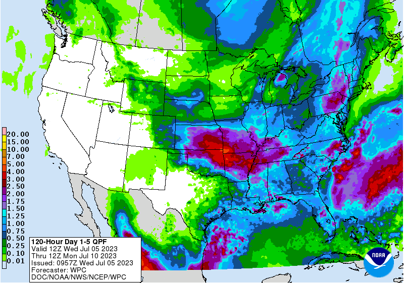
And the rain this could bring as we go out through the next several days, nothing
less than tremendous for northern and eastern OK!
Or, if you want to stick to the somewhat safer 48hour-forecast.
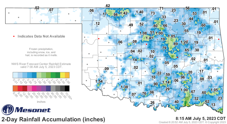
OR! if you want to stick to the super-duper-safe climatologist's special
forecast, which is actually a hind-cast (and we all know just how painful that
can be...but better than getting it in a sling, oddly enough) for what has
already fallen in the last 48 hours.
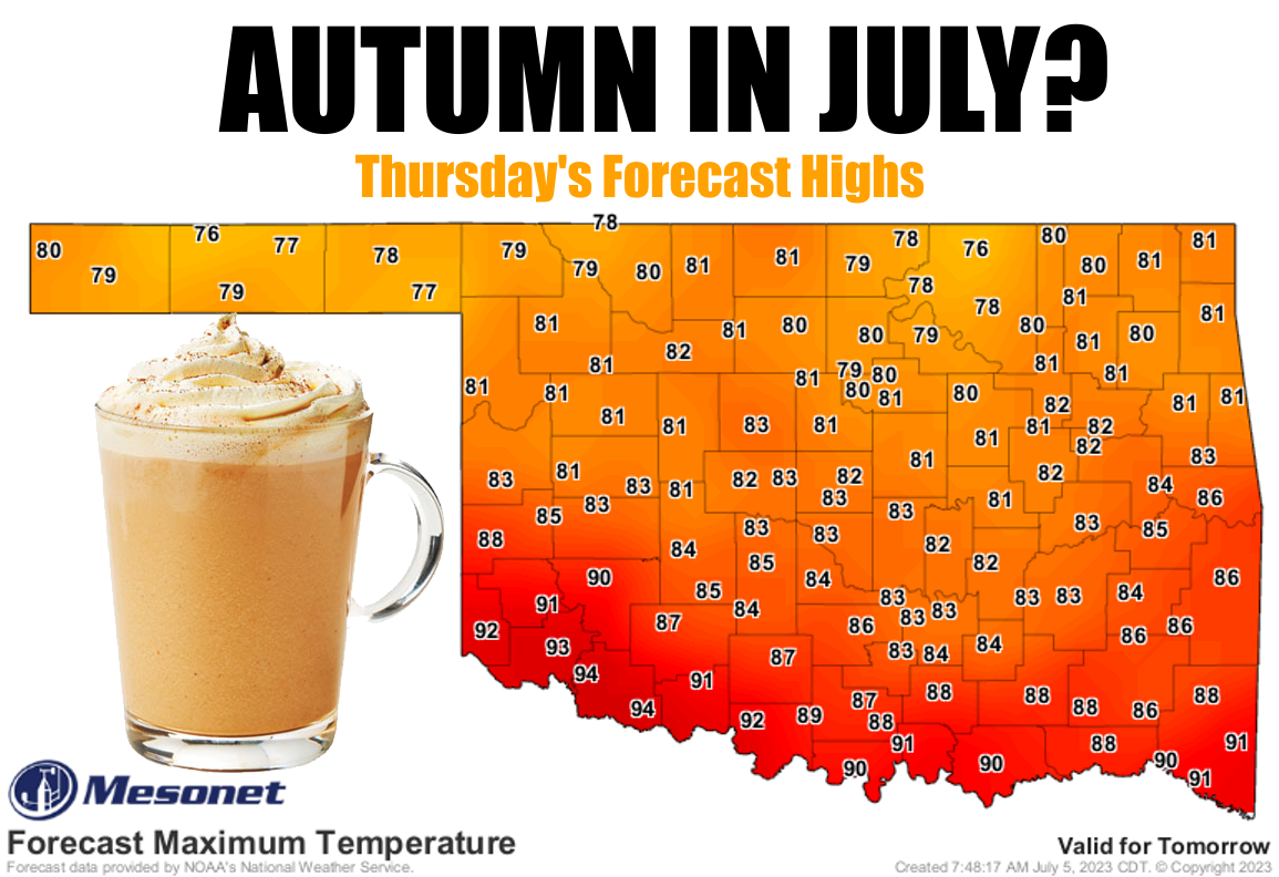
Now, back to those temperatures. Look, I'm a famous warm weather fan, and by
"warm" I mean "really hot." But there's a difference between my "really hot"
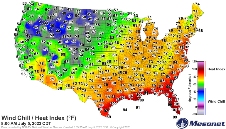
and others' "really hot." I don't mean this, like we had yesterday.
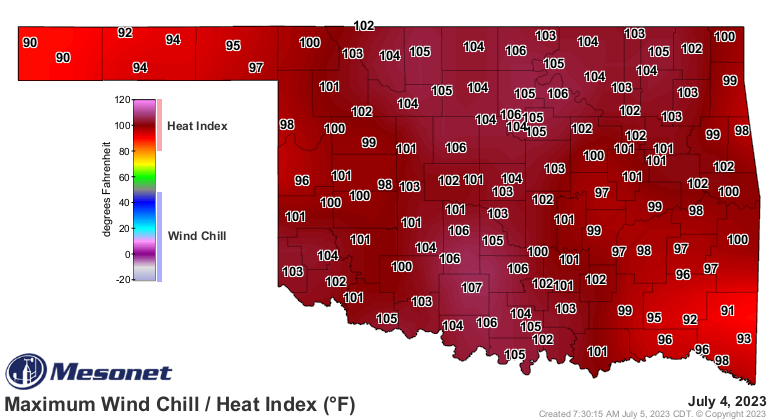
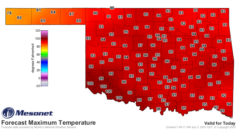
I mean this! In other words, heat WITHOUT the steam.
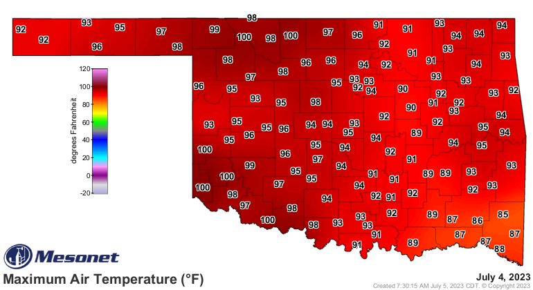
But, it is summertime in Oklahoma, and it's tough to get one without the other,
barring a lovely drying SW wind at about 40 mph...so despite my love of the heat,
I'm willing to offer this ONE TIME voucher for everybody to be a pumpkin spice
latte fan (shudder!) and celebrate our Autumn in July! Why? Because I'd rather
see 70s and low 80s than a 105 heat index. That's where this lovely but oddly
strong (Oddly Strong was my band's name in kindergarten!) cold front stretched
from the Great Lakes down through the High Plains to our NW comes in.
We're gonna have another hot one today...in between storms, of course.

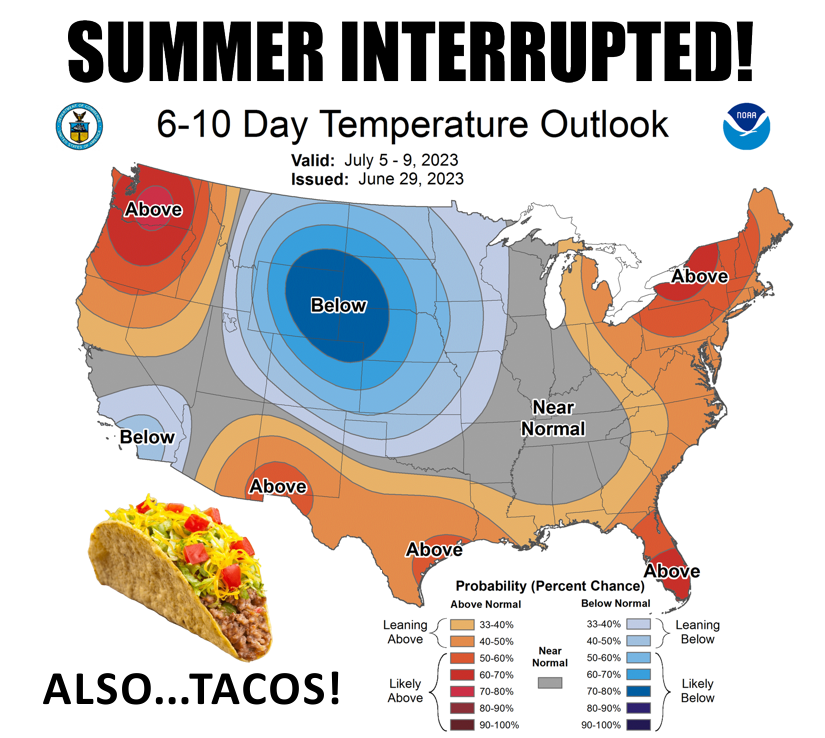
Then we get several days of more seasonable weather, as promised last week
in this graphic.
So wait for it tomorrow and go big on the spice...easy on the latte!
Gary McManus
State Climatologist
Oklahoma Mesonet
Oklahoma Climatological Survey
gmcmanus@mesonet.org
July 5 in Mesonet History
| Record | Value | Station | Year |
|---|---|---|---|
| Maximum Temperature | 107°F | WALT | 2011 |
| Minimum Temperature | 50°F | KENT | 2004 |
| Maximum Rainfall | 6.39 inches | HOBA | 2010 |
Mesonet records begin in 1994.
Search by Date
If you're a bit off, don't worry, because just like horseshoes, “almost” counts on the Ticker website!