Ticker for June 27, 2023
MESONET TICKER ... MESONET TICKER ... MESONET TICKER ... MESONET TICKER ...
June 27, 2023 June 27, 2023 June 27, 2023 June 27, 2023
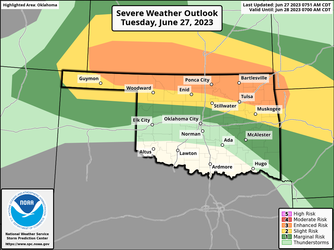
Thar it blows!
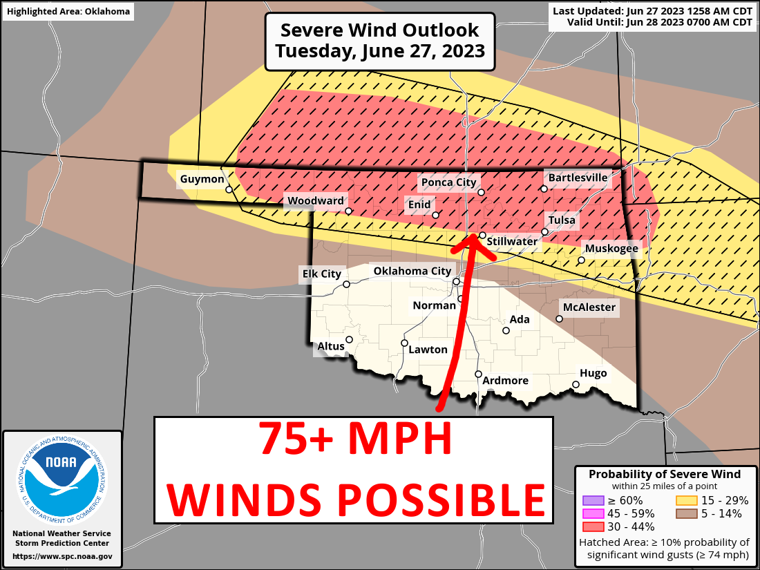
You're worried about the wind, Sundance? Heck, the hail will probably kill ya!

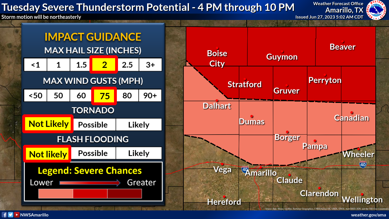
And the tornado threat, while low, isn't zero on this Enhanced threat day (night
really).

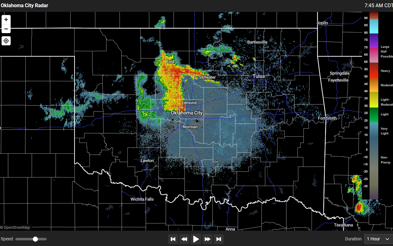
Heck, it's storming (and raining) right now for crying out loud!
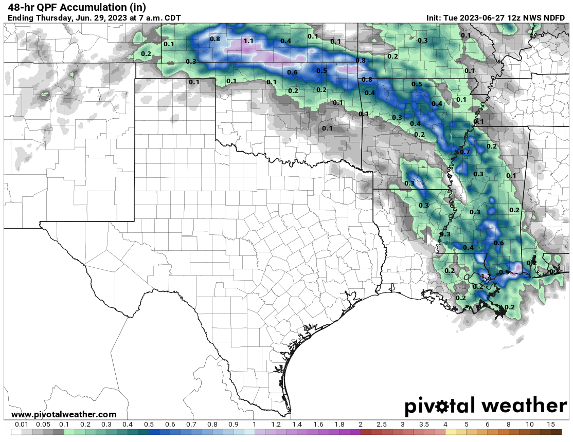
So what'cha gonna do? Not much you can do but prepare for severe weather in the
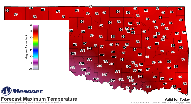
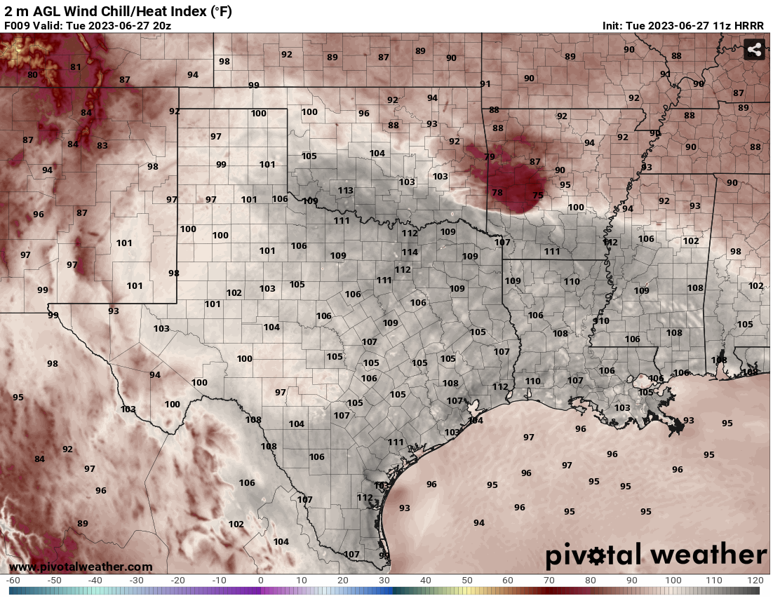
far northern counties and nasty moist heat to the south where heat index values
are expected to get up into the 110s.

That upper-level ridge is ensconced (English to Okie dictionary: positioned)
over the Southern Plains, but just far south enough to allow a storm system
to travel up and over the ridge and skirt the northern border of the state
with Kansas, while also giving the southern two-thirds of the state that
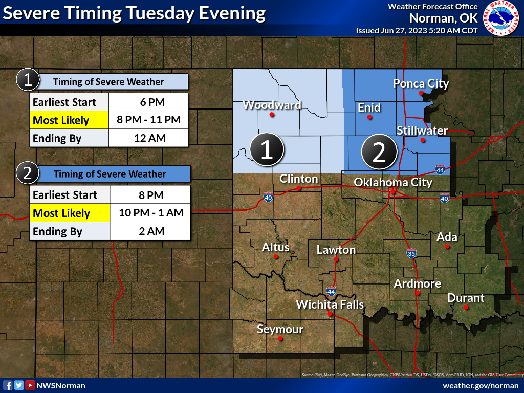
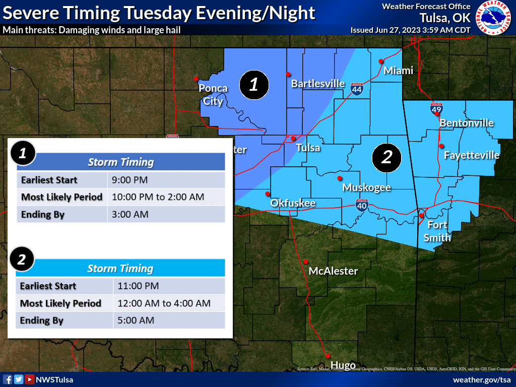
punishing heat. The storm timing will be this evening into the overnight hours,
and yes, Tulsa will be in the severe wind threat even as it is starting to come
out of the worse of the damage from last week's Derecho.
As Tulsans can tell you, now would not be a good time to lose power due to
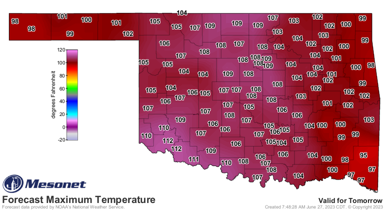
storm damage, especially with the hottest day of the year coming tomorrow. These
are ACTUAL air temps, not heat index values!
The bronze lining (budget cuts), unless you're wanting to harvest wheat? At
least there's rain with the storms?
Gary McManus
State Climatologist
Oklahoma Mesonet
Oklahoma Climatological Survey
gmcmanus@mesonet.org
June 27 in Mesonet History
| Record | Value | Station | Year |
|---|---|---|---|
| Maximum Temperature | 112°F | BUFF | 2012 |
| Minimum Temperature | 50°F | COOK | 2003 |
| Maximum Rainfall | 4.21 inches | KING | 2007 |
Mesonet records begin in 1994.
Search by Date
If you're a bit off, don't worry, because just like horseshoes, “almost” counts on the Ticker website!