Ticker for May 25, 2023
MESONET TICKER ... MESONET TICKER ... MESONET TICKER ... MESONET TICKER ...
May 25, 2023 May 25, 2023 May 25, 2023 May 25, 2023
The West is the Best

"Spritzer"...that's brilliant! I don't know how I come up with these. Why I must
be the smarterest person ever to have...okay, I asked ChatGPT to give me some
words that rhyme with "Drifter."
It also came up with "mistor," "drizzler," which were both fine. But then it spit
out "slither," which has ZERO to do with rain. And "spatter," which doesn't rhyme
at all. And "pitter-patter?"
HA! What a maroon.
How much more of the Ticker is written by ChatGPT? Well, none, of course. The
AI used by my brain to write this drivel (which rhymes with drizzle!) runs on an
old Atari 386-DX16. However, even my brain can comprehend the magnificent
turnaround exhibited by the western half of the state's rainfall fortunes. And
remember, it's raining out west right now, for crying out loud!
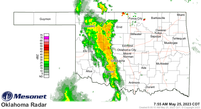
This current storm complex that brought severe weather to the High Plains last
night also brought plenty of welcome moisture...enough so that we even have a
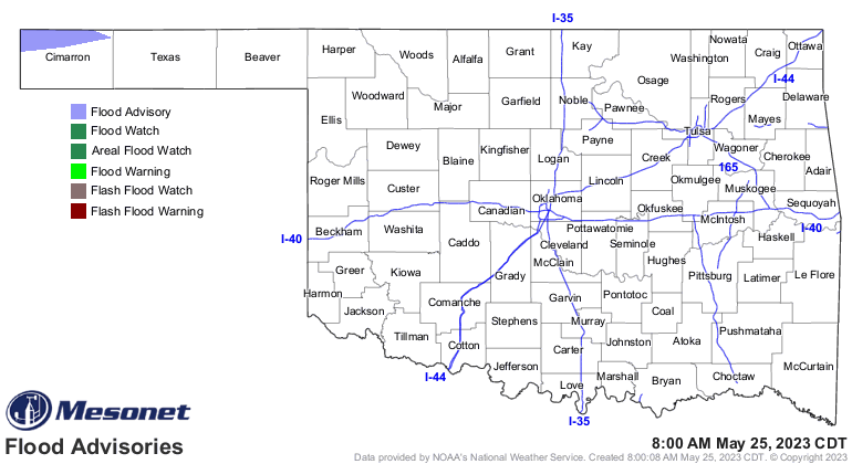
flood advisory for NW Cimarron County? At least it's showing up on the advisories
map.
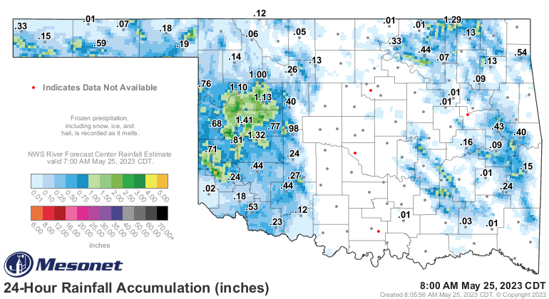
"Flood Advisory
National Weather Service Amarillo TX
810 PM CDT Wed May 24 2023
...The National Weather Service in Amarillo has issued a Flood
Advisory for the following rivers in Oklahoma...
Cimarron River at Kenton 2NE affecting Cimarron County.
.Runoff from heavy rain in northeast New Mexico has caused a
significant rise on the Cimarron River.
For the Cimarron River...including Kenton 2NE...elevated river
levels are forecast."
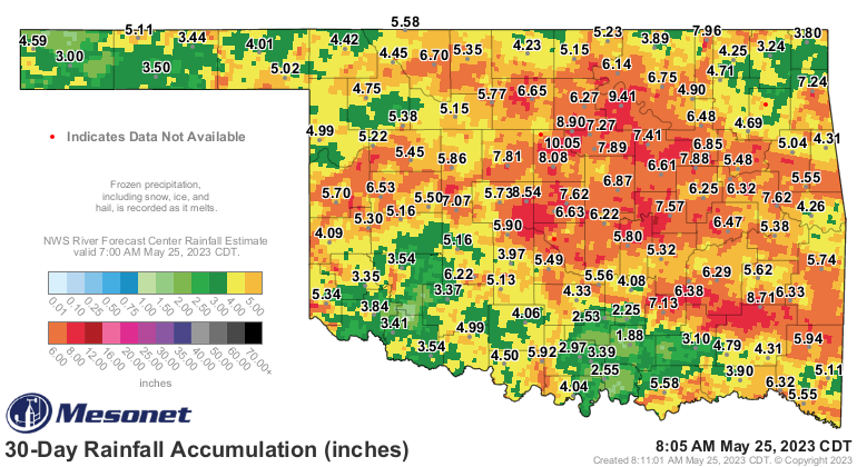
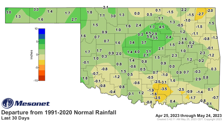
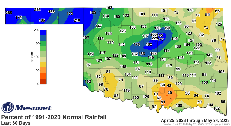
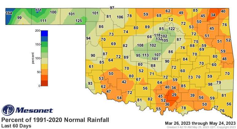
Impressive. Extend that rainfall map from 24 hours to 30 days and we can see
who are the new haves and have-nots.
And this week's new Drought Monitor map doesn't reflect the heavier rains, but
we've seen more improvement nonetheless as the national author continues to
walk the tightrope between short-term improvements vs. long-term deficits.
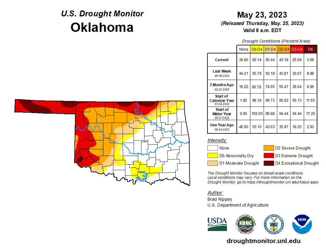
Why is there still drought? This right here...

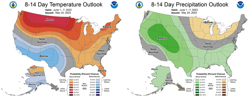
As for the forecast, the High Plains should remain the focus of Mother Nature's
spigot as we head from May into June.

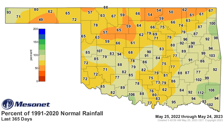
Dare we talk about how parts of southern and eastern Oklahoma are starting to
look dry?
Oh my! (And I didn't even have to use our AI Overlords to come up with that
magnifice....errrr, kindergartner-ish rhyme.
Gary McManus
State Climatologist
Oklahoma Mesonet
Oklahoma Climatological Survey
gmcmanus@mesonet.org
May 25 in Mesonet History
| Record | Value | Station | Year |
|---|---|---|---|
| Maximum Temperature | 103°F | BEAV | 2012 |
| Minimum Temperature | 33°F | KENT | 2002 |
| Maximum Rainfall | 4.74 inches | WILB | 2025 |
Mesonet records begin in 1994.
Search by Date
If you're a bit off, don't worry, because just like horseshoes, “almost” counts on the Ticker website!