Ticker for May 8, 2023
MESONET TICKER ... MESONET TICKER ... MESONET TICKER ... MESONET TICKER ...
May 8, 2023 May 8, 2023 May 8, 2023 May 8, 2023
Mune?

I don't particularly like this weather pattern we've been in for the last week or
so. Right, nobody asked me but then again nobody ever does but I keep blathering
on anyway! So we've seemingly skipped much of May and already gone into a mid-June
style pattern with highs in the 80s and 90s (which I love) punctuated by lots of
humidity (which I hate) and storms created in a weakly-jetted environment (and
we ALL know just how painful that can be!).
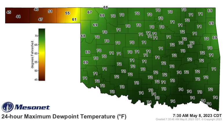
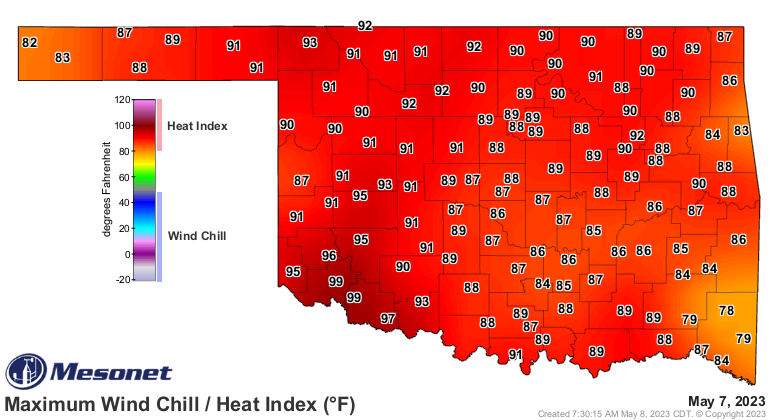
Just look at these dewpoints and heat index values from yesterday (and high air
temps as well).

Oh, and another thing I frown upon (besides hairbrushes)...temperatures that fail
to hit 100. Oh, I've got nothing against 99...I hope to make that number myself,
ya know. I *WILL* live to see those flying cars we keep hearing about. But
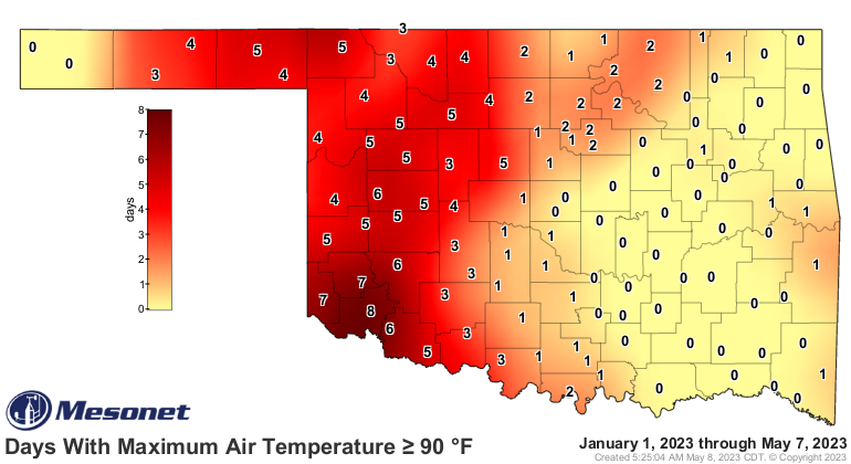
we had several stations hit 99 degrees over the last 3 days, but none with the
guts to hit triple-digits for the first time this year. I had high hopes for
Altus and Mangum, but I'm sorely disappointed in my hometown of Buffalo for
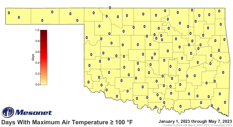
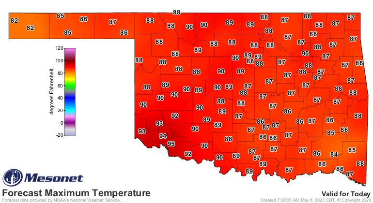
leaving me hanging yesterday. The highs above 90 map keeps growing, but that
highs above 100 map continues to stare back at me with 120 eyes like some
macabre (English to Okie translation: disturbing) temperature spider.

We have another shot today and tomorrow for that elusive 100, but I don't think
we'll get as close as 99, to be honest, and I'm rarely honest unless I'm lying.
Yeah, figure that one out!
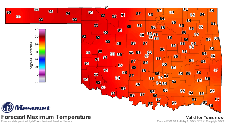
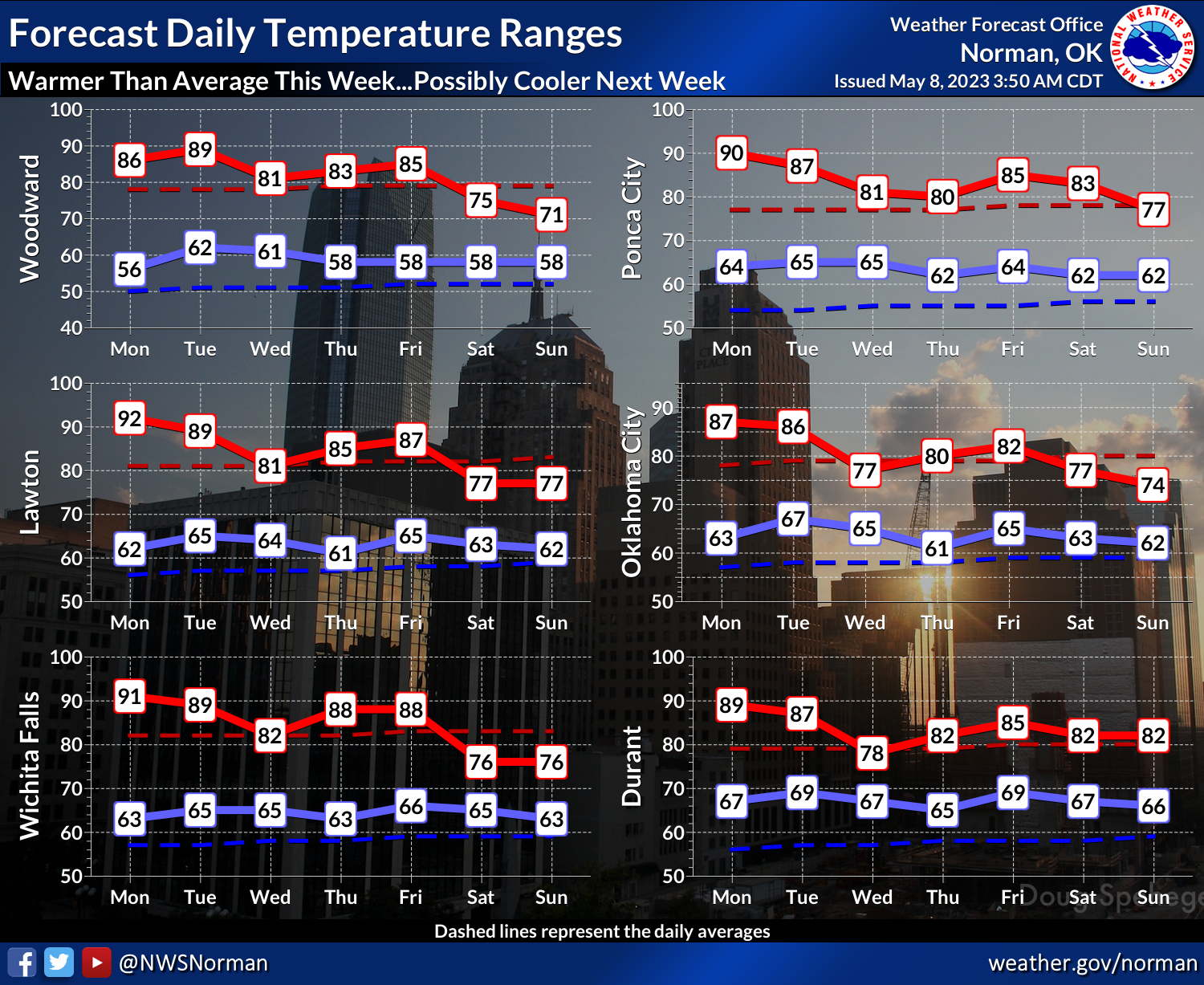
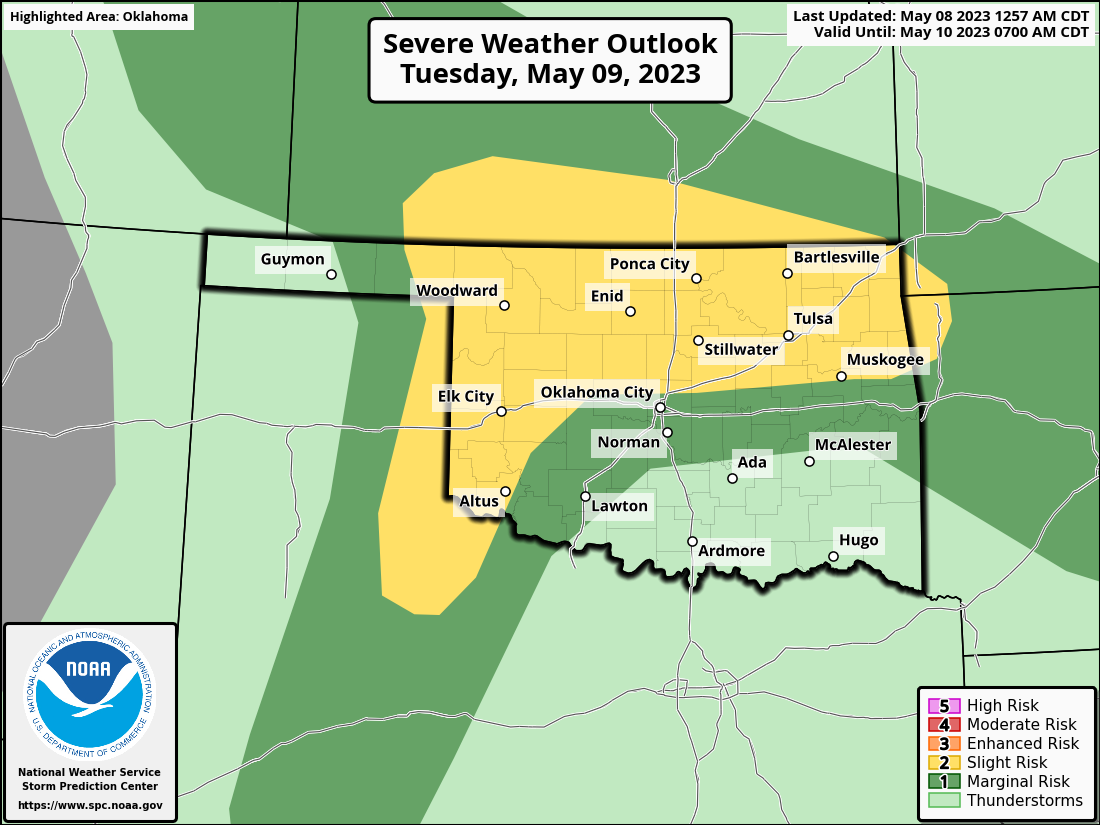
Then as the moisture increases, we get more clouds and more rain and we descend
into where we were a couple of weeks ago with highs back in the 70s with lots
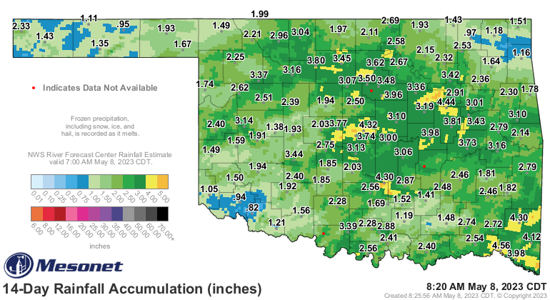
of moisture chances. A visit from the Tropics with a southern branch storm
moving up through Texas in the early weekend gives us our biggest chance of
widespread rainfall, reflected in the top graphic. It's also the big trigger
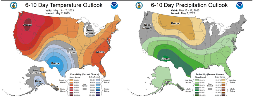
for our increased odds of above normal precip and below normal temps over
weekend and early next week.
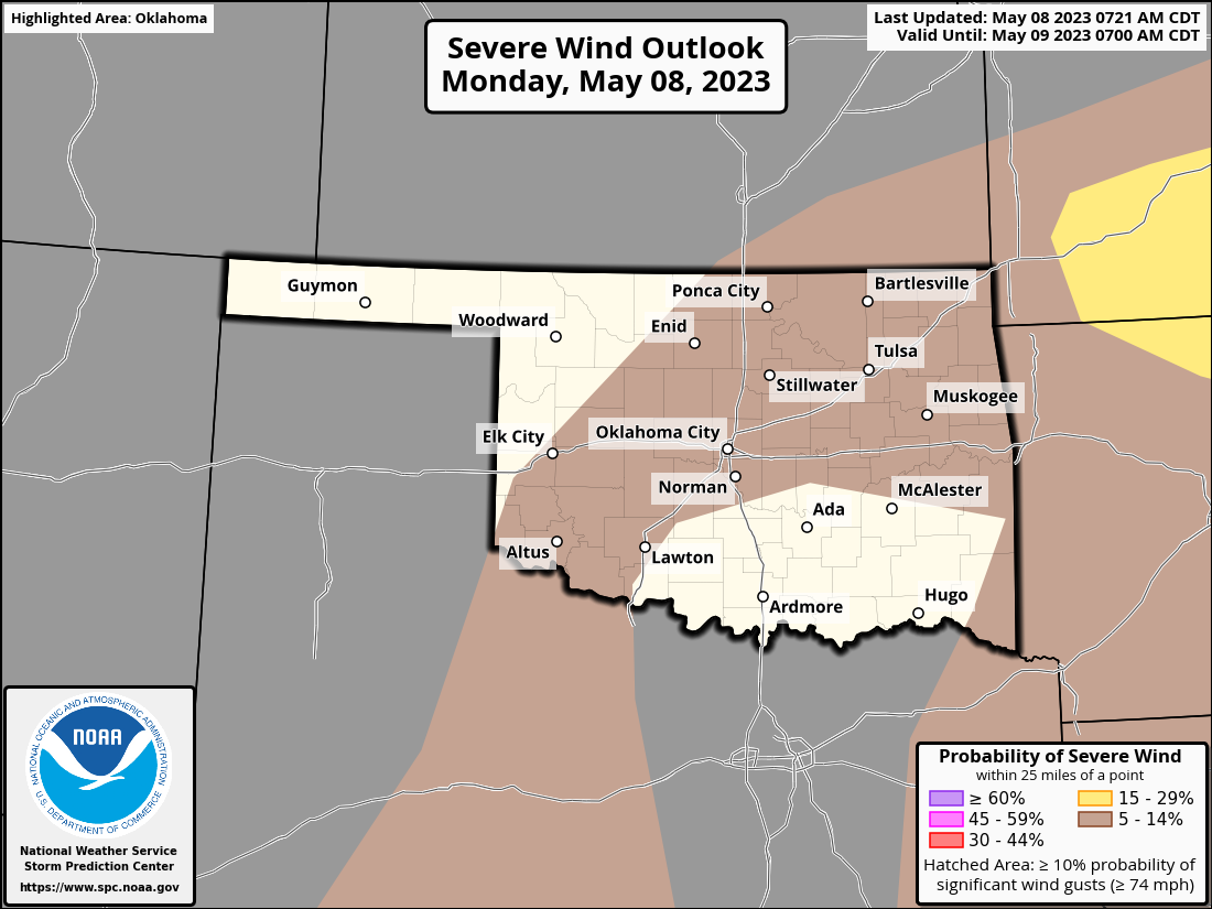
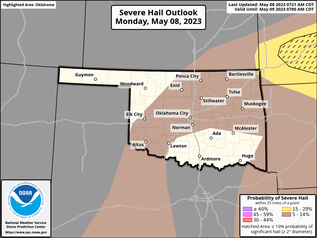
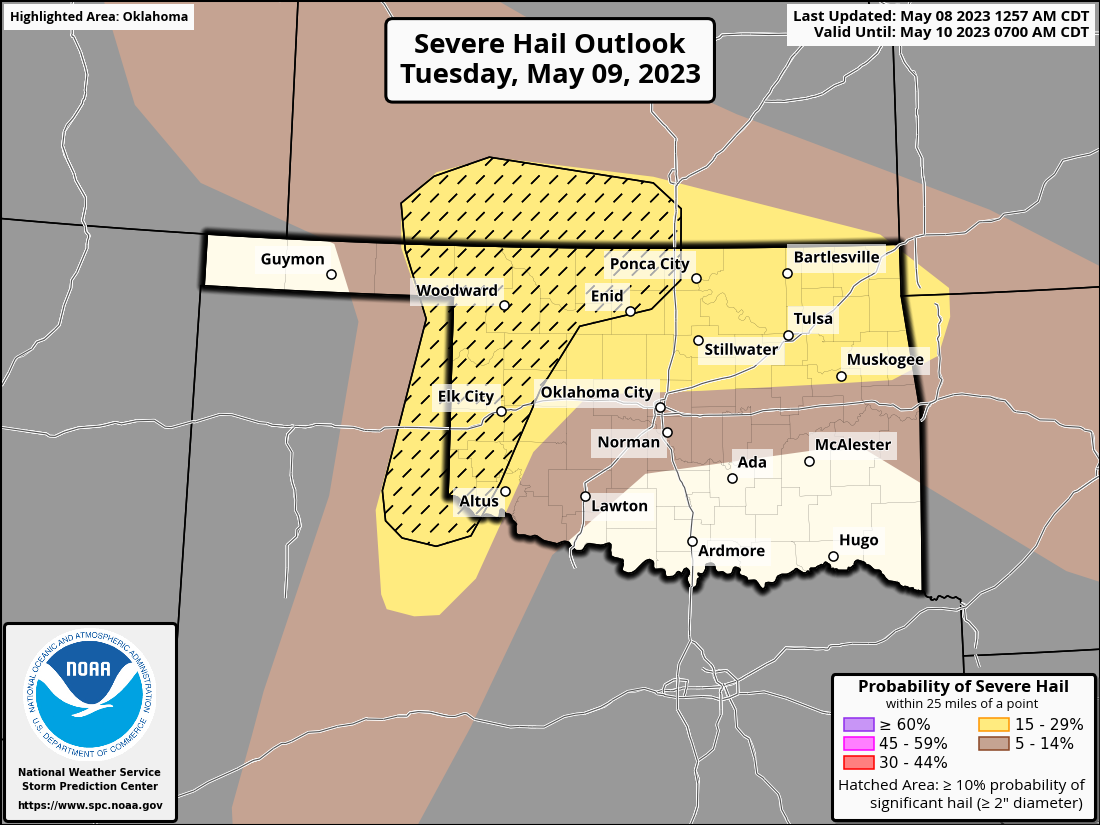
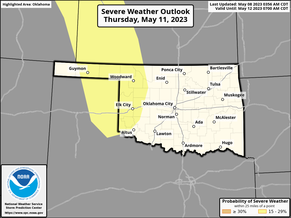
There will be the chance for severe weather off and on throughout the week,
and maybe into the weekend, but nothing like classical May severe weather
scenarios. We seemingly had that in April before we skipped right into June.
With shear being nothing to write home about, watch for messy storms with some
big hail and high winds, but the tornado threat will remain very low.
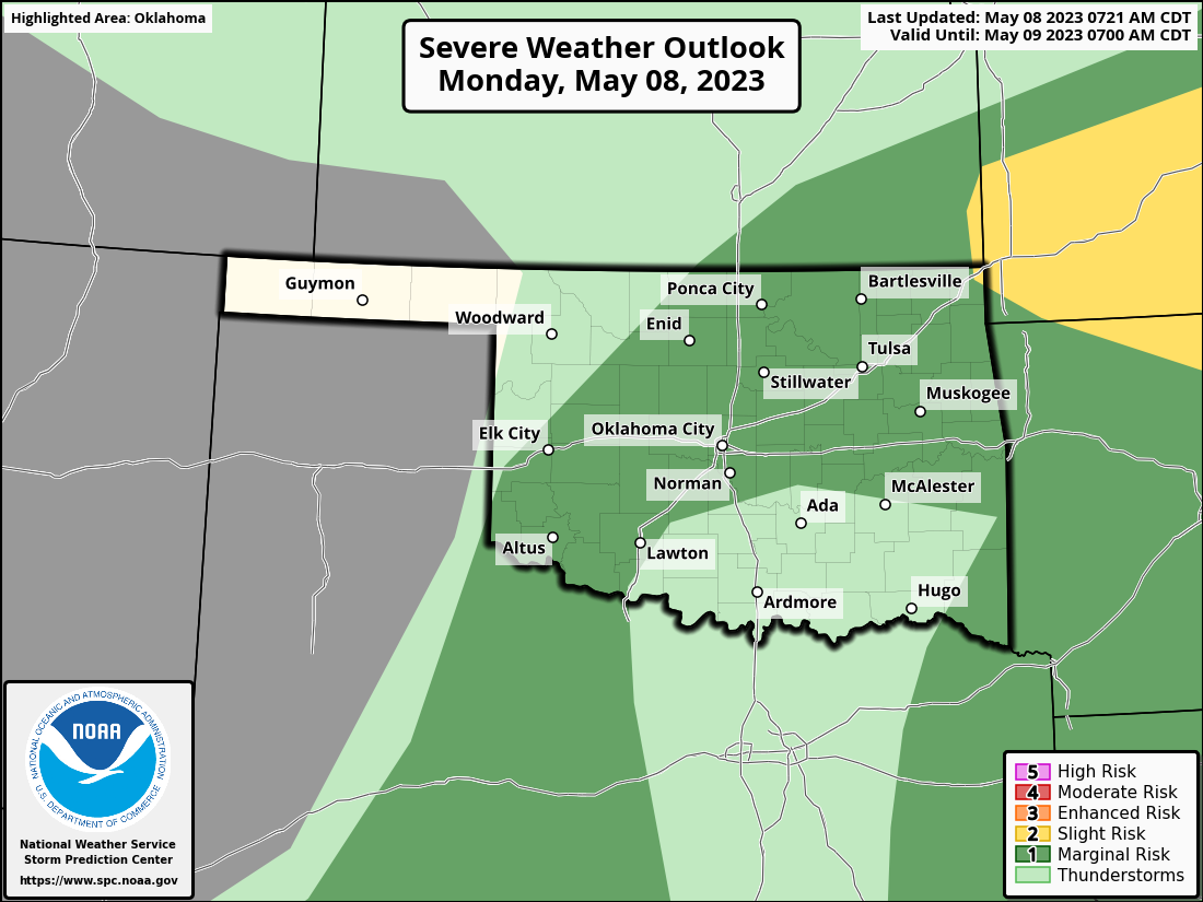
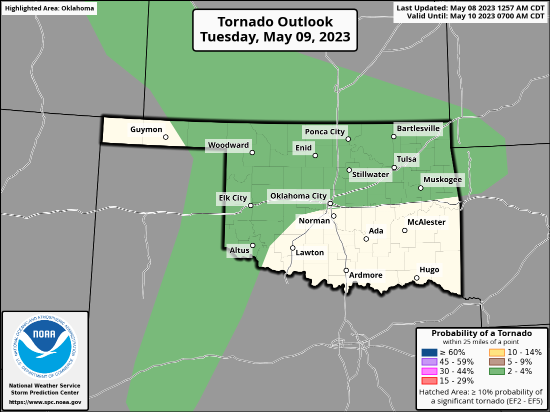

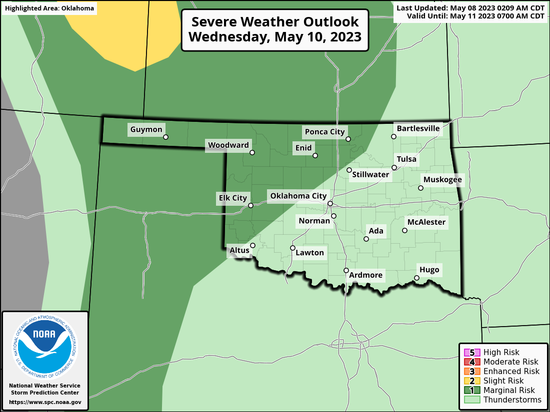
You have to stay weather aware this week, however, because it IS Oklahoma after
all, and much like after eating Taco Bell...things could turn nastier as we go
forward. The rain over the past few days did at least fill in some of those
precipitation holes from our big rains of 2 weeks ago.
So June for a couple more days, then back to April/May, then straight to July
probably. Because variety is the spice of like I guess.
Gary McManus
State Climatologist
Oklahoma Mesonet
Oklahoma Climatological Survey
gmcmanus@mesonet.org
May 8 in Mesonet History
| Record | Value | Station | Year |
|---|---|---|---|
| Maximum Temperature | 108°F | ALTU | 2011 |
| Minimum Temperature | 34°F | CHER | 2010 |
| Maximum Rainfall | 5.86 inches | FTCB | 2007 |
Mesonet records begin in 1994.
Search by Date
If you're a bit off, don't worry, because just like horseshoes, “almost” counts on the Ticker website!