Ticker for February 15, 2023
MESONET TICKER ... MESONET TICKER ... MESONET TICKER ... MESONET TICKER ...
February 15, 2023 February 15, 2023 February 15, 2023 February 15, 2023
Not just another Wednesday
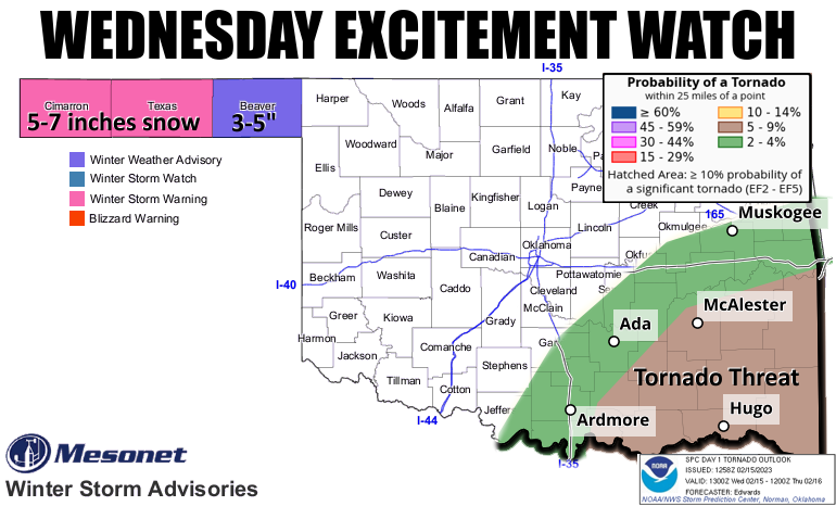
I know we've combined two agencies in one in this graphic (sorry, Mesonet gets
top billing!), but I just wanted to have some way to show you how one storm system
is going to provide vastly different experiences to two vastly different parts of
the state. And it's rather fitting, since there aren't two more disparate (English
to Okie translation: "different") areas WITHIN the state. But like we needed more
excitement, right? Did you enjoy the grit in your teeth and eyes yesterday?
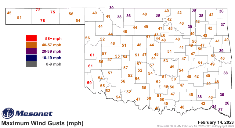
Geez, sometimes the fun is in overdoing it, am I right Ladies and Gentlemen? Winds
will kick up again today, but nothing like yesterday, which I like to call
"testerday," since we were all tested to within an inch of our sanity. Today's
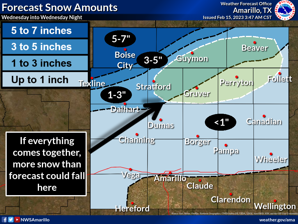
excitement includes a massive winter storm to our NW which will clip the, uhhhhh,
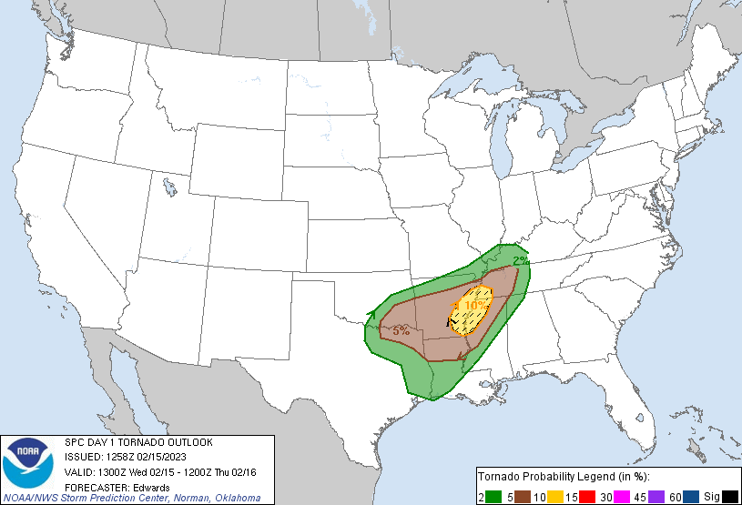
NW part of our state. And also some fairly significant severe weather to our
SE which will clip the, uhhhhh, SE part of our state. Weird how all that works, no?


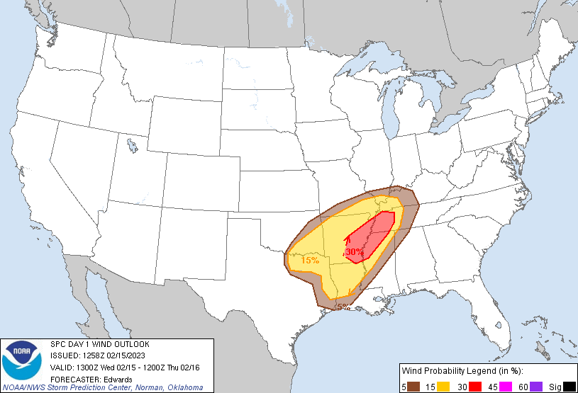
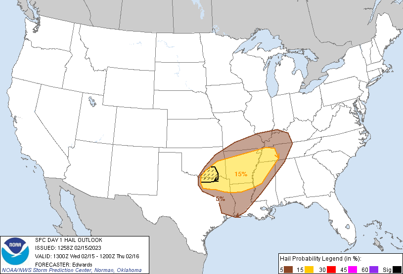
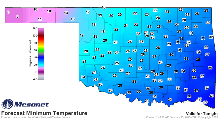
For the rest of us (sorry, no Festivus), we get to watch from afar. I'm afraid
our excitement will be confined to that strong arctic front's passage, which will
take us back to winter in a hurry.


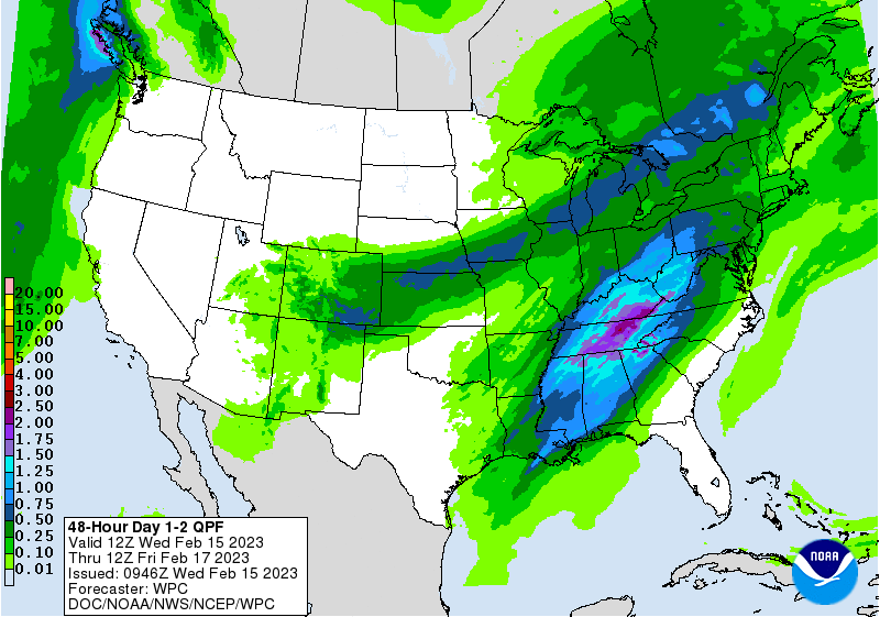
We will see some pretty decent moisture up in the Panhandle, albeit in a very
indecent form.
Following this excitement, we rebound pretty quickly to our previous pre-spring
pattern as we draw closer and closer to winter's inexorable (English to Okie
translation: "unable to stop!") end.
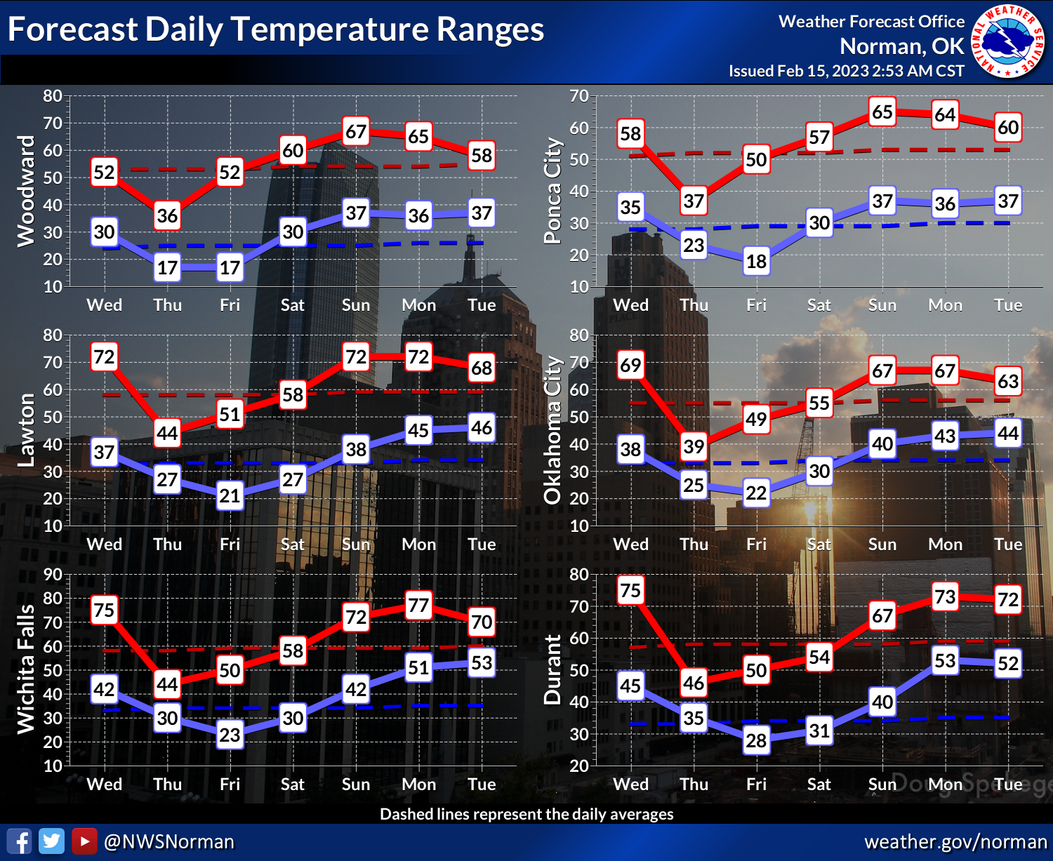
It looks like we'll largely avoid our experiences from February 2022 (COLD!)
and February 2021 (FOREGETABOUTIT!), but still enough of the month left where
something frigid this way could come. There's still lots of wrangling and
hand-wringing (and we all know just how painful that can be) over a sudden
stratospheric warming event over the Arctic, which can lead to a disruption of
the Polar Vortex, which can lead to bigtime cold weather happenings in the
North American continent, but that's very difficult to predict or determine
potential impacts.
And we always have March, right?
Gary McManus
State Climatologist
Oklahoma Mesonet
Oklahoma Climatological Survey
gmcmanus@mesonet.org
February 15 in Mesonet History
| Record | Value | Station | Year |
|---|---|---|---|
| Maximum Temperature | 86°F | BURN | 2000 |
| Minimum Temperature | -22°F | KENT | 2021 |
| Maximum Rainfall | 2.12″ | CLOU | 2001 |
Mesonet records begin in 1994.
Search by Date
If you're a bit off, don't worry, because just like horseshoes, “almost” counts on the Ticker website!