Ticker for February 9, 2023
MESONET TICKER ... MESONET TICKER ... MESONET TICKER ... MESONET TICKER ...
February 9, 2023 February 9, 2023 February 9, 2023 February 9, 2023
Snowklahoma
Not to get too personal, Ladies and Gentlemen (and most of the rest of you), but
let me get too personal. I didn't know it was going to snow last night. I had no
clue, which according to my wife is my normal state of mind. But it DID snow and
it snowed HARD! I also had no clue we were going to have widespread travel
problems this morning with the leftover snow and then the most horrid of all
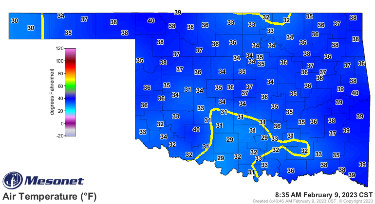
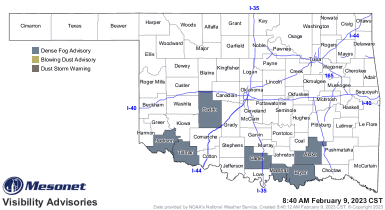
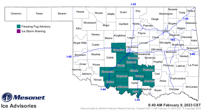
ambience weather phenomena...freezing fog. But that's what we're dealing with
this morning, although that should be going away pretty quickly with the sun.
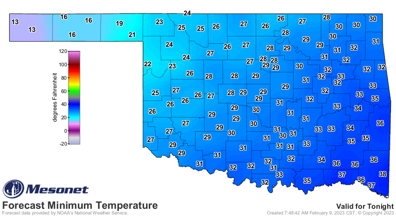
With a chance of a repeat tonight, let me give a bit of advice, and a word of
caution. Do NOT drink milk with Taco Bell. There, I said it. But here's some
more...don't believe that there will be no travel impacts with snow even if you're
a bit above freezing. Well, if the air is above freezing, if you aren't then
enjoy your brains. Especially if it's heavy snow. something to keep in mind
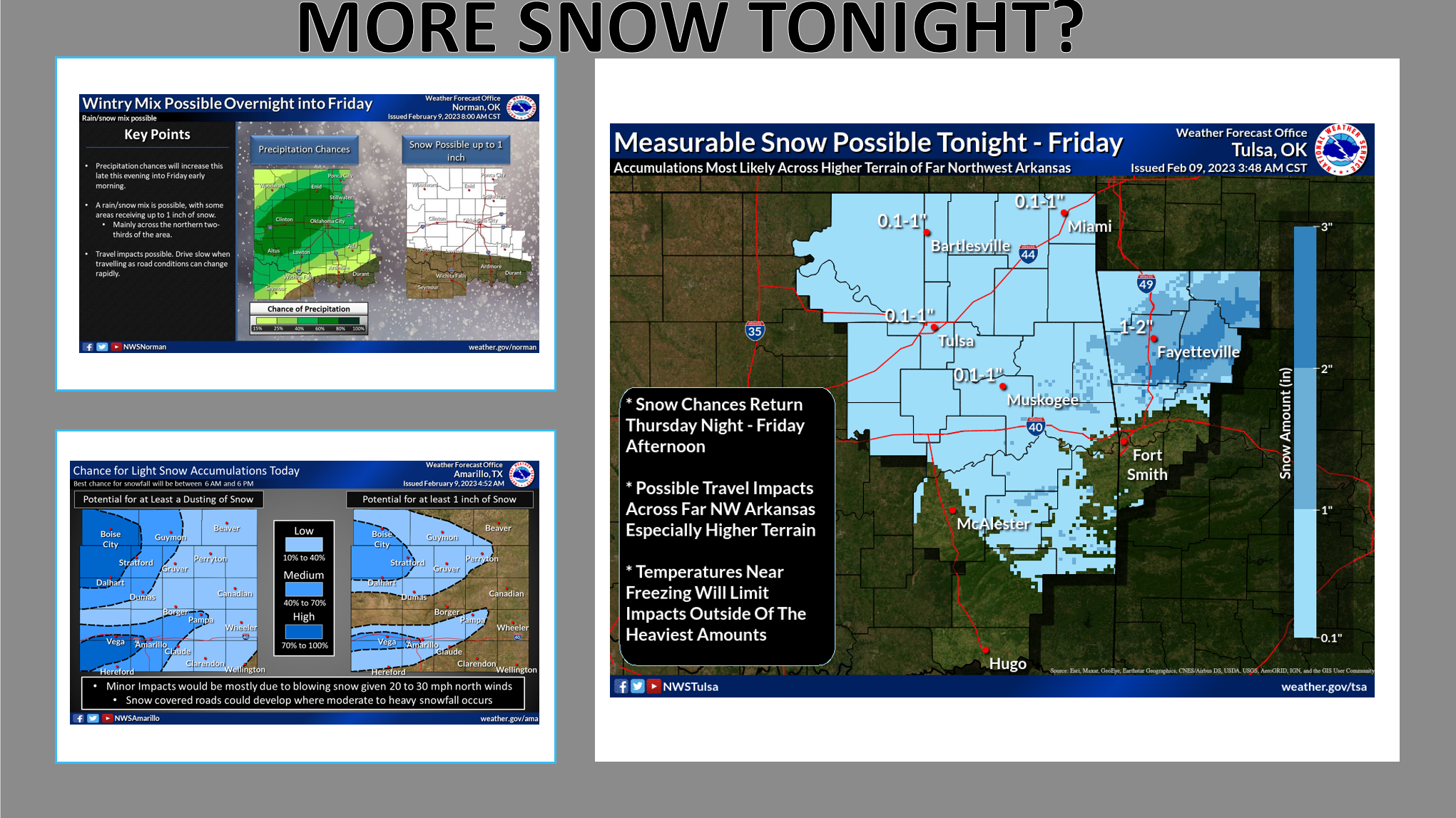
tonight if we see that repeat from last night. It does appear somebody could
end up with a good inch, with maybe more in some localized places. Just assume
if you see snow falling, there might be some travel impacts, just to be safe.
And we will drop below freezing again, so tomorrow's commute might be a bit
icy AND dicey.
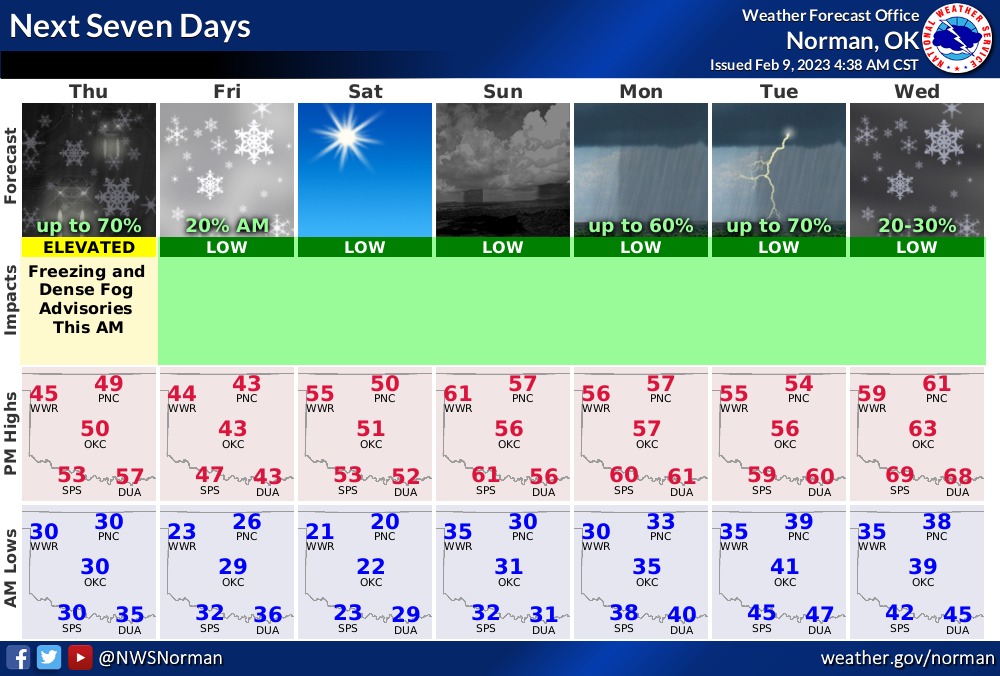
And that isn't the end of our precip chances, we should see a pretty good
chance for rain Sunday into Tuesday, then again on Wednesday.
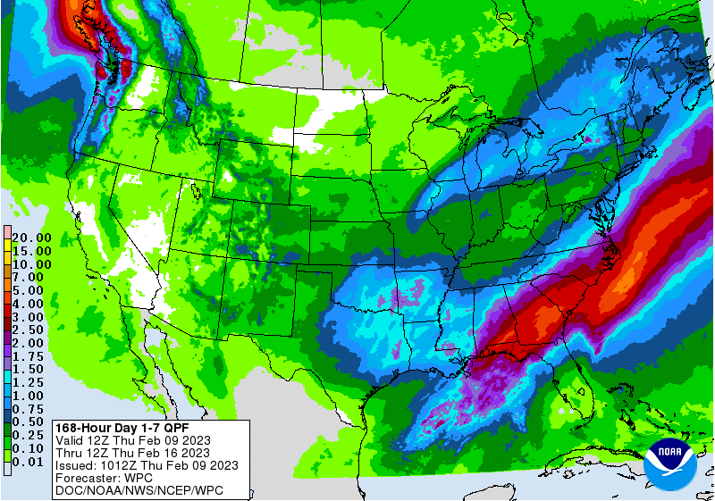
Needs to spread to the NW...you know the drill. They're drought central in the
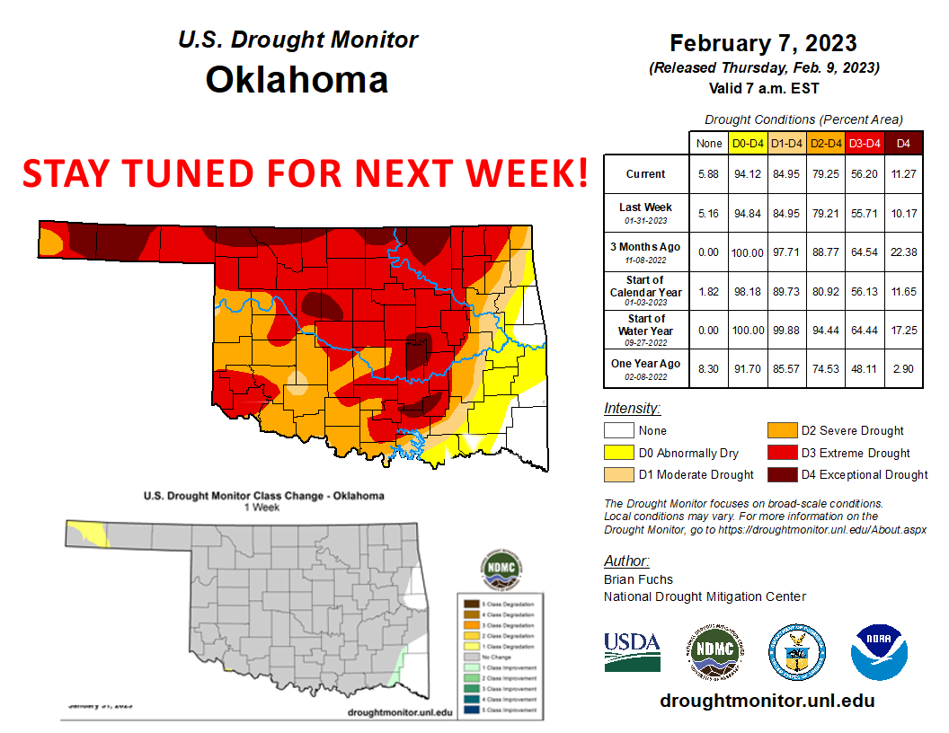
state now. Speaking of drought, the new Drought Monitor map doesn't show many
changes, just some worsening in the western Panhandle and a bit of improvement
in the far SE. Now you might be asking yourself: "Bug Gary, it rained a TON
the last few days, why didn't the Drought Monitor map show lots of improvements?"
First off, quit calling yourself Gary! You have to earn that name and all the
poor outcomes that come with it! Think I'm kidding? Watch any show or TV and
see who is usually named "Gary." But I digress...here's the deal: the Drought
Monitor process goes from Tuesday to Tuesday, with the maps released on Thursday.
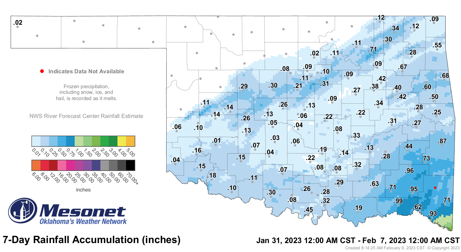
In order to have a stopping point for the national author and prevent a host
of last-minute changes possibly delaying the map, we can only consider precip
that has fallen from 6 a.m. Tuesday to 6 a.m. the following Tuesday. So this
is what we had to work with on this week's map.
And THIS is what we will have to work with on next week's map (but keep in mind
whatever falls from now to 6 a.m. next Tuesday also gets added on).
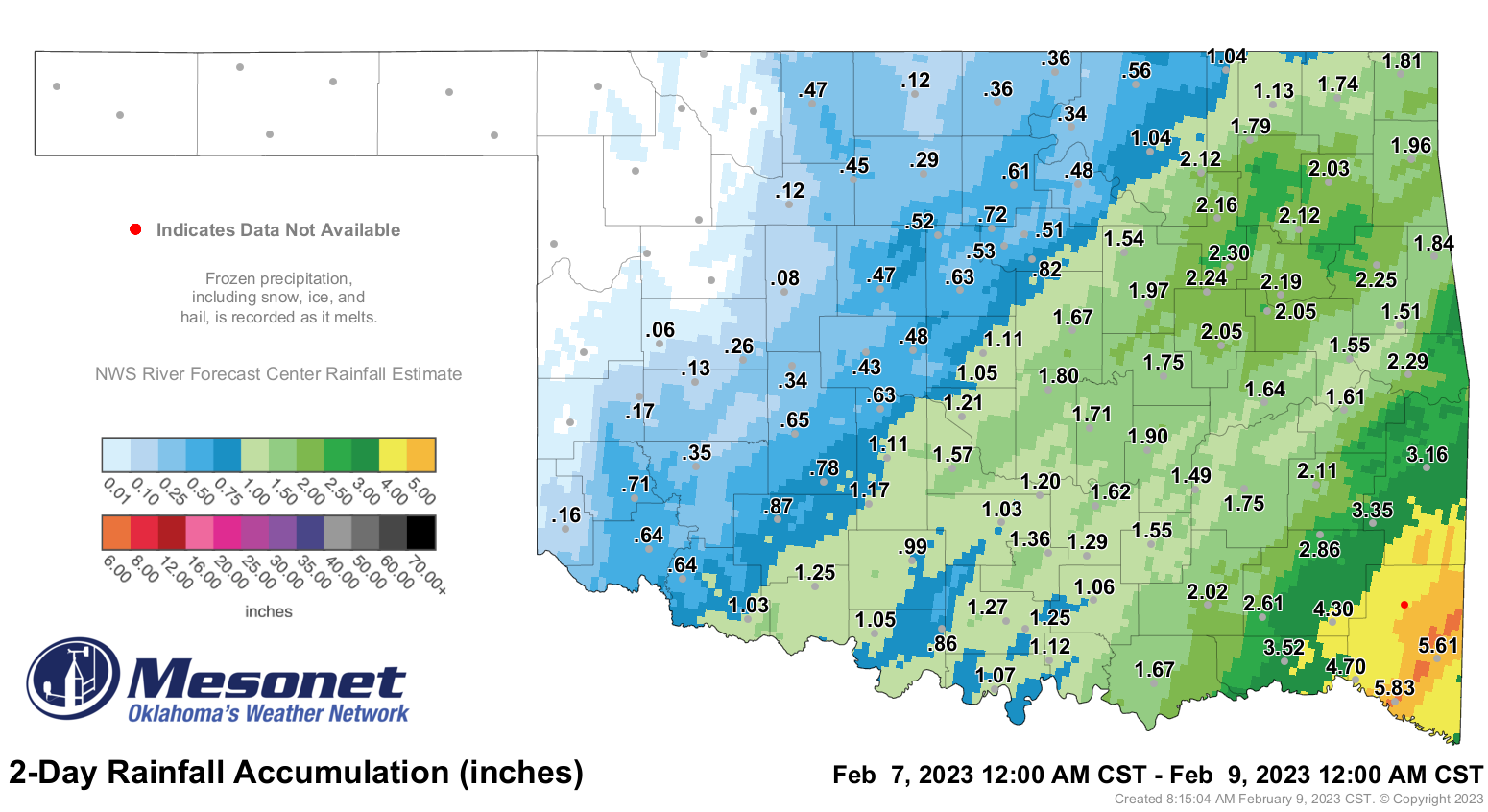
Blending recent rains into the long-term lack of rainfall, especially in the
cool season, can be really tricky. But improvements can be expected next week.
Gary McManus
State Climatologist
Oklahoma Mesonet
Oklahoma Climatological Survey
gmcmanus@mesonet.org
February 9 in Mesonet History
| Record | Value | Station | Year |
|---|---|---|---|
| Maximum Temperature | 82°F | GRA2 | 2000 |
| Minimum Temperature | -18°F | MEDF | 2011 |
| Maximum Rainfall | 1.02″ | VINI | 2001 |
Mesonet records begin in 1994.
Search by Date
If you're a bit off, don't worry, because just like horseshoes, “almost” counts on the Ticker website!