Ticker for February 1, 2023
MESONET TICKER ... MESONET TICKER ... MESONET TICKER ... MESONET TICKER ...
February 1, 2023 February 1, 2023 February 1, 2023 February 1, 2023
Too many Ices
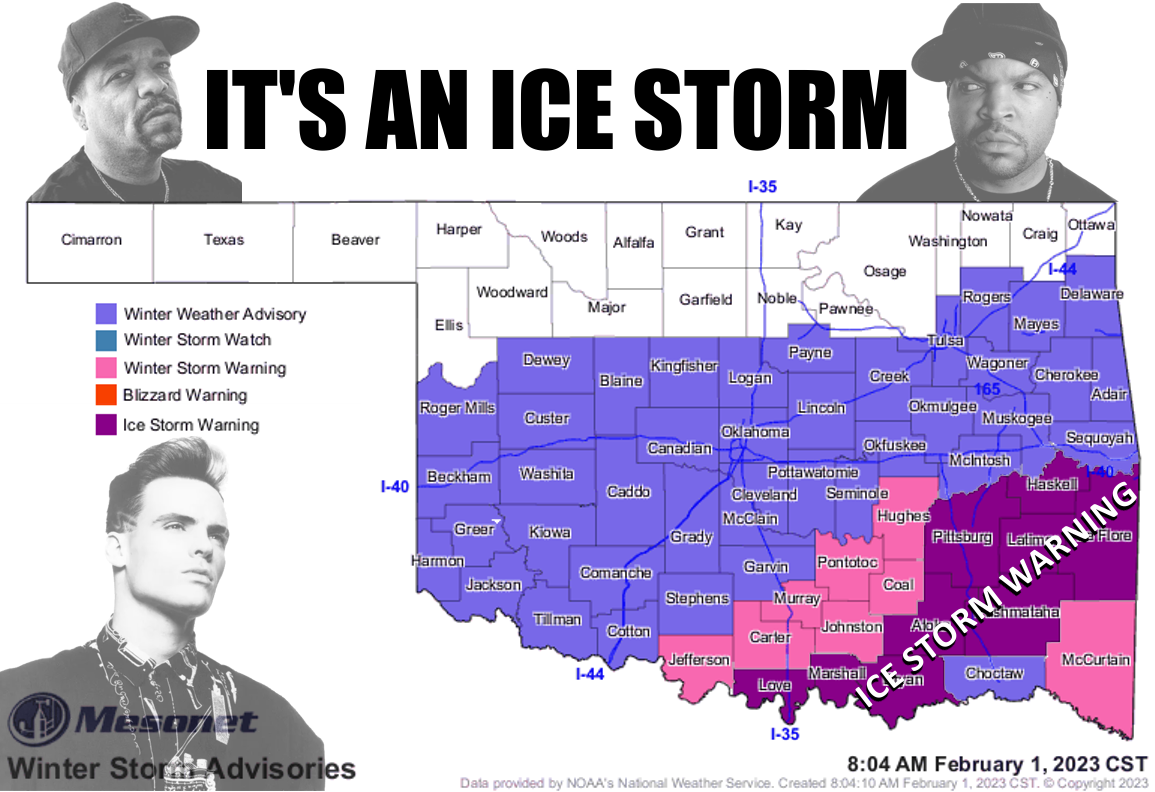
THAT'S IT, WE'RE COMPLETELY OUT OF CELEBRITY ICES! And we're completely over this
winter storm(s). Can't we go back to last week's Norman Rockwell half-dollar
size snowfall? Better yet, can't we go back to the first 3 weeks of January that
were on pace for the warmest January on record (see summary below).
Interesting, no? Well how about this...the 5 (5! [FIVE!]) tornadoes that touched
down on Jan. 2 were the earliest in the calendar year on record in Oklahoma, at
least dating back to 1950 when the most accurate records began. And that was also
the highest for any January on record as well (see summary below). How does that
bode (English to Okie translation: "help predict") for the rest of the year? Well,
not much of anything, but it's the 2020s so expect anything.
Oh yeah, back to today's ice, which will also run into tomorrow. Once again
I'll let our NWS friends (it wasn't easy, we had to tie a tornado to a rope and
hang it around our neck) tell the story there.
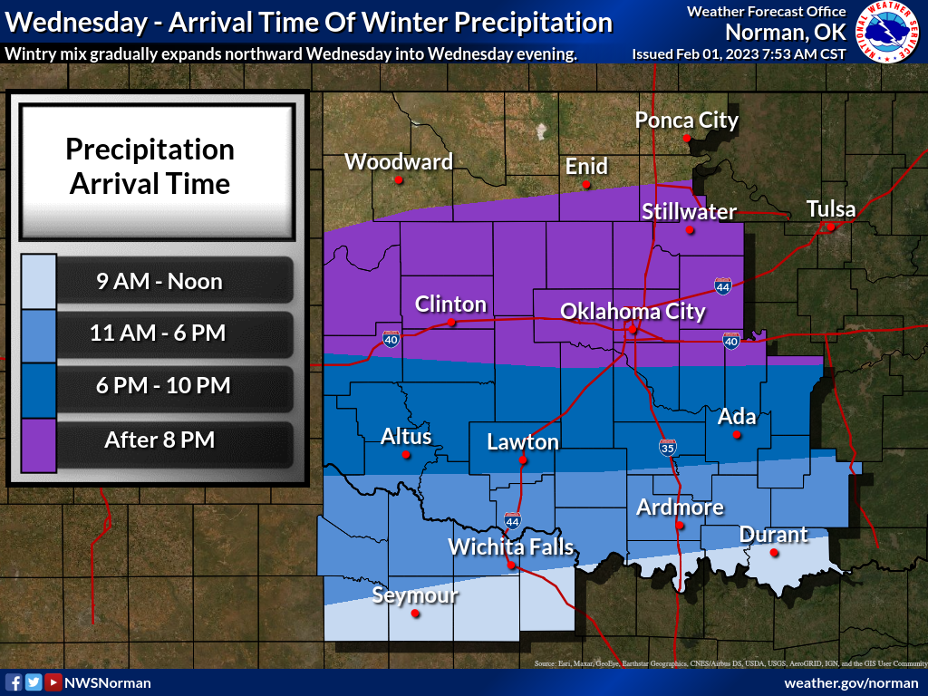
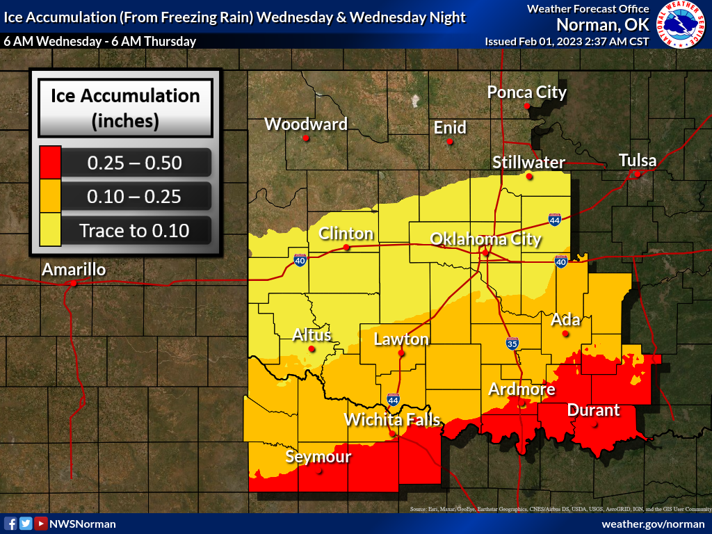

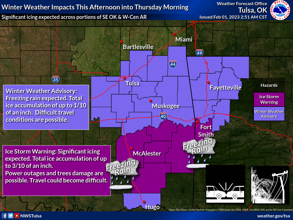
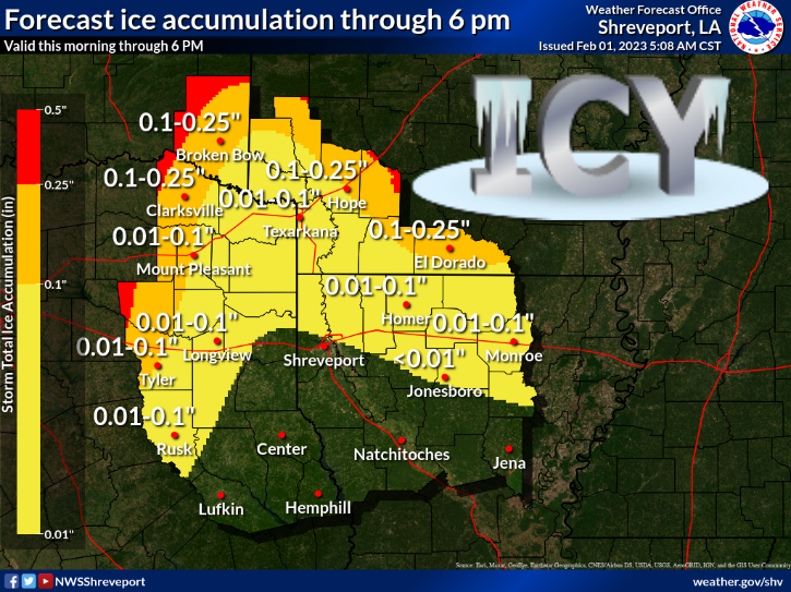
Don't worry, just another day and we start our march back to March...better known
as February. I hope.

----------------------------------------------------------------------------------
Tornadoes, Ice Highlight January Weather
Oklahoma’s January 2023 may have begun with a springlike bang, but it ended with
a more appropriate wintry punch. Warm weather dominated the first three weeks of
the month, and was on pace to become one of the warmest Januarys on record
before winter crashed the party. The early springlike weather also brought
Oklahoma its earliest tornadoes within the calendar year since accurate records
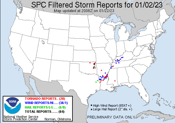
began in 1950. On Jan. 2, severe storms developed across northeastern Oklahoma
and quickly became tornadic, producing five confirmed tornadoes according to
the National Weather Service. Not only were the twisters the earliest on record,
but the total was also the highest for any January since 1950, besting the four
touchdowns recorded in 1957, 1967, 2008, and 2021. The five twisters were
generally weak, but still produced damage to homes, outbuildings, and trees. An
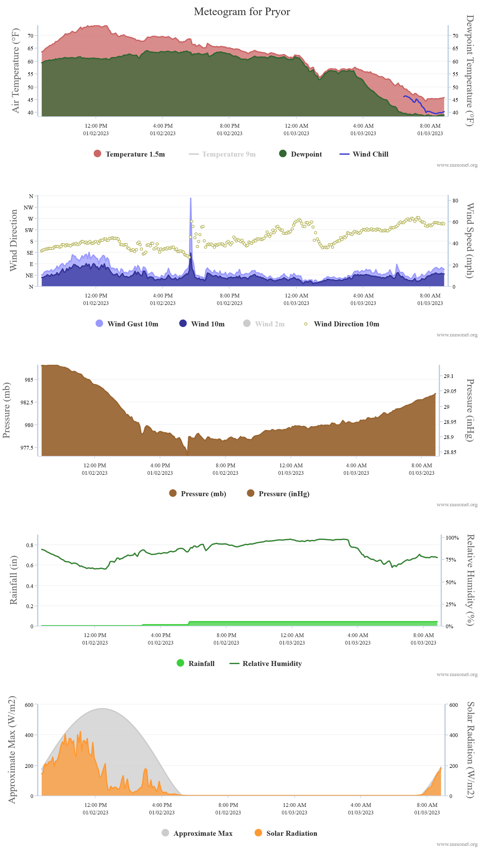
EF-0 tornado that touched down near Pryor moved over the Oklahoma Mesonet site
there, producing a wind gust of 81 mph.
Highs in the 60s and 70s during January’s first three weeks were replaced with
snow, sleet, and freezing rain over the month’s final 10 days. The first winter
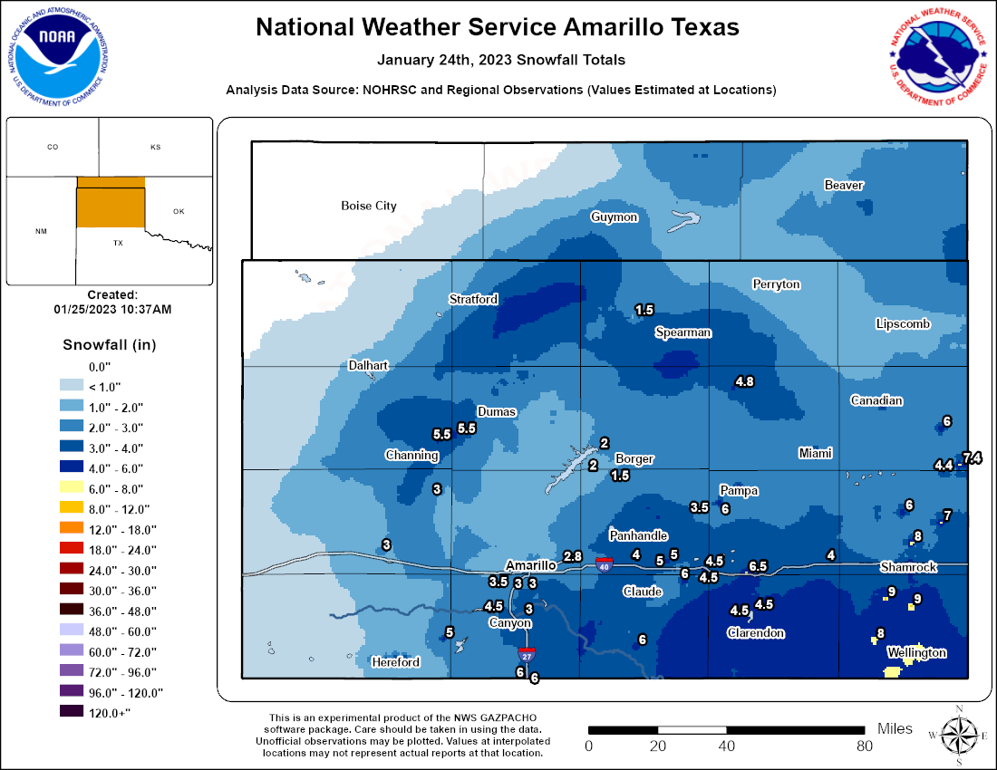
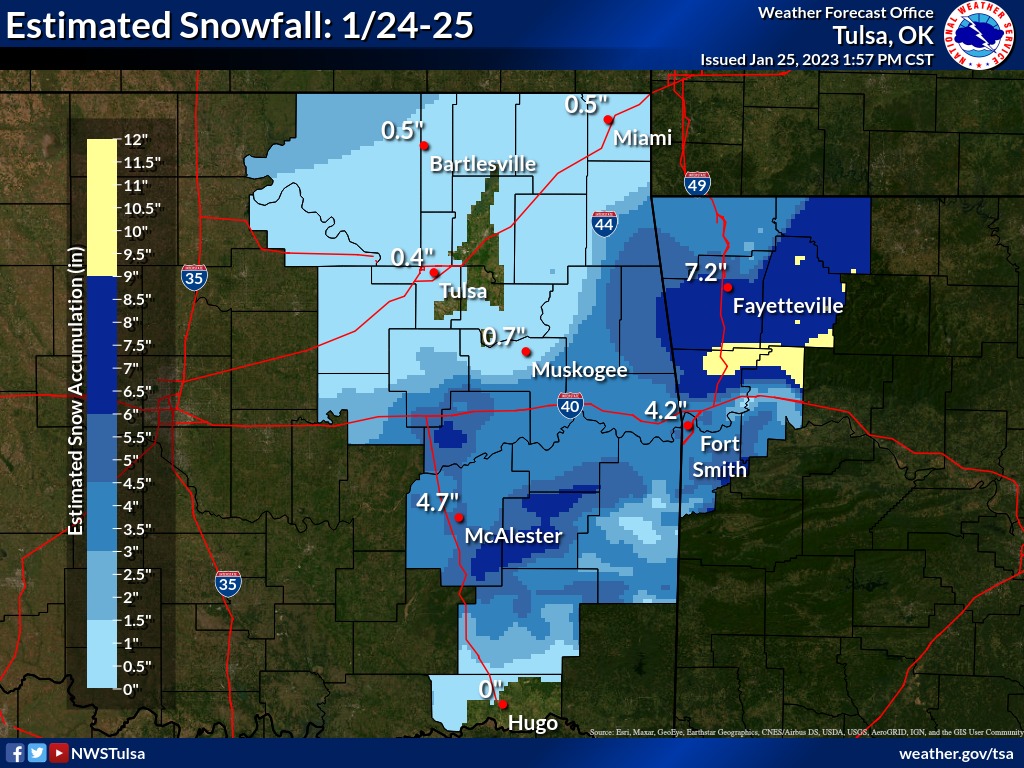
storm on Jan. 23-24 brought the type of picturesque snowfall rarely seen in
Oklahoma. Temperatures hovered near freezing in the state, which helped produce
snowflakes to the size of half-dollars that fell into a near windless
environment, an oddity on most days in Oklahoma. West central Oklahoma saw 6-8
inches of snow with Erick leading the state at 8.9 inches. Locations in central
and eastern Oklahoma reported 4-6 inches, and nearly everybody saw at least
some snow, albeit briefly.

The second winter storm struck just a few days later, but this version was
accompanied by frigid arctic air with highs in the teens and 20s and wind
chills in the single digits to below zero. There were two separate waves of
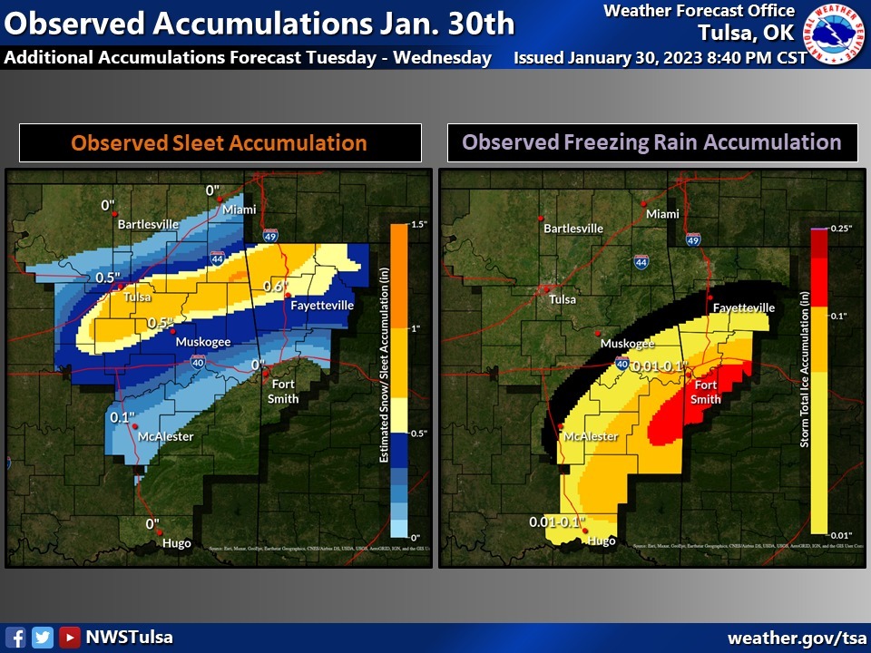
frozen precipitation over the month’s final two days. Thunder-sleet greeted
Oklahomans to start the day on the 30th, the convective activity dumping 1-1.5
inches of sleet along the Interstate 44 corridor. Freezing rain fell across
southern Oklahoma, enough to glaze trees and other exposed objects. The second
round early on the 31st brought more sleet and freezing rain across southern
and central Oklahoma, but not quite as widespread as the previous day.
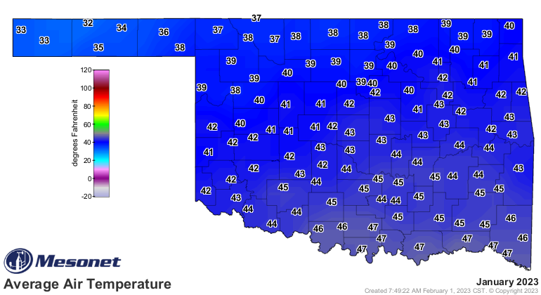
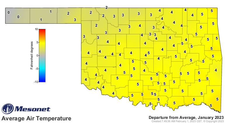
The statewide average temperature finished at 41.9 degrees for the month, 3.6
degrees above normal and ranked as the 15th warmest January since records began
in 1895. The highest reading of the month, 85 degrees, was recorded at
Burneyville on the 11th. Temperatures of at least 80 degrees were recorded 14
times across three days at the 120 Mesonet sites, and at least 70 degrees 374
times on 10 separate days. The lowest January temperature was 2 degrees at
Boise City on Jan. 30 and again at Eva on Jan. 31. The lowest wind chill was
minus 14 degrees at Eva, Goodwell, and Hooker, all on Jan. 30.
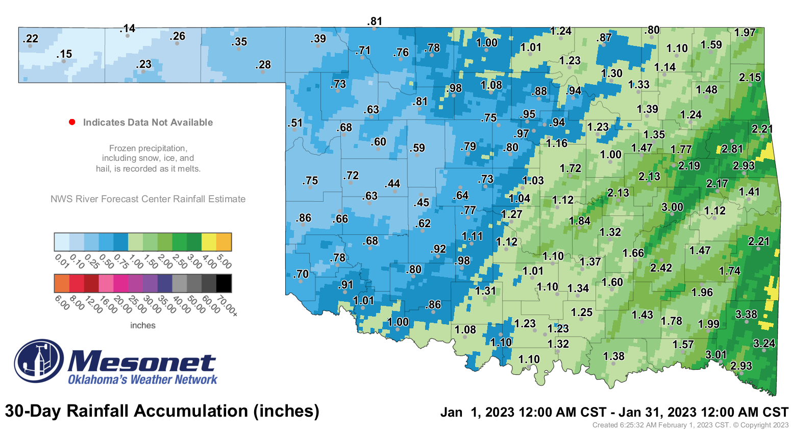
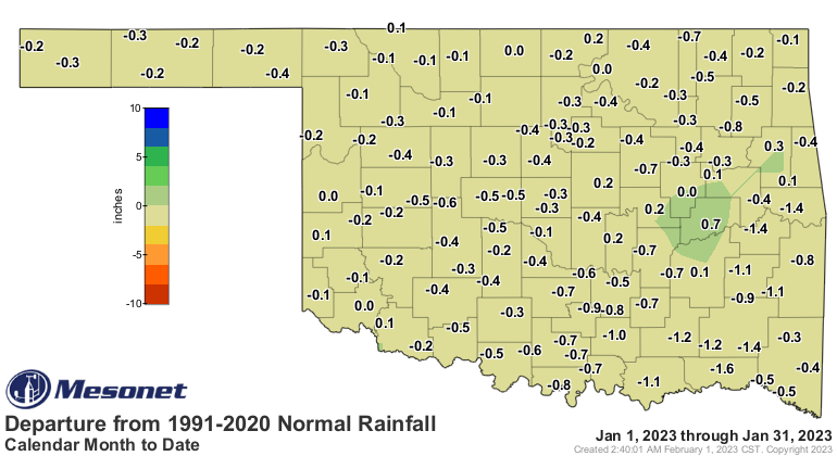
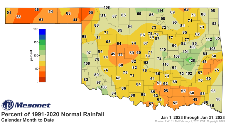
Statewide average precipitation finished with a preliminary total of 1.17
inches for the month, 0.4 inches below normal and ranked as the 58th driest
January since records began in 1895. That monthly total was expected to rise as
frozen precipitation continued to melt and be accounted for across much of the
southeastern two-thirds of the state. Far eastern Oklahoma had the greatest
totals of 3-4 inches, with a few localized areas with 4-5 inches evident on
radar estimates. Much of the western half of the state ended with less than an
inch of precipitation, the Mesonet site at Eva’s 0.14 inches bringing up the
rear.
There was little change in Oklahoma’s drought situation in January, with 89% of
the state in at least moderate drought at the end of the month according to the
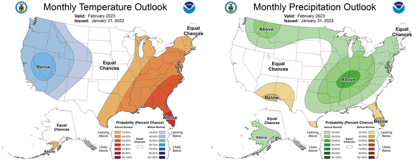
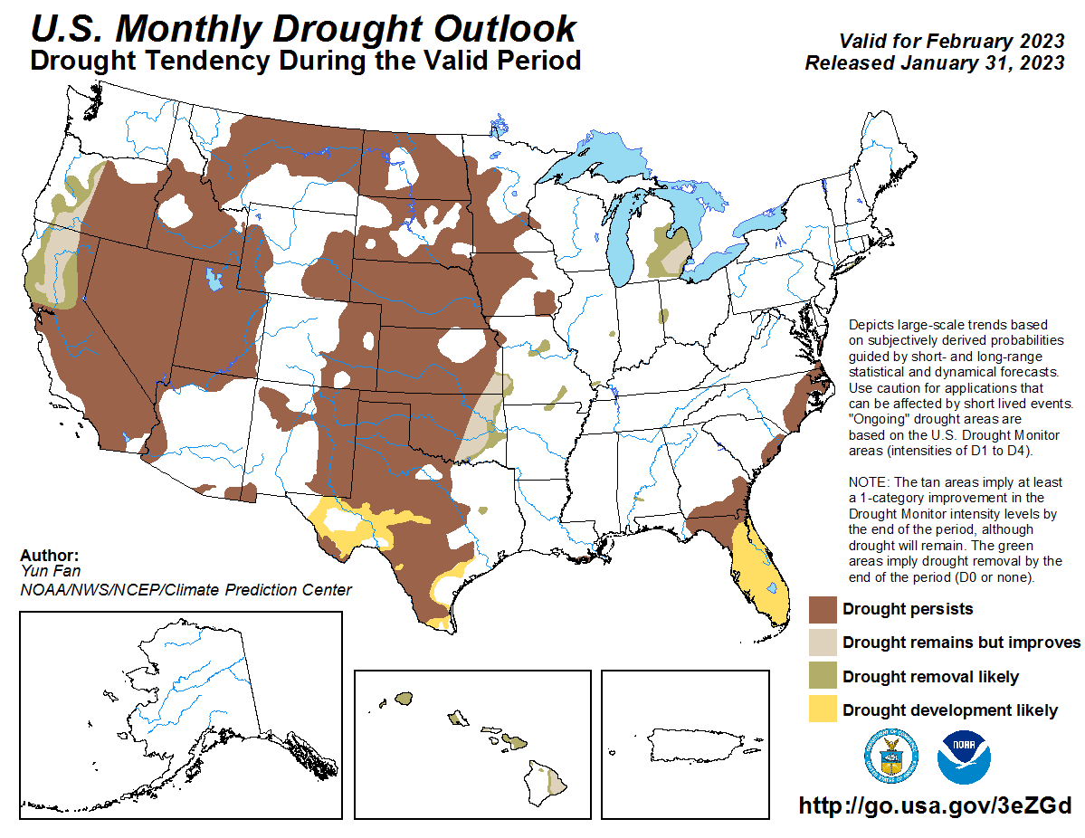
U.S. Drought Monitor. The Climate Prediction Center’s February precipitation
outlook indicates increased odds for above normal precipitation across the
eastern four-fifths of the state, but especially for the eastern one-third of
Oklahoma. The temperature outlook shows increased odds of above normal
temperatures for far southeastern Oklahoma. The hopeful precipitation outlook
leads to CPC’s February drought forecast of improvements across the eastern
one-third of the state. Drought is expected to persist across the western
two-thirds, however.
###
Gary McManus
State Climatologist
Oklahoma Mesonet
Oklahoma Climatological Survey
gmcmanus@mesonet.org
February 1 in Mesonet History
| Record | Value | Station | Year |
|---|---|---|---|
| Maximum Temperature | 81°F | SLAP | 2003 |
| Minimum Temperature | -7°F | BOIS | 2011 |
| Maximum Rainfall | 1.61 inches | MTHE | 2011 |
Mesonet records begin in 1994.
Search by Date
If you're a bit off, don't worry, because just like horseshoes, “almost” counts on the Ticker website!