Ticker for January 9, 2023
MESONET TICKER ... MESONET TICKER ... MESONET TICKER ... MESONET TICKER ...
January 9, 2023 January 9, 2023 January 9, 2023 January 9, 2023
The Dry and the Furious
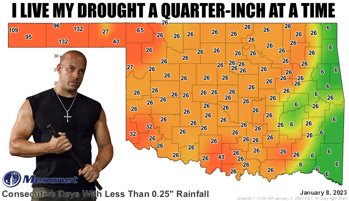
132 days...it's been 132 days since either Goodwell or Hooker have received at
least a quarter-inch of rain in a single day, and even then it was just 0.27" and
0.32" for Hooker, respectively. That was way back on Aug. 29, 2022. Here are some
fun facts about Aug. 17, 2022:
* In college football, OU was ranked #8 and OSU was ranked #12
* The top movie that week was "The Invitation" (yeah, I saw it...not good)
* You could buy a Coke and a Snickers bar for a quarter
Okay, that last one was a bit of a doozy...a quarter of $20 if you're lucky,
but it does demonstrate just how long some folks have been without substantial
rainfall. That's a bit extreme, but even folks in the main body of the state have
seen their stretch rise to 26+ days, so we are definitely in a dry stretch. And
lowering the threshold down to a tenth of an inch doesn't help much.
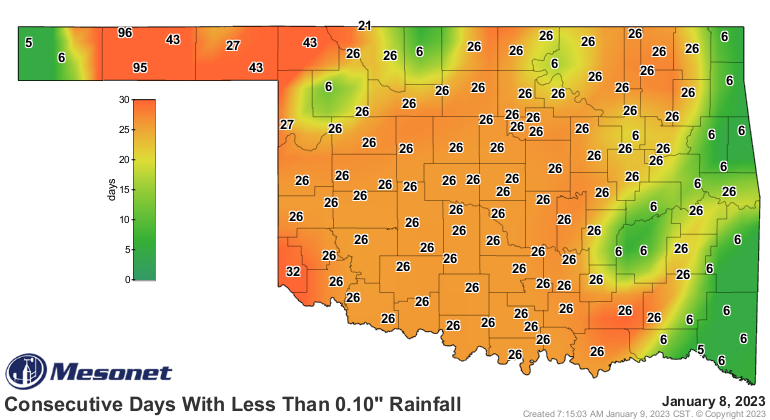
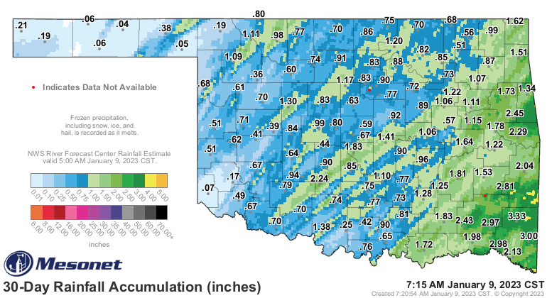
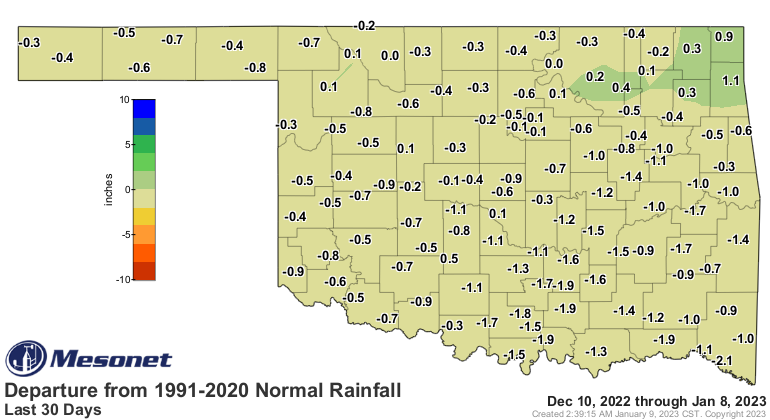
That 30-day Mesonet rainfall map is looking pretty pathetic, and trust me...I
know what looking pathetic is because mirrors exist!
Check out the percent of normal map for that same period.
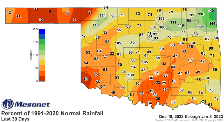
Only a few spots have above normal rainfall for the period, mostly concentrated
up in far NE OK. It's not quite that dire, however, at least for the 30-day
period because we are in the driest part of the year. So even those areas
where the pct of normal rainfall is down below 25%, those deficits are in
reality (from somebody that has questionable "reality" skills) between an inch
or two down in southern OK and maybe a half-inch or so up in NW OK.
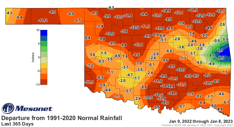
But they act as compound interest on deficits that have been going on more than
a year, and in reality (uh oh!) date back 18 months. So even this map is not
where those deficits really are.
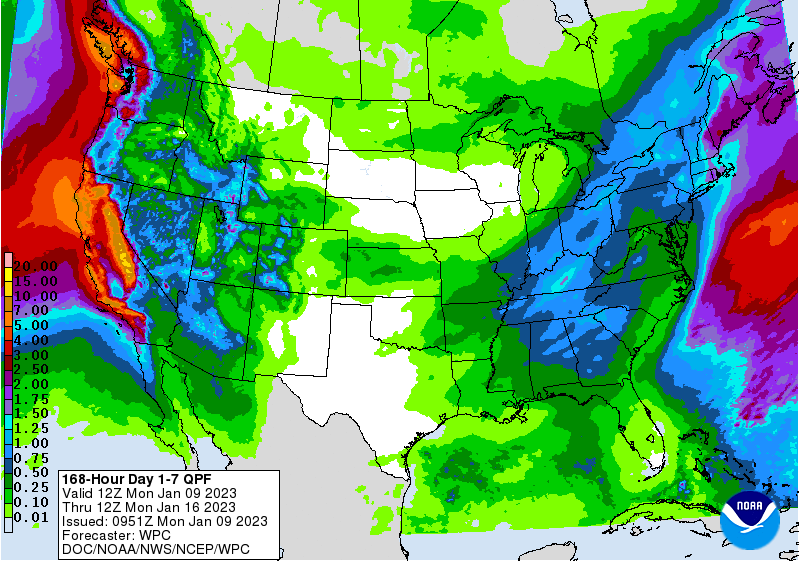
And don't expect much help in the next week or so.
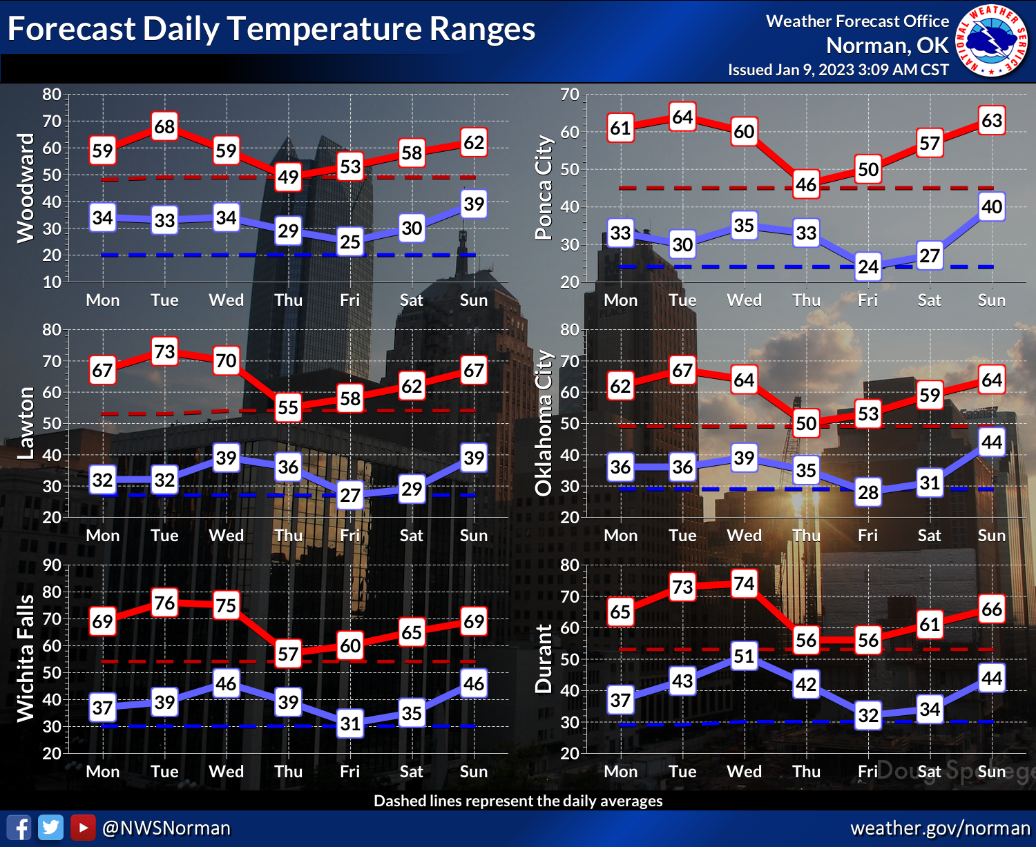
In fact, except for later in the week, temperatures should be up up UP in above
normal territory, and remain that way for the foreseeable future.

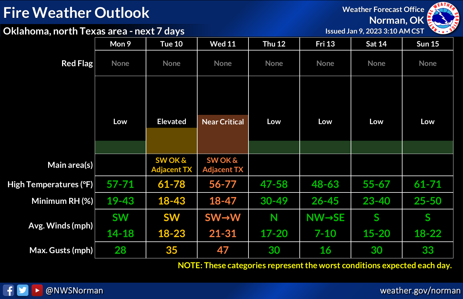
And now we're getting into the time of the year when those day-to-day weather
conditions can generate wildfire danger, with all that dead and dormant
vegetation having cured for a good long while. So when we get frontal
passages and the winds kick up with strong gusts to over 30 mph, and the RH drops
and temperatures go up before the cold front arrives, we will see that fire
danger start to kick up into the dangerous category. Wednesday is just such a
day.
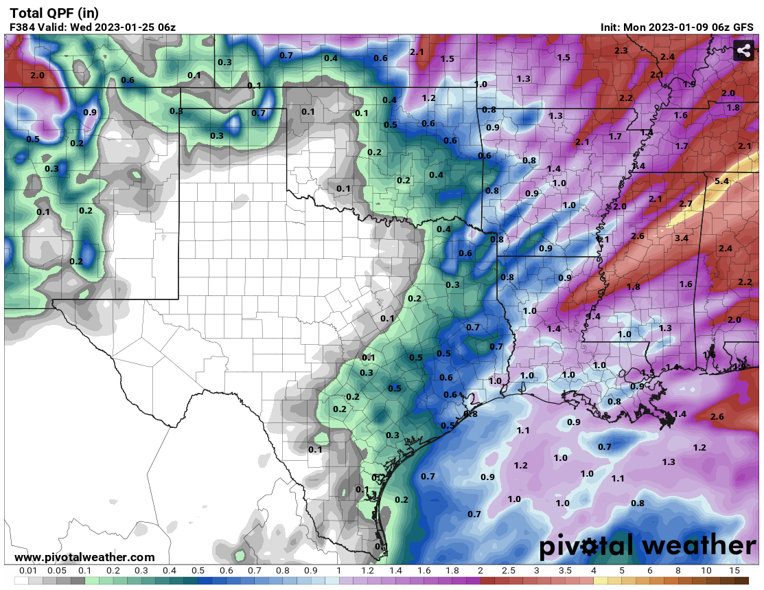
For those that want a return to winter, and some snow, not even the fantasy-casts
are helping. SNOW?? Heck, we can't even get a good rainy fantasy-cast!
Gary McManus
State Climatologist
Oklahoma Mesonet
Oklahoma Climatological Survey
gmcmanus@mesonet.org
January 9 in Mesonet History
| Record | Value | Station | Year |
|---|---|---|---|
| Maximum Temperature | 81°F | ALTU | 2009 |
| Minimum Temperature | -4°F | JAYX | 2010 |
| Maximum Rainfall | 1.09 inches | BROK | 2013 |
Mesonet records begin in 1994.
Search by Date
If you're a bit off, don't worry, because just like horseshoes, “almost” counts on the Ticker website!