Ticker for November 29, 2022
MESONET TICKER ... MESONET TICKER ... MESONET TICKER ... MESONET TICKER ...
November 29, 2022 November 29, 2022 November 29, 2022 November 29, 2022
Here comes winter!
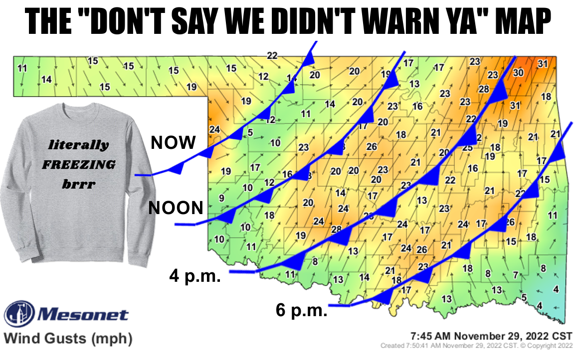
Don't be like THOSE people. You know, the ones you see running to their car in
their t-shirts when the wind chill is 20 degrees. But especially don't be like me.
You know, just like me in general. Here's the deal though...don't say we didn't
warn ya. Above you see the APPROXIMATE times of today's cold front passage. It will
march right on through the state and bring us right back to winter, but before it
gets to central OK and into the SE, we're gonna see highs warm up into the 60s and
70s.
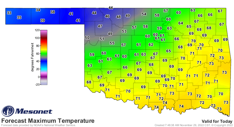
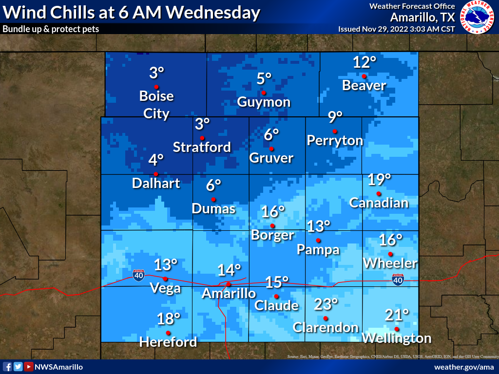
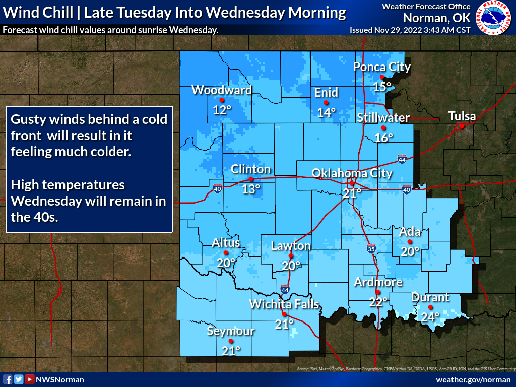
Winter officially begins for weather types on Dec. 1, but of course we've already
been in winter for some time now by weather "type." But we get these respites that
we're so accustomed to, then this happens. So be prepared for a bone-chilling
morning tomorrow with wind chills in the single-digits to the teens.
And from the "it could always be worse" department (the same department that
produces the Ticker: "Hey, it could be written worse!"), when this storm
system interacts with the rich, deep moisture to our southeast, bigtime severe
weather is expected, with large, violent tornadoes possible.
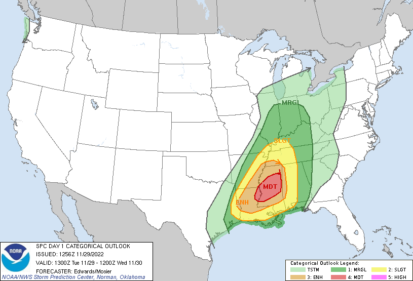
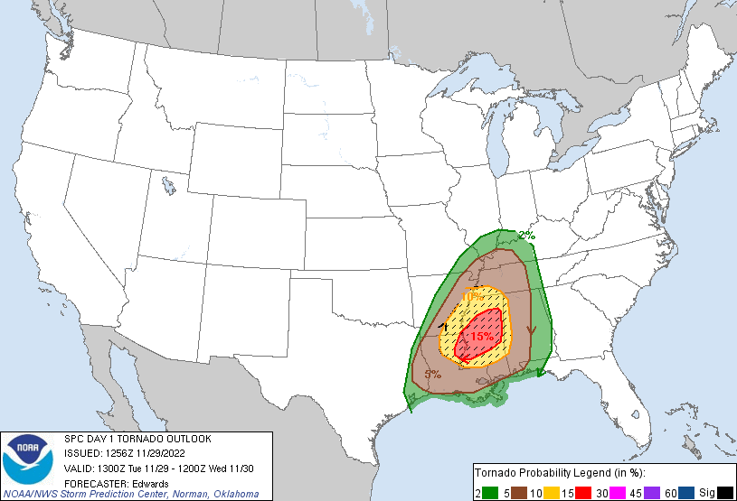
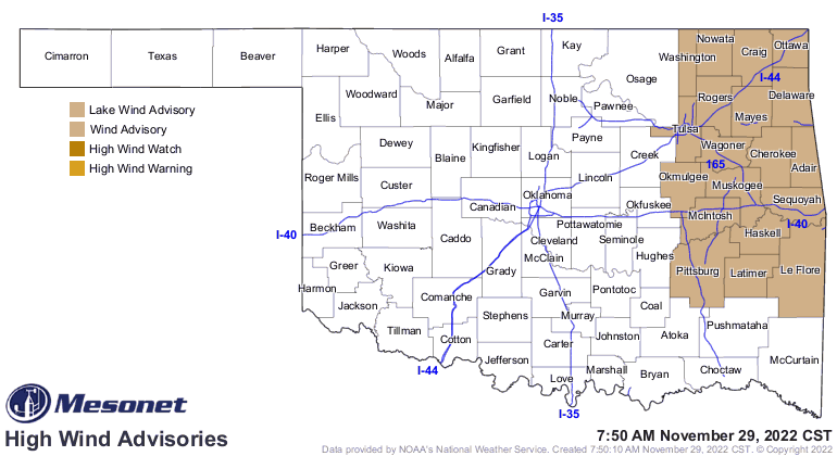
Winds are really gonna kick up across eastern OK, so keep your parkas pinned
down (I have no idea what that means, just sounded good).
Here's the kicker: in the time it took me to write this saw the front either pass
you or get closer to you, so go ahead and dread!
Gary McManus
State Climatologist
Oklahoma Mesonet
Oklahoma Climatological Survey
gmcmanus@mesonet.org
November 29 in Mesonet History
| Record | Value | Station | Year |
|---|---|---|---|
| Maximum Temperature | 84°F | ARNE | 2014 |
| Minimum Temperature | 8°F | TIPT | 2001 |
| Maximum Rainfall | 3.85 inches | TALI | 2006 |
Mesonet records begin in 1994.
Search by Date
If you're a bit off, don't worry, because just like horseshoes, “almost” counts on the Ticker website!