Ticker for November 16, 2022
MESONET TICKER ... MESONET TICKER ... MESONET TICKER ... MESONET TICKER ...
November 16, 2022 November 16, 2022 November 16, 2022 November 16, 2022
Cold shmold!
Sorry I didn't Tick yesterday, I was on the road. No, I wasn't traveling, I was
literally laying in the road in the fetal position, still upset that my house
completely whiffed on the snow.

Sorry, I didn't see any maps with totals from the Amarillo NWS office, but it
did indeed snow in the Panhandle as well.
Full disclosure (WHAT? NO, not that!), I *WAS* actually traveling yesterday, but
all I seemed to miss was more cold weather. Yeah, my worst nightmare, next to
the hair products aisle down to the Wal Marts. Cold yesterday, cold today, cold
tomorrow.
Cold cold cold.

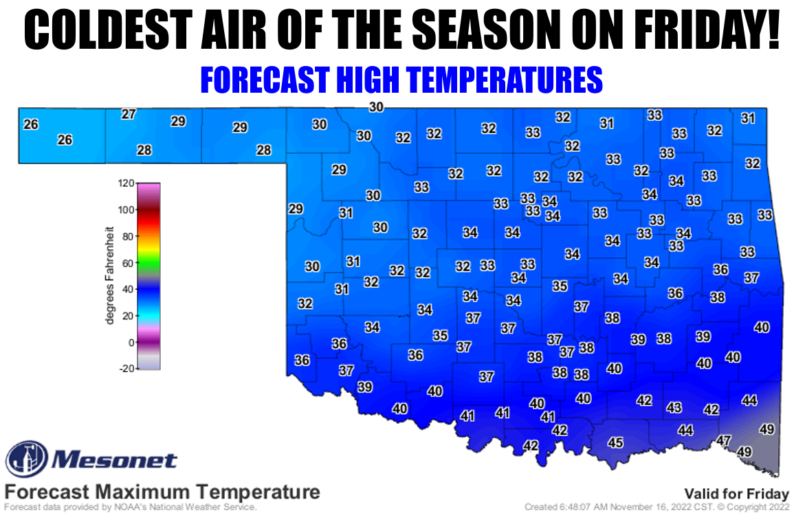
Ahh, but you see, today isn't cold, and neither was yesterday. Okay, it was
"cold," but not FRIDAY cold! That next cold front is a doozy. If we had had
that one on Monday, we'd still be blanketed in snow from Kenton to Broken Bow.
It will be the first time we've seen highs finish BELOW freezing in the state
since Westville (in far EASTERN Oklahoma!) hit 29 degrees back on March 11.
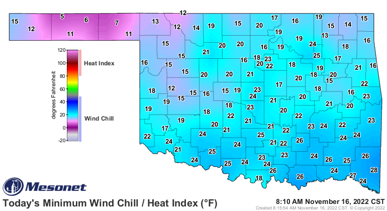
Saturday morning will be pretty brutal as well. I suspect we'll see single digits
up in the Panhandle.

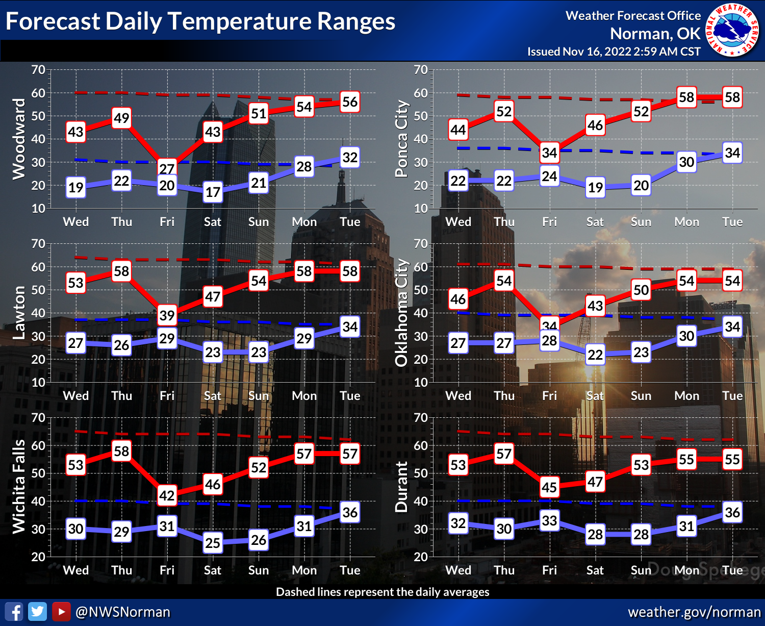
The current below-normal streak is gonna last at least through early next week,
so with that initial cold front that set off this cool/cold snap entering the
state on Nov. 10, that puts the tally at 13 days if it lasts. We will not have
seen a below-normal streak IN THE COOL SEASON since February 2021.
Yeah, THAT February 2021.
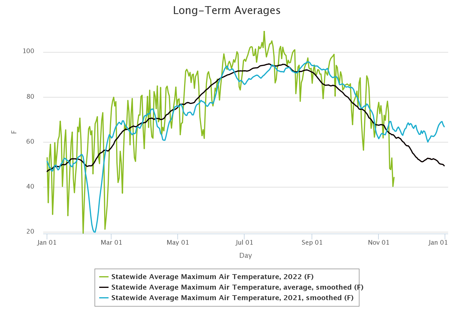
It's not as cold as that period, obviously, but still indicative of the
"weirdness" of this cool span. Check out our statewide average highs from
2021 (blue), 2022 (green), vs. the long-term Mesonet average (black).
But we have to go through this
before we get to this.
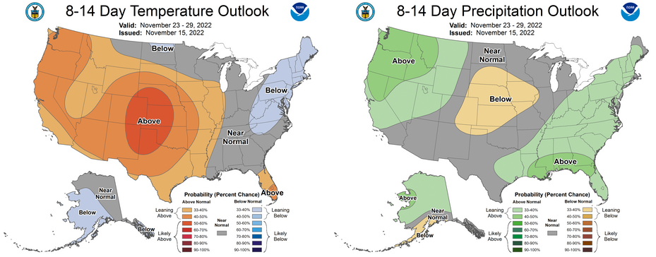
The weather around Thanksgiving looks a bit unsettled with some moisture
possible, but not cold enough for snow or ice as of now. Speaking of snow,
almost everybody in the state has seen at least a dusting.
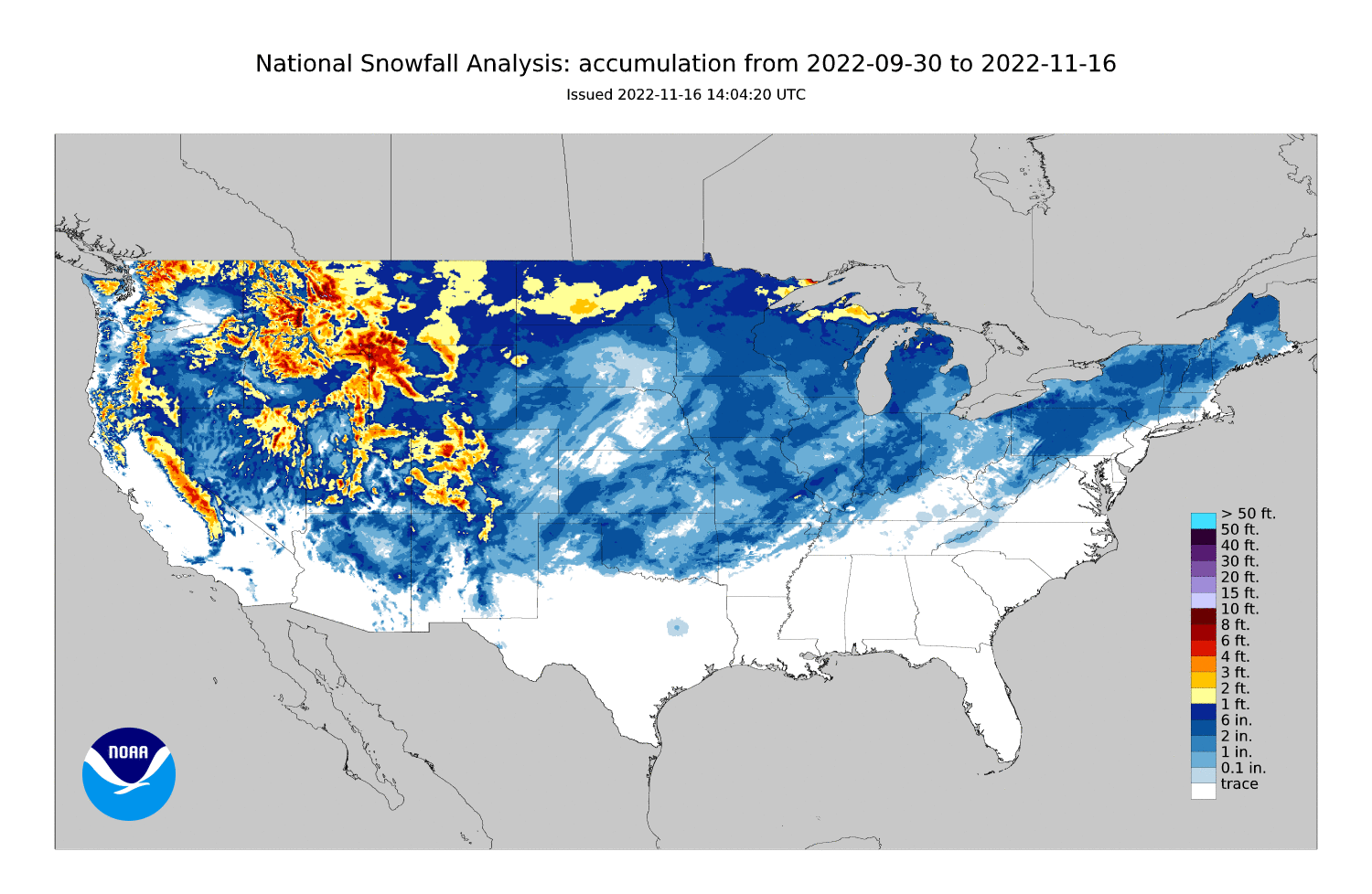
Indicative of nothing, probably, but ahead of most years at this point in the
season. Since 2008, only 2018 comes close to coverage this time of year.

But hey, "Indicative of nothing" is the Ticker motto.
Gary McManus
State Climatologist
Oklahoma Mesonet
Oklahoma Climatological Survey
gmcmanus@mesonet.org
November 16 in Mesonet History
| Record | Value | Station | Year |
|---|---|---|---|
| Maximum Temperature | 90°F | BUFF | 2016 |
| Minimum Temperature | 7°F | KENT | 1997 |
| Maximum Rainfall | 3.72 inches | PAWN | 1996 |
Mesonet records begin in 1994.
Search by Date
If you're a bit off, don't worry, because just like horseshoes, “almost” counts on the Ticker website!