Ticker for November 4, 2022
MESONET TICKER ... MESONET TICKER ... MESONET TICKER ... MESONET TICKER ...
November 4, 2022 November 4, 2022 November 4, 2022 November 4, 2022
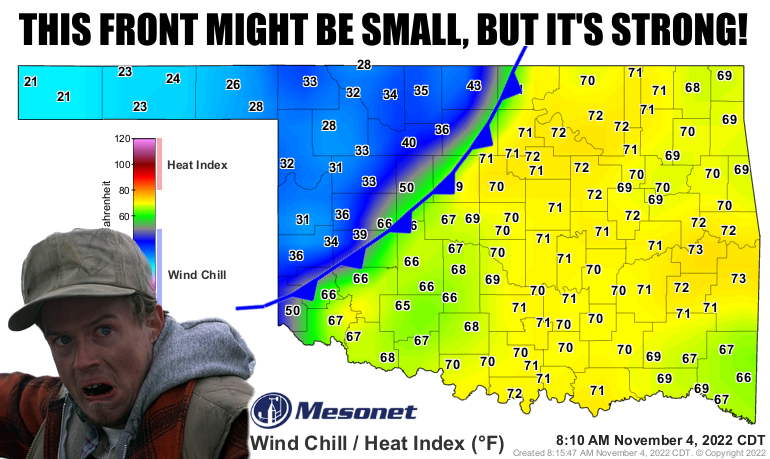
Plains Fronts and Wind Chills
By the way, can you believe THAT GUY ^ became THIS GUY?

If you'd told me that Cousin Owen from "Planes, Trains and Automobiles" would
eventually be perpetually typecast as a smarmy lawyer...well, I'd have been just
as shocked if somebody told me my hair brush would eventually be used as a paper
weight.
And "smarmy lawyer" ain't an insult to the profession, just THAT guy. Besides, you
should hear what people say about meteorologists.
Go ahead, we can all hear you! And anyways, I'm a climatologist, so there.
Anyway, today's setup is still looking like it has all week, with the cold front
blasting its way into the state. Any storms behind the cold front are gonna be
elevated and contain mainly a large hail threat, but any storms going up in the
warm sector (that area ahead of the cold front) could be more dangerous. That's
expected to occur after the front moves farther into SE OK later this afternoon,
but should any storms go up before then (again, in the warm sector ahead of the
cold front), they'll need to be tracked carefully since instability is so high
(the atmosphere, not me, although I'm very unstable, I can't produce tornadoes)
and there is strong shear in place.
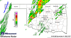
Again, that doesn't mean that the storms going on behind the front aren't
severe...that's already occurring. We've had several severe t-storm warnings
already and a good bit of rain here and there.
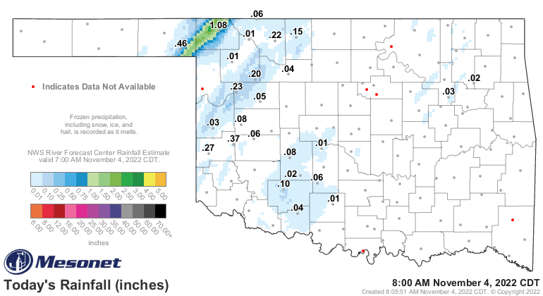
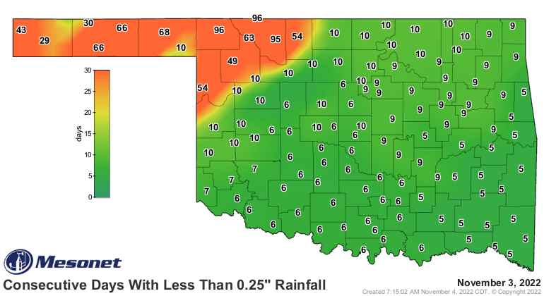
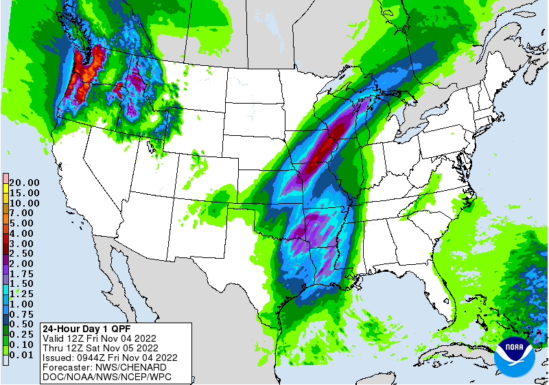
That inch-plus rain total in Buffalo is the most rain they've received in a
single day since March 21 (1.23"), and more rain than they've received altogether
since July 31, 96 days ago.
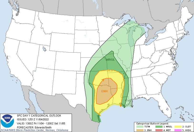
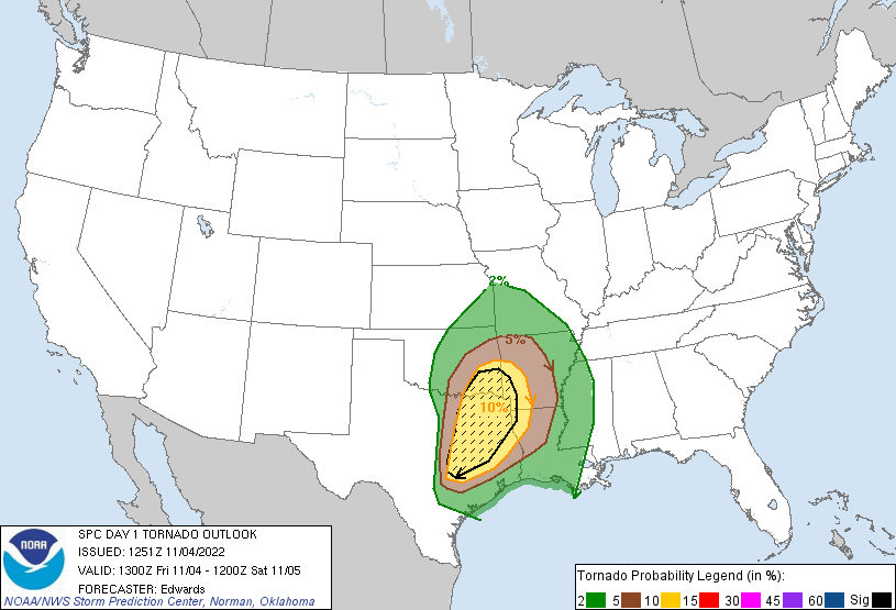
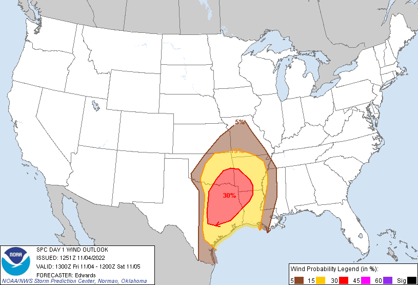
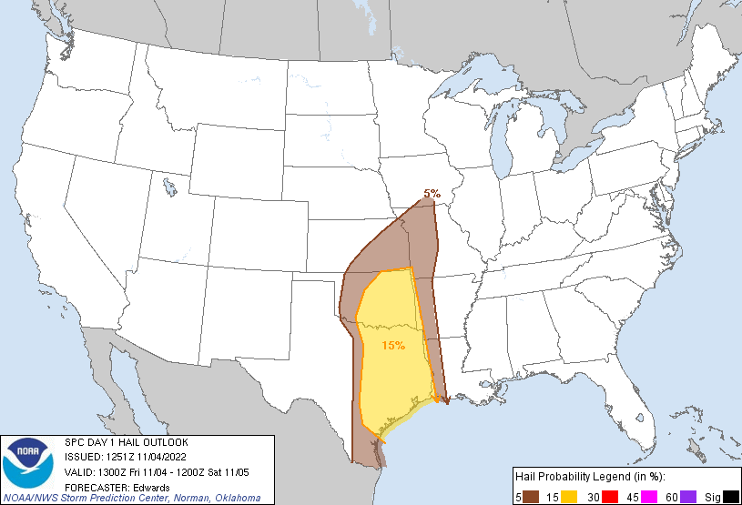
At any rate, here are the current thoughts from SPC. Folks across the state
should be prepared for severe weather, and tuning into your local NWS office/
favorite media source for up to the minute weather updates, but ESPECIALLY
those down in SE OK, where there is a risk of STRONG (EF2-EF5) tornadoes today.
Wish there was more rain with it, but we'll take what we can get.
Gary McManus
State Climatologist
Oklahoma Mesonet
Oklahoma Climatological Survey
gmcmanus@mesonet.org
November 4 in Mesonet History
| Record | Value | Station | Year |
|---|---|---|---|
| Maximum Temperature | 91°F | MANG | 2005 |
| Minimum Temperature | 17°F | CAMA | 2011 |
| Maximum Rainfall | 4.77 inches | VALL | 2024 |
Mesonet records begin in 1994.
Search by Date
If you're a bit off, don't worry, because just like horseshoes, “almost” counts on the Ticker website!