Ticker for November 3, 2022
MESONET TICKER ... MESONET TICKER ... MESONET TICKER ... MESONET TICKER ...
November 3, 2022 November 3, 2022 November 3, 2022 November 3, 2022
Drought continues
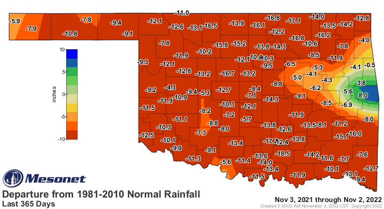
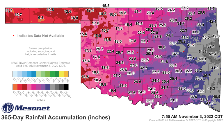
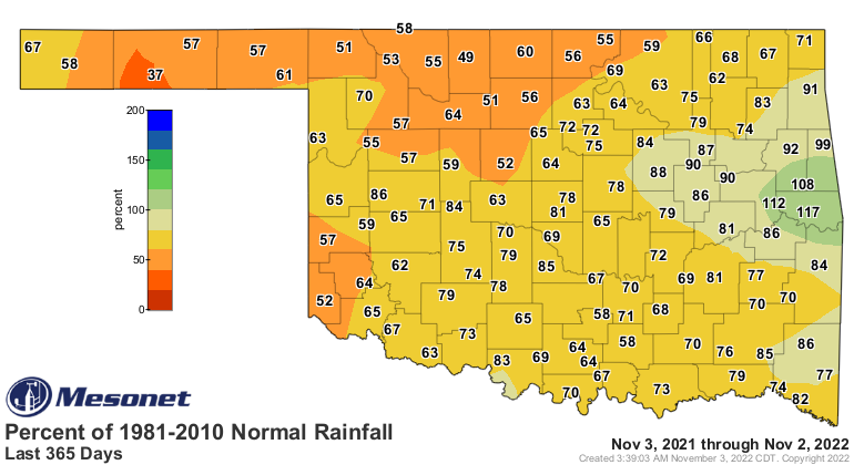
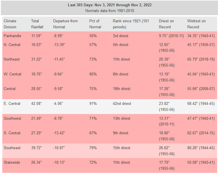
Drought continues across Oklahoma, and it is easy to see why. Rainfall deficits
from 365 days to 30 days all point to unusually dry weather across most areas of
Oklahoma, a combination of long-term drought (actually going back to August 2021)
and short-term "flash" drought beginning on June 11, 2022. Short-term wetness
cannot break through strongly enough to break that long-term dryness, as evidenced
by the current U.S. Drought Monitor map and the 365-day rainfall maps that back it.
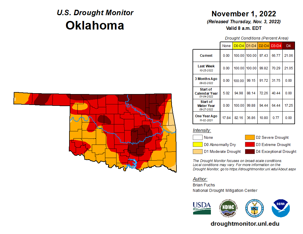
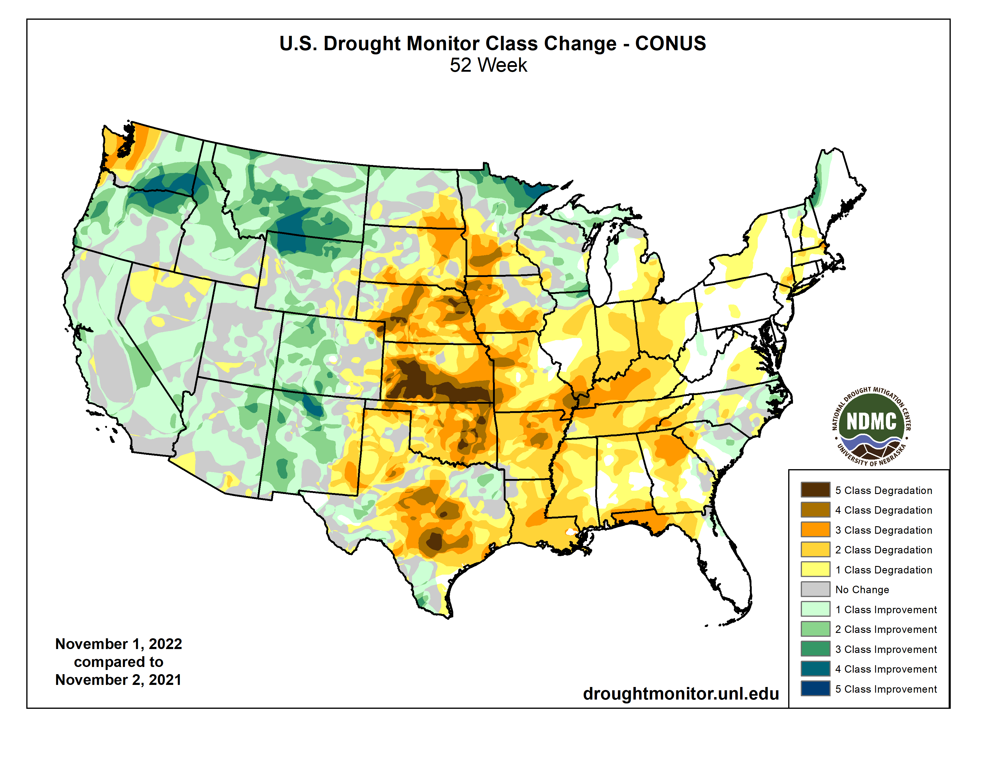
And the Drought Monitor change map shows how that dryness has impacted the
Southern Plains.
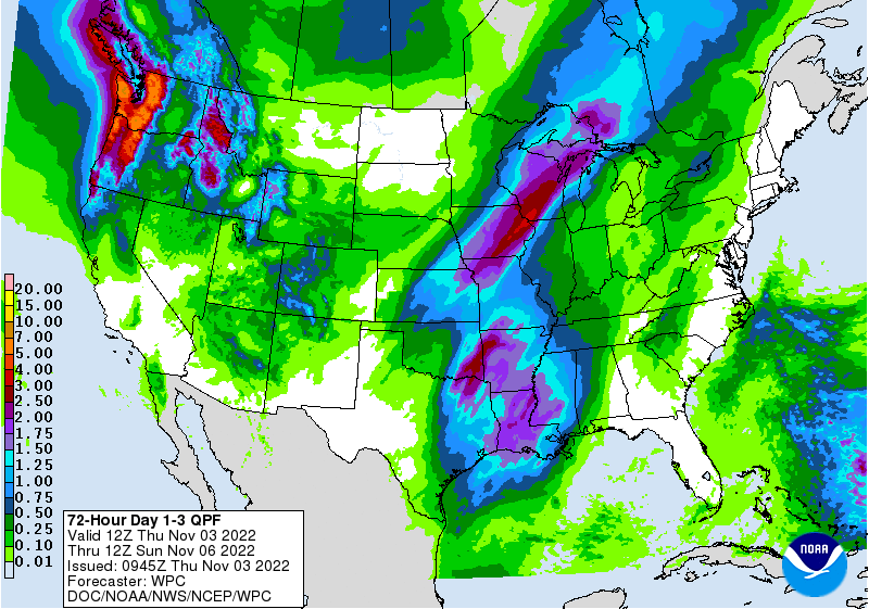
While we definitely need rain, the current severe weather setup is not the most
favorable choice of delivering it. However, the speed of the system and possible
dry-air intrusion tomorrow could leave most of the area with a lot less rainfall
that was first forecast.
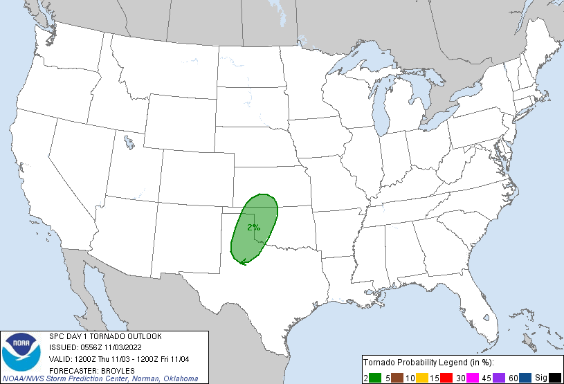
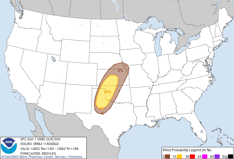
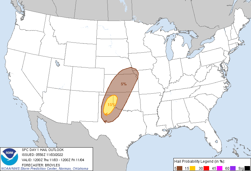
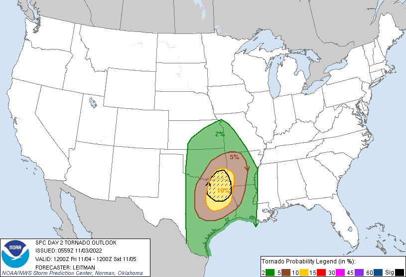
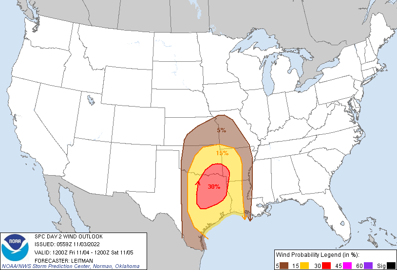
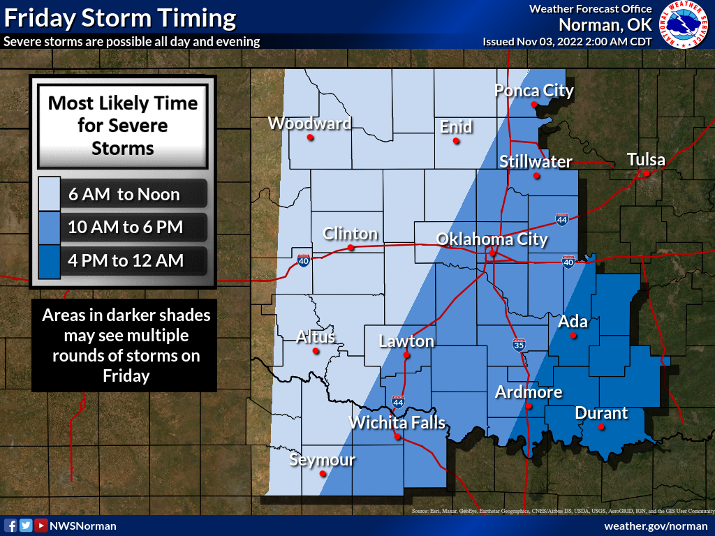
As we've gotten closer, the highest severe threat has shifted farther to the
southeast, but it has also intensified. There is now a fairly significant
threat of damaging tornadoes across SE OK coming up on Friday, although the
threat to the rest of the state is not zero either Thursday or Friday. Large
wind and hail remain a threat as well.
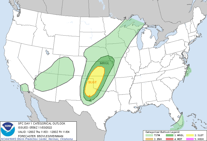


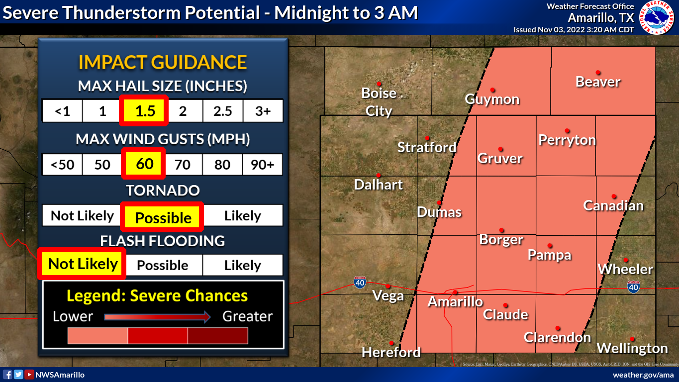
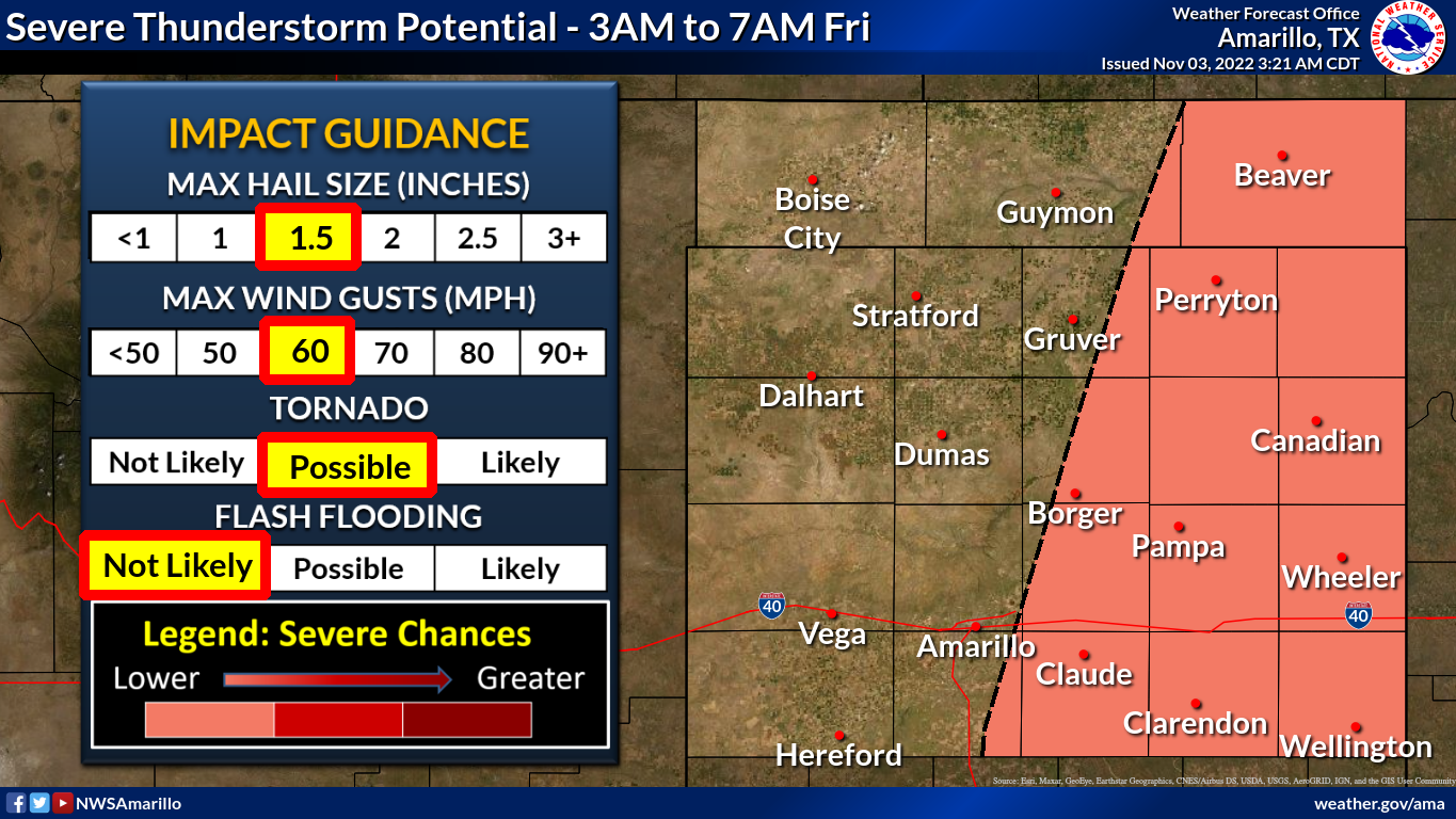
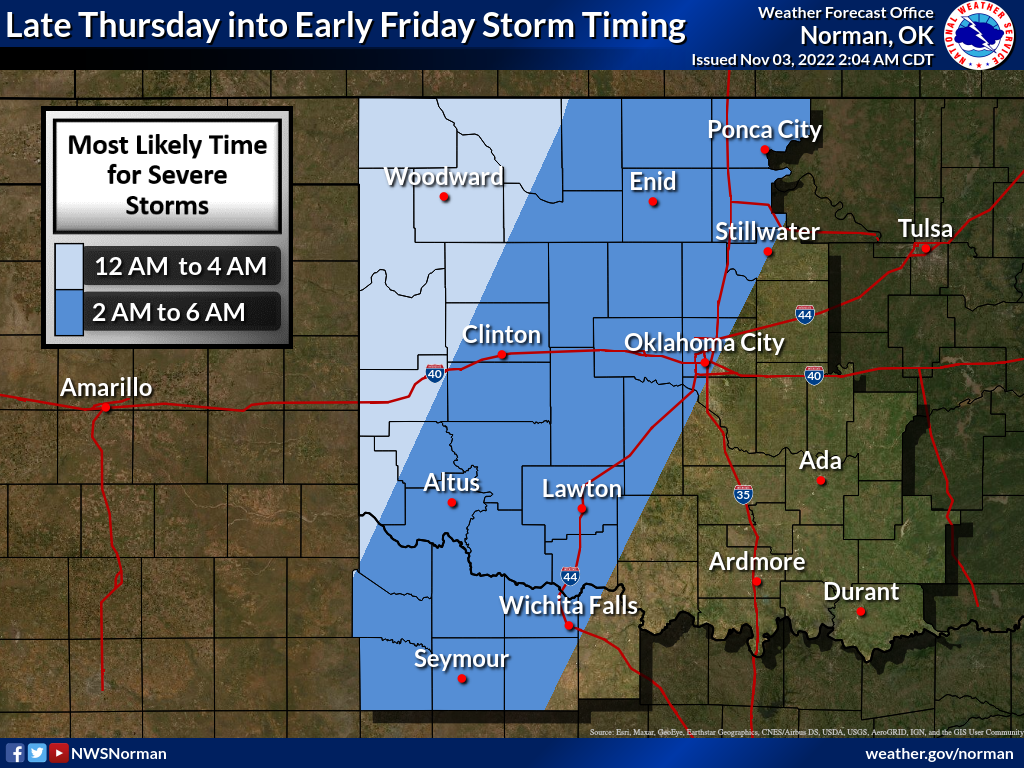
The timing of that severe weather will be overnight out west, and then later
in the day for Friday's ongoing threat.
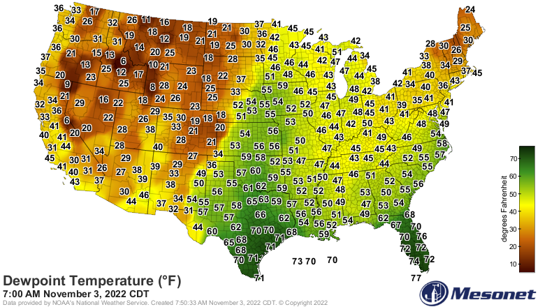
The fuel for this storm system is streaming north on strong southerly winds,
reaching all the way up into the Northern Plains. The moisture and winds have
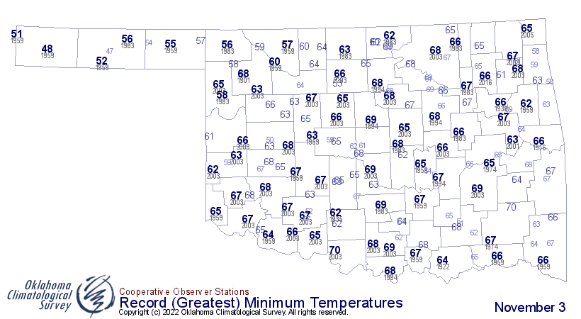
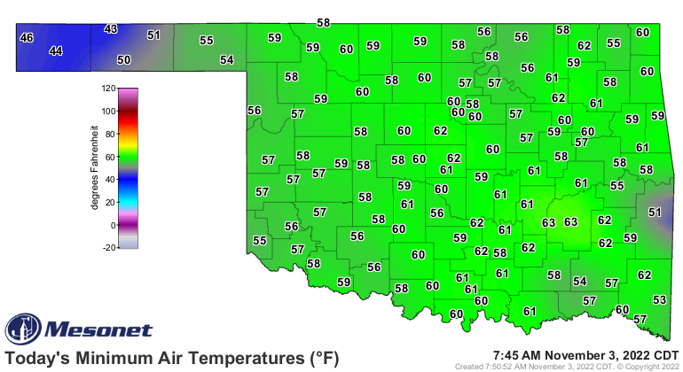
helped keep Oklahoma's overnight temperatures well into the 50s and 60s, near
record territory for high minimum temperatures for this time of year.
At any rate, the forecast rainfall from this storm system is not expected to
put much of a dent in the drought across the western half to two-thirds of the
state. Eastern Oklahoma could see definitely drought relief, however.
Gary McManus
State Climatologist
Oklahoma Mesonet
Oklahoma Climatological Survey
gmcmanus@mesonet.org
November 3 in Mesonet History
| Record | Value | Station | Year |
|---|---|---|---|
| Maximum Temperature | 93°F | MANG | 2005 |
| Minimum Temperature | 10°F | KENT | 2004 |
| Maximum Rainfall | 6.69 inches | TISH | 2024 |
Mesonet records begin in 1994.
Search by Date
If you're a bit off, don't worry, because just like horseshoes, “almost” counts on the Ticker website!