Ticker for September 27, 2022
MESONET TICKER ... MESONET TICKER ... MESONET TICKER ... MESONET TICKER ...
September 27, 2022 September 27, 2022 September 27, 2022 September 27, 2022
Halvsies

My Tuesday mornings are usually reserved for my Mensa meetings. I told them they
would have to find somebody else to clean the bathrooms this morning because we
have big weather happening.
A friend of mine had a trip to Tampa Bay next Saturday and asked me for some
resources to track it. I told him "Yeah, you might want to postpone that trip."
It certainly appears that Tampa Bay has the possibility for a catastrophic hit
by a possible major hurricane. Lot's of "possibles" there, but we're still a
ways out and those things like to wobble.
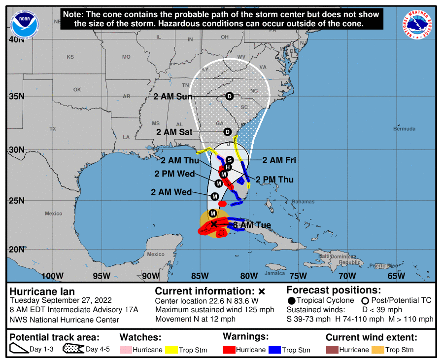
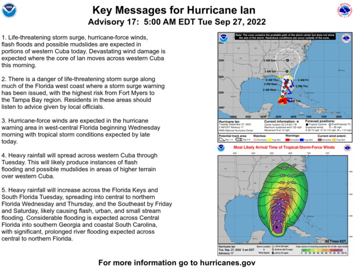
Yikes! All that scary language, and in reality the storm surge could be the most
devastating part of the storm. Would this scare ya, from the Tampa Bay area
NWS OFFICE:
- LATEST LOCAL FORECAST: Life-threatening storm surge possible
- Peak Storm Surge Inundation: The potential for 7-10 feet
above ground somewhere within surge prone areas
- Window of concern: Begins this evening
- THREAT TO LIFE AND PROPERTY THAT INCLUDES TYPICAL FORECAST
UNCERTAINTY IN TRACK, SIZE AND INTENSITY: Potential for storm
surge flooding greater than 9 feet above ground
- The storm surge threat has increased from the previous
assessment.
- PLAN: Plan for extreme life-threatening storm surge
flooding greater than 9 feet above ground.
- PREPARE: Evacuation efforts should soon be brought to
completion before driving conditions become unsafe.
- ACT: Leave immediately if evacuation orders are given for
your area to avoid being cut off from emergency services or
needlessly risk lives.
- POTENTIAL IMPACTS: Devastating to Catastrophic
- 3 FT surge above high tide floods beaches in barrier
islands.
- 4 FT surge above high tide floods Matlacha and cuts off
causeway to Pine Island.
- 4 FT surge above high tide cuts off the causeway to Sanibel.
- 4 FT surge above high tide floods much of Bokeelia and ST
James City.
- 5 FT surge above high tide begins to submerge Cape Coral
and Fort Myers west of U.S. 41 and south of Daniels Parkway.
YIKES YIKES YIKES!
Now we feel for those folks, this is obviously one of those storms, at least it
appears to be early on, that could change things forever down that way. All that
being said, darned if we wouldn't take about half that rainfall distributed
in a nice timely manner over the next month.
Sure, and I'd like to be buying lots of combs and brushes for myself, too. Life
isn't that easy, obviously. So while Florida and then up the East Coast deals
with Ian, we deal with whatever it is you want to call what we have: lots of
high pressure, NW flow cutting off the Gulf moisture, and endless sunny skies
with no chance of rain.
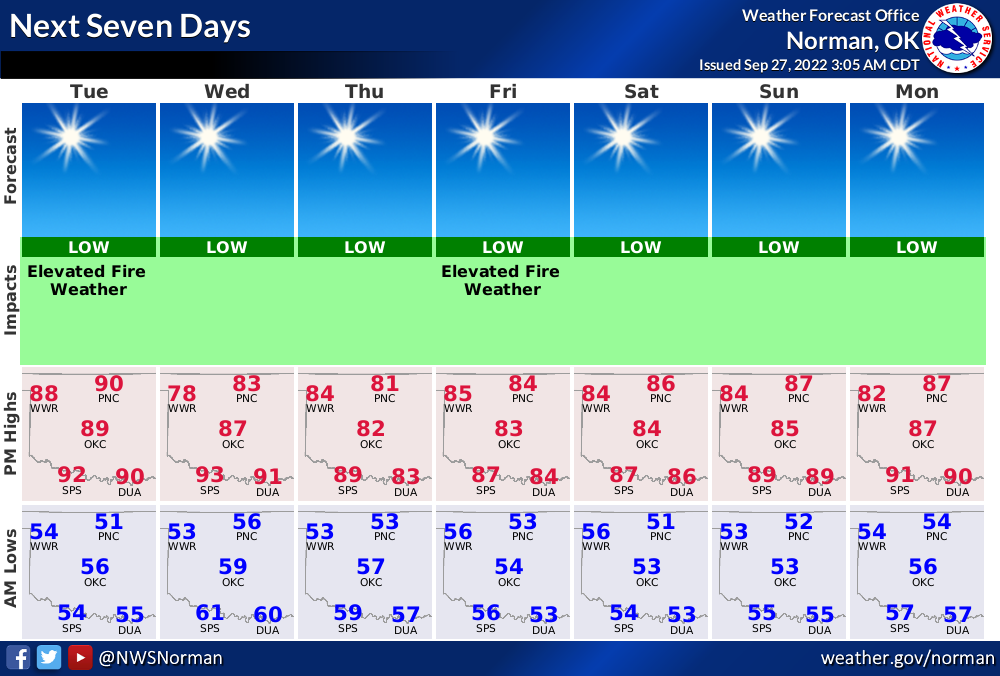
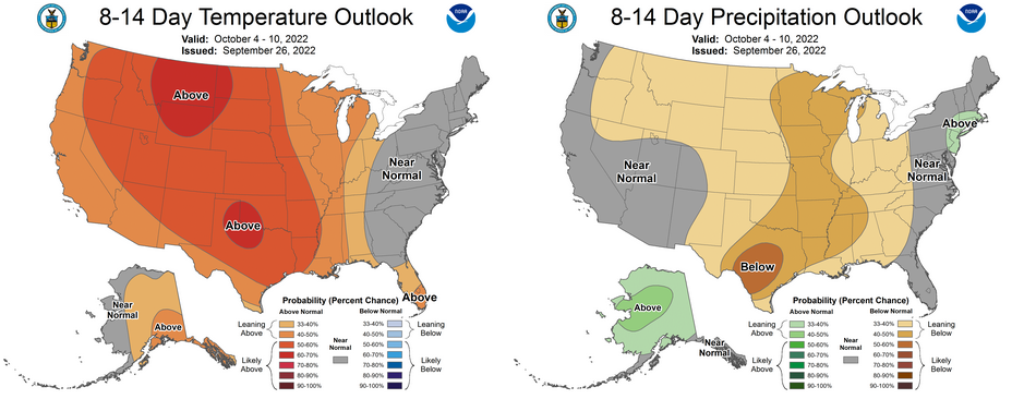
I keep showing the same maps over and over, but I hope that eventually we'll
see a change somewhere down the road. It doesn't look like any changes are
happening soon, at least through the first week or so of October. So we might
as well learn to live with it, and it's not bad temperature-wise, to tell the
truth. We have nice cool mornings that require a jacket, then deliciously warm
and afternoons with lots of dry air making it feel even nicer. Just look at
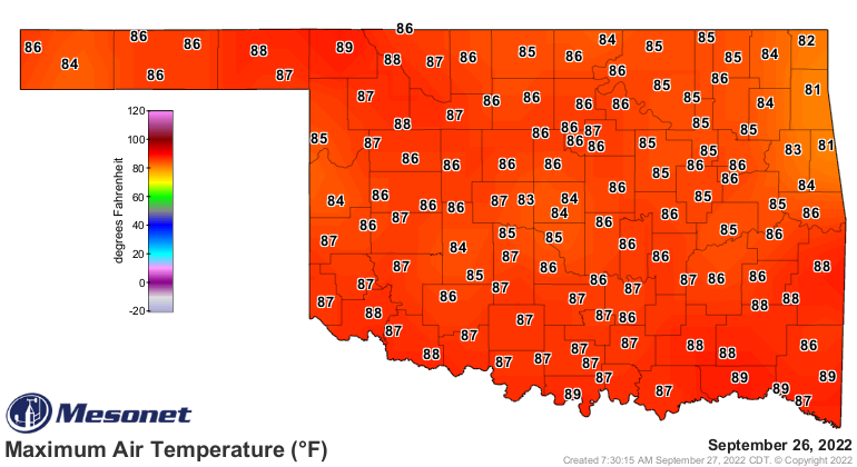
yesterday's highs vs. the maximum heat index values.
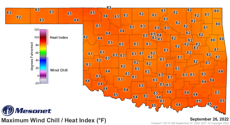
Those lower heat index values vs. the actual air temperatures are simply a
consequence of that dry air being more efficient at evaporating your sweat,
which is a cooling process for your body. That's what sweat is for, after all.
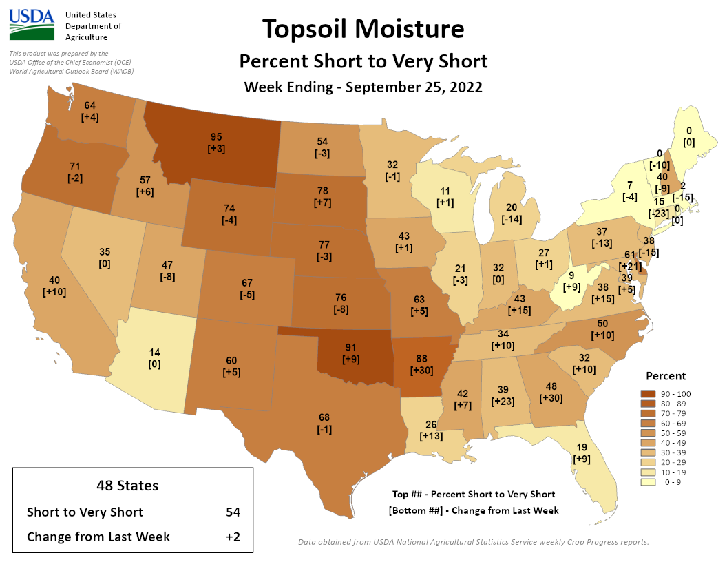
Nice design feature, right? Now as we go forward, our drought is going to
get worse and worse. Even now, we have the second worst topsoil conditions in
the U.S., behind our good friends in Montana.
So while we send our prayers down to the Southeast, we also say them for our
area. Catastrophe is catastrophe, after all.
Gary McManus
State Climatologist
Oklahoma Mesonet
Oklahoma Climatological Survey
gmcmanus@mesonet.org
September 27 in Mesonet History
| Record | Value | Station | Year |
|---|---|---|---|
| Maximum Temperature | 101°F | BUFF | 2019 |
| Minimum Temperature | 36°F | OILT | 2010 |
| Maximum Rainfall | 2.86 inches | CLAY | 2012 |
Mesonet records begin in 1994.
Search by Date
If you're a bit off, don't worry, because just like horseshoes, “almost” counts on the Ticker website!