Ticker for September 26, 2022
MESONET TICKER ... MESONET TICKER ... MESONET TICKER ... MESONET TICKER ...
September 26, 2022 September 26, 2022 September 26, 2022 September 26, 2022
Choke it down!
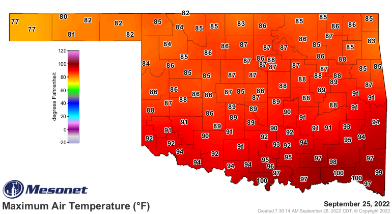
Forget the temperatures, they are what they are (SCIENCE!). And what they are is
(say what??) seasonable, but still above normal, and that's the way it's gonna be
for at least the next week, and beyond.
I've heard different folks predicting no more 100s. Heck, I've even some folks say
no more widespread 90s. We got into the 100s yesterday, for crying out loud!
Wait...WAIIIITTTTT!! I said I wasn't going to talk about temperatures. Remember,
I said "they are what they are" in one of the most profound scientific statements
in recent memory. Okay, I have short-term memory problems, but let's talk about
what I really came here to say.
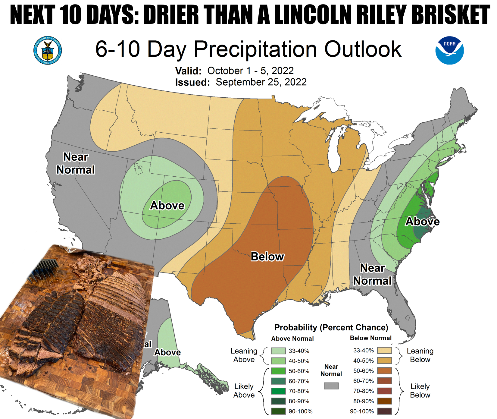
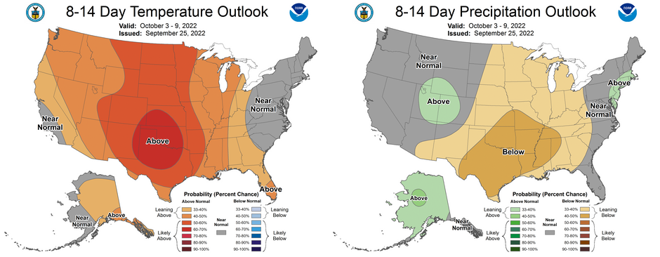
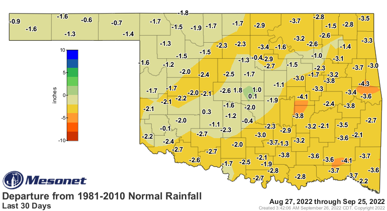
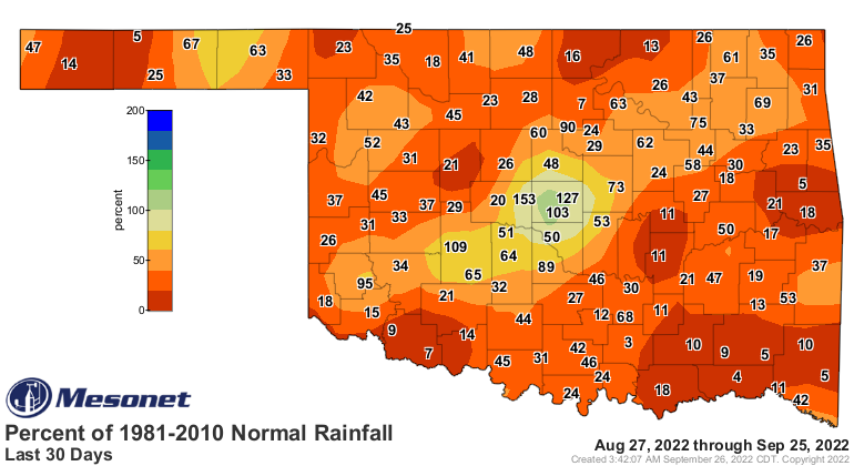
Dry. It's dry as heck, and it's just gonna get worse. We're now working on a
really nice-not nice month's worth of a dry spell again, which spells more
trouble for our drought.

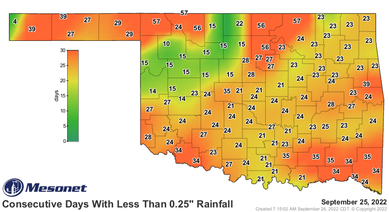
You can see the bulk of the state in the 20-24 day range for not having at least
a tenth of an inch of rain in a single day, so obviously that's gonna go past
31 days in a week, and then probably keep building. As for the quarter-inch
map (it's actually bigger than that), you can see those periods in some parts of
the state are gonna go past 2 months.
What we're trying to say here is this is another example of our long periods
in between rainfall events. So if you look at the 60-day map, it looks like
we've had some pretty decent rain in some parts of the state, and we have...but
when was that rain?
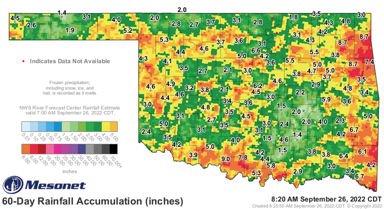
Then you take a look at the 30-day maps, and you can see that most of that
rainfall occurred back in August.
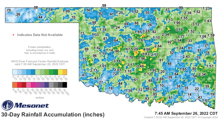
Soon, most of that rain is going to drop off the 30-day maps, and it's gonna
look ugly.
Yeah, I heard the jokes. Now don't you feel bad?
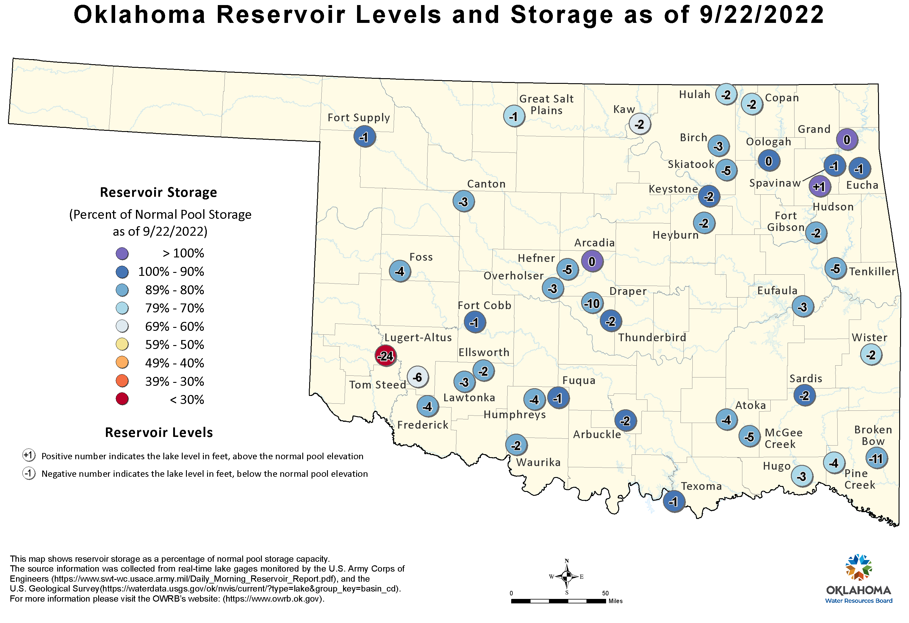
Oklahoma's lakes and farm ponds continue to dwindle.
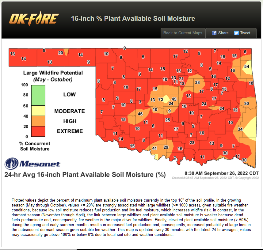
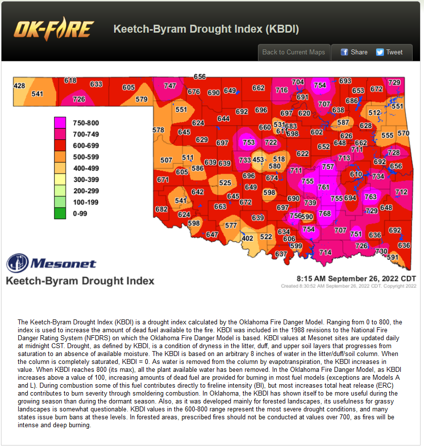
And fire danger is about to be a big problem if we don't see appreciable
moisture. Once it gets cold out (it will, I promise) and the vegetation starts
to die and go dormant, it won't matter anyway. Two of the indicators the Mesonet
uses to gauge fire danger are pinging into extreme categories, that 16-inch
plant available water map, as well as the KBDI.
So our normal fire season that starts later in the fall will be here a bit early
thanks to the drought inducing forced dormant and dead vegetation, or fuel
loads. We don't have to wait for that first killing frost, the drought is taking
care of that. Our average first frost is about a month away, after all.

So we'll see some cold fronts I'm sure, but will the generate rainfall? The
fantasy-casts aren't giving us good rain until 2 weeks out.
Let's hope fantasy becomes reality.
Gary McManus
State Climatologist
Oklahoma Mesonet
Oklahoma Climatological Survey
gmcmanus@mesonet.org
September 26 in Mesonet History
| Record | Value | Station | Year |
|---|---|---|---|
| Maximum Temperature | 101°F | SLAP | 2020 |
| Minimum Temperature | 29°F | CAMA | 2000 |
| Maximum Rainfall | 7.70 inches | WEST | 1996 |
Mesonet records begin in 1994.
Search by Date
If you're a bit off, don't worry, because just like horseshoes, “almost” counts on the Ticker website!