Ticker for August 17, 2022
MESONET TICKER ... MESONET TICKER ... MESONET TICKER ... MESONET TICKER ...
August 17, 2022 August 17, 2022 August 17, 2022 August 17, 2022
Wished for?

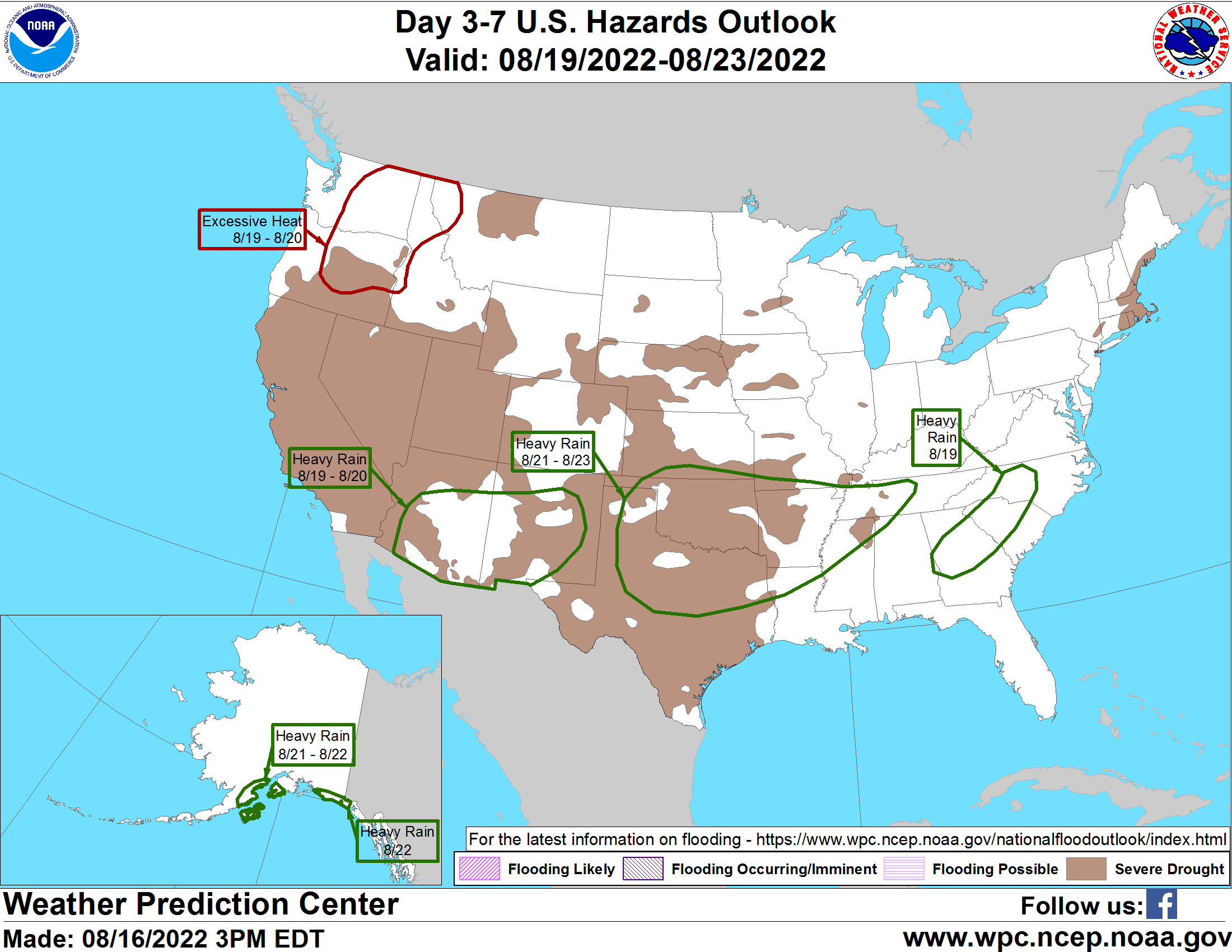
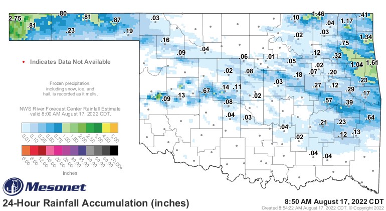
Now look here, *I* don't know for sure that these rainfall amounts are going to
verify, but they are consistently in the national analyses so who am I to argue?
Well, other than being the Master of All Time and Space, but how I think of myself
in my own head doesn't really help here. But this would be the classic Oklahoma
Drought-Flood dipole, where we see tons of extremely severe drought (or severely
extreme drought) followed by widespread heavy rains over time which would then
cause bigtime flooding problems. But let's worry about that as we get farther into
the weekend.
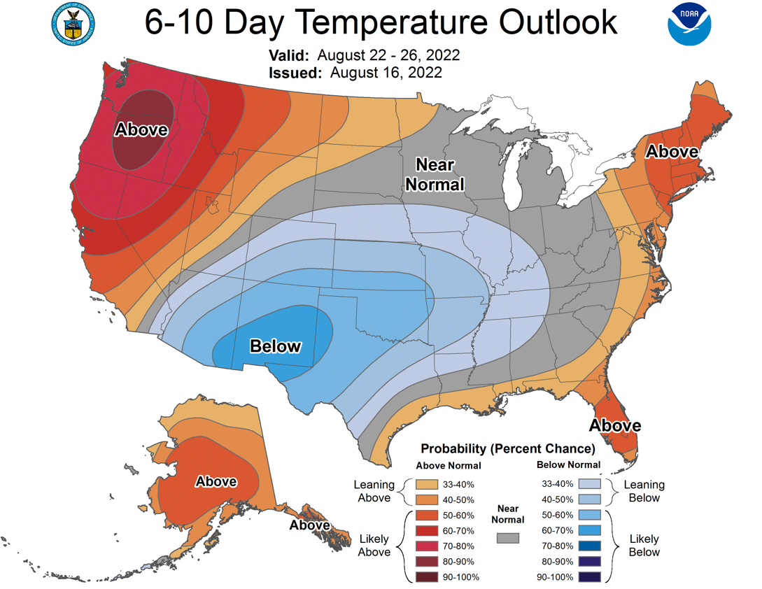
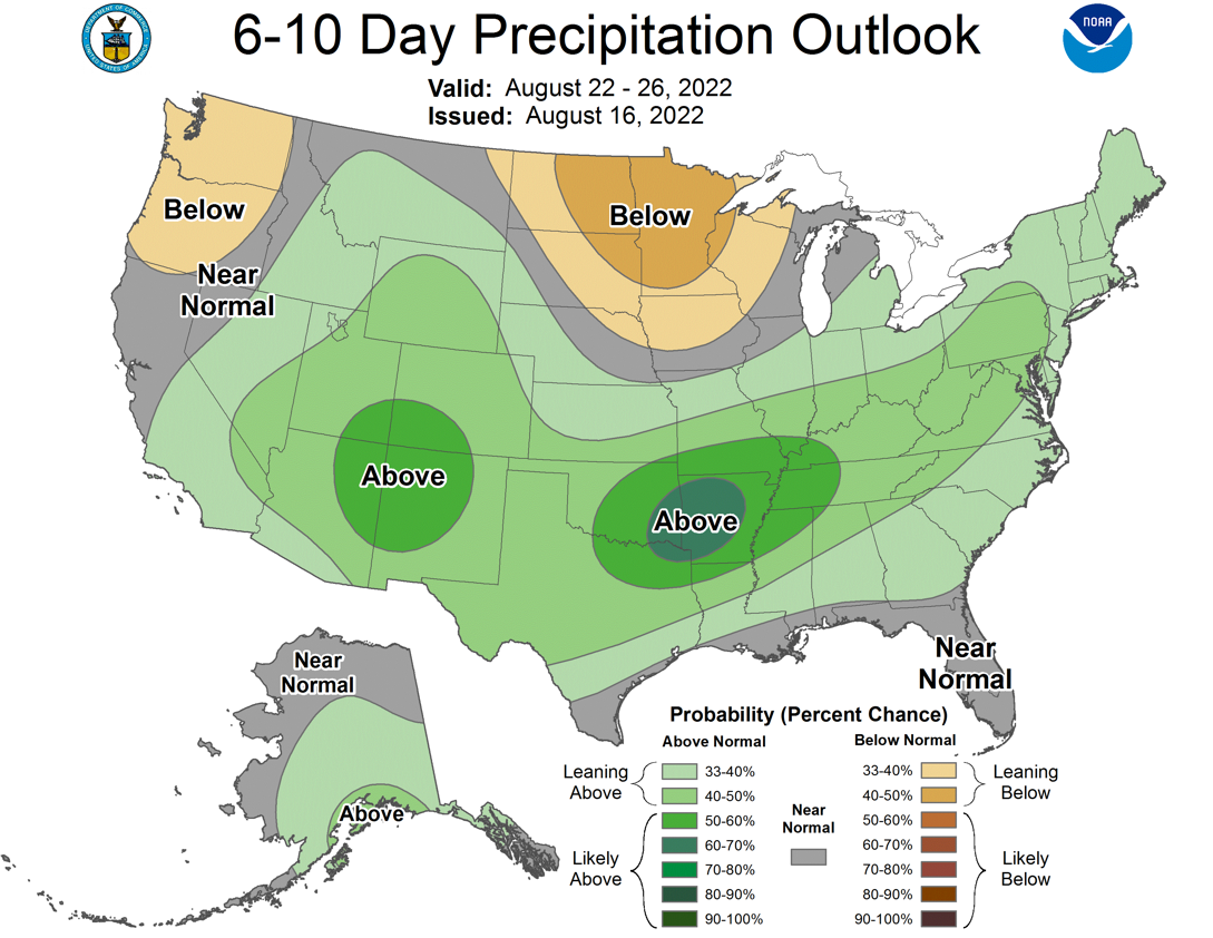
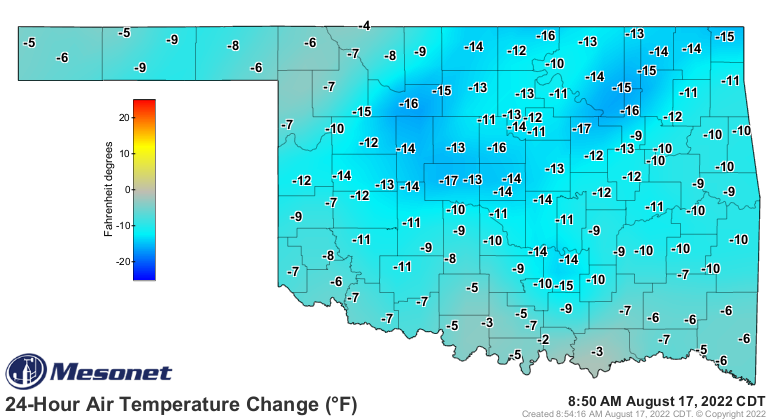
What we DO know is that it is going to be exceptionally cooler over the next couple
of weeks than what we've seen so far.
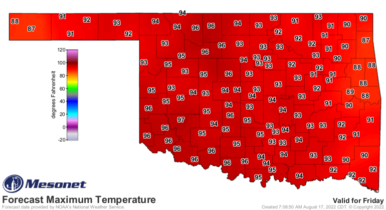
"But Gary, what about those 90s coming up on Friday and Saturday?" you may be asking
yourself. First off, if your name isn't Gary, there might be a problem there.
Secondly, this is how this pattern change (what I perhaps foolishly called
"The Death of Summer") works...whereas previously we had greatly extended
periods of hot weather interrupted by relatively brief periods of cooler
(relatively speaking) weather, now we should see greatly extended periods of
milder weather interrupted by brief periods of hot weather. At least for the
next couple of weeks, hopefully. So if you look at a graph of statewide average
high temps this summer (red line) vs. the long-term Mesonet average (black
line), HOPEFULLY this is what it will resemble going forward through the rest
of August as successive cold fronts continue to knock down the temperatures
should summer get too bold again. Take a look at the beginning of the graph
to begin June, and summer. That is more like the weather we will be seeing. Not
quite that cool, but similar in both temperature and if the forecasts come to
fruition, rainfall as well.

Some of you will hate it, and I get it. But we desperately needed a change
because the drought was headed in a really terrible direction for most of us.
And it can still get hot enough in September to allow for all of those outdoor
activities like trips to the lake and whatnot. But the long-term outlooks for
the rest of the month continue us in this cooler and wetter pattern.
And some of us have already gotten started on the switchover from dry and hot
to cool and wet.
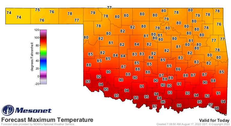
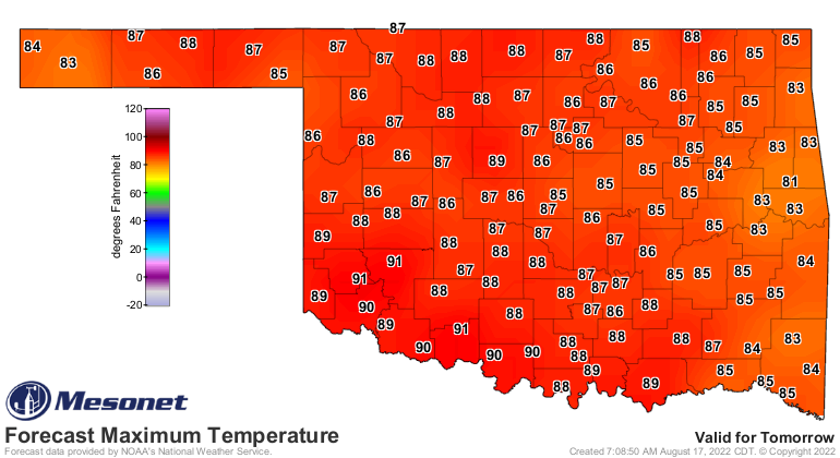
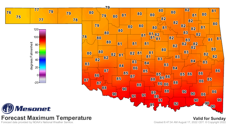
Today and tomorrow will be mild, hot again Friday and Saturday, then another
front and bigtime rains (hopefully!) later on Saturday then extended cool again.
Rinse (but hopefully not in flood waters), repeat.

There are inherent dangers in this forecast being realized, of course. Most of
those heavy rains being forecast are 5-7 days out, the limits of being real
precise in their accuracy (or is it accurate with their preciseness?). There has
already been something of a dreaded "southward shift" in the heavy rains in some
of the models. We will continue with hope until the maps start to look less
favorable, however.
Hope is all we've got at the moment...that Drought Monitor map that comes out
tomorrow is going to be a doozy.
Gary McManus
State Climatologist
Oklahoma Mesonet
Oklahoma Climatological Survey
gmcmanus@mesonet.org
August 17 in Mesonet History
| Record | Value | Station | Year |
|---|---|---|---|
| Maximum Temperature | 114°F | GRA2 | 2023 |
| Minimum Temperature | 53°F | ANTL | 1999 |
| Maximum Rainfall | 5.78 inches | MEDF | 2009 |
Mesonet records begin in 1994.
Search by Date
If you're a bit off, don't worry, because just like horseshoes, “almost” counts on the Ticker website!