Ticker for August 10, 2022
MESONET TICKER ... MESONET TICKER ... MESONET TICKER ... MESONET TICKER ...
August 10, 2022 August 10, 2022 August 10, 2022 August 10, 2022
Raincne
I warned ya about that. No, not that! This. And I'll thank you to leave me out of
your personal affairs.
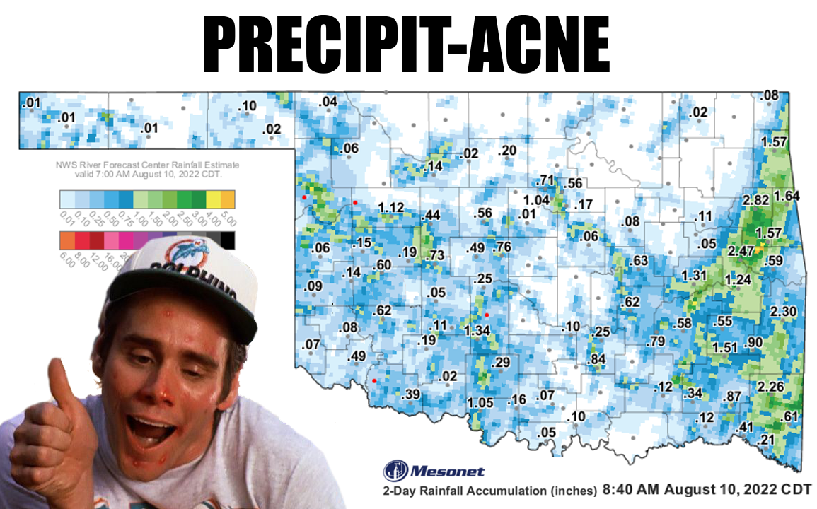
It's the old acne method of giving us rainfall that Mother Nature loves to do
during the summer. Sure, lots of folks got rain, but their relatives that live
in the next town (heck, next door!) got zilch. And a lovely rain it was, for those
lucky enough to be underneath one of these isolated areas of showers. Now across
far eastern OK, there was actually some widespread precip going on, so less acne
there and more of a full-on rash. Here some of the higher totals.
-***-
Tahlequah 2.82 inches
Webbers Falls 2.47 inches
Wister 2.30 inches
Mt. Henry 2.26 inches
Westville 1.64 inches
Cookson 1.57 inches
Jay 1.57 inches
Clayton 1.51 inches
-****-
So not bad, right? By the way, isn't it odd that "Westville" is in far eastern
Oklahoma in Adair County? At any rate, nice totals. However, HOWEVER (and that's
a big "however"...I used all caps to prove it), 39 of the Mesonet's 120 sites
received zilch.
Zero. Point. Zero.
The ole goose egg.
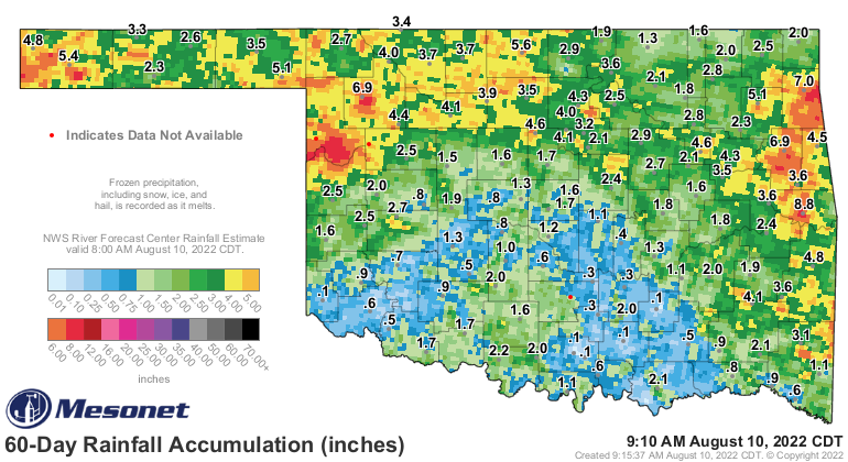
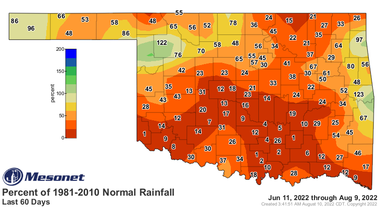
And another 22 received less than a tenth of an inch. In fact, in the last 60
days, since that goes back to the beginning of this flash drought on June 11, we
have 26 Mesonet sites that have recorded less than an inch of rainfall...and
Centrahoma and Newport have less than a tenth (8 hundredths for both)!
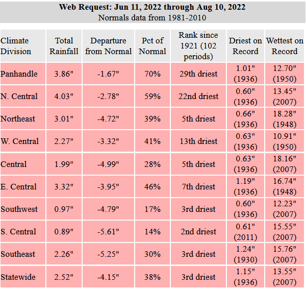
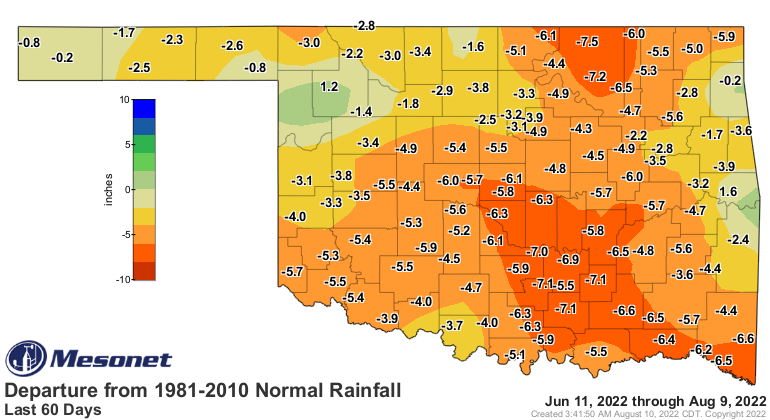
That 60-day period (counting a bit more with this morning added in) was the
3rd driest in at least the last 100 years. For South Central Oklahoma, it was
the 2nd driest. Many areas across the state are 5-8 inches below normal over
that period. For Centrahoma, Newport, and even Hollis...they've had ONE PERCENT
of normal for that time frame.
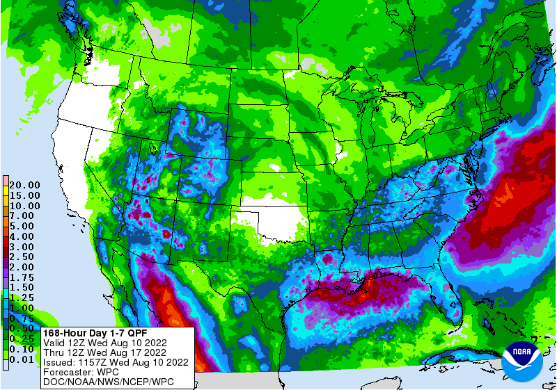
Flash drought at its worst. And there isn't much hope for even spotty showers
over the next week or so, as the heat dome takes control once again. That area
of high pressure will mean lots of sinking air which inhibits even cloud growth,
so back to the sun and heat.
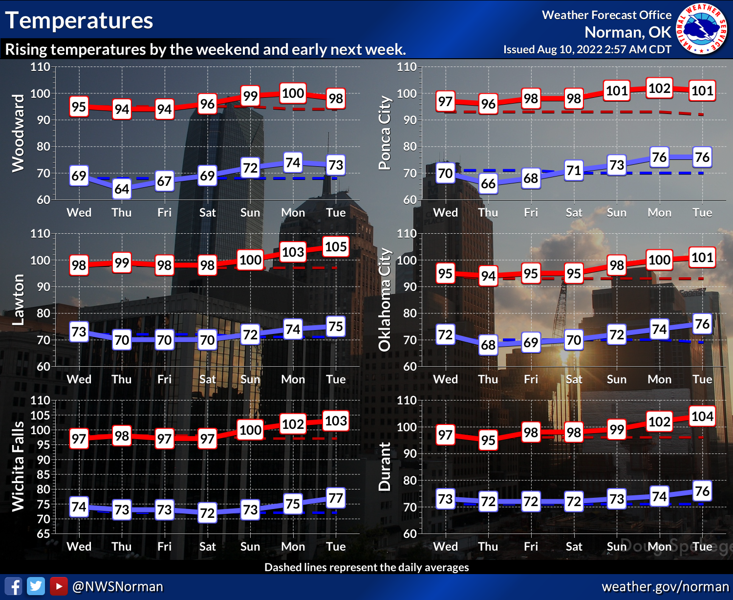
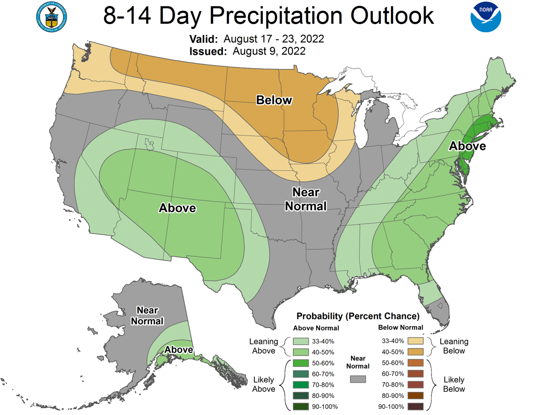
After our upcoming Week of Suffering (I capitalized it because it almost sounds
religious...but in Oklahoma I guess watching the weather is sort of a religion),
we do have hope for later next week to see that heat dome flatten, some cold
fronts slip in, and get some milder and WETTER weather in here. Still in
fantasy-cast territory, as I said yesterday, but it's looking possible at
least.

Now go slather on that, uhhhhh, Clearasil?? Is that still a thing?
Gary McManus
State Climatologist
Oklahoma Mesonet
Oklahoma Climatological Survey
gmcmanus@mesonet.org
August 10 in Mesonet History
| Record | Value | Station | Year |
|---|---|---|---|
| Maximum Temperature | 109°F | GRA2 | 2011 |
| Minimum Temperature | 55°F | EVAX | 2024 |
| Maximum Rainfall | 4.20 inches | CHIC | 2017 |
Mesonet records begin in 1994.
Search by Date
If you're a bit off, don't worry, because just like horseshoes, “almost” counts on the Ticker website!